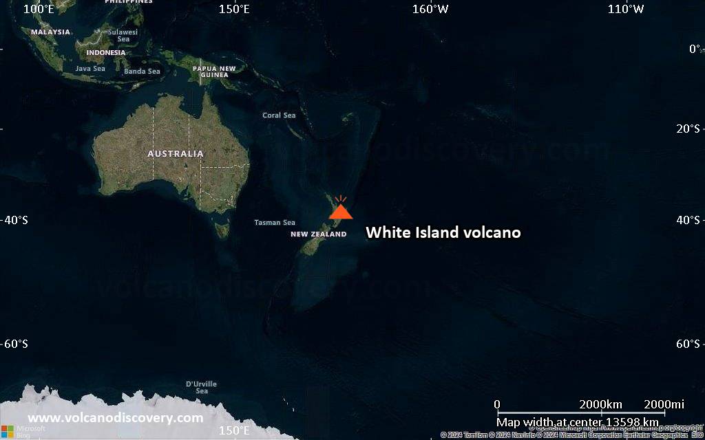
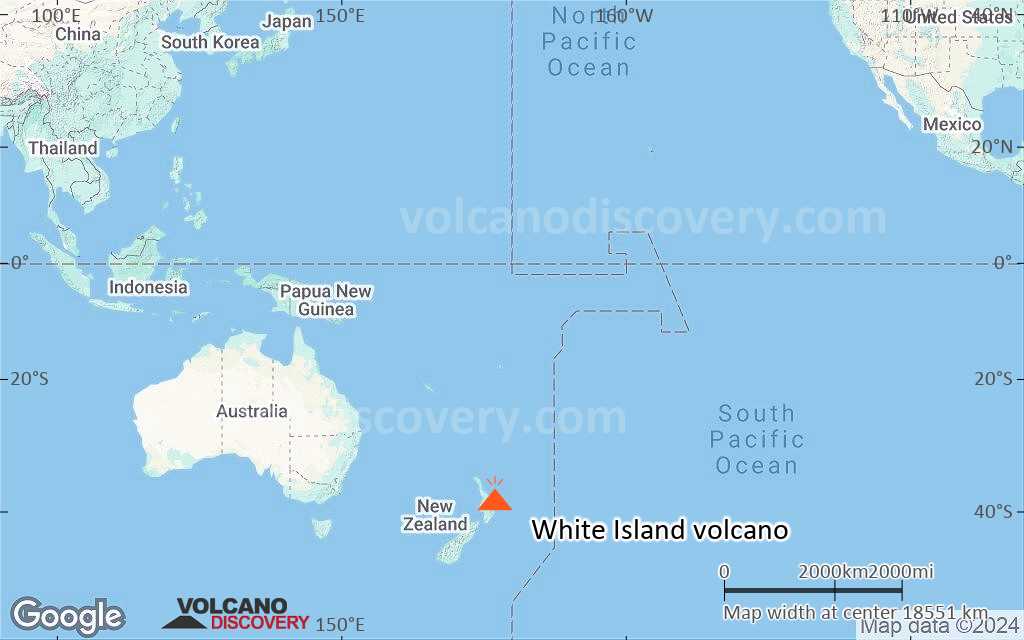
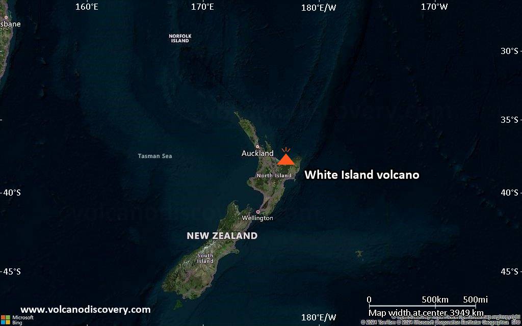
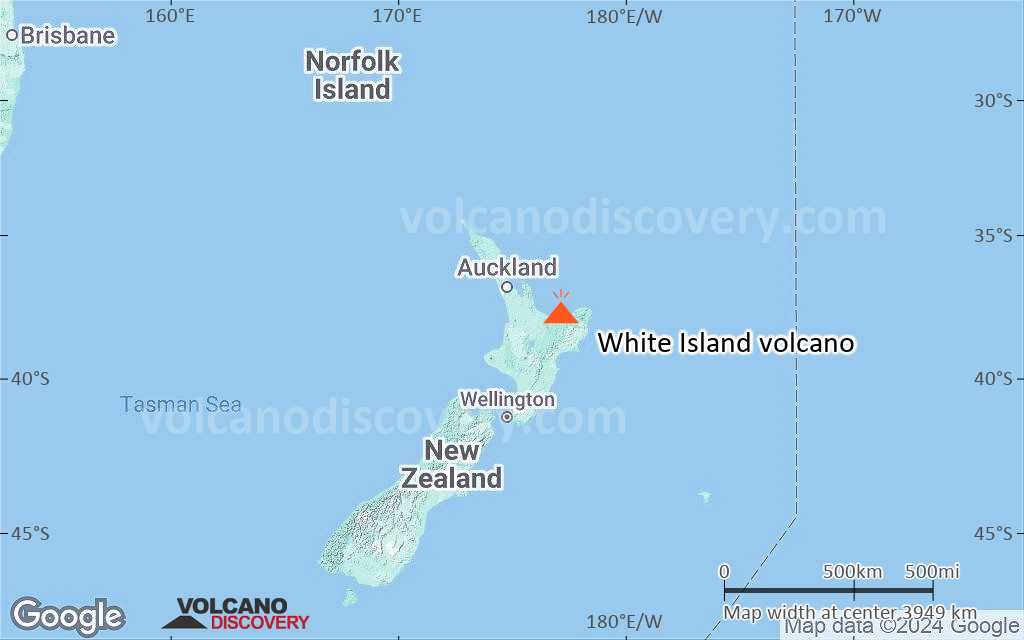
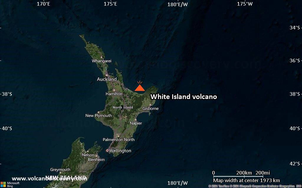
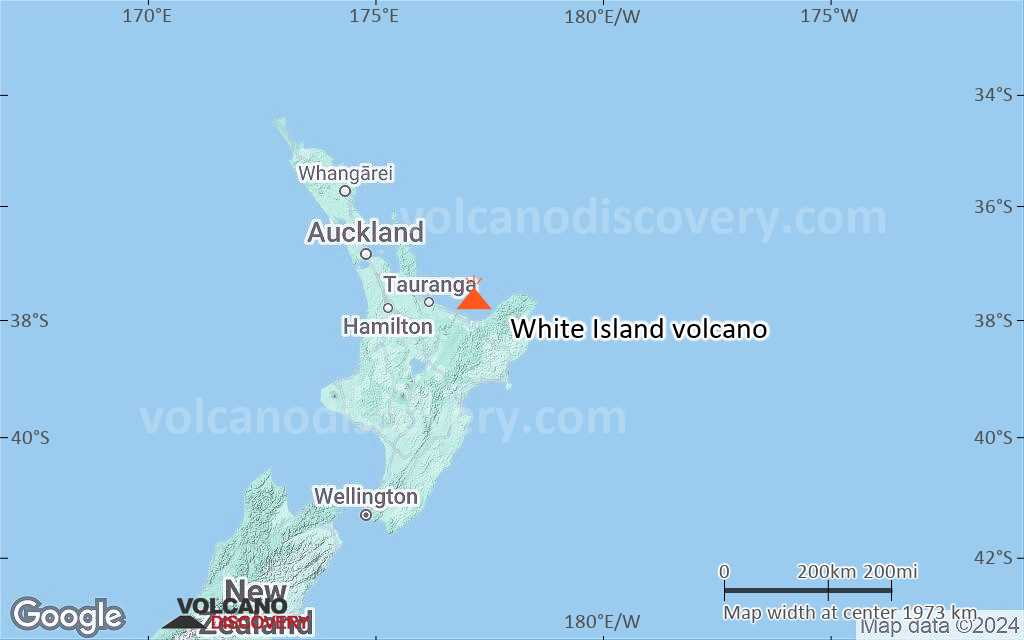
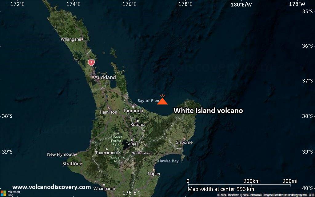
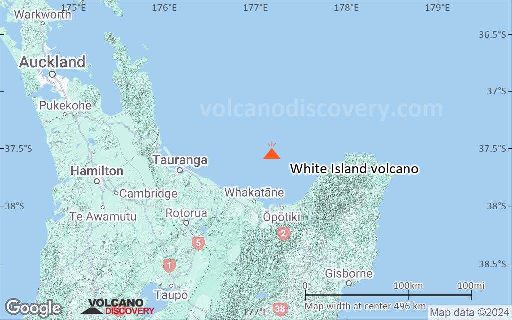
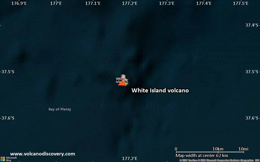
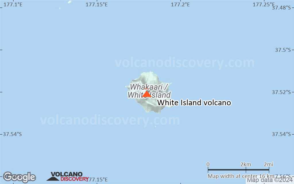
White Island Volcano
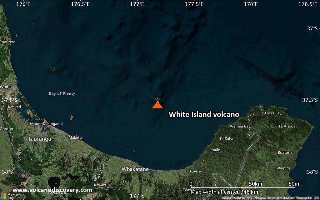
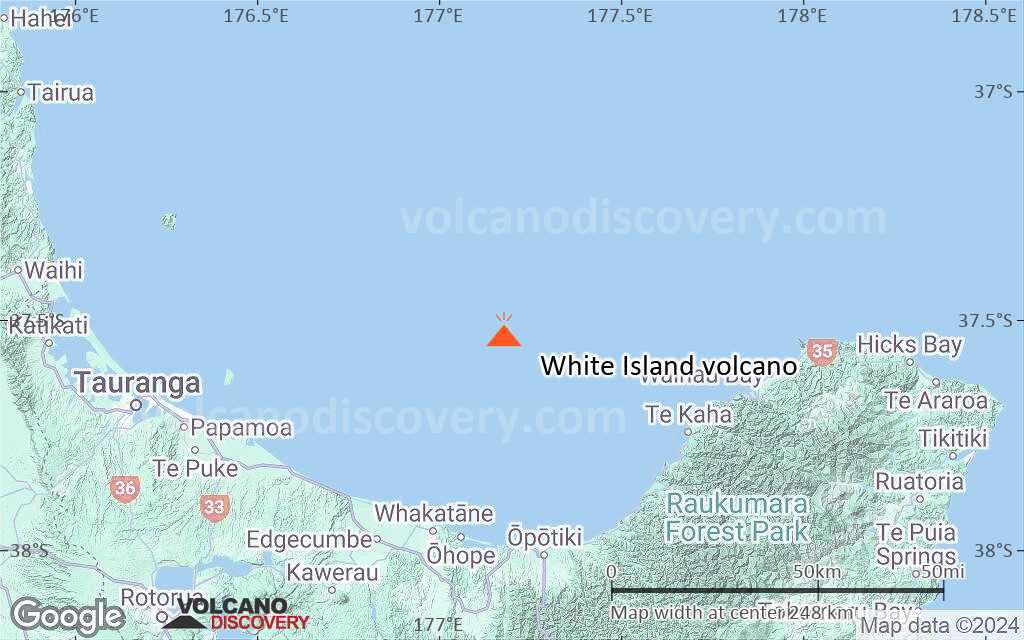
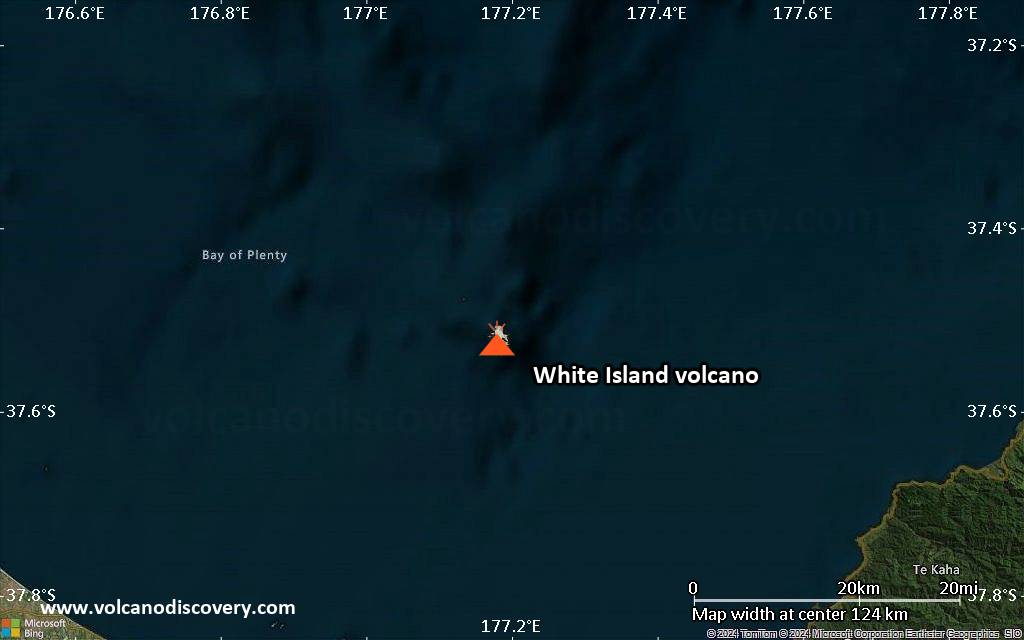
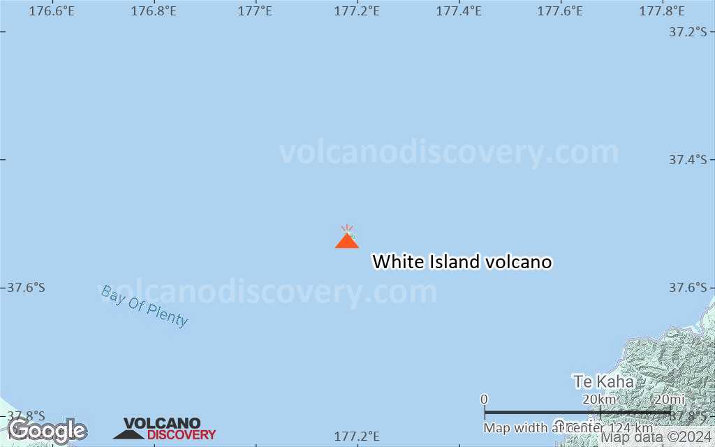
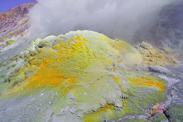
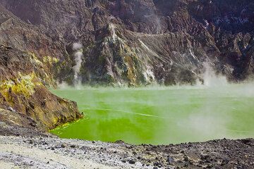
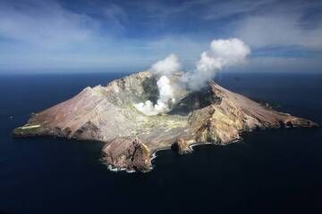
White Island in the Bay of Plenty ca. 50 km off the North Island's east coast is one of New Zealands most active volcanoes, well known for its spectacular crater with strong hydrothermal activity and sulphur deposits. It is part of the active Taupo volcanic zone and last erupted in 2001 (phreatic explosion).
White Island volcano eruptions: 2019, 2016, 2013, 2012, 2001, 1998-2000, 1998, 1995, 1986-94, 1983-84, 1976-82, 1974, 1971, 1971, 1970, 1969, 1968-69, 1966-67, 1962, 1959, 1958, 1957, 1955, 1947, 1933, 1930, 1928, 1926, 1924, 1922, 1909, 1908 (?), 1886?,1886, 1885 (?), 1885, 1856 (?), 1836, 1826
Latest nearby earthquakes
| Date and Time | Mag / Depth | Distance / Location | |||
|---|---|---|---|---|---|
| Apr 1, 03:44 am (GMT +13) 9 hours ago | 1.8 5 km | 7.5 km (4.6 mi) to the S | Info | ||
| Mar 31, 01:11 pm (GMT +12) 23 hours ago | 2.7 38 km | 26 km (16 mi) to the SE | Info | ||
| Sunday, March 30, 2025 GMT (1 quake) | |||||
| Mar 30, 08:22 pm (GMT +13) 1 day 16 hours ago | 2.0 109 km | 12 km (7.7 mi) to the NW | Info | ||
| Friday, March 28, 2025 GMT (1 quake) | |||||
| Mar 28, 11:22 pm (GMT +13) 4 days ago | 2.1 4.4 km | 23 km (14 mi) to the S | Info | ||
| Thursday, March 27, 2025 GMT (1 quake) | |||||
| Mar 27, 12:28 pm (GMT +12) 5 days ago | 2.3 98 km | 29 km (18 mi) to the N | Info | ||
| Wednesday, March 26, 2025 GMT (3 quakes) | |||||
| Mar 27, 02:32 am (GMT +13) 5 days ago | 1.9 88 km | 0.2 km (0.2 mi) to the N | Info | ||
| Mar 26, 09:54 pm (GMT +13) 6 days ago | 2.0 104 km | 19 km (12 mi) to the NW | Info | ||
| Mar 26, 03:52 pm (GMT +13) 6 days ago | 2.5 34 km | 8.9 km (5.5 mi) to the E | Info | ||
| Monday, March 24, 2025 GMT (2 quakes) | |||||
| Mar 24, 07:45 pm (GMT +13) 8 days ago | 2.5 77 km | 12 km (7.2 mi) to the N | Info | ||
Background
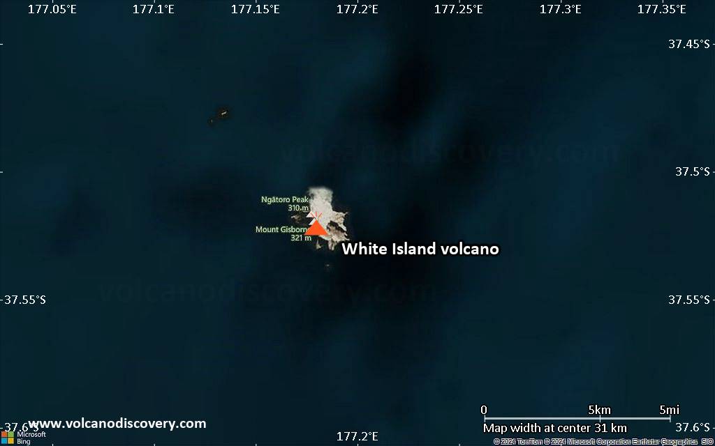
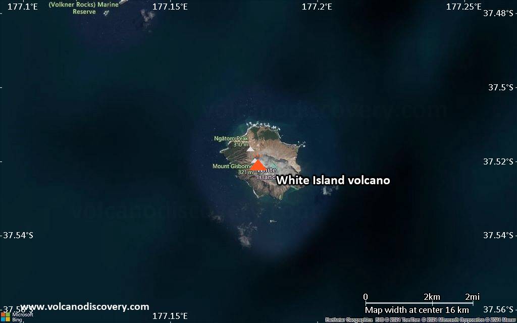
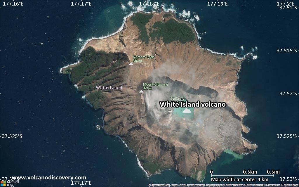
Uninhabited 2 x 2.4 km White Island, one of New Zealand's most active volcanoes, is the emergent summit of a 16 x 18 km submarine volcano in the Bay of Plenty about 50 km offshore of North Island. The 321-m-high island consists of two overlapping andesitic-to-dacitic stratovolcanoes; the summit crater appears to be breached to the SE because the shoreline corresponds to the level of several notches in the SE crater wall. Volckner Rocks, four sea stacks that are remnants of a lava dome, lie 5 km NNE of White Island. Intermittent moderate phreatomagmatic and strombolian eruptions have occurred at White Island throughout the short historical period beginning in 1826, but its activity also forms a prominent part of Maori legends. Formation of many new vents during the 19th and 20th centuries has produced rapid changes in crater floor topography. Collapse of the crater wall in 1914 produced a debris avalanche that buried buildings and workers at a sulfur-mining project.(Source: GVP)
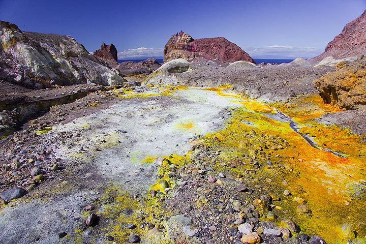
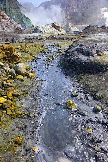
White Island Volcano Photos
Significant volcanic eruptions: White Island volcano
Additionally, there are 6 uncertain or discredited eruptions from White Island volcano.
| Date | Note | VEI | Deaths | Damage | ||
|---|---|---|---|---|---|---|
Historical obs./docs. | ? | |||||
| 1978/90 Crater Complex Historical obs./docs. | 2 | |||||
Historical obs./docs. | 2 | 22 | Info | |||
| 2012 lava dome Historical obs./docs. | 1 | |||||
| 1978/90 Crater Complex Historical obs./docs. | 1 | |||||
| 1978/90 Crater Complex Historical obs./docs. | 2 | |||||
| MH vent Historical obs./docs. | 2 | |||||
| MH vent Historical obs./docs. | 3? | |||||
| NW corner of 1978/90 crater complex Historical obs./docs. | 2 | |||||
Historical obs./docs. | 1 | |||||
| Wade Crater Historical obs./docs. | 1 | |||||
| Congress and numerous other craters Historical obs./docs. | 3 | |||||
| North margin of 1978 crater complex Historical obs./docs. | 2 | |||||
Discredited Eruption | ||||||
| Christmas, Gibrus, and 1978 craters Historical obs./docs. | 3 | |||||
| SE of Donald Mound, Historical obs./docs. | 2 | |||||
| South of Rudolf (1971 crater) Historical obs./docs. | 2 | |||||
| Noisy Nellie Crater Historical obs./docs. | 2 | |||||
| Rudolf vent Historical obs./docs. | 2 | |||||
| Rudolf vent Historical obs./docs. | 2 | |||||
| Rudolf vent (back wall of 1933 crater) Historical obs./docs. | 3 | |||||
| Gilliver Crater Historical obs./docs. | 3 | |||||
| Big John Crater Historical obs./docs. | 3 | |||||
| Noisy Nellie Crater Historical obs./docs. | 2 | |||||
| Noisy Nellie and 1933 craters Historical obs./docs. | 1 | |||||
Historical obs./docs. | 2 | |||||
Historical obs./docs. | 2 | |||||
| Noisy Nellie Crater Historical obs./docs. | 2 | |||||
| Foot of crater ridge (1933 crater) Historical obs./docs. | 3 | |||||
Historical obs./docs. | 2 | |||||
| Between Big Donald and Lot's Wife Historical obs./docs. | 1 | |||||
| Little Donald vent Historical obs./docs. | 2 | |||||
| North end of crater (Schuberts Fairy?) Historical obs./docs. | 2 | |||||
| NW end of crater (Lot's Wife vent) Historical obs./docs. | 2 | |||||
Discredited Eruption | ||||||
| 1914 Sep 10 (eruption | Historical obs./docs. | 0 | 11 | Info | ||
Historical obs./docs. | 2 | |||||
?? | Uncertain Eruption | 2 | ||||
Eruptions of White Island volcano
A new phase of activity started on 5 August 2012, following an increase in seismic activity since July. The eruption consisted in weak ash emissions from a new vent in the Crater Lake. It is the first ash emission from White Island in 12 years. ...more info
White Island Volcano FAQ
+When was the last eruption of White Island volcano?
The last confirmed eruption of White Island occurred in 2024.
+How often does White Island volcano erupt?
Since 1826, White Island volcano has had at least 37 historically documented eruptions. This means that it erupts on average every 5.4 years.
Many eruptions of White Island have lasted more than one year. In total, the volcano has been in eruption during 52 out of 199 years until now. In other words, White Island has been active at least one in 3.8 years on average. Note that this value is likely an underestimate, because the known history of eruptions from White Island is likely incomplete, especially further back in time.
+How active is White Island volcano at present?
White Island volcano is very active: Since 1900, it has had 48 eruptions, and been active during 48 years out of 126 as of now. This means, White Island has been in eruption one in 2.6 years on average. The last eruption was in 2024 and ended 3 months ago.
+When was the largest eruption of White Island volcano?
The largest eruption of White Island volcano in historic times occurred in 2000. It ranks as a "vulcanian" eruption with a magnitude 3 on the VEI (Volcanic Explosivity Index) scale.
Latest satellite images
White Island Volcano Maps