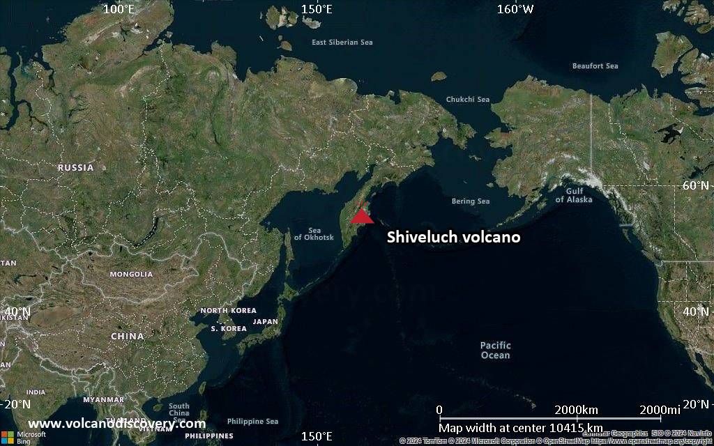
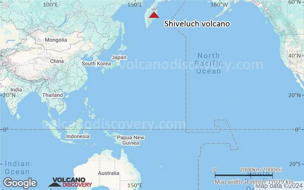
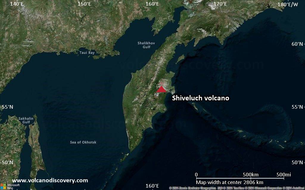
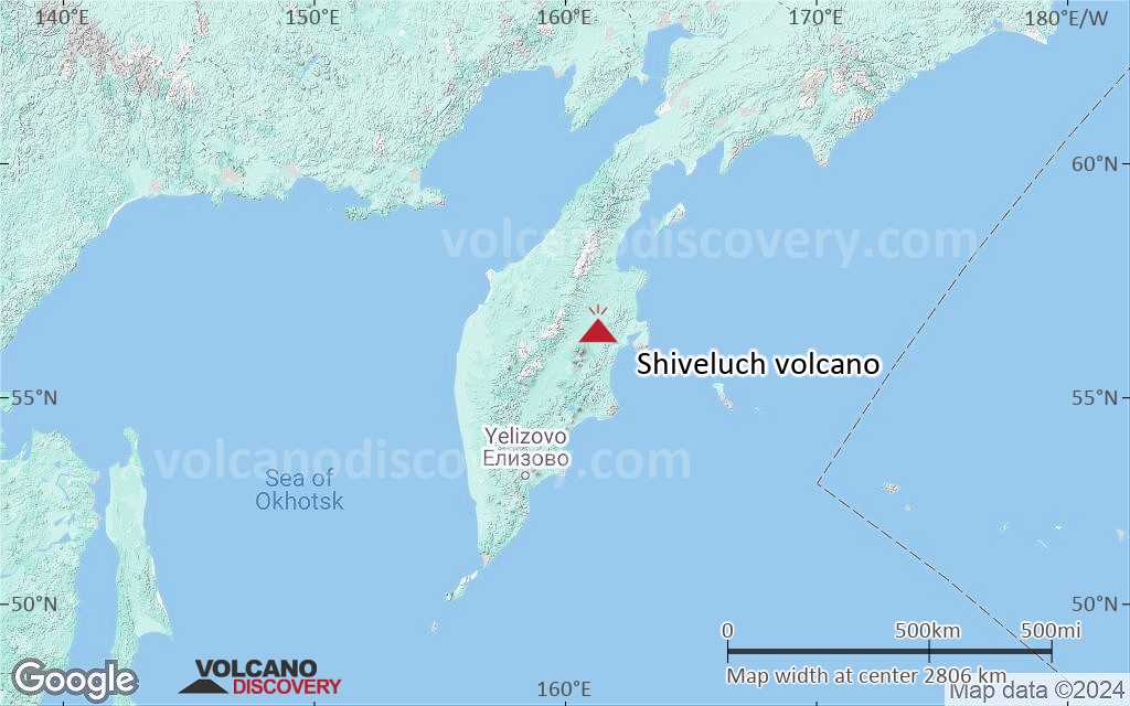
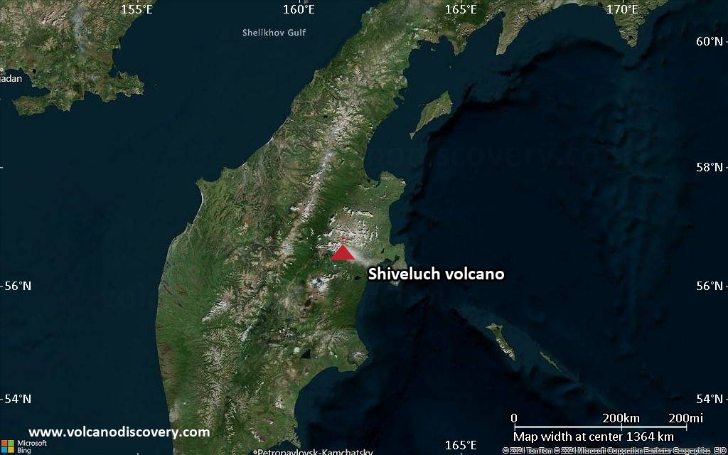
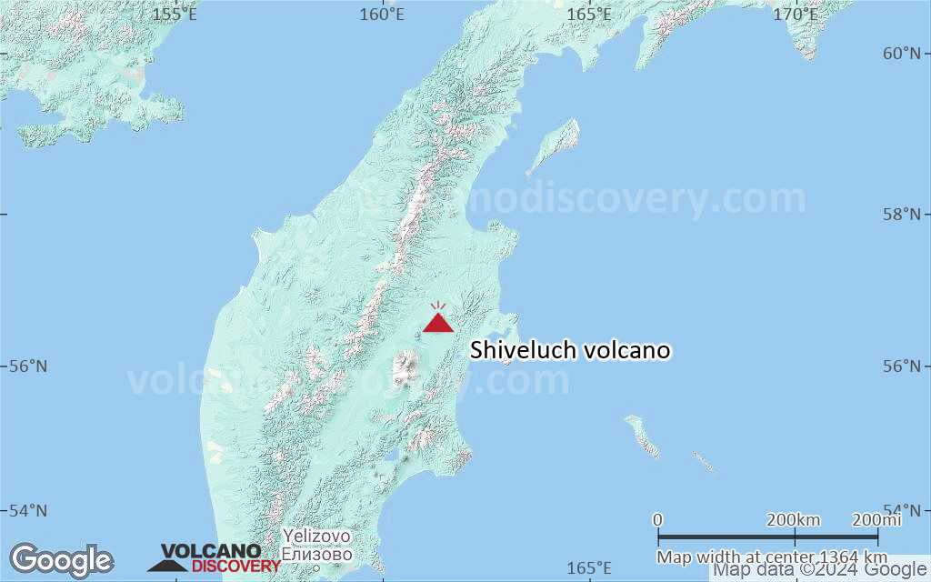
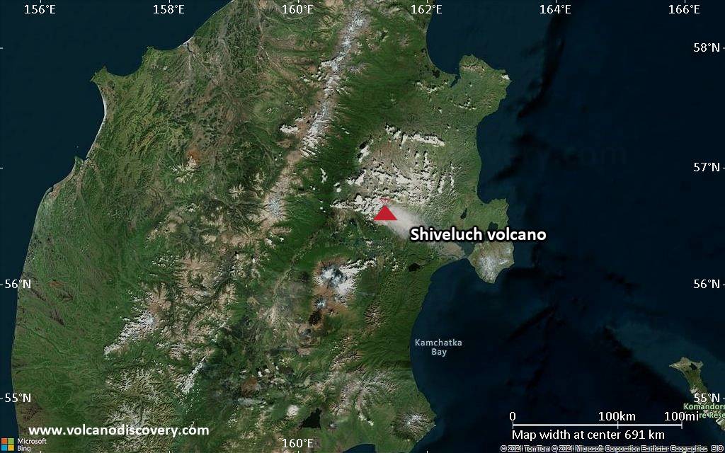
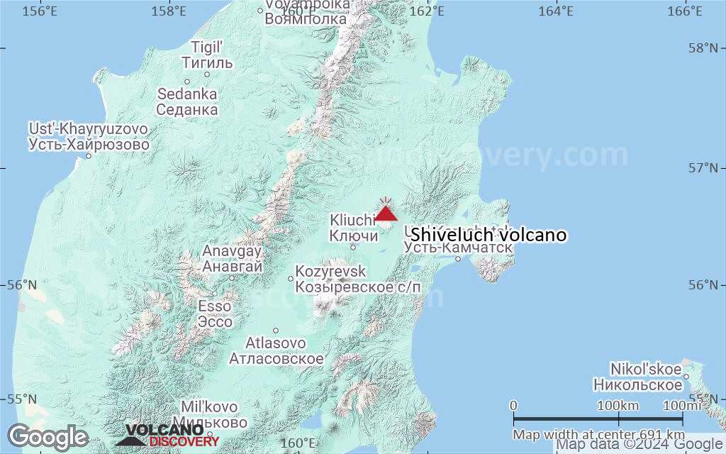
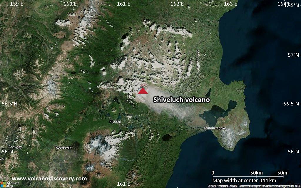
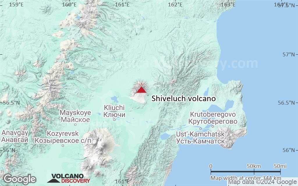
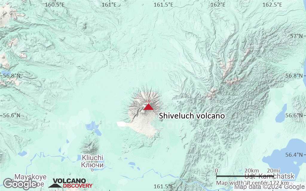
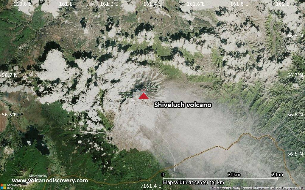
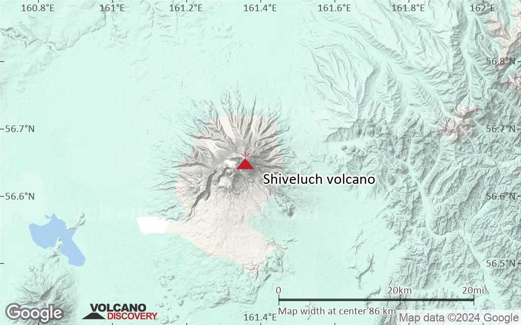
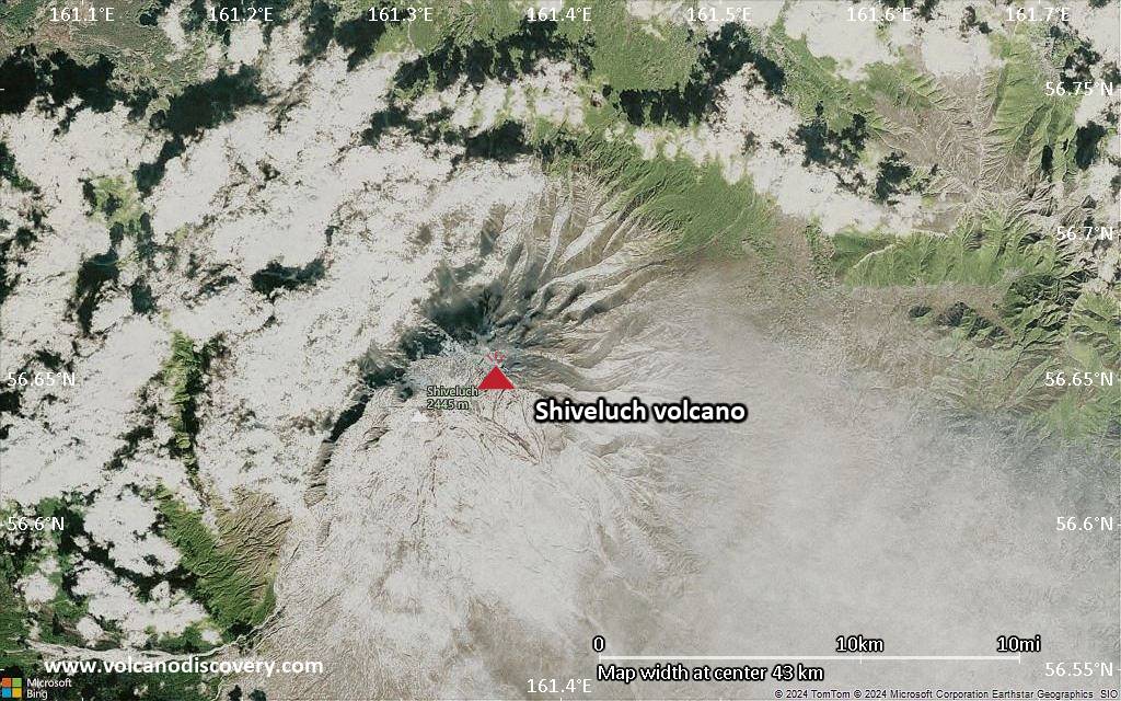
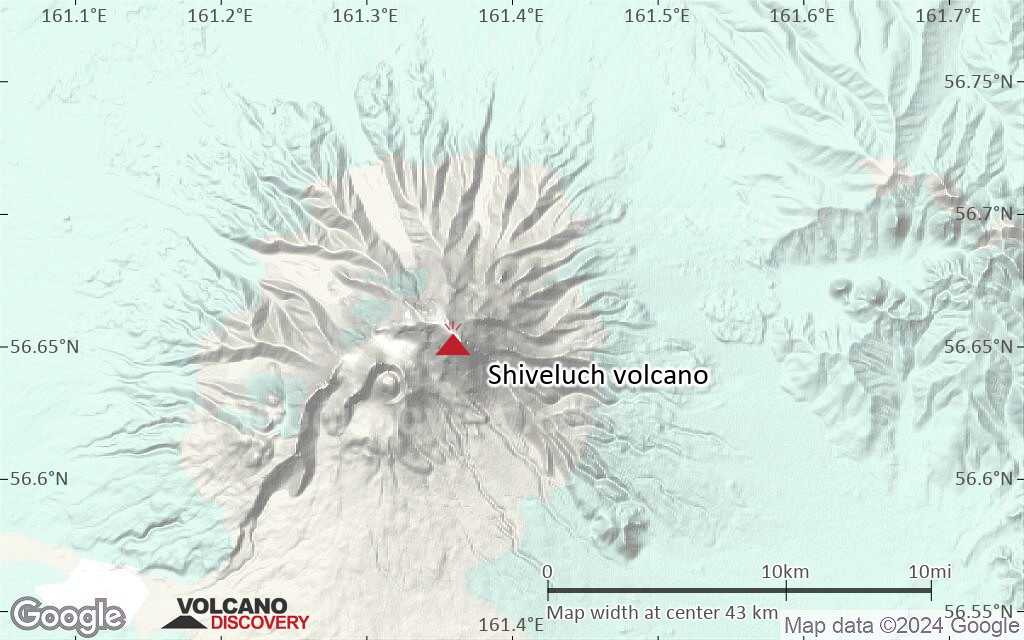
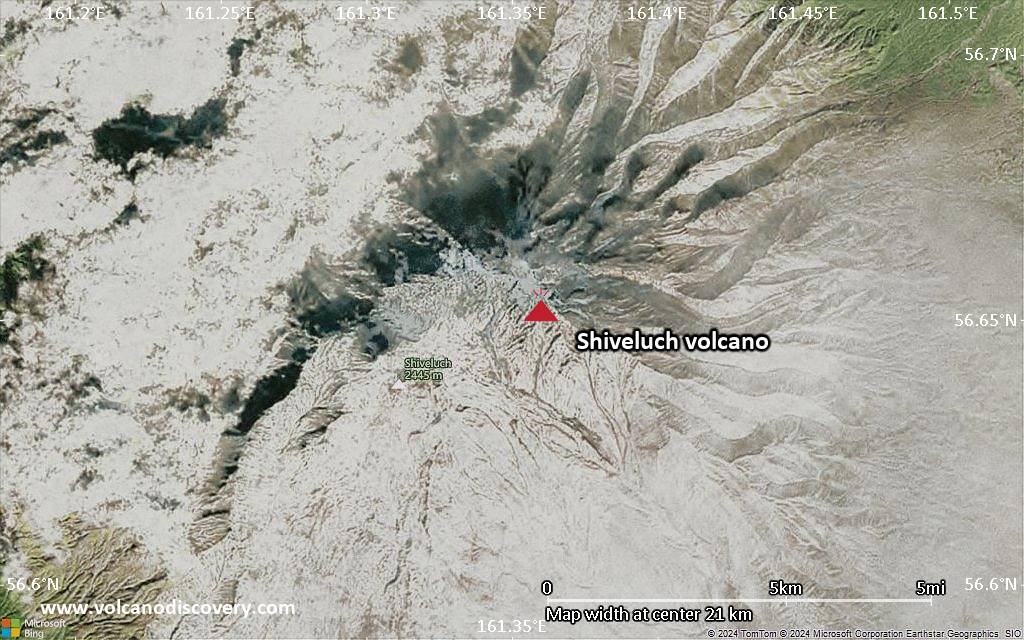
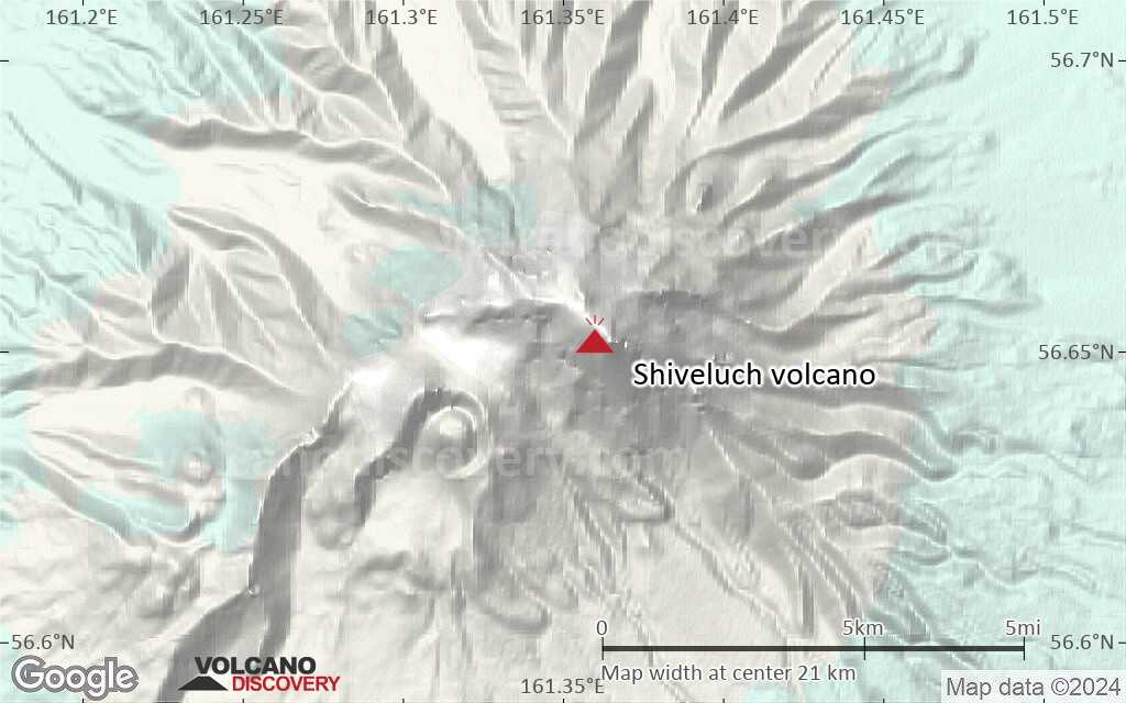
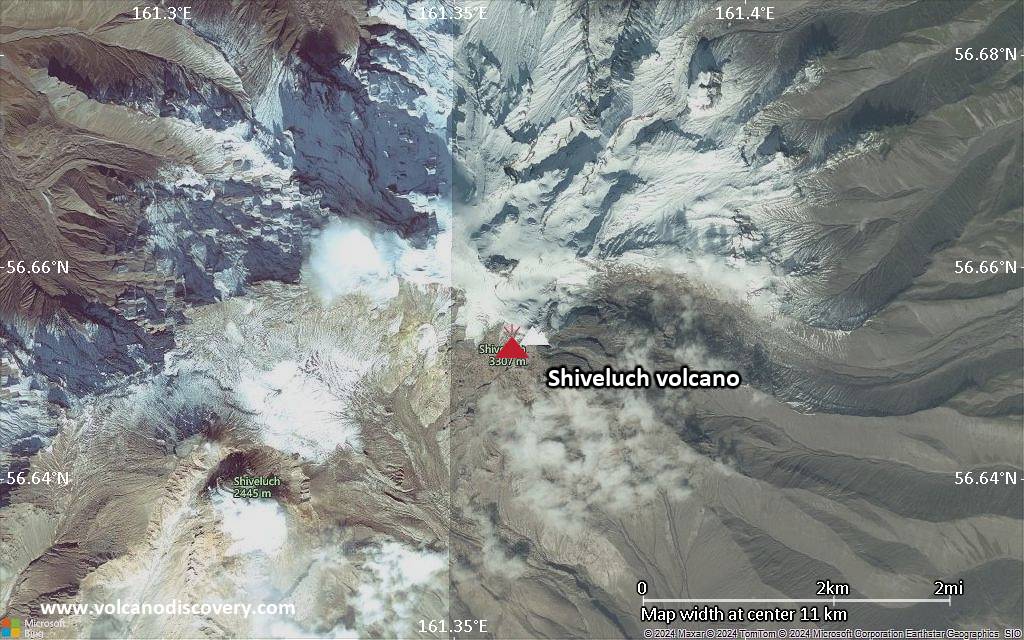
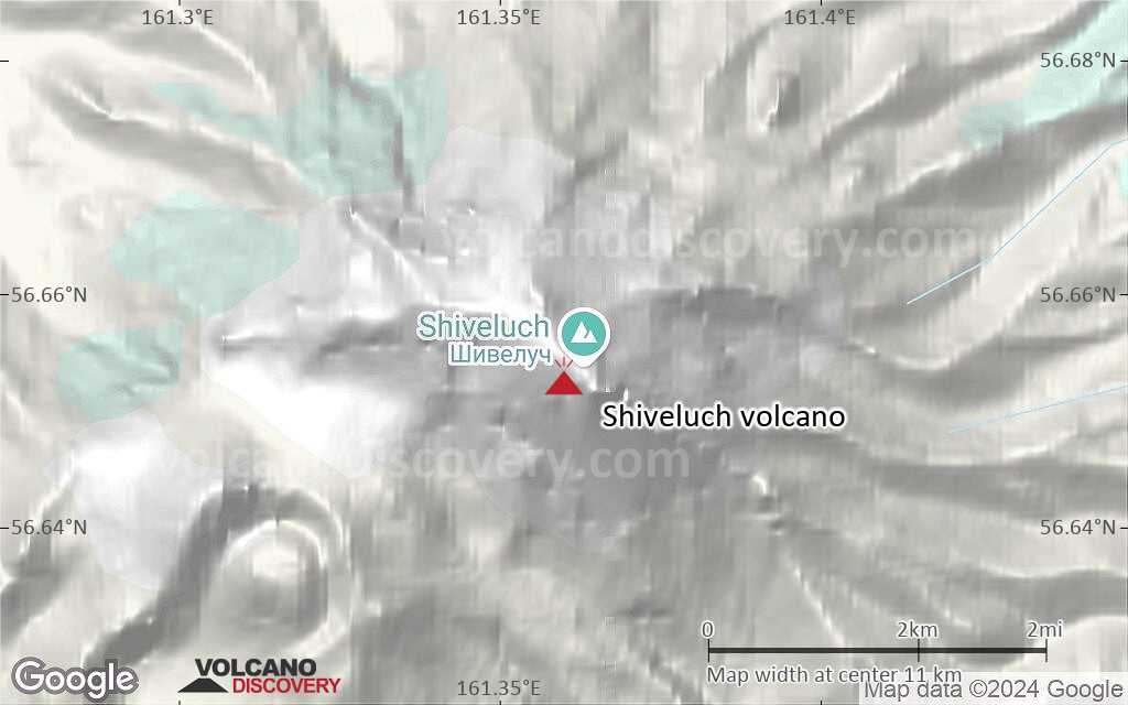
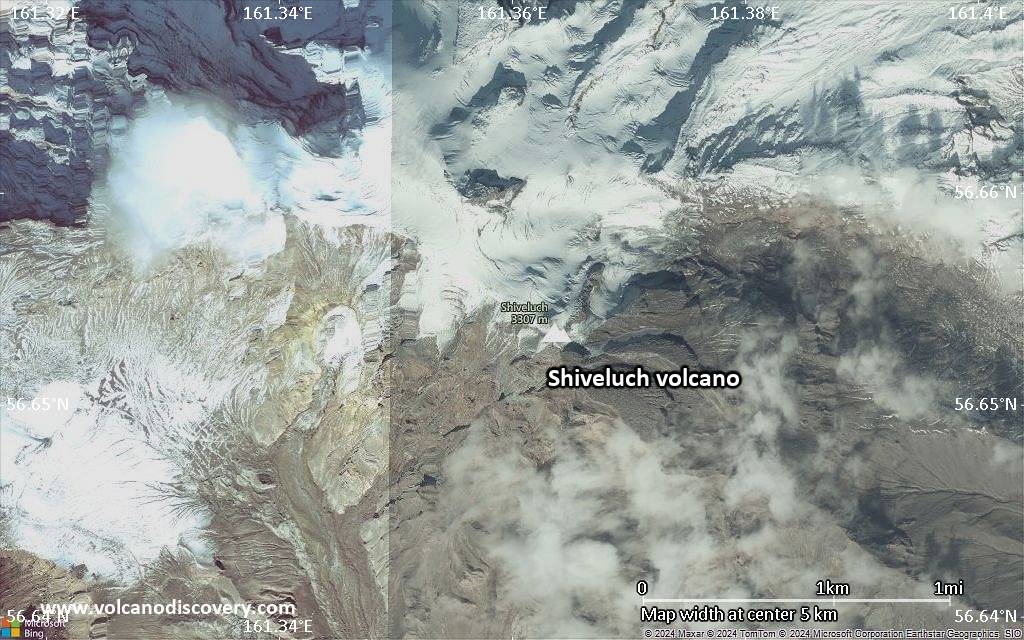
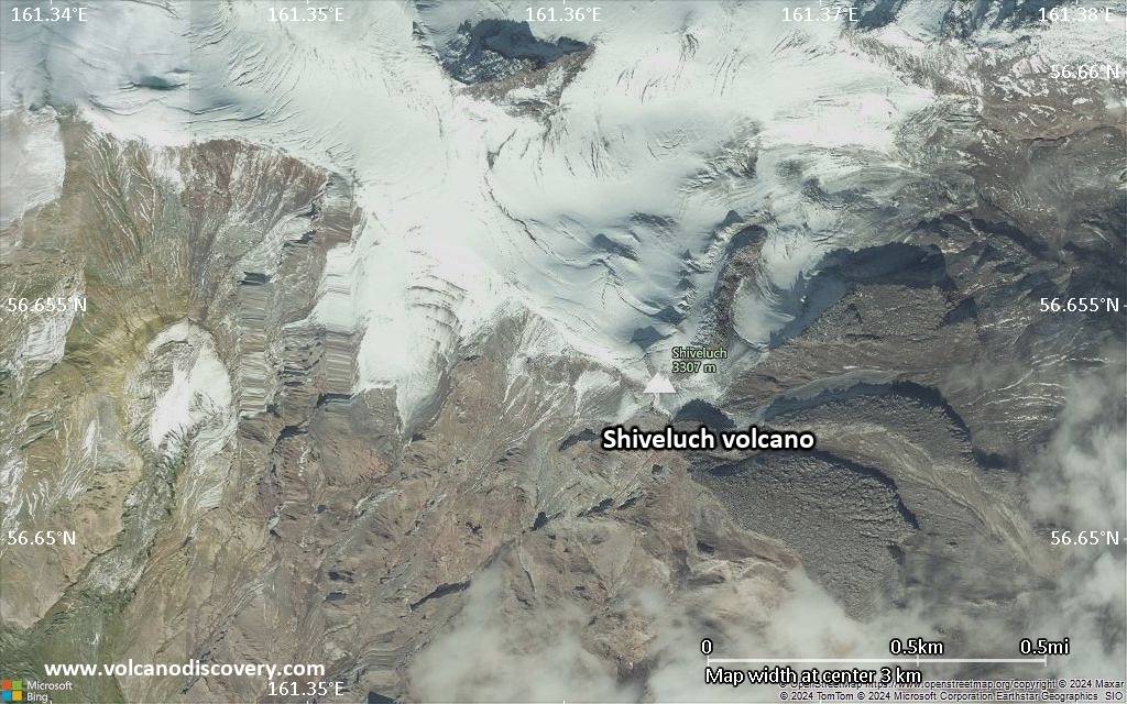
| RSS | EN | DE | EL | ES | FR | IT | RU

Shiveluch Volcano

Updated: Apr 2, 2025 03:31 GMT -
Stratovolcano
Kamchatka, 56.65°N / 161.36°E
Summit height: 3283 m (10,771 ft)
Current status: erupting (4 out of 5)
Last update: 31 Mar 2025 (Volcanic Ash Advisory)
Shiveluch volcano on a Terra satellite image from 19 Feb 2012. Volcanic debris is seen on the lower flanks; the debris traveled about 10 kilometers (6 miles) from Shiveluch’s growing lava dome. (Nasa Earth Observatory)

Shiveluch (Sheveluch) volcano is one of Kamchatka's largest and most active volcanoes, and the one that has had the most violent eruptions.

[smaller] [larger]
Typical eruption style: Highly explosive. Construction of lava domes and large pyroclastic flows caused by dome collapse. One of Kamchatka's largest and most active volcanoes.
Shiveluch volcano eruptions: 1739(?), 1800(?), 1854 (Plinian eruption), 1879-83, 1897-98, 1905, 1928-29, 1930, 1944-50, 1964 (sub-Plinian, large dome collapse and debris flow), 1980-81, 1984, 1985, 1986-88, 1988, 1989 1990-94, 1997, 1998, 1999, 1999-ongoing

Latest nearby earthquakes

Date and TimeMag / DepthDistance / Location

Background

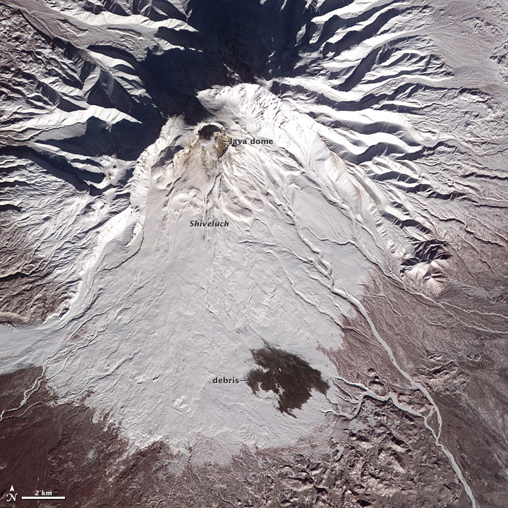
Shiveluch has had over 60 large explosive eruptions during the past 10,000 years. Catastrophic eruptions took place in 1854 and 1956, when a large part of the lava dome collapsed and created a devastating debris avalanche.
It belongs to the Kliuchevskaya volcano group and is about 65,000 years old. Its summit is truncated by a broad 9-km-wide caldera of about 10,000 years of age, breached to the south. Many lava domes dot its outer flanks. Widespread tephra layers from Shiveluch's eruptions are valuable time markers for dating volcanic events in Kamchatka.

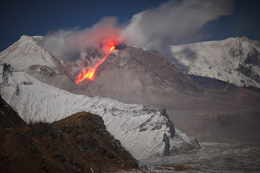
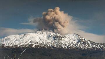
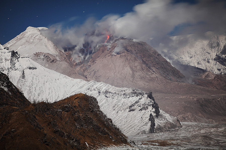
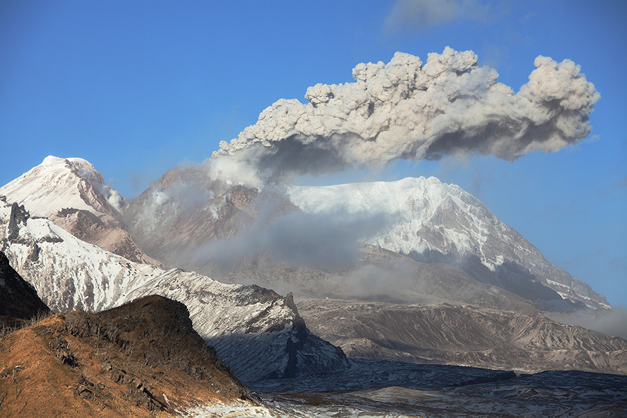
Shiveluch Volcano Photos

Significant volcanic eruptions: Shiveluch volcano

In the past 10,000 years, Shiveluch has had at least 102 confirmed volcanic eruptions, out of which 20 are documented by historical records, while the others can be inferred from geological evidence.
Additionally, there are 3 uncertain or discredited eruptions from Shiveluch volcano.
The table below lists all known eruptions (date in bold face) of Shiveluch volcano since around 1800. Updates on the most recent volcanic activity of Shiveluch can be found on the news page of Shiveluch volcano.
DateNoteVEIDeathsDamage
1999 Aug 15 - ongoing
Historical obs./docs.
4?
2024 Aug 17
(eruption 1999 Aug 15 - ongoing)
Tsunami recorded
Historical obs./docs.
4
Info
1999 Aug 15
(eruption 1999 Aug 15 - ongoing)
Historical obs./docs.
4
light
Info
1999 Apr 3 - Apr 12
Historical obs./docs.
2
1998 May 30 - Sep 3
Historical obs./docs.
3
1997 Mar 8 - Apr 4
Historical obs./docs.
2
1990 Jan 10 - 1995 Feb 16 ±15 d.
Historical obs./docs.
3
1990 Feb 2
(eruption 1990 Jan 10 - 1995 Feb 16 ±15 d.)
Historical obs./docs.
3
light
Info
1989 Apr 7 - Jun 26
Historical obs./docs.
2
1988 Dec 7
Historical obs./docs.
2?
1986 Mar 28 - 1988 Feb 28
Historical obs./docs.
3
1985 May 26 - Oct 25
Historical obs./docs.
2
1984 Mar 17 - Sep 6
Historical obs./docs.
2?
1980 Aug 23 - 1981 Dec 1 ±30 d.Center of 1964 crater
Historical obs./docs.
1
1964 Nov 12Molodoy Sheveluch summit domes
Historical obs./docs.
4+
1944 Nov 5 - 1950 Apr 6Suelich
Historical obs./docs.
2
1930 Feb 1 ±30 d.
Historical obs./docs.
1
1928 Jan 27 - 1929 Apr 15 ±45 d.
Historical obs./docs.
1
1905
Historical obs./docs.
?
1897 - 1898
Historical obs./docs.
2
1879 - 1883
Historical obs./docs.
3
1854 Feb 18
Historical obs./docs.
5
1854 Feb 18
(eruption 1854 Feb 18)
Historical obs./docs.
5
light
Info
?? 1800 ±10 y.
Uncertain Eruption
3
Remark:
Our list of volcanic eruptions closely follows the database of eruptions of the Smithsonian's Global Volcanism Project (GVP), the internationally most recognized data source for volcanic eruptions, but also includes significant eruptive episodes or related volcano events. "Volcanic eruptions" are usually to be understood as sequences of individual eruptive episodes that can follow each other, or even overlap (if several vents are involved), and can last many years, decades or even longer. For example, the current activity of Stromboli volcano is understood as a single eruption that has been ongoing since 1934.
Sources: NOAA National Centers for Environmental Information (NCEI), Global Significant Volcanic Eruptions Database. doi:10.7289/V5TD9V7K | Global Volcanism Project / Smithsonian Institution

Shiveluch Volcano FAQ

+When was the last eruption of Shiveluch volcano?

+How often does Shiveluch volcano erupt?

+How active is Shiveluch volcano at present?

+When was the largest eruption of Shiveluch volcano?

Latest satellite images

Shiveluch satellite image sat1Shiveluch satellite image sat2
Shiveluch Volcano Tours
Kamchatka (Russia)
Kamchatka - Land of Colors
volcano expedition to Kamchatka
16-19 days - Easy to Moderate
Price 0 €
no scheduled dates at present
Kamchatka (Russia)
Shiveluch Volcano Special
8-day expedition to see the ongoing eruption of Shiveluch volcano 16-24 Mar 2019
9 days / 8 nights - Easy
Price 2750 €
no scheduled dates at present

Shiveluch Volcano Maps

Below is a selection of maps showing the location and surroundings of the volcano at various resolutions based on aerial-imagery / terrain maps. Feel free to use them for non-commercial purposes on your blog or website as long as you credit them with a link back to this page (click to copy it).
Satellite/aerial-type map of Shiveluch volcano (world scale)
Terrain-type map of Shiveluch volcano (world scale)
Satellite/aerial-type map of Shiveluch volcano (region scale large)
Terrain-type map of Shiveluch volcano (region scale large)
Satellite/aerial-type map of Shiveluch volcano (region scale medium)
Terrain-type map of Shiveluch volcano (region scale medium)
Satellite/aerial-type map of Shiveluch volcano (region scale small)
Terrain-type map of Shiveluch volcano (region scale small)
Satellite/aerial-type map of Shiveluch volcano (local scale large)
Terrain-type map of Shiveluch volcano (local scale large)
Satellite/aerial-type map of Shiveluch volcano (local scale medium)
Terrain-type map of Shiveluch volcano (local scale medium)
Satellite/aerial-type map of Shiveluch volcano (local scale small)
Terrain-type map of Shiveluch volcano (local scale small)
Satellite/aerial-type map of Shiveluch volcano (scale of 10s of km)
Terrain-type map of Shiveluch volcano (scale of 10s of km)
Satellite/aerial-type map of Shiveluch volcano (scale of 20-40 km)
Terrain-type map of Shiveluch volcano (scale of 20-40 km)
Satellite/aerial-type map of Shiveluch volcano (scale of approx. 10-20 km)
Terrain-type map of Shiveluch volcano (scale of approx. 10-20 km)
Satellite/aerial-type map of Shiveluch volcano (scale of 5-10 km)
Satellite/aerial-type map of Shiveluch volcano (scale of few kilometers)
Volcanoes & Earthquakes - new app for Android
Guaranteed tours
6-19 Apr 2025: Desert, salt and volcanoes - Danakil desert (Ethiopia)
12-19 Apr 2025: Europe's Volcanic Outpost - Canary Islands
9-25 Jun 2025: Volcanoes and Spices - Sulawesi/Halmahera (Indonesia)
27 Jun - 6 Jul 2025: Iceland Volcano Special - Iceland
7-23 Jul 2025: Volcanoes and Spices - Sulawesi/Halmahera (Indonesia)
1-17 Aug 2025: Volcanoes and Spices - Sulawesi/Halmahera (Indonesia)
13-26 Sep 2025: Green Volcanoes - Azores (Portugal)
1-14 Oct 2025: Desert, salt and volcanoes - Danakil desert (Ethiopia)
4-12 Oct 2025: From Stromboli to Etna - Sicily and Eolian Islands (Italy)
= spaces available   = guaranteed   = few spaces left   = booked out
Wed, 26 Mar 2025, 15:00

Sheveluch volcano (Russia) - Smithsonian / USGS Weekly Volcanic Activity Report for 19 March-25 March 2025 (Continuing Activity)

The Kamchatkan Volcanic Eruption Response Team (KVERT) reported that lava extrusion may have continued at Sheveluch's “300 years of RAS” dome on the SW flank of Old Sheveluch and at the Young Sheveluch dome during 13-20 March. Daily thermal anomalies over the domes were identified in satellite images. The Aviation Color Code remained at Orange (the second highest level on a four-color scale). ... Read all

On this page:

Why is there advertising on this site?
Sources: VolcanoDiscovery / VolcanoAdventures and other sources as noted.
Use of material: Most text and images on our websites are owned by us. Re-use is generally not permitted without authorization. Contact us for licensing rights.
Volcanoes & Earthquakes
VolcanoDiscovery Home
Volcanoes | Earthquakes | Photos | Volcano News | App
Adventure & Study Travel
Tours to Volcanoes and Volcanic Areas: walking tours, photo tours, study tours
Tours & Dates | FAQ | About us
Get our newsletter!
Company info
Contact | Legal info | Terms & conditions
Follow us
Follow us on facebook Follow us on Instagram Follow us on Bluesky Follow us on Twitter Visit our Youtube channel
EN | DE | EL | ES | FR | IT | RU
VolcanoDiscovery GmbH, Germany, Reg. nr.: HRB 103744, EU Tax Id: DE 297 465 123 owned and created by
Dr. Tom Pfeiffer, volcanologist, volcano photographer, tour organizer member of
IAVCEI
IAVCEI
Vulkanologische Gesellschaft
Volcanological Society
Ecotourism Greece
Ecotourism Greece
RUV insurance
Insured by R+V
VolcanoDiscovery © 2004- All Rights Reserved | Privacy - Cookie Settings