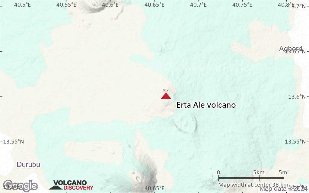
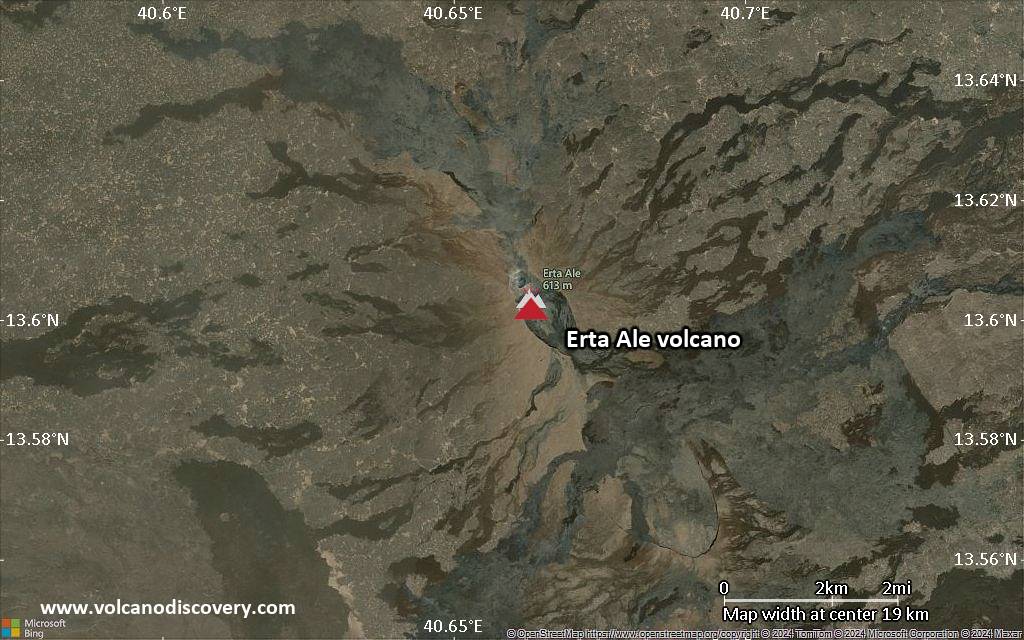
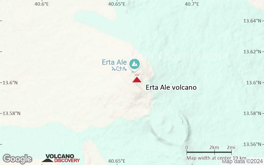
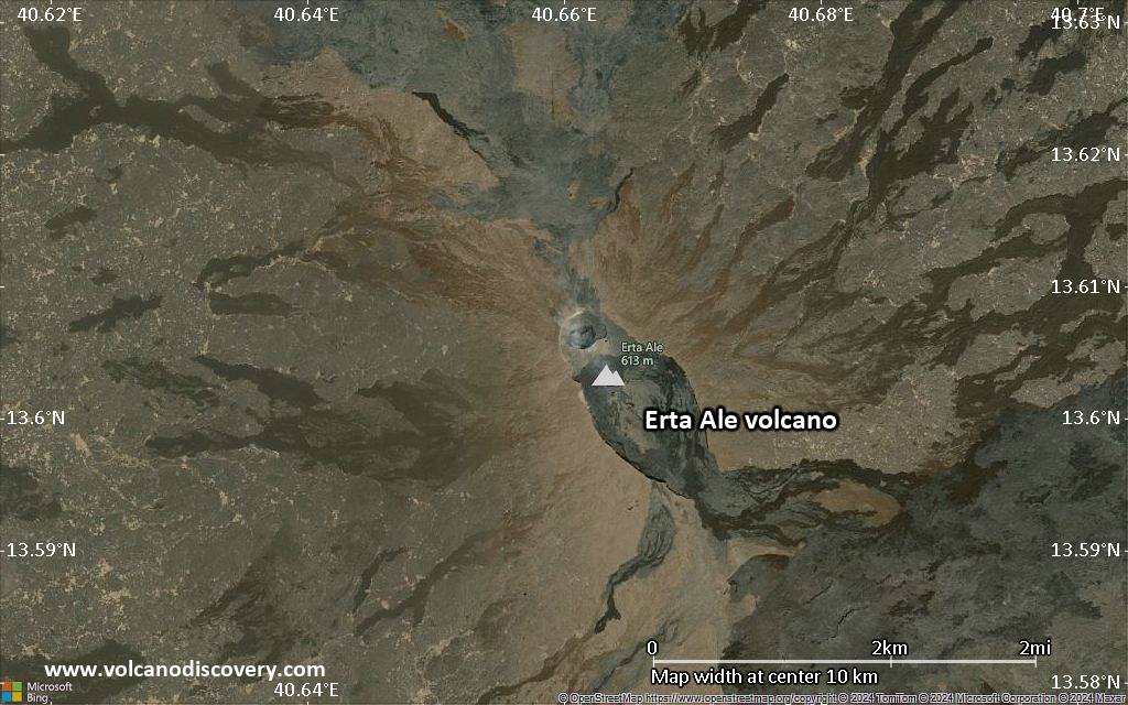
| RSS | EN | DE | EL | ES | FR | IT | RU

Erta Ale Volcano

Updated: Mar 24, 2025 23:16 GMT -
Shield volcano
Danakil depression, Ethiopia, 13.6°N / 40.66°E
Summit height: 613 m / 2,011 ft
Current status: erupting (4 out of 5)
Last update: 22 Jan 2025 (Smithsonian / USGS Weekly Volcanic Activity Report)
Erta Ale's active crater containing the lava lake

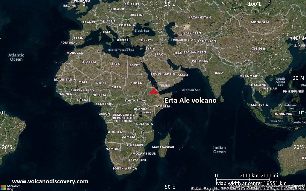
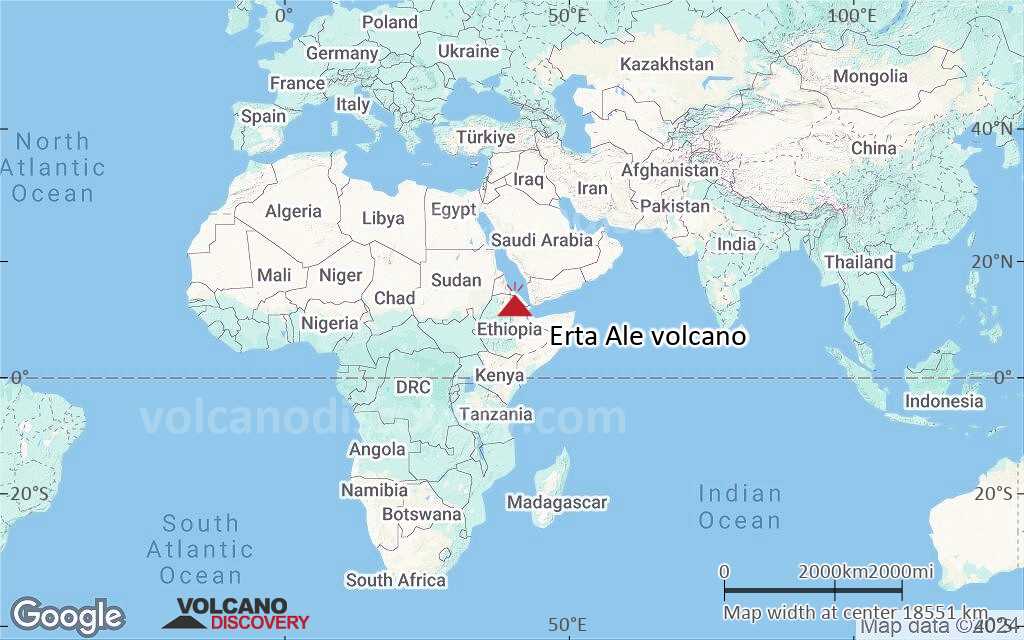
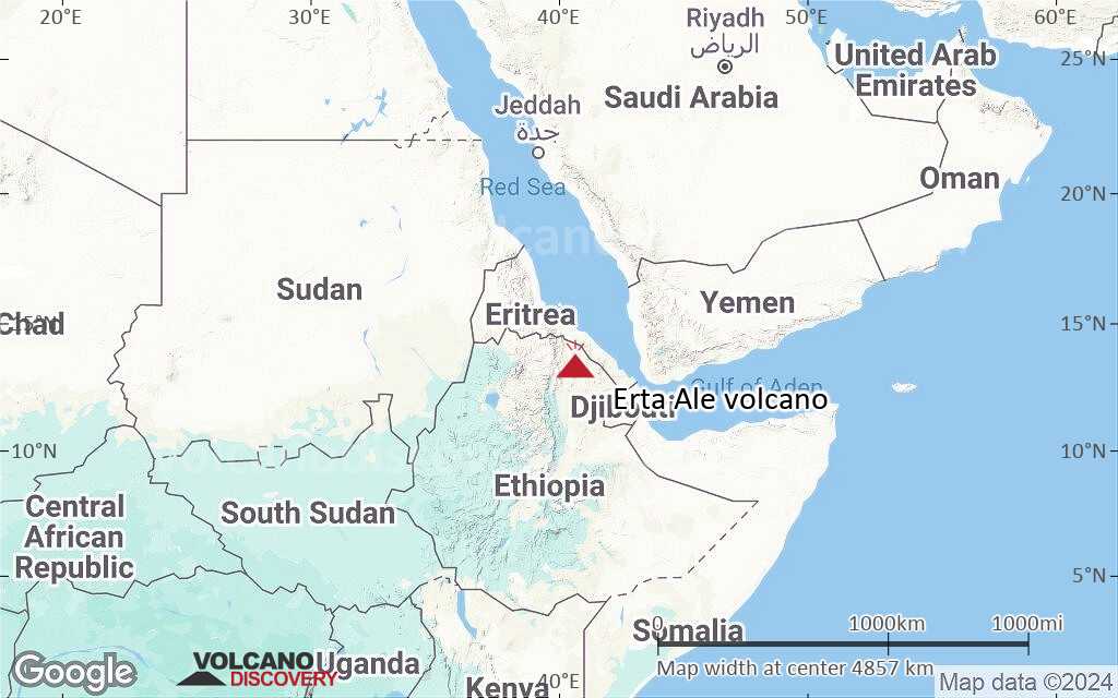
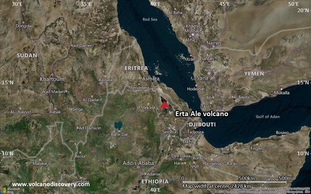
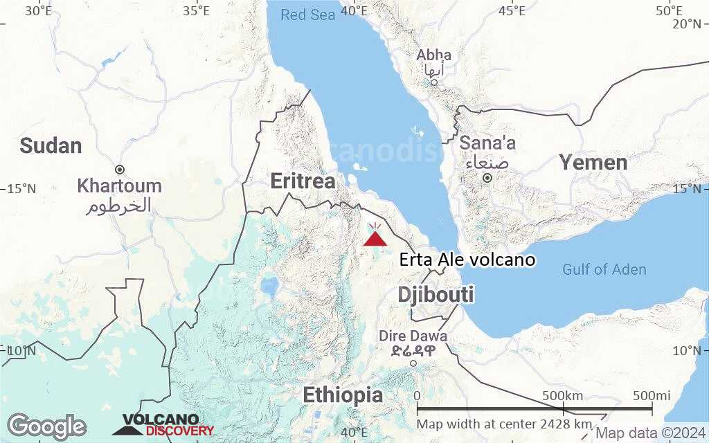
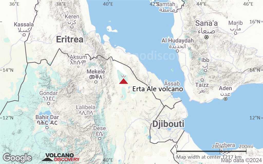
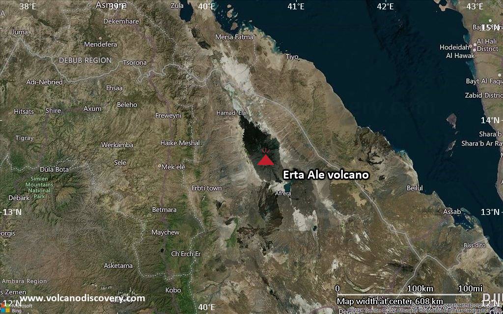
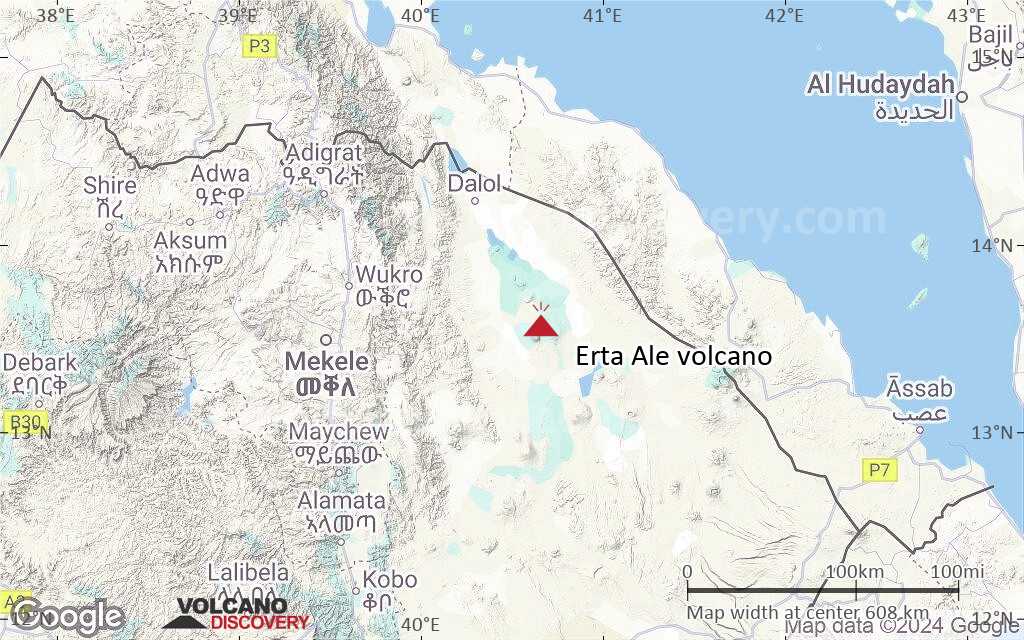
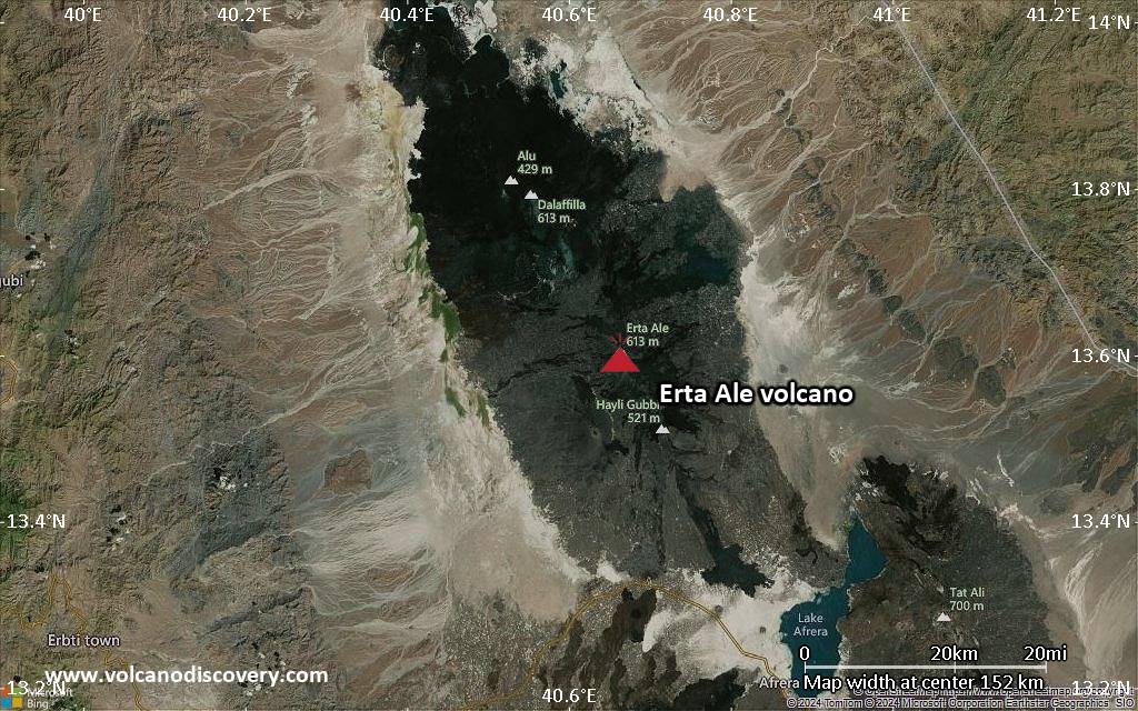
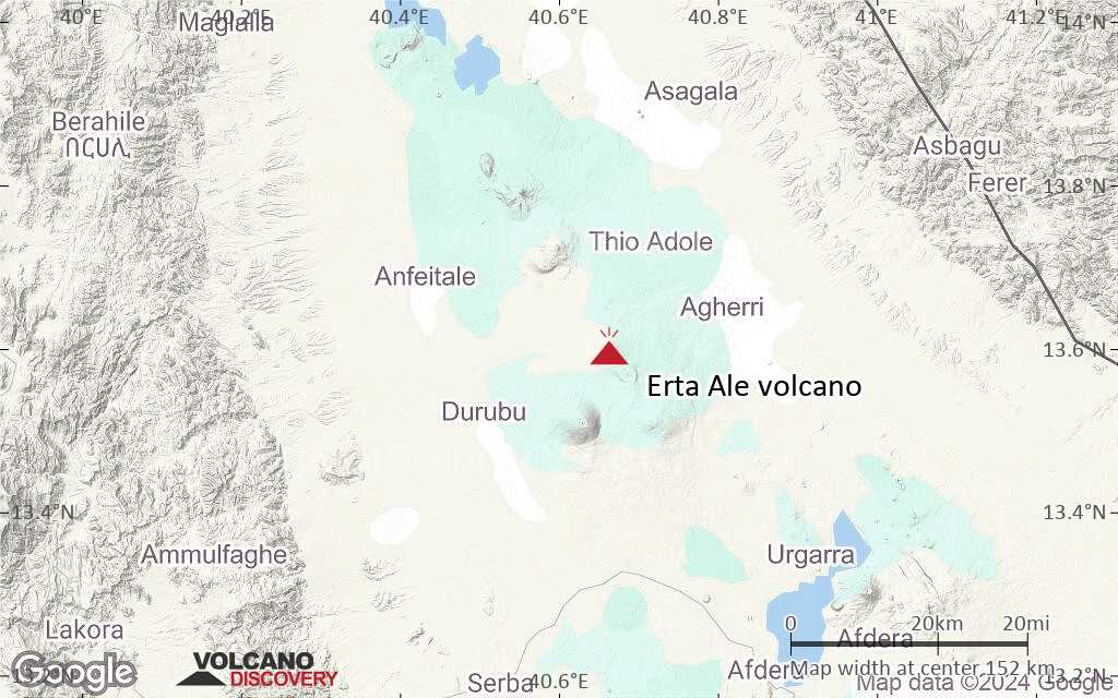
Erta Ale volcano is a large basaltic shield volcano in the Erta Ale volcanic range in the central northern Danakil depression (NE Ethiopia).
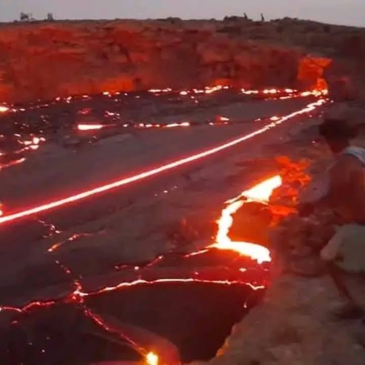
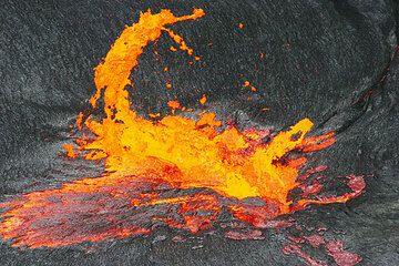
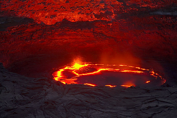
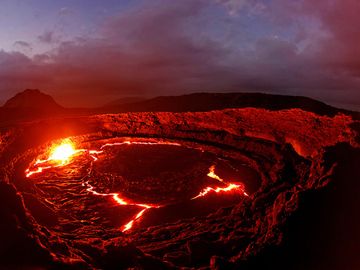
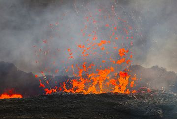
It is famed for its persistent lava lake which has been active during most of the past decades since it was first discovered in the 1960s.
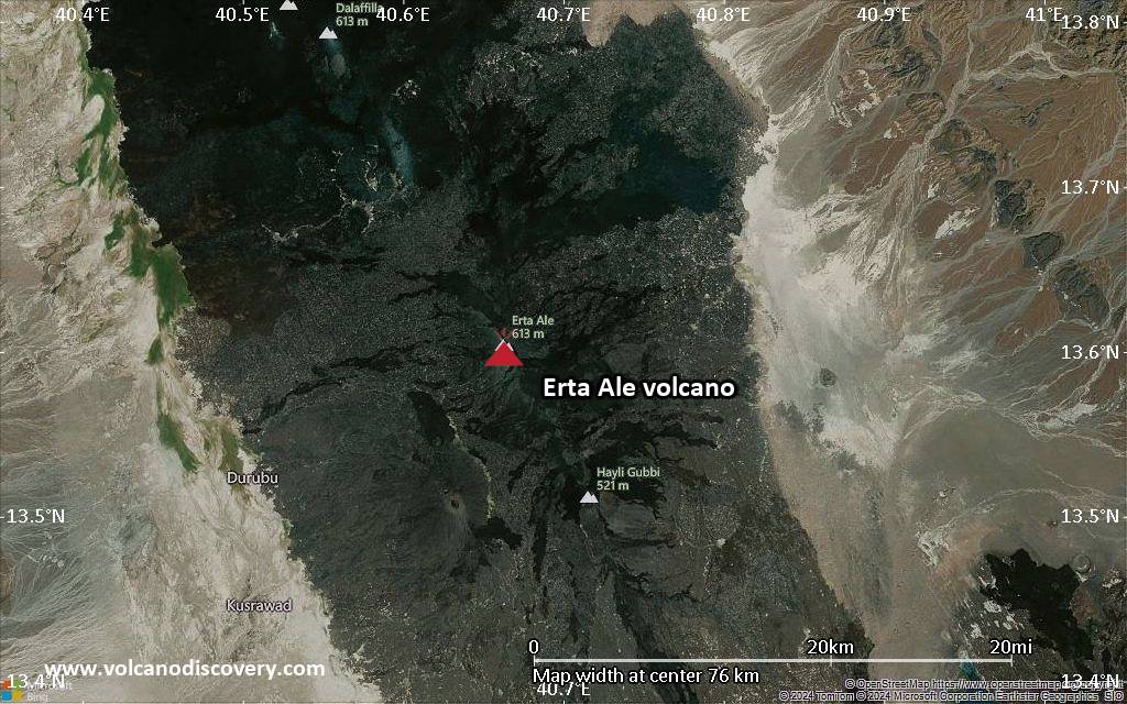
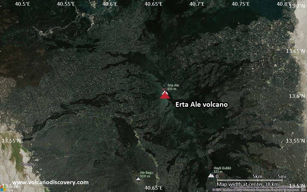
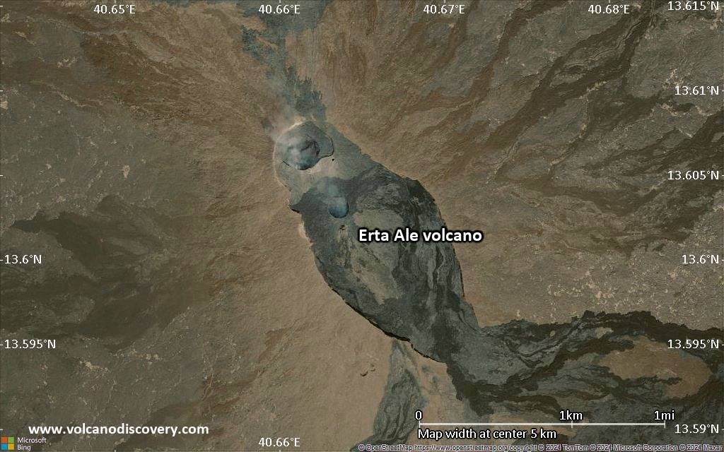
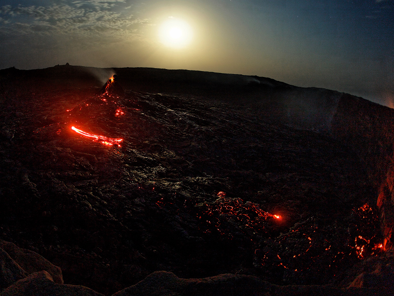
Erta Ale is only 613 m high, but as typical for a shield volcano has a very gentle slopes and a large 40 km diameter base. The summit is truncated by a complex, elongated 1700 x 600 m wide caldera which contains vast lava flows and several larger and smaller pit craters, most notably the active north and south crater, which contains the lava lake at present.
Erta Ale is one of the main attractions of the Danakil, and had became a popular tour destination in recent years. Unfortunately, the deadly attack on 4 January 2012 against tourists and scientists camped on the crater rim, in which several were killed, illustrates that the area is politically unstable and can be subject to terrorist attacks. Anyone visiting the volcano should be aware of this.

[smaller] [larger]
Typical eruption style: Effusive. Persistant lava lake.
Erta Ale volcano eruptions: 1873(?), 1903(?), 1904(?), 1906, 1940, 1960, 1967-2004, 2005-ongoing

Latest nearby earthquakes

Date and TimeMag / DepthDistance / Location

Background

Erta Ale is one of the few volcanoes on the world that have an almost persistent lava lake. It is an isolated basaltic shield volcano, 50 km wide, rising more than 600 m from below sea level in the barren Danakil depression.
The volcano contains a 0.7 x 1.6 km elliptical summit crater with several steep-sided pit craters, one of them containing a lava lake. Another larger 1.8 x 3.1 km wide depression, elongated parallel to the trend of the Erta Ale range is located to the SE of the summit and is bounded by curvilinear fault scarps on the SE side. Fresh-looking basaltic lava flows from these fissures have poured into the caldera and locally overflowed its rim. The summit caldera is renowned for one, or sometimes two long-term lava lakes that have been active since at least 1967, or possibly since 1906. Recent fissure eruptions have occurred on the northern flank of Erta Ale.
---
Source: GVP, Smithsonian Institution

Erta Ale Volcano Photos

Significant volcanic eruptions: Erta Ale volcano

In the past 10,000 years, Erta Ale has had at least 4 confirmed eruptions, all documented by historical records or observations.
Additionally, there are 3 uncertain or discredited eruptions from Erta Ale volcano.
The table below lists all known eruptions (date in bold face) of Erta Ale volcano in historic times and during the past 10,000 years. Updates on the most recent volcanic activity of Erta Ale can be found on the news page of Erta Ale volcano.
DateNoteVEIDeathsDamage
1967 or before - ongoing
Historical obs./docs.
0
1960 Jan 16 ±15 d.
Historical obs./docs.
0
1940
Historical obs./docs.
0
1906 May
Historical obs./docs.
0
?? 1904 Nov 1 ±60 d.
Uncertain Eruption
2
?? 1903
Uncertain Eruption
2
?? 1873
Uncertain Eruption
2
Remark:
Our list of volcanic eruptions closely follows the database of eruptions of the Smithsonian's Global Volcanism Project (GVP), the internationally most recognized data source for volcanic eruptions, but also includes significant eruptive episodes or related volcano events. "Volcanic eruptions" are usually to be understood as sequences of individual eruptive episodes that can follow each other, or even overlap (if several vents are involved), and can last many years, decades or even longer. For example, the current activity of Stromboli volcano is understood as a single eruption that has been ongoing since 1934.
Sources: NOAA National Centers for Environmental Information (NCEI), Global Significant Volcanic Eruptions Database. doi:10.7289/V5TD9V7K | Global Volcanism Project / Smithsonian Institution

Erta Ale Volcano FAQ

+When was the last eruption of Erta Ale volcano?

+How often does Erta Ale volcano erupt?

+How active is Erta Ale volcano at present?

Latest satellite images

ErtaAle satellite image sat1ErtaAle satellite image sat2
Erta Ale Volcano Tours
Danakil desert (Ethiopia)
Desert, salt and volcanoes
14-day expedition to Erta Ale volcano and Dallol hydrothermal field (Danakil desert, Ethiopia)
14 days / 13 nights - Moderate
Price $ 4390
17-30 Nov 2024
27 Dec 24 - 9 Jan 2025
2-15 Feb 2025
Danakil desert (Ethiopia)
Erta Ale Volcano Special
8-day expedition to Erta Ale volcano, Ethiopia
8 days - Moderate
Price $ 3190
Custom and group dates
29 Oct - 5 Nov 2025
27 Dec 25 - 3 Jan 2026
12-19 Jan 2025

Erta Ale Volcano Maps

Below is a selection of maps showing the location and surroundings of the volcano at various resolutions based on aerial-imagery / terrain maps. Feel free to use them for non-commercial purposes on your blog or website as long as you credit them with a link back to this page (click to copy it).
Satellite/aerial-type map of Erta Ale volcano (world scale)
Terrain-type map of Erta Ale volcano (world scale)
Satellite/aerial-type map of Erta Ale volcano (region scale large)
Terrain-type map of Erta Ale volcano (region scale large)
Satellite/aerial-type map of Erta Ale volcano (region scale medium)
Terrain-type map of Erta Ale volcano (region scale medium)
Satellite/aerial-type map of Erta Ale volcano (region scale small)
Terrain-type map of Erta Ale volcano (region scale small)
Satellite/aerial-type map of Erta Ale volcano (local scale large)
Terrain-type map of Erta Ale volcano (local scale large)
Satellite/aerial-type map of Erta Ale volcano (local scale medium)
Terrain-type map of Erta Ale volcano (local scale medium)
Satellite/aerial-type map of Erta Ale volcano (local scale small)
Terrain-type map of Erta Ale volcano (local scale small)
Satellite/aerial-type map of Erta Ale volcano (scale of 10s of km)
Terrain-type map of Erta Ale volcano (scale of 10s of km)
Satellite/aerial-type map of Erta Ale volcano (scale of 20-40 km)
Terrain-type map of Erta Ale volcano (scale of 20-40 km)
Satellite/aerial-type map of Erta Ale volcano (scale of approx. 10-20 km)
Terrain-type map of Erta Ale volcano (scale of approx. 10-20 km)
Satellite/aerial-type map of Erta Ale volcano (scale of 5-10 km)
Satellite/aerial-type map of Erta Ale volcano (scale of few kilometers)
Volcanoes & Earthquakes - new app for Android
Guaranteed tours
6-19 Apr 2025: Desert, salt and volcanoes - Danakil desert (Ethiopia)
12-19 Apr 2025: Europe's Volcanic Outpost - Canary Islands
9-25 Jun 2025: Volcanoes and Spices - Sulawesi/Halmahera (Indonesia)
27 Jun - 6 Jul 2025: Iceland Volcano Special - Iceland
7-23 Jul 2025: Volcanoes and Spices - Sulawesi/Halmahera (Indonesia)
1-17 Aug 2025: Volcanoes and Spices - Sulawesi/Halmahera (Indonesia)
13-26 Sep 2025: Green Volcanoes - Azores (Portugal)
1-14 Oct 2025: Desert, salt and volcanoes - Danakil desert (Ethiopia)
4-12 Oct 2025: From Stromboli to Etna - Sicily and Eolian Islands (Italy)
= spaces available   = guaranteed   = few spaces left   = booked out
Wed, 22 Jan 2025, 15:00

Erta Ale volcano (Ethiopia) - Smithsonian / USGS Weekly Volcanic Activity Report for 15 January-21 January 2025 (Continuing Activity)

Satellite images of Erta Ale on 7, 17, and 22 January showed thermal anomalies over the N and S pit crater vent areas. ... Read all
Wed, 15 Jan 2025, 19:53

Erta Ale volcano (Danakil depression, Ethiopia) field report: incredible videos from eruption site

The active lava flow continues to occupy the southern pit crater area (image: Enku Mulugeta)
Following the recent intense effusive activity of the volcano, the local guide and geologist Enku Mulugeta observed the activity at the site from where we were provided first-hand information. ... Read all
New photos from Erta Ale, Ethiopia!

On this page:

Why is there advertising on this site?
Sources: VolcanoDiscovery / VolcanoAdventures and other sources as noted.
Use of material: Most text and images on our websites are owned by us. Re-use is generally not permitted without authorization. Contact us for licensing rights.
Volcanoes & Earthquakes
VolcanoDiscovery Home
Volcanoes | Earthquakes | Photos | Volcano News | App
Adventure & Study Travel
Tours to Volcanoes and Volcanic Areas: walking tours, photo tours, study tours
Tours & Dates | FAQ | About us
Get our newsletter!
Company info
Contact | Legal info | Terms & conditions
Follow us
Follow us on facebook Follow us on Instagram Follow us on Bluesky Follow us on Twitter Visit our Youtube channel
EN | DE | EL | ES | FR | IT | RU
VolcanoDiscovery GmbH, Germany, Reg. nr.: HRB 103744, EU Tax Id: DE 297 465 123 owned and created by
Dr. Tom Pfeiffer, volcanologist, volcano photographer, tour organizer member of
IAVCEI
IAVCEI
Vulkanologische Gesellschaft
Volcanological Society
Ecotourism Greece
Ecotourism Greece
RUV insurance
Insured by R+V
VolcanoDiscovery © 2004- All Rights Reserved | Privacy - Cookie Settings
Cookie-free, privacy-friendly web stats