Dama Ali Volcano
Updated: Mar 31, 2025 07:55 GMT -
Shield volcano
Ethiopia, 11.28°N / 41.63°E 
Summit height: 1068 m / 3,504 ft
Current status: normal or dormant (1 out of 5)
[smaller] [larger]
Dama Ali volcano eruptions: 1631
Latest nearby earthquakes
| Date and Time | Mag / Depth | Distance / Location | |||
|---|---|---|---|---|---|
Background
Dama Ali is a broad shield volcano that rises above the NW shore of Lake Abbe (also known as Lake Abhe) in eastern Ethiopia. The 25-km-wide volcano was constructed at the southern end of the Kalo Plain. Nested circular craters are located at the summit of the dominantly basaltic volcano, which also displays an older caldera rim. An arcuate chain of rhyolitic lava domes occupies the northern, western, and southern flanks. Youthful basaltic lava flows surround these domes and blanket the flanks of the volcano, and recent flows cover the young sediments of the Kalo and Abhe basins. The Asmara basaltic pyroclastic cone located in the southern Kalo basin SW of the base of Dama Ali volcano and was considered to have had activity during the last 2000 years (International Association of Volcanology and Chemistry of the Earth's Interior, 1973). Dama Ali is considered the most likely source of an eruption reported to have occurred in 1631 (Gouin, 1979). Major fumarolic activity occurs in the summit crater, and abundant hot springs are found on the volcano.---
Smithsonian / GVP volcano information
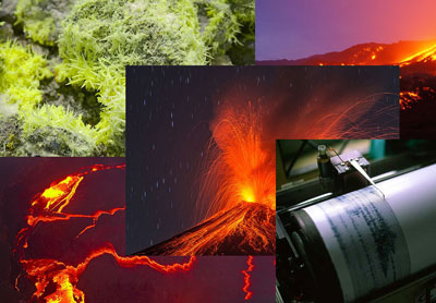
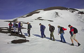
Dama Ali Volcano Photos
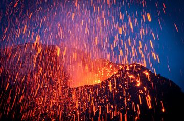
Fireworks at Stromboli volcano, Italy. The photo was taken in spring 2009 and shows an explosion from Stromboli's NE crater in the evening twilight. In the first half of ...
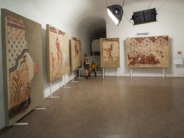
Diverse frescos and wall decorations in then main exhibition hall. (Photo: Tobias Schorr)
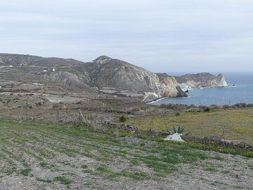
View towards the areas of Akrotiri peninsula that domed up when the first lavas weld up from deep below and pushed the then seafloor above sea level. (Photo: Ingrid Smet)
The first half of the climb to Bocca Nuova is in the relatively flat area around the summit complex known as the Piano caldera (probably formed during a violend summit er...
Significant volcanic eruptions: Dama Ali volcano
No historic eruptions are known from Dama Ali volcano, but at least one eruption in 1631 AD can be inferred from geological evidence.
The table below lists all known eruptions (date in bold face) of Dama Ali volcano in historic times and during the past 10,000 years. Updates on the most recent volcanic activity of Dama Ali can be found on the news page of Dama Ali volcano.
| Date | Note | VEI | Deaths | Damage | |
|---|---|---|---|---|---|
| Volcano Uncertain | ? | ||||
| 1631 AD Feb 14 (eruption | Historical obs./docs. | 0 | 50 | moderate | Info |
Remark:
Our list of volcanic eruptions closely follows the database of eruptions of the Smithsonian's Global Volcanism Project (GVP), the internationally most recognized data source for volcanic eruptions, but also includes significant eruptive episodes or related volcano events. "Volcanic eruptions" are usually to be understood as sequences of individual eruptive episodes that can follow each other, or even overlap (if several vents are involved), and can last many years, decades or even longer. For example, the current activity of Stromboli volcano is understood as a single eruption that has been ongoing since 1934.
Sources: NOAA National Centers for Environmental Information (NCEI), Global Significant Volcanic Eruptions Database. doi:10.7289/V5TD9V7K | Global Volcanism Project / Smithsonian Institution
Dama Ali Volcano FAQ
+When was the last eruption of Dama Ali volcano?
The last confirmed eruption of Dama Ali occurred in 1631 AD.
Latest satellite images

Dama Ali Volcano Maps
Below is a selection of maps showing the location and surroundings of the volcano at various resolutions based on aerial-imagery / terrain maps. Feel free to use them for non-commercial purposes on your blog or website as long as you credit them with a link back to this page (click to copy it).

Satellite/aerial-type map of Dama Ali volcano (world scale)

Terrain-type map of Dama Ali volcano (world scale)

Satellite/aerial-type map of Dama Ali volcano (region scale large)

Terrain-type map of Dama Ali volcano (region scale large)

Satellite/aerial-type map of Dama Ali volcano (region scale medium)

Terrain-type map of Dama Ali volcano (region scale medium)

Satellite/aerial-type map of Dama Ali volcano (region scale small)

Terrain-type map of Dama Ali volcano (region scale small)

Satellite/aerial-type map of Dama Ali volcano (local scale large)

Terrain-type map of Dama Ali volcano (local scale large)

Satellite/aerial-type map of Dama Ali volcano (local scale medium)

Terrain-type map of Dama Ali volcano (local scale medium)

Satellite/aerial-type map of Dama Ali volcano (local scale small)

Terrain-type map of Dama Ali volcano (local scale small)

Satellite/aerial-type map of Dama Ali volcano (scale of 10s of km)

Terrain-type map of Dama Ali volcano (scale of 10s of km)

Satellite/aerial-type map of Dama Ali volcano (scale of 20-40 km)

Terrain-type map of Dama Ali volcano (scale of 20-40 km)

Satellite/aerial-type map of Dama Ali volcano (scale of approx. 10-20 km)

Terrain-type map of Dama Ali volcano (scale of approx. 10-20 km)

Satellite/aerial-type map of Dama Ali volcano (scale of 5-10 km)

Satellite/aerial-type map of Dama Ali volcano (scale of few kilometers)