| RSS | EN | DE | EL | ES | FR | IT | RU

Terceira Volcano

Updated: Apr 17, 2025 21:32 GMT -
stratovolcano, caldera, lavadomes
Terceira Island, Azores, 38.74°N / -27.32°W
Summit height: 1023 m
Current status: restless (2 out of 5)
Last update: 27 Jun 2024 (strongly increased seismic activity)
Santa Barbara Terceira volcano (image: Eva Kubelková)

Terceira Island contains 4 stratovolcanoes and fissure systems constructed along a prominent ESE-WNW-trending fissure zone that cuts across the island.
The westernmost volcanic center, Santa Barbara volcano, is the youngest and the one active in historic times. Its edifice is truncated by two calderas.

[smaller] [larger]
Typical eruption style: Effusive
Terceira volcano eruptions: 1998 Nov-2000 Mar (submarine), 1867, 1761, 1400 ± 50 years, 1200 ± 300 years, 920 AD ± 50 years, 820 AD ± 40 years, 190 AD ± 40 years, 70 AD ± 40 years, 60 BC (?), 90 BC ± 100 years, 670 BC ± 300 years, 940 BC ± 50 years, 2530 BC ± 40 years, 6720 BC ± 50 years

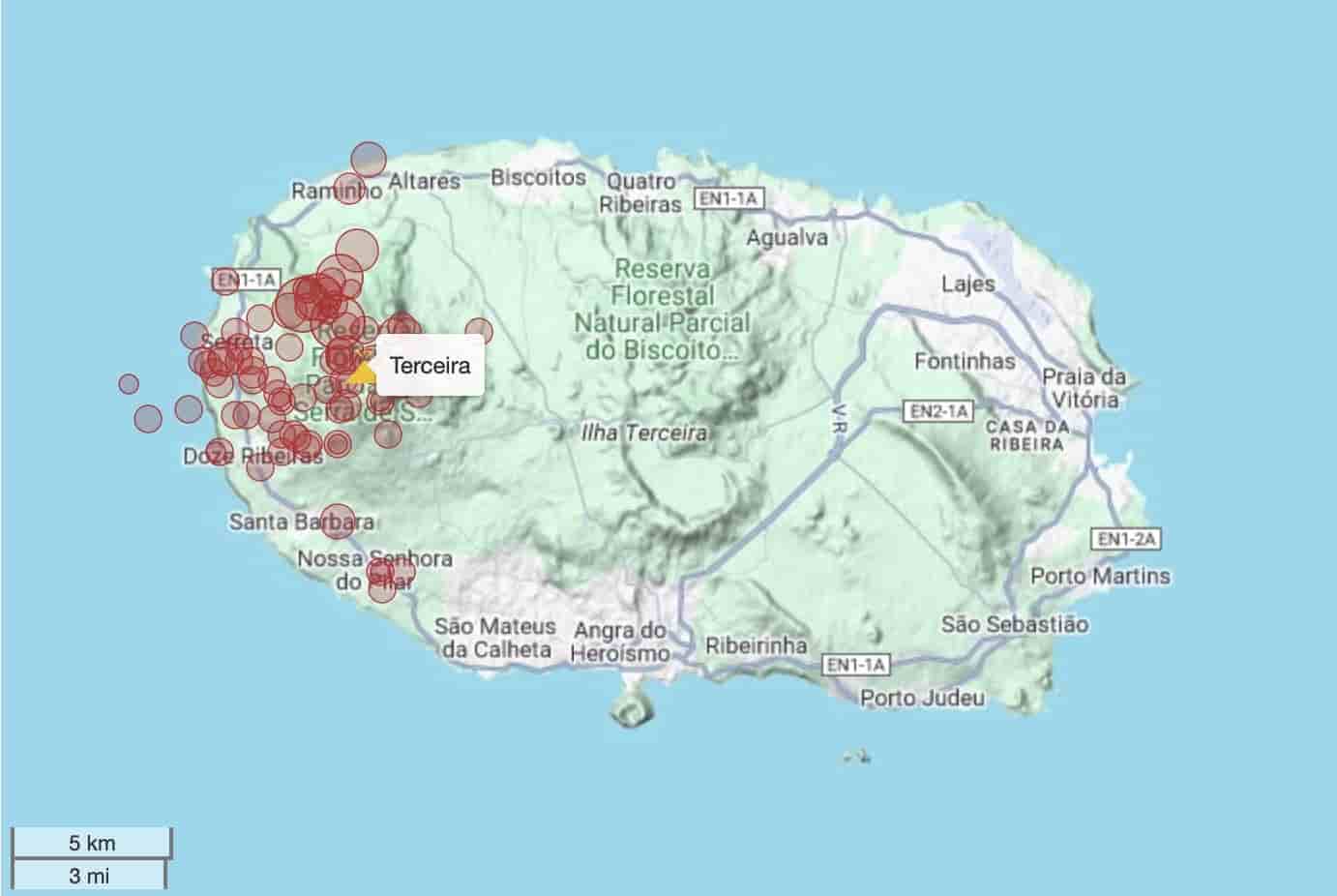
Latest nearby earthquakes

Date and TimeMag / DepthDistance / Location
Apr 17, 01:24 pm (Universal Time)
2.0

8.8 km
1.8 km (1.1 mi) to the NW Azores Islands, Portugal Info
Tuesday, April 15, 2025 GMT (1 quake)
Apr 15, 03:10 am (Universal Time)
2.2

3.7 km
4.8 km (3 mi) to the NE Azores Islands, Portugal Info

Background

Historically active Santa Barbara volcano at the western end of the island is truncated by two calderas. The youngest of these formed about 15,000 years ago. Comenditic lava domes fill and surround the caldera.
Pico Alto lies north of the fissure zone in the north-central part of the island and contains a Pleistocene caldera largely filled by lava domes and lava flows.
Guilherme Moniz caldera lies along the fissure zone immediately to the south, and 7-km-wide Cinquio Picos caldera at the SE end of the island is the largest in the Azores. Historical eruptions have occurred from Pico Alto, the fissure zone between Pico Alto and Santa Barbara, and from submarine vents west of Santa Barbara.
Most Holocene eruptions have produced basaltic-to-rhyolitic lava flows from the fissure zone transecting the island.

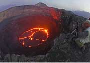
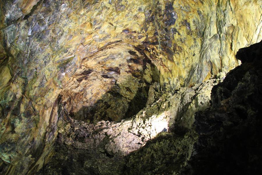
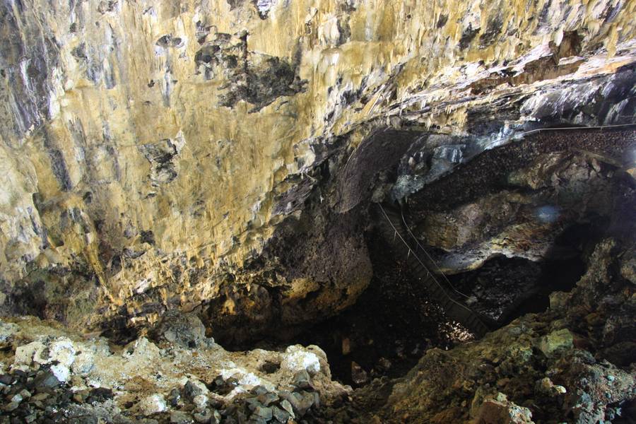
Terceira Volcano Photos

Significant volcanic eruptions: Terceira volcano

In the past 10,000 years, Terceira has had at least 15 confirmed volcanic eruptions, out of which 3 are documented by historical records, while the others can be inferred from geological evidence.

The table below lists all known eruptions (date in bold face) of Terceira volcano in historic times and during the past 10,000 years. Updates on the most recent volcanic activity of Terceira can be found on the news page of Terceira volcano.
DateNoteVEIDeathsDamage
1998 Nov 25 ? - 2000 Mar 16 ±15 d.Serreta Ridge (submarine vent W of Terceira)
Historical obs./docs.
0
1867 Jun 1 - Jun 8Submarine vent 3-6 WNW of Terceira
Historical obs./docs.
3
1761 Apr 17 - Apr 28 ?Fissure zone (east of Santa Barbara)
Historical obs./docs.
2
1400 ±50 y. ADFarol I dome (Santa Barbara)?
1200 ±300 y. ADGuilherme Moniz (Pico Alto)?
920 ±50 y. ADGuilherme Moniz (Quinta da Madalena)?
820 ±40 y. ADSanta Barbara?
190 ±40 y. ADGuilherme Moniz (Pico Alto)?
70 ±40 y. ADFissure zone (east of Santa Barbara)?
60 ? BCFissure zone (south of Pico Alto)?
90 ±100 y. BCFissure zone (east of Santa Barbara)?
670 ±300 y. BCGuilherme Moniz?
940 ±50 y. BCSanta Barbara NW flank (Lagoinha dome)?
2530 ±40 y. BCFissure zone (east of Santa Barbara)?
6720 ±50 y. BCGuilherme Moniz (Pico das Pardelas)?
Remark:
Our list of volcanic eruptions closely follows the database of eruptions of the Smithsonian's Global Volcanism Project (GVP), the internationally most recognized data source for volcanic eruptions, but also includes significant eruptive episodes or related volcano events. "Volcanic eruptions" are usually to be understood as sequences of individual eruptive episodes that can follow each other, or even overlap (if several vents are involved), and can last many years, decades or even longer. For example, the current activity of Stromboli volcano is understood as a single eruption that has been ongoing since 1934.
Sources: NOAA National Centers for Environmental Information (NCEI), Global Significant Volcanic Eruptions Database. doi:10.7289/V5TD9V7K | Global Volcanism Project / Smithsonian Institution

Terceira Volcano FAQ

+When was the last eruption of Terceira volcano?

+How often does Terceira volcano erupt?

+How active is Terceira volcano at present?

+When was the largest eruption of Terceira volcano?

Latest satellite images

Terceira satellite image sat1Terceira satellite image sat2
Terceira Volcano Tours
Azores (Portugal)
Green Volcanoes
14-day geo and photo tour to the Azores: Sao Miguel, Pico, Faial, Flores
14 days / 13 nights - Moderate
Price 4450 €
13-26 Sep 2025

Terceira Volcano Maps

Below is a selection of maps showing the location and surroundings of the volcano at various resolutions based on aerial-imagery / terrain maps. Feel free to use them for non-commercial purposes on your blog or website as long as you credit them with a link back to this page (click to copy it).
Satellite/aerial-type map of Terceira volcano (world scale)
Terrain-type map of Terceira volcano (world scale)
Satellite/aerial-type map of Terceira volcano (region scale large)
Terrain-type map of Terceira volcano (region scale large)
Satellite/aerial-type map of Terceira volcano (region scale medium)
Terrain-type map of Terceira volcano (region scale medium)
Satellite/aerial-type map of Terceira volcano (region scale small)
Terrain-type map of Terceira volcano (region scale small)
Satellite/aerial-type map of Terceira volcano (local scale large)
Terrain-type map of Terceira volcano (local scale large)
Satellite/aerial-type map of Terceira volcano (local scale medium)
Terrain-type map of Terceira volcano (local scale medium)
Satellite/aerial-type map of Terceira volcano (local scale small)
Terrain-type map of Terceira volcano (local scale small)
Satellite/aerial-type map of Terceira volcano (scale of 10s of km)
Terrain-type map of Terceira volcano (scale of 10s of km)
Satellite/aerial-type map of Terceira volcano (scale of 20-40 km)
Terrain-type map of Terceira volcano (scale of 20-40 km)
Satellite/aerial-type map of Terceira volcano (scale of approx. 10-20 km)
Terrain-type map of Terceira volcano (scale of approx. 10-20 km)
Satellite/aerial-type map of Terceira volcano (scale of 5-10 km)
Satellite/aerial-type map of Terceira volcano (scale of few kilometers)
Volcanoes & Earthquakes - new app for Android
Guaranteed tours
9-25 Jun 2025: Volcanoes and Spices - Sulawesi/Halmahera (Indonesia)
27 Jun - 6 Jul 2025: Iceland Volcano Special - Iceland
7-23 Jul 2025: Volcanoes and Spices - Sulawesi/Halmahera (Indonesia)
1-17 Aug 2025: Volcanoes and Spices - Sulawesi/Halmahera (Indonesia)
1-14 Oct 2025: Desert, salt and volcanoes - Danakil desert (Ethiopia)
4-12 Oct 2025: From Stromboli to Etna - Sicily and Eolian Islands (Italy)
3-19 Nov 2025: Volcanoes and Spices - Sulawesi/Halmahera (Indonesia)
= spaces available   = guaranteed   = few spaces left   = booked out
Thu, 27 Jun 2024, 17:01

Santa Bárbara volcano (Terceira Island, Azores): increased earthquake activity triggers volcanic alert

Recent earthquakes under Terceira island (past 30 days), clustering under the Santa Barbara volcano
The Institute of Volcanology of the University of the Azores (IVAR) increased the volcanic alert level of Santa Barbara volcano on Terceira Island to V3 on a scale ranging from V0 (green, normal) to V6 (red, erupting). The decision came after a new seismic crisis has been affecting the western part of the island since June 24, 2022, continues, with a current tendency of increasing. ... Read all

On this page:

Why is there advertising on this site?
Sources: VolcanoDiscovery / VolcanoAdventures and other sources as noted.
Use of material: Most text and images on our websites are owned by us. Re-use is generally not permitted without authorization. Contact us for licensing rights.
Volcanoes & Earthquakes
VolcanoDiscovery Home
Volcanoes | Earthquakes | Photos | Volcano News | | Shop | App
Adventure & Study Travel
Tours to Volcanoes and Volcanic Areas: walking tours, photo tours, study tours
Tours & Dates | FAQ | About us
Get our newsletter!
Company info
Contact | Legal info | Terms & conditions
Follow us
Follow us on facebook Follow us on Instagram Follow us on Bluesky Follow us on Twitter Visit our Youtube channel
EN | DE | EL | ES | FR | IT | RU
VolcanoDiscovery GmbH, Germany, Reg. nr.: HRB 103744, EU Tax Id: DE 297 465 123 owned and created by
Dr. Tom Pfeiffer, volcanologist, volcano photographer, tour organizer member of
IAVCEI
IAVCEI
Vulkanologische Gesellschaft
Volcanological Society
Ecotourism Greece
Ecotourism Greece
RUV insurance
Insured by R+V
VolcanoDiscovery © 2004- All Rights Reserved | Privacy - Cookie Settings