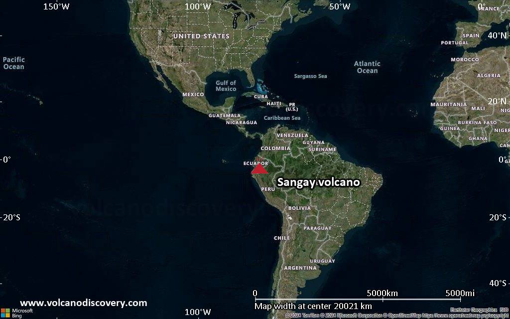
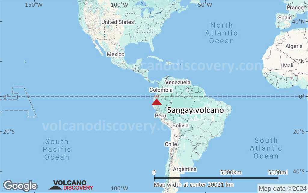
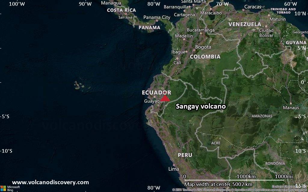
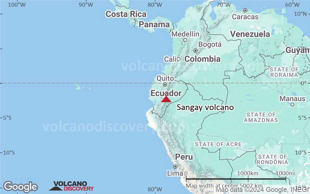
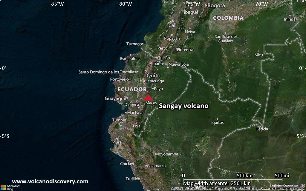
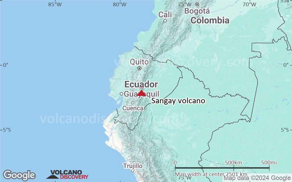
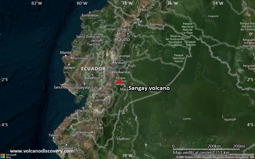
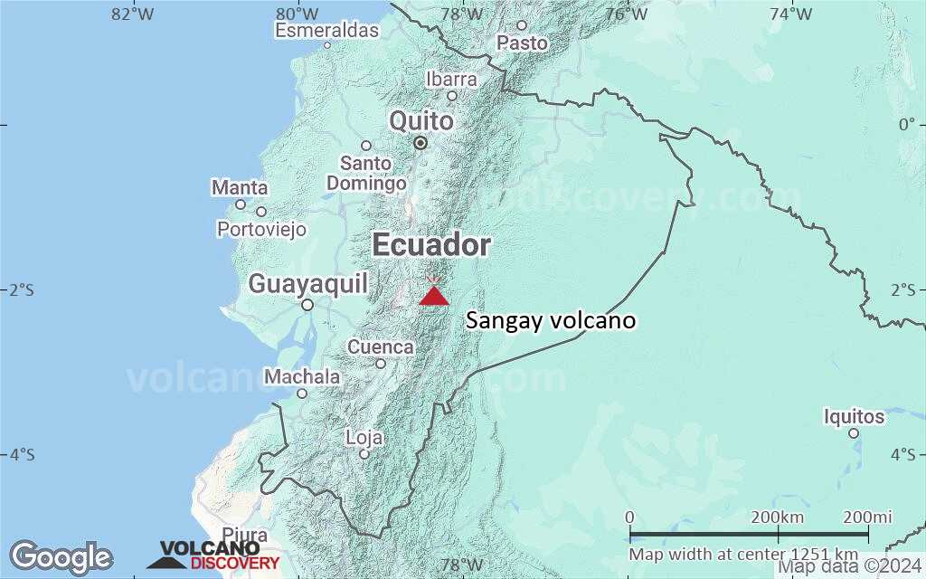
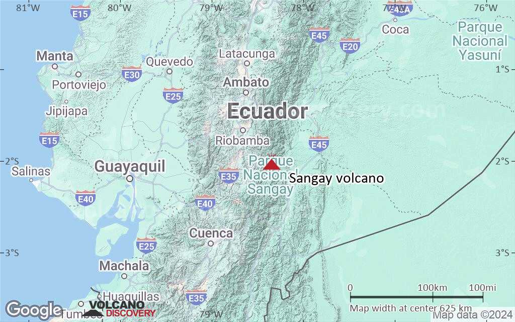
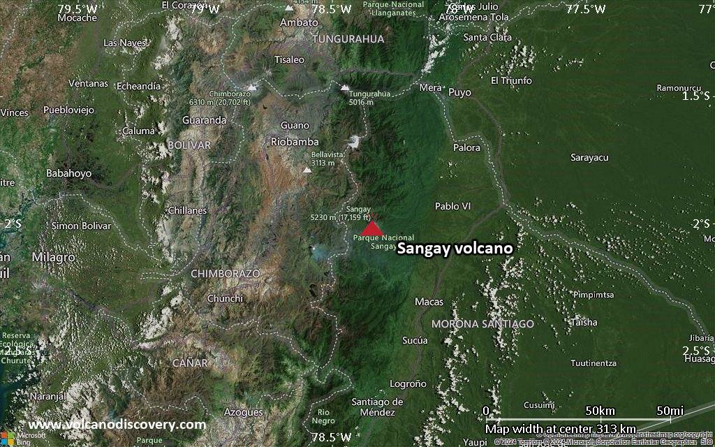
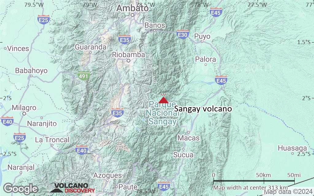
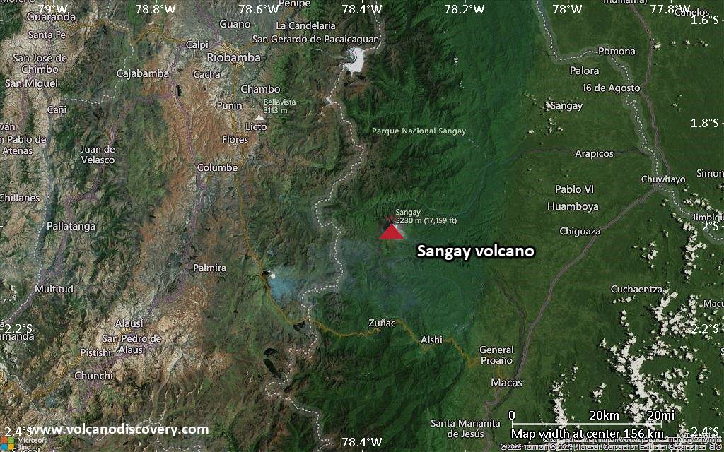
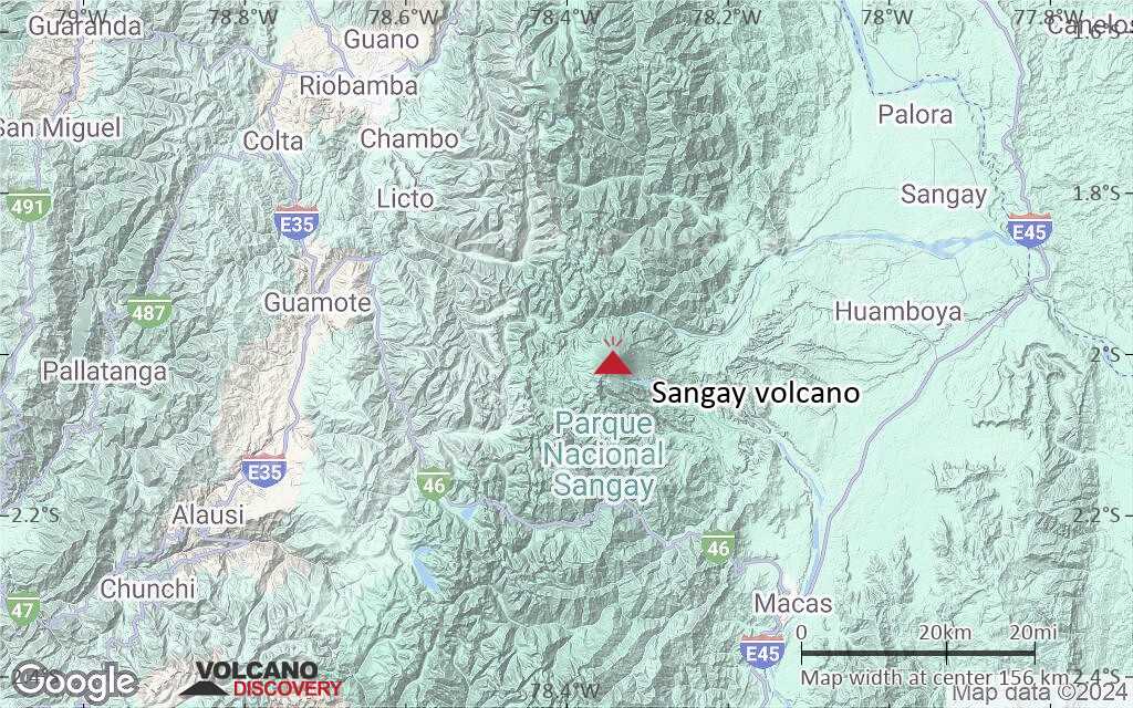
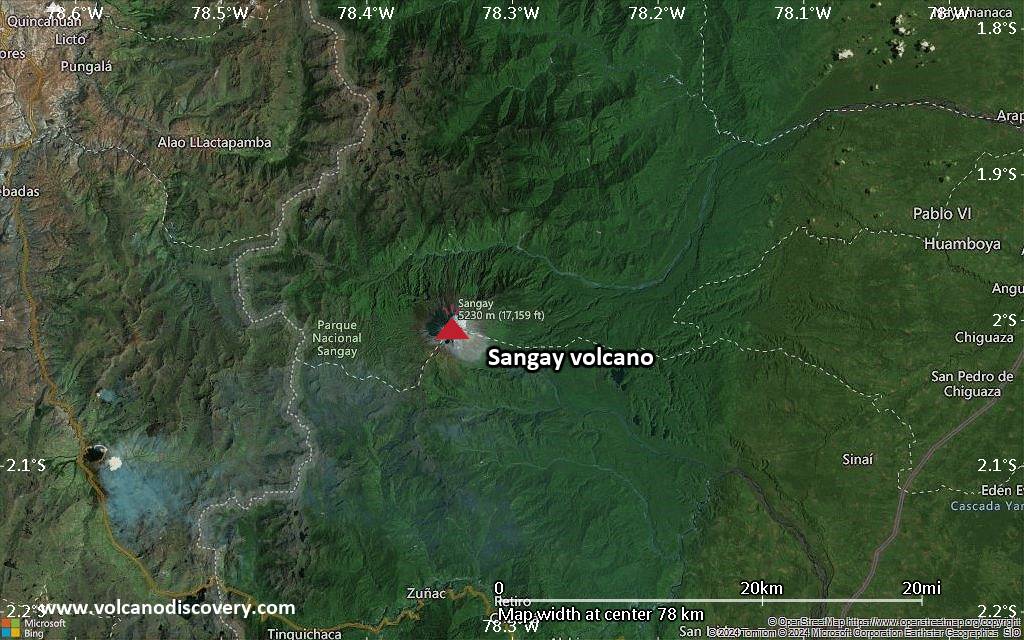
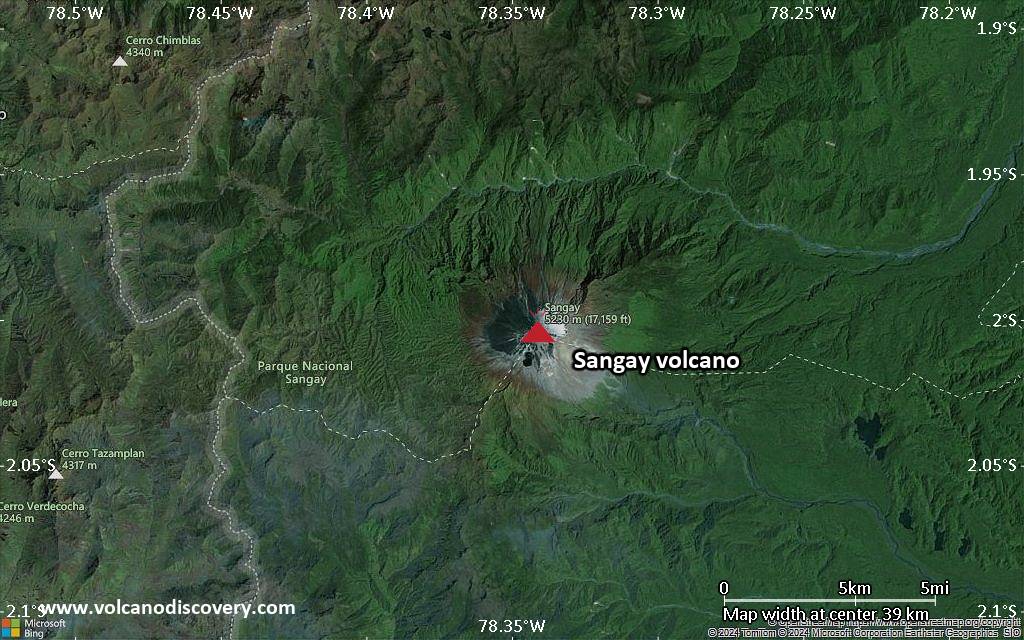
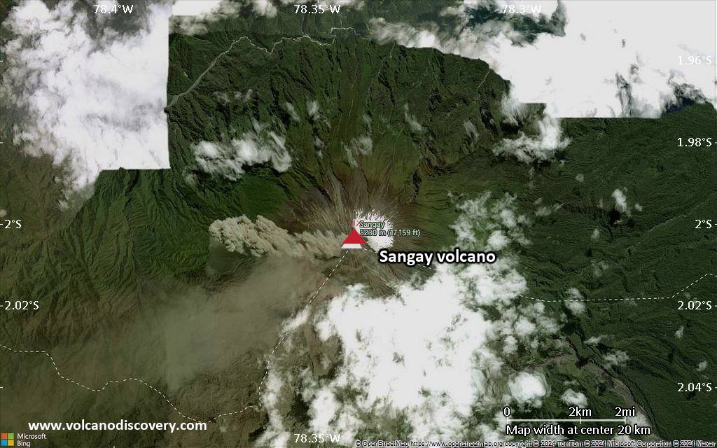
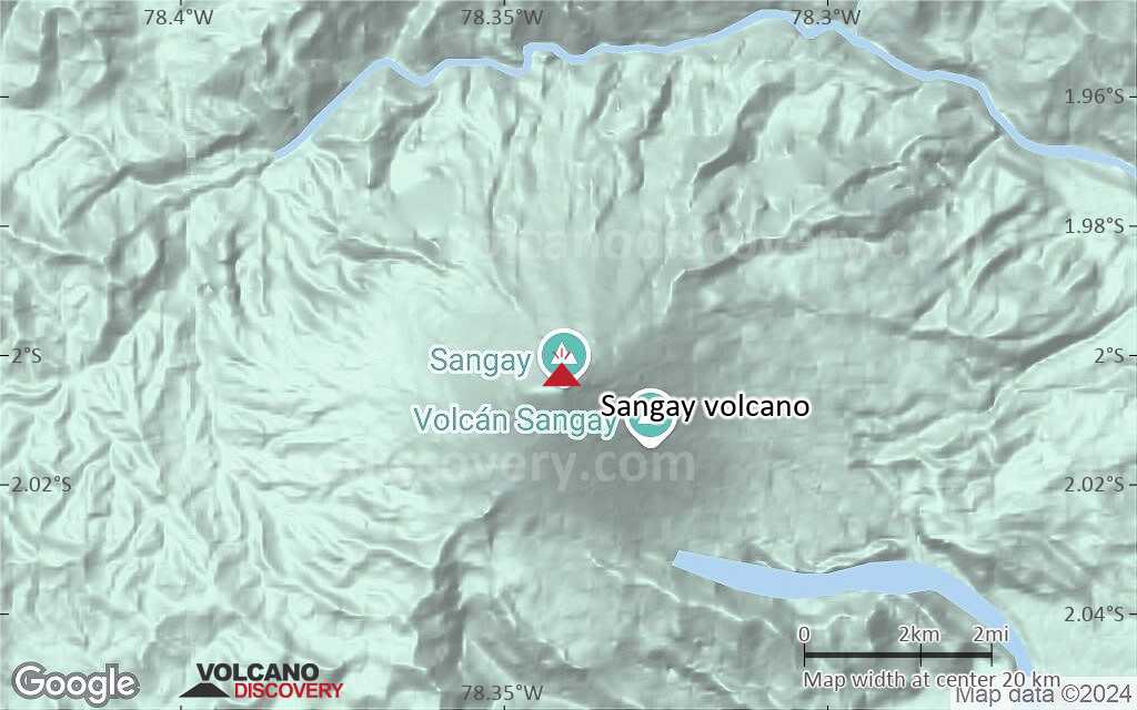
| RSS | EN | DE | EL | ES | FR | IT | RU

Sangay Volcano

Updated: Apr 10, 2025 12:30 GMT -
Stratovolcano
Ecuador, -2°S / -78.34°W
Summit height: 5230 m (17,159 ft)
Current status: erupting (4 out of 5)
Last update: 10 Apr 2025 (Volcanic Ash Advisory)
Sangay volcano during an eruption in Jan 2020 seen from Macas

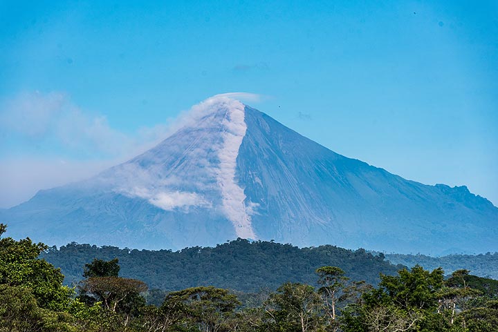
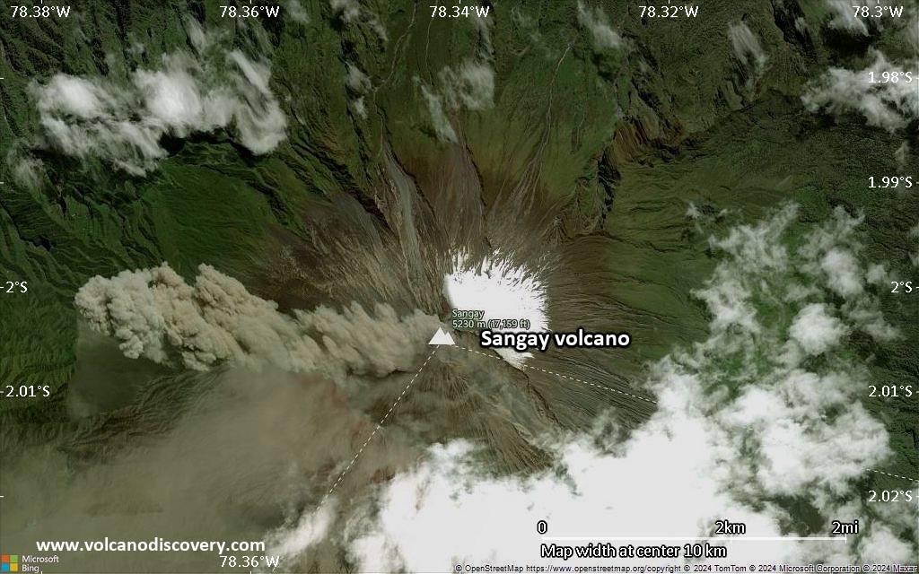
Sangay volcano is one of the highest active volcanoes in the world and one of Ecuador's most active ones. Located isolated east of the Andean crest, with it's perfect steep cone shape and glacier-covered top, it towers majestically at 5230 m high above the Amazonian rainforest.

[smaller] [larger]
Typical eruption style: Explosive. In historic time: frequent, intermittent strombolian activity
Sangay volcano eruptions: 1934-ongoing (as of 2020), 1728-1916, 1628 (first observation) - ?

Latest nearby earthquakes

Date and TimeMag / DepthDistance / Location

Background

Sangay has had frequent eruptions in historic times, mostly of strombolian type. The present-day volcano was built within horseshoe-shaped calderas of two previous edifices, which were destroyed by collapse to the east, producing large debris avalanches that reached the Amazonian lowlands. The modern edifice dates back to at least 14,000 years ago.
Sangay towers above the tropical jungle on the east side; on the other sides flat plains of ash from the volcano have been sculpted by heavy rains into steep-walled canyons up to 600 m deep. The earliest report of a historical eruption was in 1628. More or less continuous eruptions were reported from 1728 until 1916, and again from 1934 to the present. The more or less constant eruptive activity has caused frequent changes to the morphology of the summit crater complex.

---
Source: GVP Sangay volcano information

Significant volcanic eruptions: Sangay volcano

In the past 10,000 years, Sangay has had at least 11 confirmed eruptions, all documented by historical records or observations.
The table below lists all known eruptions (date in bold face) of Sangay volcano in historic times and during the past 10,000 years. Updates on the most recent volcanic activity of Sangay can be found on the news page of Sangay volcano.
DateNoteVEIDeathsDamage
2019 Mar 26 - ongoing
Historical obs./docs.
2
2021 Mar 5
(eruption 2019 Mar 26 - ongoing)
Historical obs./docs.
2
moderate
Info
2018 Aug 8 - Dec 7
Historical obs./docs.
2
2018 Feb 25Summit crater
Historical obs./docs.
1
2017 Jul 20 - Oct 19Summit crater
Historical obs./docs.
2
2016 Mar 17 ±2 d. - Nov 17Summit crater
Historical obs./docs.
2
2015 Jan 18 - Apr 7Summit crater complex
Historical obs./docs.
2
2013 Jan 25 - May 24Summit crater complex
Historical obs./docs.
2
2011 Jun 6 - 2012 Sep 19Summit crater complex
Historical obs./docs.
2
1934 Aug 8 - 2011 Mar 2
Historical obs./docs.
3
1976 Aug 12
(eruption 1934 Aug 8 - 2011 Mar 2)
Historical obs./docs.
32
Info
1728 Sep 30 ±30 d. - 1916 or before
Historical obs./docs.
3
1628 AD Oct
Historical obs./docs.
3
Remark:
Our list of volcanic eruptions closely follows the database of eruptions of the Smithsonian's Global Volcanism Project (GVP), the internationally most recognized data source for volcanic eruptions, but also includes significant eruptive episodes or related volcano events. "Volcanic eruptions" are usually to be understood as sequences of individual eruptive episodes that can follow each other, or even overlap (if several vents are involved), and can last many years, decades or even longer. For example, the current activity of Stromboli volcano is understood as a single eruption that has been ongoing since 1934.
Sources: NOAA National Centers for Environmental Information (NCEI), Global Significant Volcanic Eruptions Database. doi:10.7289/V5TD9V7K | Global Volcanism Project / Smithsonian Institution

Sangay Volcano FAQ

+When was the last eruption of Sangay volcano?

+How often does Sangay volcano erupt?

+How active is Sangay volcano at present?

+When was the largest eruption of Sangay volcano?

Latest satellite images

Sangay satellite image sat1Sangay satellite image sat2

Sangay Volcano Maps

Below is a selection of maps showing the location and surroundings of the volcano at various resolutions based on aerial-imagery / terrain maps. Feel free to use them for non-commercial purposes on your blog or website as long as you credit them with a link back to this page (click to copy it).
Satellite/aerial-type map of Sangay volcano (world scale)
Terrain-type map of Sangay volcano (world scale)
Satellite/aerial-type map of Sangay volcano (region scale large)
Terrain-type map of Sangay volcano (region scale large)
Satellite/aerial-type map of Sangay volcano (region scale medium)
Terrain-type map of Sangay volcano (region scale medium)
Satellite/aerial-type map of Sangay volcano (region scale small)
Terrain-type map of Sangay volcano (region scale small)
Satellite/aerial-type map of Sangay volcano (local scale large)
Terrain-type map of Sangay volcano (local scale large)
Satellite/aerial-type map of Sangay volcano (local scale medium)
Terrain-type map of Sangay volcano (local scale medium)
Satellite/aerial-type map of Sangay volcano (local scale small)
Terrain-type map of Sangay volcano (local scale small)
Satellite/aerial-type map of Sangay volcano (scale of 10s of km)
Terrain-type map of Sangay volcano (scale of 10s of km)
Satellite/aerial-type map of Sangay volcano (scale of 20-40 km)
Terrain-type map of Sangay volcano (scale of 20-40 km)
Satellite/aerial-type map of Sangay volcano (scale of approx. 10-20 km)
Terrain-type map of Sangay volcano (scale of approx. 10-20 km)
Satellite/aerial-type map of Sangay volcano (scale of 5-10 km)
Satellite/aerial-type map of Sangay volcano (scale of few kilometers)
Volcanoes & Earthquakes - new app for Android
Guaranteed tours
12-19 Apr 2025: Europe's Volcanic Outpost - Canary Islands
9-25 Jun 2025: Volcanoes and Spices - Sulawesi/Halmahera (Indonesia)
27 Jun - 6 Jul 2025: Iceland Volcano Special - Iceland
7-23 Jul 2025: Volcanoes and Spices - Sulawesi/Halmahera (Indonesia)
1-17 Aug 2025: Volcanoes and Spices - Sulawesi/Halmahera (Indonesia)
1-14 Oct 2025: Desert, salt and volcanoes - Danakil desert (Ethiopia)
4-12 Oct 2025: From Stromboli to Etna - Sicily and Eolian Islands (Italy)
3-19 Nov 2025: Volcanoes and Spices - Sulawesi/Halmahera (Indonesia)
= spaces available   = guaranteed   = few spaces left   = booked out

On this page:

Why is there advertising on this site?
Sources: VolcanoDiscovery / VolcanoAdventures and other sources as noted.
Use of material: Most text and images on our websites are owned by us. Re-use is generally not permitted without authorization. Contact us for licensing rights.
Volcanoes & Earthquakes
VolcanoDiscovery Home
Volcanoes | Earthquakes | Photos | Volcano News | App
Adventure & Study Travel
Tours to Volcanoes and Volcanic Areas: walking tours, photo tours, study tours
Tours & Dates | FAQ | About us
Get our newsletter!
Company info
Contact | Legal info | Terms & conditions
Follow us
Follow us on facebook Follow us on Instagram Follow us on Bluesky Follow us on Twitter Visit our Youtube channel
EN | DE | EL | ES | FR | IT | RU
VolcanoDiscovery GmbH, Germany, Reg. nr.: HRB 103744, EU Tax Id: DE 297 465 123 owned and created by
Dr. Tom Pfeiffer, volcanologist, volcano photographer, tour organizer member of
IAVCEI
IAVCEI
Vulkanologische Gesellschaft
Volcanological Society
Ecotourism Greece
Ecotourism Greece
RUV insurance
Insured by R+V
VolcanoDiscovery © 2004- All Rights Reserved | Privacy - Cookie Settings