


Sand Mountain Volcano
Updated: Apr 2, 2025 04:14 GMT -
cinder cones
Oregon (Canada and USA (mainland)), 44.38°N / -121.93°W 
Summit height: 1664 m / 5,459 ft
Current status: normal or dormant (1 out of 5)
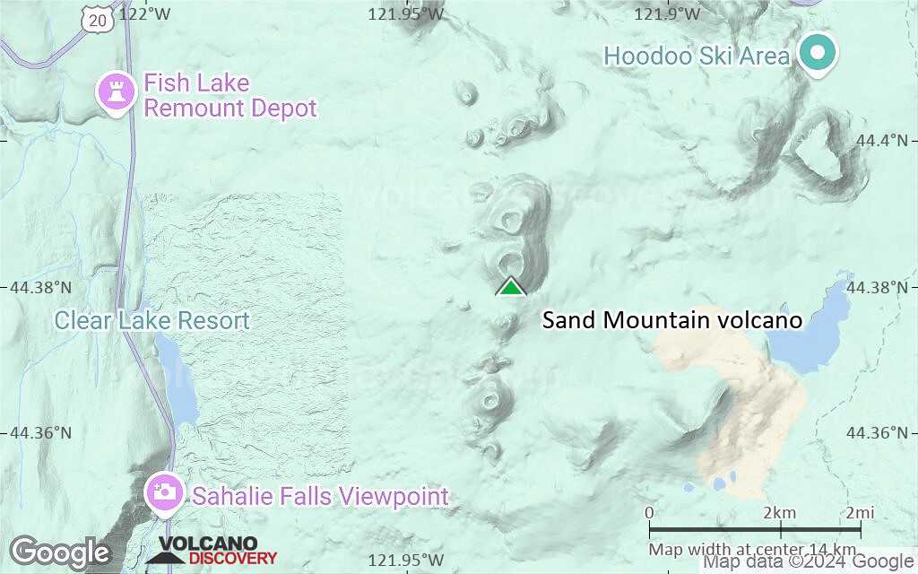
Sand Mountain is a cluster of 23 cinder cones NW of Mt Washington, Oregon. The youngest eruption took place to form Lost Lake cinder cone at the north end of the chain about 2000 years ago.
[smaller] [larger]
Sand Mountain volcano eruptions: 70 AD ± 150, 800 BC ±300, 900 BC ± 100, 1740 BC ± 300, 2290 BC ± 300 (all radiocarbon dated)
Latest nearby earthquakes
| Date and Time | Mag / Depth | Distance / Location | |||
|---|---|---|---|---|---|
Background
Most of the 23 basaltic and basaltic-andesite cinder cones of Sand Mountain volcanic field are aligned along a N-S trending line immediately west of the Cascade crest NW of Mount Washington. A secondary trend of alignment in NNW and NNE direction intersects the N-S line near the largest cinder cone, Sand Mountain.Geologically young lava flows from vents on the western side were erupted between 3000-4000 years ago. The lava flows traveled mostly to the west, blocking local drainages and forming several small lakes.
Source: GVP
Sand Mountain Volcano Photos
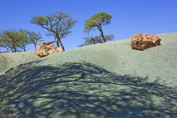
Green weathered sandstone in the Geralta mountains in northern Ethiopia. (Photo: Tom Pfeiffer)
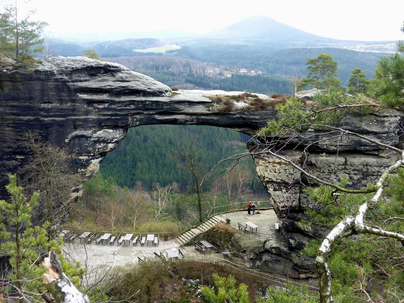
Pravčická brána, Europe's largest natural sandstone arch, and in the background Rùžovský vrch, an ancient extinct basaltic volcano and the highest mountain (619 m) in the...
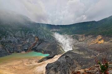
Kawah Ratu - Mt. Tangkuban Perahu, West Java, Indonesia
Mt. Tangkuban Perahu is Bandung's most famous volcano just 28 km north of the city. This volcano has a ...
Mt. Tangkuban Perahu is Bandung's most famous volcano just 28 km north of the city. This volcano has a ...

Only the shape of Rùžovský vrch in the Elbe Sandstone Mountains reminds of its past as being an active volcano during the Tertiary period. (Photo: Janka)
Significant volcanic eruptions: Sand Mountain volcano
No historic eruptions are known from Sand Mountain volcano, but evidence from at least 2 eruptions during the past 10,000 years can be found in the geological record.
The table below lists all known eruptions (date in bold face) of Sand Mountain volcano in historic times and during the past 10,000 years. Updates on the most recent volcanic activity of Sand Mountain can be found on the news page of Sand Mountain volcano.
| Date | Note | VEI | Deaths | Damage | |
|---|---|---|---|---|---|
| 4 | |||||
| Jack Mountain | 2? | ||||
Remark:
Our list of volcanic eruptions closely follows the database of eruptions of the Smithsonian's Global Volcanism Project (GVP), the internationally most recognized data source for volcanic eruptions, but also includes significant eruptive episodes or related volcano events. "Volcanic eruptions" are usually to be understood as sequences of individual eruptive episodes that can follow each other, or even overlap (if several vents are involved), and can last many years, decades or even longer. For example, the current activity of Stromboli volcano is understood as a single eruption that has been ongoing since 1934.
Sources: NOAA National Centers for Environmental Information (NCEI), Global Significant Volcanic Eruptions Database. doi:10.7289/V5TD9V7K | Global Volcanism Project / Smithsonian Institution
Sand Mountain Volcano FAQ
+When was the last eruption of Sand Mountain volcano?
The last confirmed eruption of Sand Mountain occurred around 950 BC.
+When was the largest eruption of Sand Mountain volcano?
The largest eruption known from the younger geological history of Sand Mountain volcano occurred around 950 BC. It only has a VEI (Volcanic Explosivity Index) of , likely because it was a mainly effusive eruption generating lava flows but very little ash.
Latest satellite images


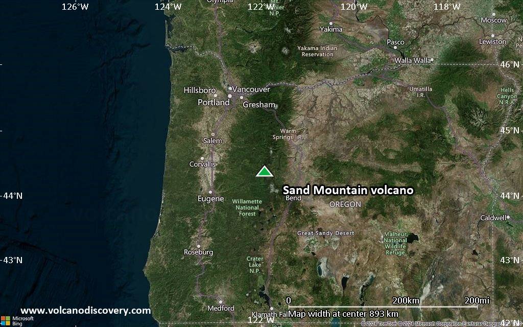
Sand Mountain Volcano Maps
Below is a selection of maps showing the location and surroundings of the volcano at various resolutions based on aerial-imagery / terrain maps. Feel free to use them for non-commercial purposes on your blog or website as long as you credit them with a link back to this page (click to copy it).

Satellite/aerial-type map of Sand Mountain volcano (world scale)

Terrain-type map of Sand Mountain volcano (world scale)

Satellite/aerial-type map of Sand Mountain volcano (region scale large)

Terrain-type map of Sand Mountain volcano (region scale large)

Satellite/aerial-type map of Sand Mountain volcano (region scale medium)

Terrain-type map of Sand Mountain volcano (region scale medium)
Satellite/aerial-type map of Sand Mountain volcano (region scale small)

Terrain-type map of Sand Mountain volcano (region scale small)

Satellite/aerial-type map of Sand Mountain volcano (local scale large)

Terrain-type map of Sand Mountain volcano (local scale large)

Satellite/aerial-type map of Sand Mountain volcano (local scale medium)

Terrain-type map of Sand Mountain volcano (local scale medium)

Satellite/aerial-type map of Sand Mountain volcano (local scale small)

Terrain-type map of Sand Mountain volcano (local scale small)

Satellite/aerial-type map of Sand Mountain volcano (scale of 10s of km)

Terrain-type map of Sand Mountain volcano (scale of 10s of km)

Satellite/aerial-type map of Sand Mountain volcano (scale of 20-40 km)

Terrain-type map of Sand Mountain volcano (scale of 20-40 km)

Satellite/aerial-type map of Sand Mountain volcano (scale of approx. 10-20 km)
Terrain-type map of Sand Mountain volcano (scale of approx. 10-20 km)

Satellite/aerial-type map of Sand Mountain volcano (scale of 5-10 km)

Satellite/aerial-type map of Sand Mountain volcano (scale of few kilometers)


