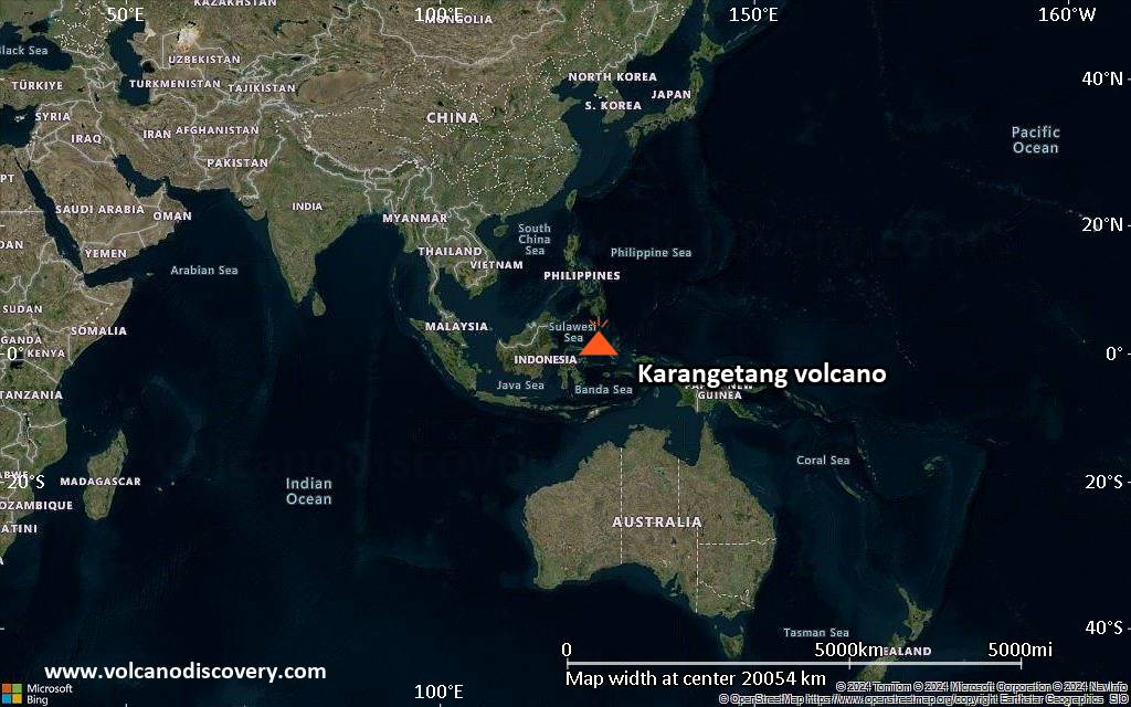
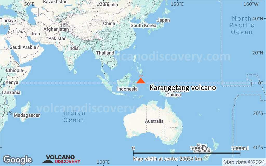
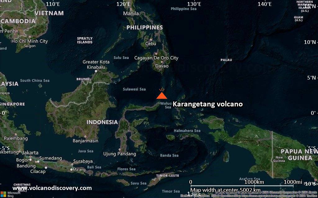
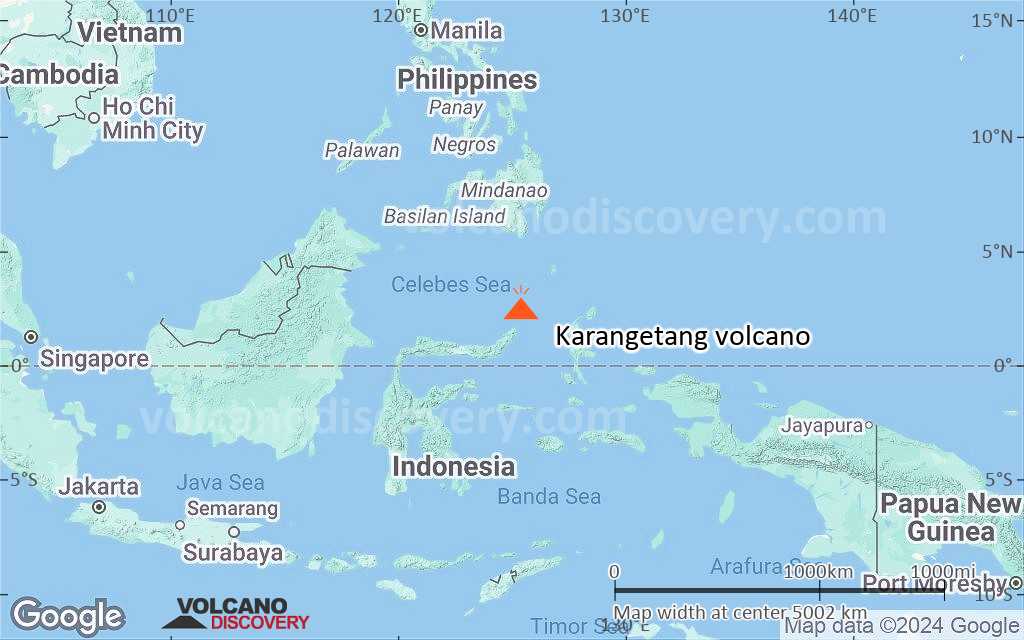
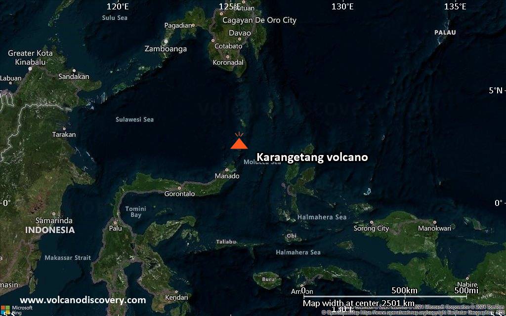
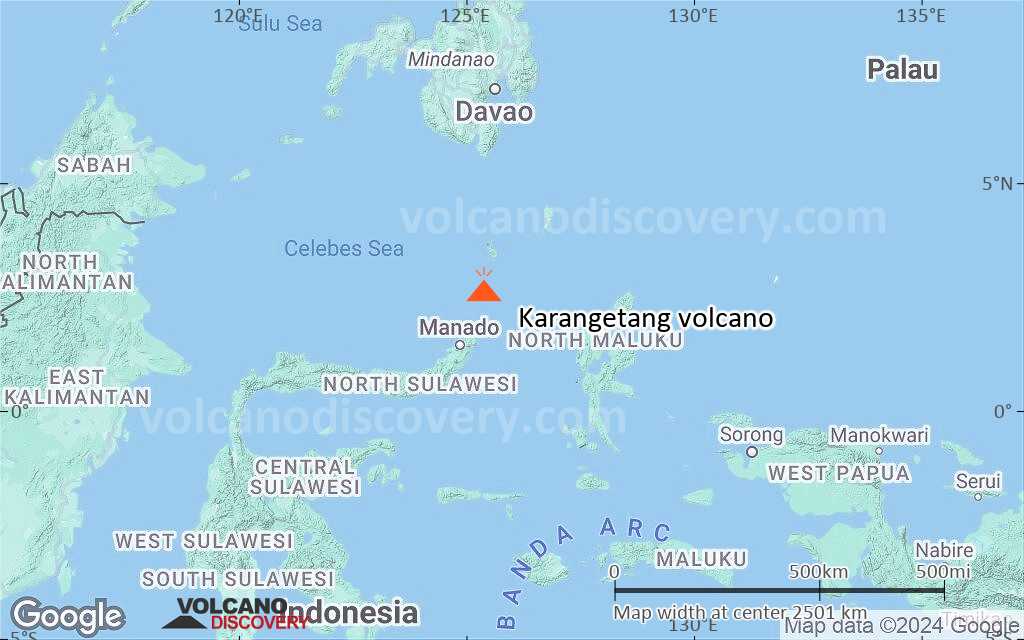
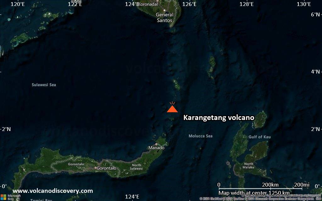
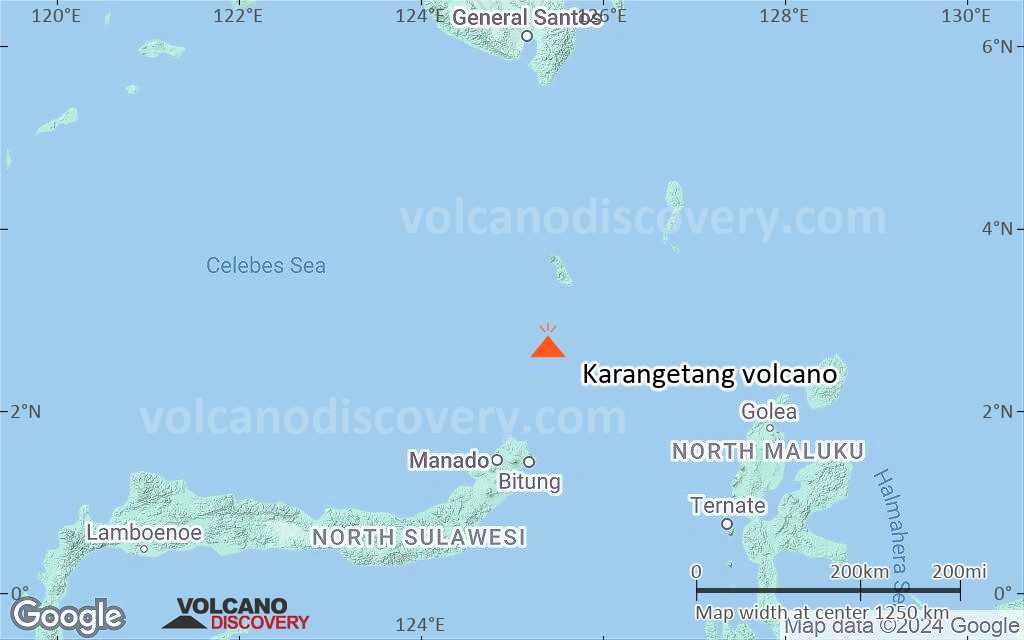
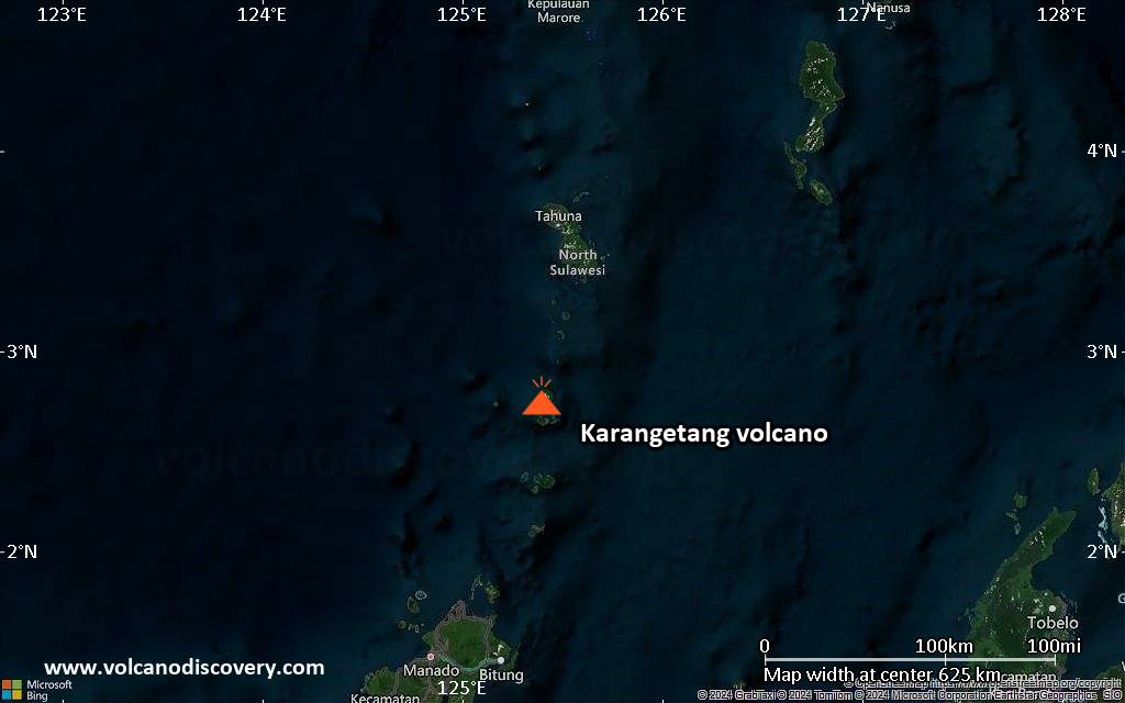
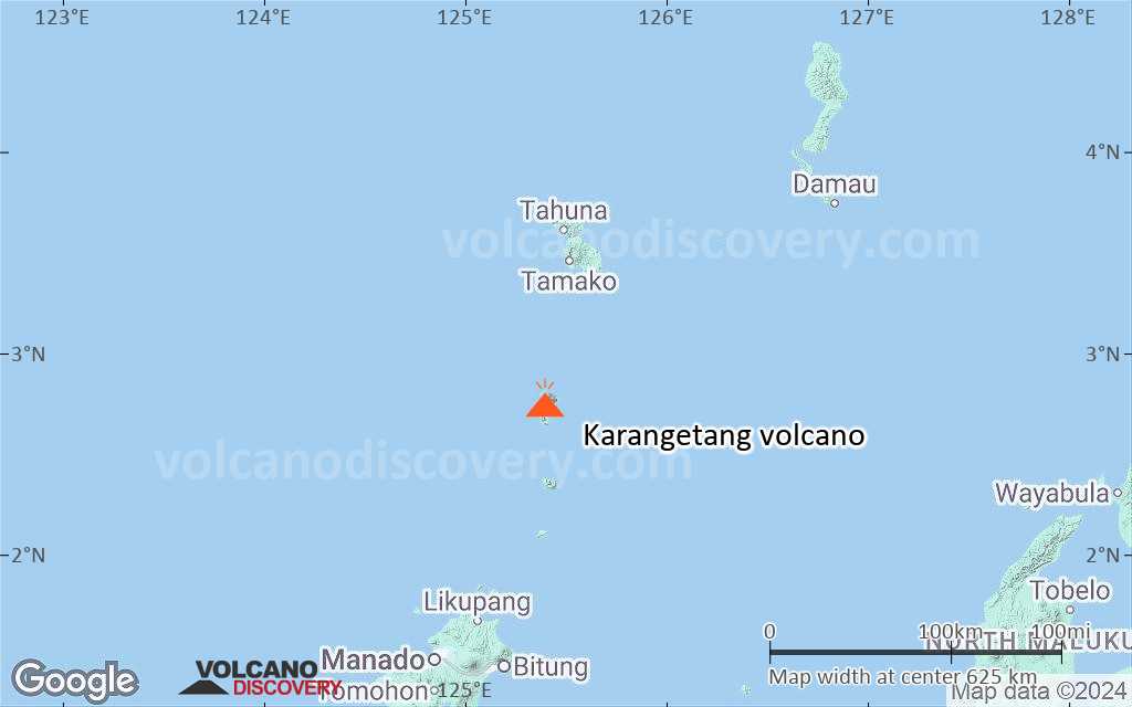
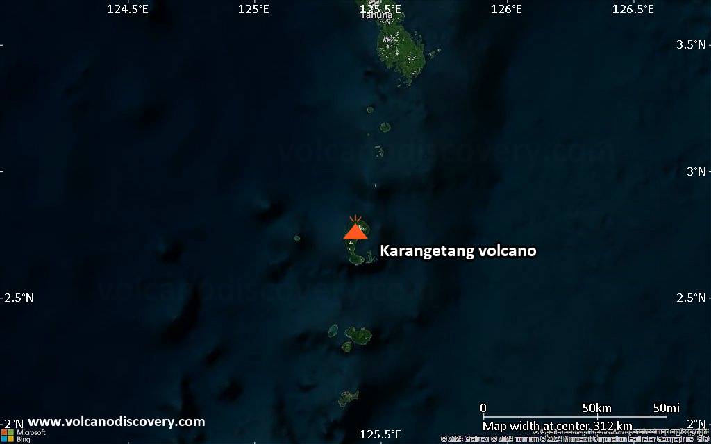
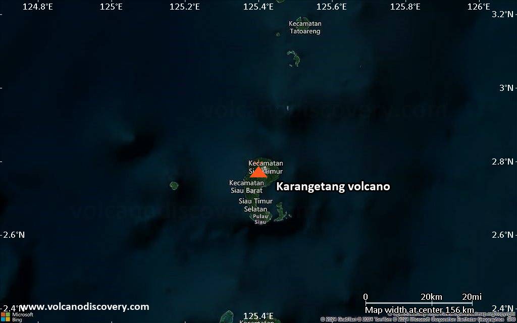
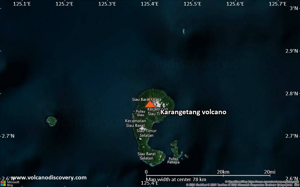
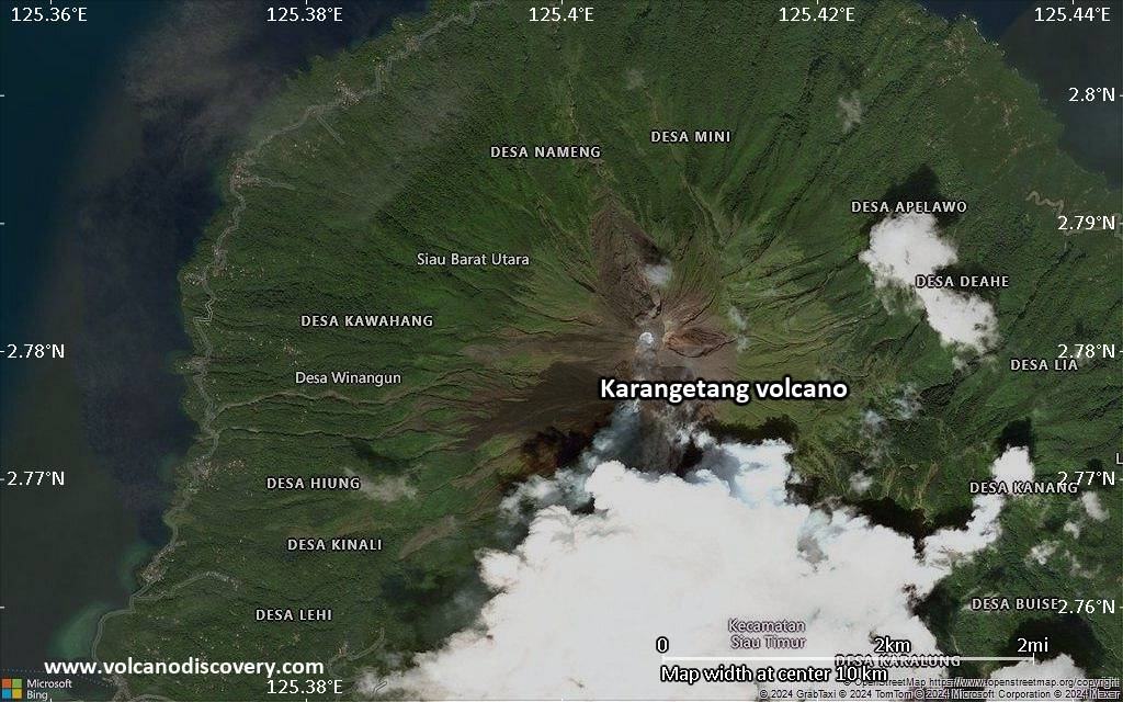
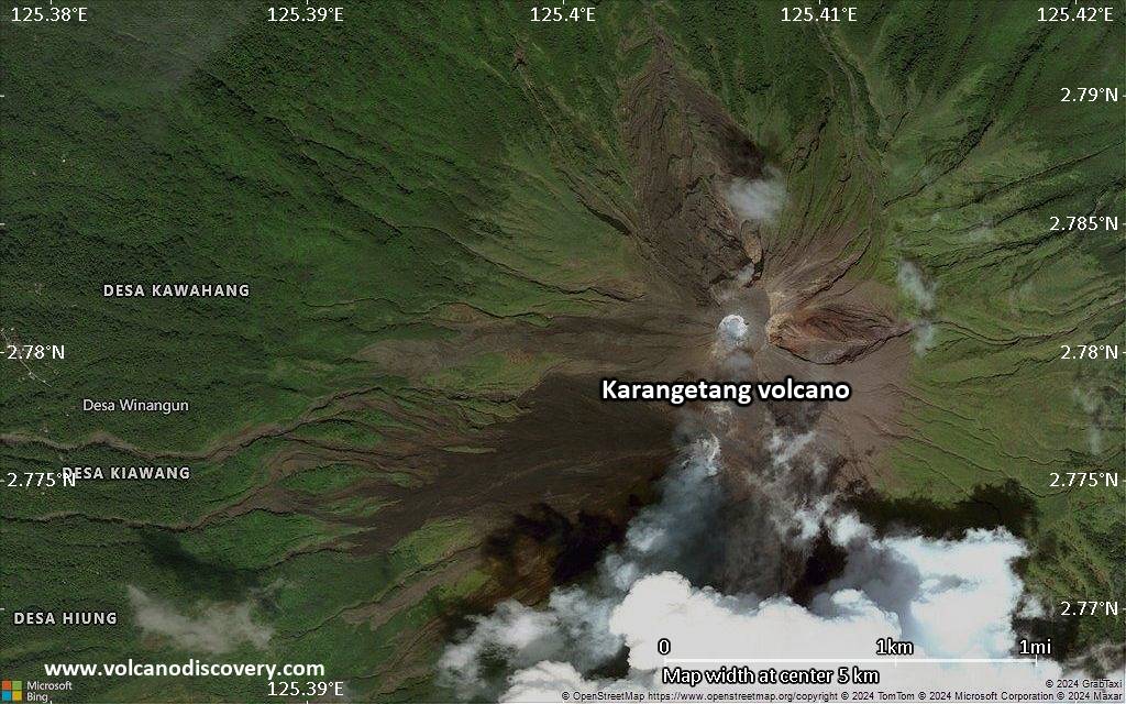
| RSS | EN | DE | EL | ES | FR | IT | RU

Karangetang Volcano

Updated: Mar 28, 2025 22:55 GMT -
Stratovolcano
Siau Island, Sangihe Islands, Indonesia, 2.78°N / 125.4°E
Summit height: 1784 m (5,853 ft)
Current status: minor activity or eruption warning (3 out of 5)
Last update: 15 Jan 2025 (Smithsonian / USGS Weekly Volcanic Activity Report)
Karangetang volcano on Api Siau Island

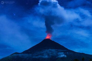
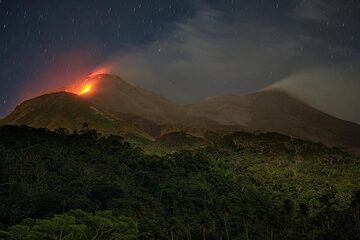
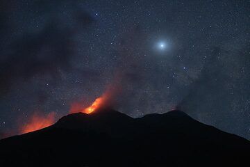
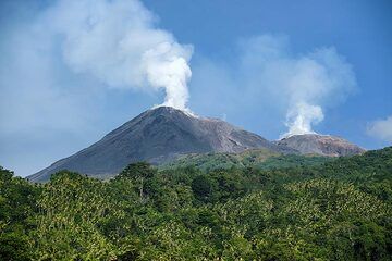
Karangetang (Api Siau) volcano is one of Indonesia's most active volcanoes. Located on the remote Api Siau Island north of N Sulawesi, it is notorious for building lava domes and producing dangerous pyroclastic flows.

[smaller] [larger]
Typical eruption style: Explosive. Formation of lava domes and pyroclastic flows.
Karangetang volcano eruptions: 1675, 1712, 1825, 1864, 1883, 1886, 1887, 1892, 1899, 1900, 1905, 1921, 1922, 1924, 1926, 1930, 1930, 1935, 1940, 1940, 1941, 1947, 1947, 1948, 1949, 1952, 1953, 1961, 1961, 1962-62, 1965-67, 1967, 1970-71, 1972-76, 1976-77, 1978, 1979, 1980, 1982, 1983-88, 1989, 1991-93, 1995, 1996-97, 1998, 1999-2003, 2004-2005. 2008-9, 2010, 2011, 2012, 2013, 2014, 2015, 2016, 2018-ongoing

Latest nearby earthquakes

Date and TimeMag / DepthDistance / Location

Background

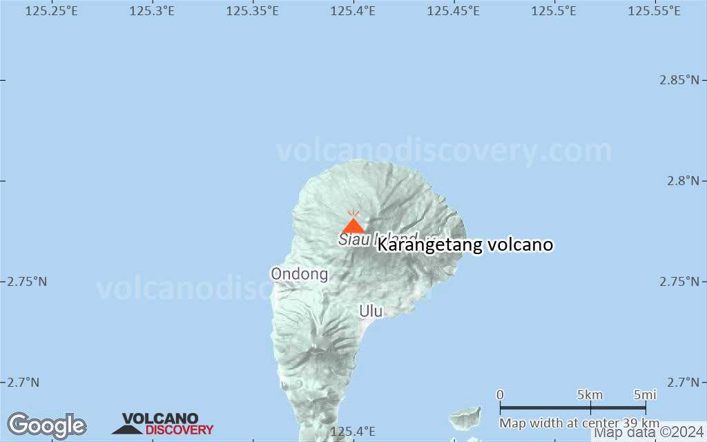
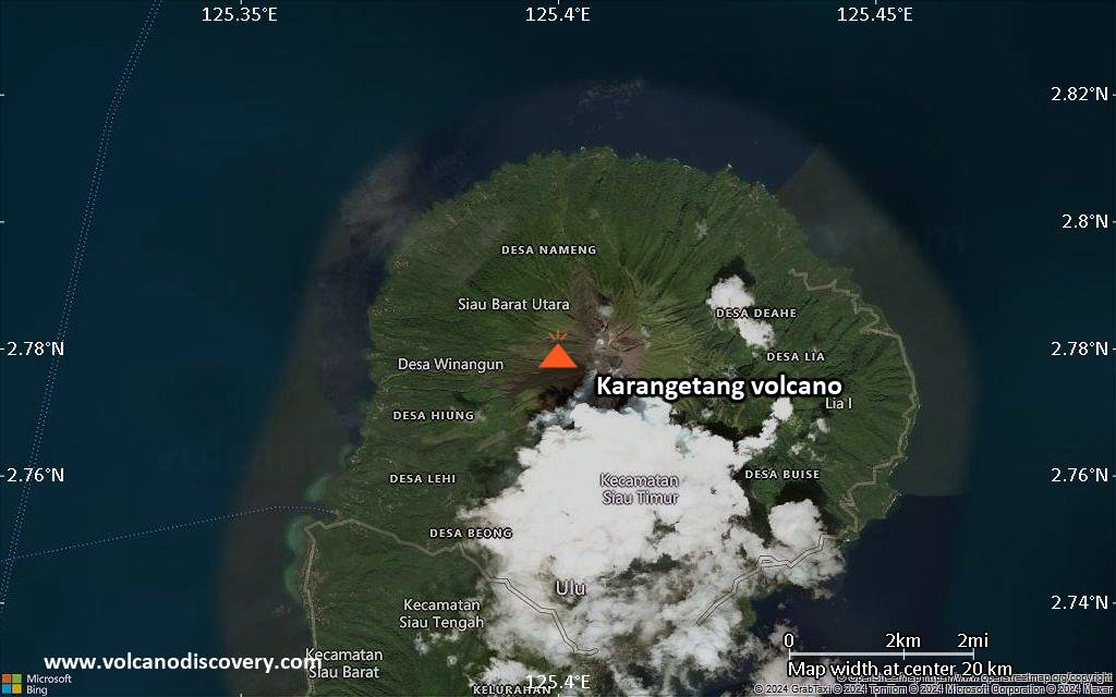
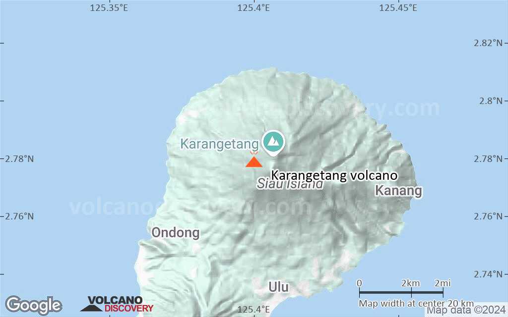
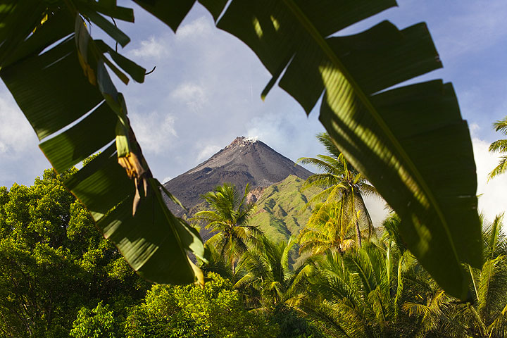
Karangetang (or Api Siau) volcano lies at the northern end of the island of Siau, north of Sulawesi. The 1784-m-high stratovolcano contains five summit craters along a N-S line. Karangetang is one of Indonesia's most active volcanoes, with more than 40 eruptions recorded since 1675 and many additional small eruptions that were not documented.

Twentieth-century eruptions have included frequent explosive activity sometimes accompanied by pyroclastic flows and lahars. Lava dome growth has occurred in the summit craters; collapse of lava flow fronts has also produced pyroclastic flows.
5 eruptions in the 20th century (1940, 1972, 1976, 1983 and 1991) caused fatalities.
---
Source: GVP, Smithsonian Institution

Karangetang Volcano Photos

Significant volcanic eruptions: Karangetang volcano

In the past 10,000 years, Karangetang has had at least 60 confirmed volcanic eruptions, out of which 59 are documented by historical records, while the others can be inferred from geological evidence.
Additionally, there are 3 uncertain or discredited eruptions from Karangetang volcano.
The table below lists all known eruptions (date in bold face) of Karangetang volcano since around 2000. Updates on the most recent volcanic activity of Karangetang can be found on the news page of Karangetang volcano.
DateNoteVEIDeathsDamage
2023 Feb 8 - Sep 5Kawah Utama, Main Crater, South Crater
Historical obs./docs.
?
?? 2022 Sep 1 ±15 d. - Oct 15 ±15 d.
Uncertain Eruption
Historical obs./docs.
?
2021 Oct 25 - 2022 Jan 10 ?Uncertain which summit crater
Historical obs./docs.
?
2018 Nov 25 - 2021 or laterKawah Dua (North Crater, Second Crater)
Historical obs./docs.
2
2018 Jul 4?Southern Crater
Historical obs./docs.
1
2018 Feb 2?North Summit Crater
Historical obs./docs.
1
?? 2017 May 10
Uncertain Eruption
Historical obs./docs.
?
2014 Jun 8 - 2016 Mar 15Main and second craters
Historical obs./docs.
2
2015 May 7
(eruption 0 AD)
Historical obs./docs.
0
light
Info
2014 Feb 9
Historical obs./docs.
2
2012 May 14 - 2013 Sep 5Crater II
Historical obs./docs.
2
2011 Mar 11 - Aug 13Crater I (S crater)
Historical obs./docs.
2
2011 Mar 18
(eruption 2011 Mar 11 - Aug 13)
Historical obs./docs.
0
light
Info
2010 Aug 6 - Dec 16 ±15 d.Crater I (S crater)
Historical obs./docs.
3?
2010 Aug 6
(eruption 2010 Aug 6 - Dec 16 ±15 d.)
Historical obs./docs.
34
Info
2008 Nov 29 ? - 2010 Mar 24 ?
Historical obs./docs.
2
?? 2008 Mar 12
Uncertain Eruption
Historical obs./docs.
1?
2006 Jul 3 - 2007 Oct 16 ±15 d.
Historical obs./docs.
1
2004 Apr 2 ? - 2005 Aug 5 ?
Historical obs./docs.
2
1999 Mar 16 ±15 d. - 2003 Oct 28
Historical obs./docs.
3?
2002 Jan 3
(eruption 1999 Mar 16 ±15 d. - 2003 Oct 28)
Historical obs./docs.
3
light
Info
Remark:
Our list of volcanic eruptions closely follows the database of eruptions of the Smithsonian's Global Volcanism Project (GVP), the internationally most recognized data source for volcanic eruptions, but also includes significant eruptive episodes or related volcano events. "Volcanic eruptions" are usually to be understood as sequences of individual eruptive episodes that can follow each other, or even overlap (if several vents are involved), and can last many years, decades or even longer. For example, the current activity of Stromboli volcano is understood as a single eruption that has been ongoing since 1934.
Sources: NOAA National Centers for Environmental Information (NCEI), Global Significant Volcanic Eruptions Database. doi:10.7289/V5TD9V7K | Global Volcanism Project / Smithsonian Institution

Karangetang Volcano FAQ

+When was the last eruption of Karangetang volcano?

+How often does Karangetang volcano erupt?

+How active is Karangetang volcano at present?

+When was the largest eruption of Karangetang volcano?

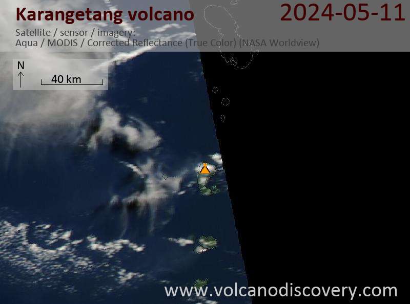
Latest satellite images

Karangetang satellite image sat1Karangetang satellite image sat2
Karangetang Volcano Tours
Sulawesi/Halmahera (Indonesia)
Volcanoes and Spices
17-day volcano trekking tour to the Molucca Sea: N-Sulawesi, Karangetang and Halmahera
17 days / 16 nights - Moderate
Price 3570 €
12-29 May 2025
9-25 Jun 2025
7-23 Jul 2025

Karangetang Volcano Maps

Below is a selection of maps showing the location and surroundings of the volcano at various resolutions based on aerial-imagery / terrain maps. Feel free to use them for non-commercial purposes on your blog or website as long as you credit them with a link back to this page (click to copy it).
Satellite/aerial-type map of Karangetang volcano (world scale)
Terrain-type map of Karangetang volcano (world scale)
Satellite/aerial-type map of Karangetang volcano (region scale large)
Terrain-type map of Karangetang volcano (region scale large)
Satellite/aerial-type map of Karangetang volcano (region scale medium)
Terrain-type map of Karangetang volcano (region scale medium)
Satellite/aerial-type map of Karangetang volcano (region scale small)
Terrain-type map of Karangetang volcano (region scale small)
Satellite/aerial-type map of Karangetang volcano (local scale large)
Terrain-type map of Karangetang volcano (local scale large)
Satellite/aerial-type map of Karangetang volcano (local scale medium)
Terrain-type map of Karangetang volcano (local scale medium)
Satellite/aerial-type map of Karangetang volcano (local scale small)
Terrain-type map of Karangetang volcano (local scale small)
Satellite/aerial-type map of Karangetang volcano (scale of 10s of km)
Terrain-type map of Karangetang volcano (scale of 10s of km)
Satellite/aerial-type map of Karangetang volcano (scale of 20-40 km)
Terrain-type map of Karangetang volcano (scale of 20-40 km)
Satellite/aerial-type map of Karangetang volcano (scale of approx. 10-20 km)
Terrain-type map of Karangetang volcano (scale of approx. 10-20 km)
Satellite/aerial-type map of Karangetang volcano (scale of 5-10 km)
Satellite/aerial-type map of Karangetang volcano (scale of few kilometers)
Volcanoes & Earthquakes - new app for Android
Guaranteed tours
6-19 Apr 2025: Desert, salt and volcanoes - Danakil desert (Ethiopia)
12-19 Apr 2025: Europe's Volcanic Outpost - Canary Islands
9-25 Jun 2025: Volcanoes and Spices - Sulawesi/Halmahera (Indonesia)
27 Jun - 6 Jul 2025: Iceland Volcano Special - Iceland
7-23 Jul 2025: Volcanoes and Spices - Sulawesi/Halmahera (Indonesia)
1-17 Aug 2025: Volcanoes and Spices - Sulawesi/Halmahera (Indonesia)
13-26 Sep 2025: Green Volcanoes - Azores (Portugal)
1-14 Oct 2025: Desert, salt and volcanoes - Danakil desert (Ethiopia)
4-12 Oct 2025: From Stromboli to Etna - Sicily and Eolian Islands (Italy)
= spaces available   = guaranteed   = few spaces left   = booked out
Karangetang volcano on Siau Island (2006, photo: Donald Tapehe)
Wed, 15 Jan 2025, 15:00

Karangetang volcano (Indonesia) - Smithsonian / USGS Weekly Volcanic Activity Report for 8 January-14 January 2025 (Continuing Activity)

The Pusat Vulkanologi dan Mitigasi Bencana Geologi (PVMBG) reported that monitoring data and visual observations during December 2024 and 1-10 January 2025 indicated decreasing unrest at Karangetang. No avalanches were observed from either Main Crater or North Crater, and neither crater produced incandescence visible at night. North Crater occasionally produced white plumes that rose as high as 400 m above the summit and drifted in multiple directions. ... Read all
Wed, 20 Nov 2024, 15:00

Karangetang (Indonesia) volcano - Smithsonian / USGS Weekly Volcanic Activity Report for 13 November-19 November 2024 (New Activity / Unrest)

Pusat Vulkanologi dan Mitigasi Bencana Geologi (PVMBG) reported that white emissions that were sometimes dense rose 50-400 m above Karangetang's summit during 13-19 November. The Alert Level remained at 3 (on a scale of 1-4) and the public was advised to stay 2.5 km away from Kawah Dua (North Crater) and the Main Crater (South Crater) with an extension to 3.5 km along the W, SW, S, and SE flanks. ... Read all

On this page:

Why is there advertising on this site?
Sources: VolcanoDiscovery / VolcanoAdventures and other sources as noted.
Use of material: Most text and images on our websites are owned by us. Re-use is generally not permitted without authorization. Contact us for licensing rights.
Volcanoes & Earthquakes
VolcanoDiscovery Home
Volcanoes | Earthquakes | Photos | Volcano News | App
Adventure & Study Travel
Tours to Volcanoes and Volcanic Areas: walking tours, photo tours, study tours
Tours & Dates | FAQ | About us
Get our newsletter!
Company info
Contact | Legal info | Terms & conditions
Follow us
Follow us on facebook Follow us on Instagram Follow us on Bluesky Follow us on Twitter Visit our Youtube channel
EN | DE | EL | ES | FR | IT | RU
VolcanoDiscovery GmbH, Germany, Reg. nr.: HRB 103744, EU Tax Id: DE 297 465 123 owned and created by
Dr. Tom Pfeiffer, volcanologist, volcano photographer, tour organizer member of
IAVCEI
IAVCEI
Vulkanologische Gesellschaft
Volcanological Society
Ecotourism Greece
Ecotourism Greece
RUV insurance
Insured by R+V
VolcanoDiscovery © 2004- All Rights Reserved | Privacy - Cookie Settings