| RSS | EN | DE | EL | ES | FR | IT | RU

Methana Volcan

Updated: 22 avril. 2025 19:07 GMT -
Lava domes
Saronic Gulf, Greece, 37.62°N / 23.34°E
Summit height: 740 m
Condition actuelle: normal / en sommeil (1 sur 5)
Methana's historic lava dome which formed in 238 BC.

Methana peninsula, located opposite Aegina Island in the Saronic Gulf of Greece, is the northwestern, still weakly active part of the Aegean volcanic arc.
An eruption in 238 BC built a small lava dome on the northern tip of the peninsula and was described by Greek and Roman historians (e.g. Pausanias). Methana peninsula is famous for its hot springs and thermal baths, hence its name.
More detailed information can be found at www.methana.com !

[smaller] [larger]
Style éruptif tipique: Effusive, construction of lava domes, hydrothermal explosions.
Eruptions du volcan Methana: around 1700 (submarine eruption of "Pavsanias", aprox. 1,5 km north-west of Methana), 238 B.C (near Kameni Hora)

Derniers séismes proches

Date et l'heureMag / Prof.Distance / Lieux
22 avril 17:51 (Temps Universel)
1.2

12 km
13 km au nord Saronikos Gulf - S. Greece Info
22 avril 20:03 (GMT +3)
1.1

14 km
19 km au nord Greece: 11 km NNW From Angistri Info
lundi, 21 avril 2025 GMT (2 séismes)
21 avril 11:37 (Temps Universel)
1.0

12 km
9.1 km au nord-ouest 7 km WSW From Angistri Info
21 avril 11:21 (Temps Universel)
0.9

10 km
14 km au nord-ouest NE Peloponnese - S. Greece Info
dimanche, 20 avril 2025 GMT (3 séismes)
20 avril 09:00 (Temps Universel)
1.7

10 km
24 km au sud-est NE Peloponnese - S. Greece Info
20 avril 03:45 (Temps Universel)
2.0

10 km
28 km au nord Saronikos Gulf - S. Greece Info
20 avril 00:21 (Temps Universel)
1.1

10 km
18 km au sud-est Saronikos Gulf - S. Greece Info
jeudi, 17 avril 2025 GMT (2 séismes)
17 avril 22:46 (GMT +3)
3.2

13 km
29 km au sud-est 13 km SE From Poros  I FELT IT - 6 reportsInfo
17 avril 19:43 (Temps Universel)
2.8

15 km
30 km au sud-est 11 km NE From Idhra  I FELT IT Info

Introduction

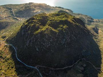
Methana volcanic system comprises a group of 32 lava mostly dacitic lava domes, whose formation started about 1-2 million years ago. The latest activity was likely around 1700 AD in form of a submarine eruption off the northern coast.
An active hydrothermal system characterizes the area, controlled by a E-W fault system that crosses the town of Methana where thermal springs are found.

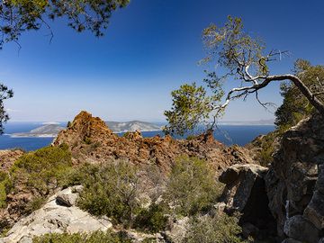
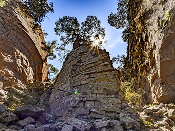
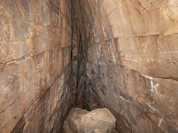
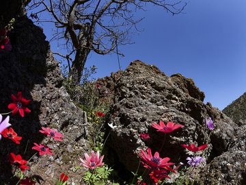
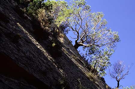
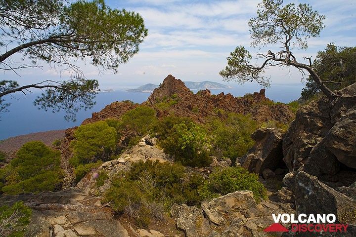
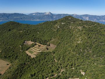
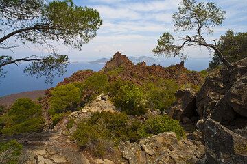
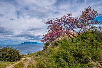
Methana Volcano Photos

Éruptions volcaniques importantes: volcano Methana

In the past 10,000 years, Methana has had only one confirmed historic eruption around 258 BC. There is one uncertain or discredited eruption in 1922 from Methana volcano.
The table below lists all known eruptions (date in bold face) of Methana volcano in historic times and during the past 10,000 years. Updates on the most recent volcanic activity of Methana can be found on the news page of Methana volcano.
DateNoteVEIMortsDommages
?? 1922 Août
Éruption incertaine
?
inconnu
258 ±18 y. BCKameno Vouno
Obs./docs historiques
3
inconnu
Remark:
Our list of volcanic eruptions closely follows the database of eruptions of the Smithsonian's Global Volcanism Project (GVP), the internationally most recognized data source for volcanic eruptions, but also includes significant eruptive episodes or related volcano events. "Volcanic eruptions" are usually to be understood as sequences of individual eruptive episodes that can follow each other, or even overlap (if several vents are involved), and can last many years, decades or even longer. For example, the current activity of Stromboli volcano is understood as a single eruption that has been ongoing since 1934.
Sources: NOAA National Centers for Environmental Information (NCEI), Global Significant Volcanic Eruptions Database. doi:10.7289/V5TD9V7K | Global Volcanism Project / Smithsonian Institution

Methana Volcano FAQ

+When was the last eruption of Methana volcano?

+How often does Methana volcano erupt?

+When was the largest eruption of Methana volcano?

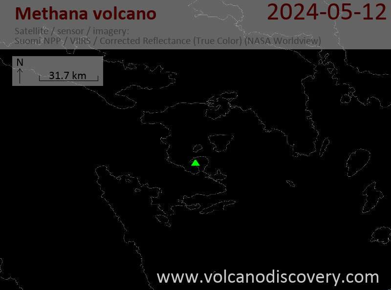
Dernières images satellite

Methana image satellite sat1Methana image satellite sat2
Methana Voyages aux Volcans
Saronic Gulf (Greece)
Treasures of the Saronic Gulf
private geo tour to the Methana volcanic peninsula and the Saronic Gulf, 2-3 days
3 days / 2 nights - Facile-Modérée
Prix 0 €
Départs sur commande possibles
Saronic Gulf (Greece)
Land of Theseus
8-day geo and walking tour in the Saronic Gulf near Athens
8 days / 7 nights - Modérée
Prix 1590 €
23-30 mars 2026

Methana Volcan Cartes

Below is a selection of maps showing the location and surroundings of the volcano at various resolutions based on aerial-imagery / terrain maps. Feel free to use them for non-commercial purposes on your blog or website as long as you credit them with a link back to this page (click to copy it).
Satellite/aerial-type map of Methana volcano (world scale)
Terrain-type map of Methana volcano (world scale)
Satellite/aerial-type map of Methana volcano (region scale large)
Terrain-type map of Methana volcano (region scale large)
Satellite/aerial-type map of Methana volcano (region scale medium)
Terrain-type map of Methana volcano (region scale medium)
Satellite/aerial-type map of Methana volcano (region scale small)
Terrain-type map of Methana volcano (region scale small)
Satellite/aerial-type map of Methana volcano (local scale large)
Terrain-type map of Methana volcano (local scale large)
Satellite/aerial-type map of Methana volcano (local scale medium)
Terrain-type map of Methana volcano (local scale medium)
Satellite/aerial-type map of Methana volcano (local scale small)
Terrain-type map of Methana volcano (local scale small)
Satellite/aerial-type map of Methana volcano (scale of 10s of km)
Terrain-type map of Methana volcano (scale of 10s of km)
Satellite/aerial-type map of Methana volcano (scale of 20-40 km)
Terrain-type map of Methana volcano (scale of 20-40 km)
Satellite/aerial-type map of Methana volcano (scale of approx. 10-20 km)
Terrain-type map of Methana volcano (scale of approx. 10-20 km)
Satellite/aerial-type map of Methana volcano (scale of 5-10 km)
Satellite/aerial-type map of Methana volcano (scale of few kilometers)

Impressions from Methana

The lava domes of Methana in spring 2019 (c) Tobias Schorr
View of the top of the historic volcano at Kameni Chora village. (c) Tobias Schorr
One of the huge rocks of the historic lava dome (c) Tobias Schorr
A thermal fault by cooling lava(c) Tobias Schorr
Red anemones in the crater (c) Tobias Schorr
Smooth fracture surfaces at the lava dome: trees, having their roots reach into the tiniest crevasses, are clinging onto the vertical walls like free-climbers.
Volcanoes & Earthquakes - new app for Android

Sur cette page:

Try our free app!
Volcanoes & Earthquakes - new app for Android
Android | iOS version

More on VolcanoDiscovery

Why is there advertising on this site?

Support us - Help us upgrade our services!

We truly love working to bring you the latest volcano and earthquake data from around the world. Maintaining our website and our free apps does require, however, considerable time and resources.
We need financing to increase hard- and software capacity as well as support our editor team. We're aiming to achieve uninterrupted service wherever an earthquake or volcano eruption unfolds, and your donations can make it happen! Every donation will be highly appreciated. If you find the information useful and would like to support our team in integrating further features, write great content, and in upgrading our soft- and hardware, please make a donation (PayPal).

Planned features:Thanks to your past donations, these features have been added recently:
Download and Upgrade the Volcanoes & Earthquakes app to get one of the fastest seismic and volcano alerts online:
Android | IOS
Thank you!
Copyright: VolcanoDiscovery ou autres sources indiquées.
Utilisation des documents: Les textes, les images et les vidéos de ce site internet sont protégées par copyright. Toute reproduction et tout usage sans accord préalable ne sont pas autorisés. Si vous désirez acquérir pour certains documents (photos, vidéos, textes ou autres) le droit de reproduction, d'édition et, plus généralement, de toute utilisation destinée à un usage public, qu'elle soit commerciale ou pas, vous êtes priés de nous contacter.
Volcanoes & Earthquakes
VolcanoDiscovery Home
Volcans | Séismes | Photos | Actualités | | Shop | App
Adventure & Study Travel
Tours to Volcanoes and Volcanic Areas: walking tours, photo tours, study tours
Voyages |
Get our newsletter!
Company info
Contact | Mentions légales | Terms & conditions
Follow us
Follow us on facebook Follow us on Instagram Follow us on Bluesky Follow us on Twitter Visit our Youtube channel
EN | DE | EL | ES | FR | IT | RU
VolcanoDiscovery GmbH, Germany, Reg. nr.: HRB 103744, EU Tax Id: DE 297 465 123 owned and created by
Dr. Tom Pfeiffer, volcanologist, volcano photographer, tour organizer member of
IAVCEI
IAVCEI
Vulkanologische Gesellschaft
Volcanological Society
Ecotourism Greece
Ecotourism Greece
RUV insurance
Insured by R+V
VolcanoDiscovery © 2004- All Rights Reserved | Privacy - Changer Préférences