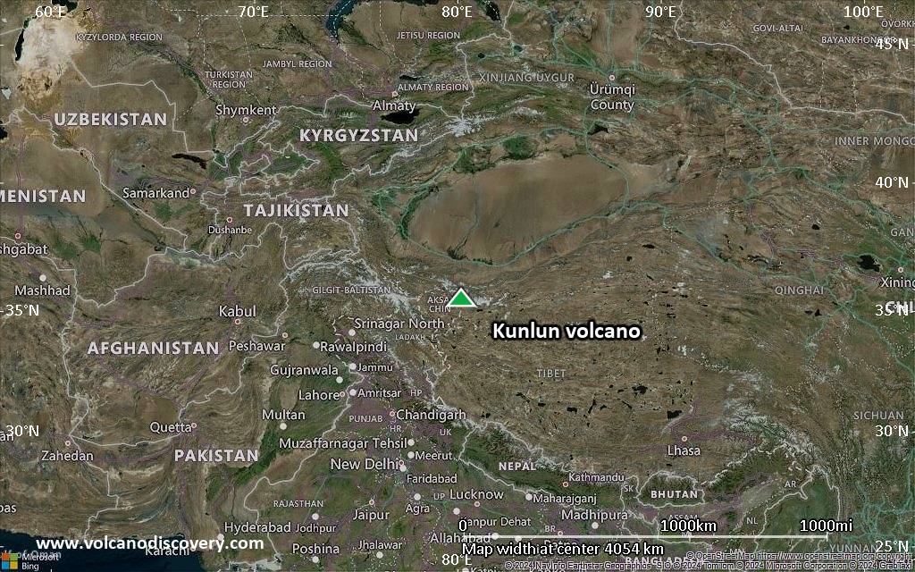
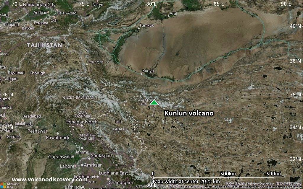
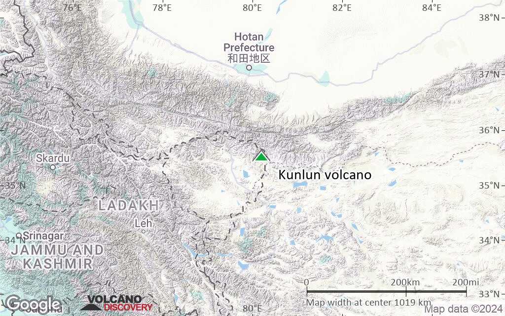
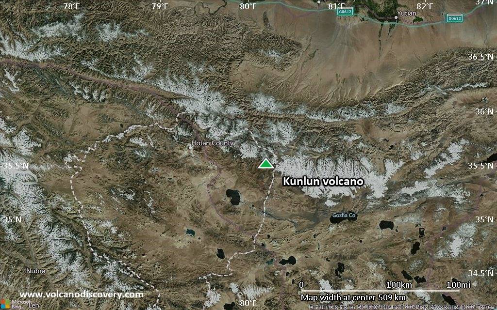
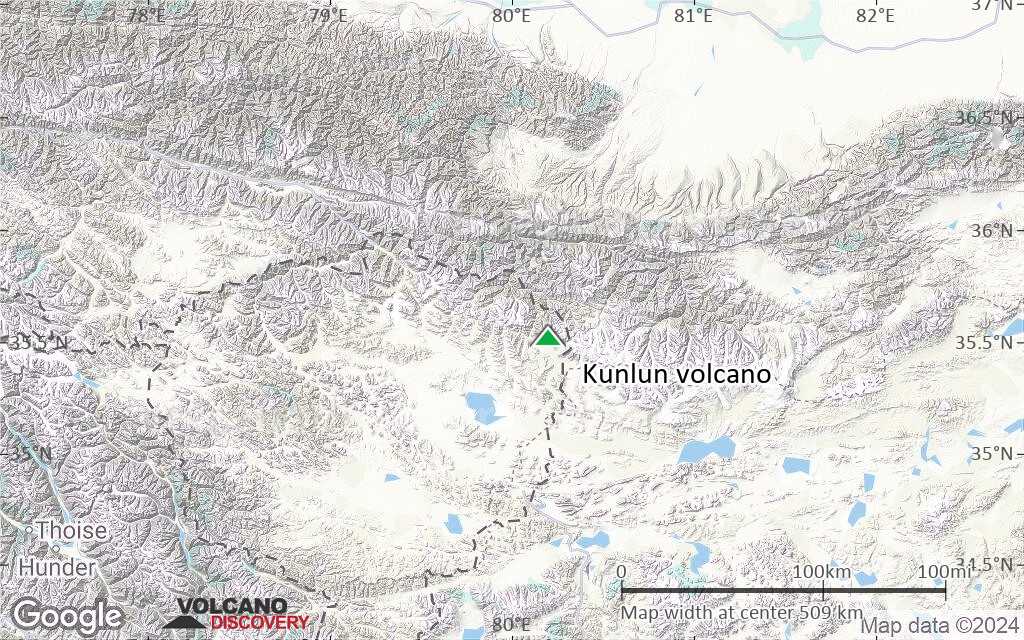
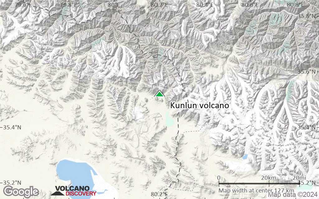
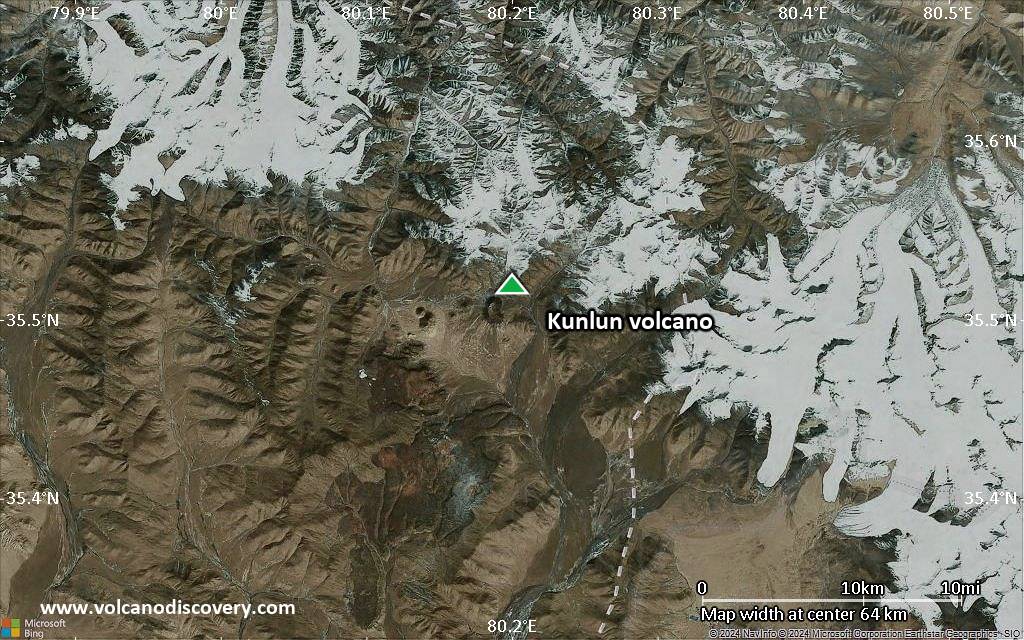
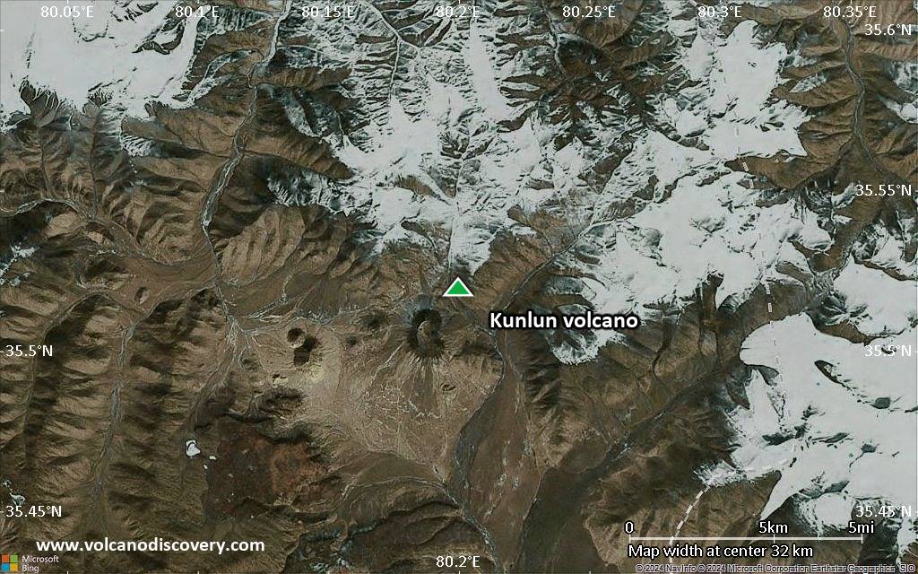
| RSS | EN | DE | EL | ES | FR | IT | RU

Kunlun Volcan

Updated: 26 avril. 2025 10:09 GMT -
pyroclastic cones
Tibet, China, 35.52°N / 80.2°E
Summit height: 5808 m / 19,055 ft
Condition actuelle: normal / en sommeil (1 sur 5)
Last update: 6 mars 2022 (SO2 cloud detected on 10 Mar 2021)

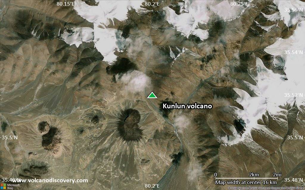
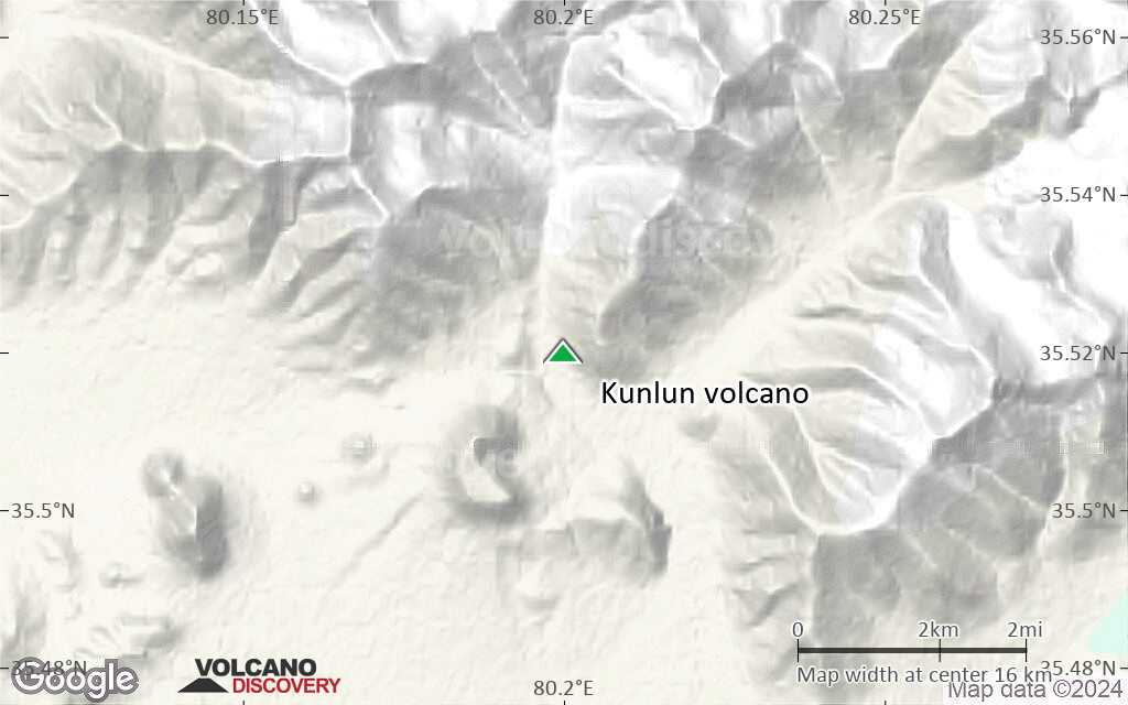
Kunlun volcano is a group of about 70 fresh-looking cinder cones in NW Tibet. Although the cones are not very large, thanks to its location in the Tibetan Plateau, Kunlun is the highest volcano in the northern hemisphere.
An eruption occurred 1951 at Ashi Shan cone, marking the latest volcanic activity in China.

[smaller] [larger]
Style éruptif tipique: strombolian
Eruptions du volcan Kunlun: 1951, uncertain reports about an eruption in the 19th century

Derniers séismes proches

Date et l'heureMag / Prof.Distance / Lieux

Introduction

The Kunlun volcano group comprises the trachyandesitic Ashikule volcano group at the western end of the Kunlun Mountains. At least 10 of the cones are Pliocene-to-Holocene age, including the Ashi Shan volcano, the youngest in China, which erupted in 1951.
This and several other young cones lie in the area around Ashi (Aqqikkol) and Wuluke (Ulugkol) lakes.

Éruptions volcaniques importantes: volcano Kunlun

In the past 10,000 years, Kunlun has had only one confirmed historic eruption in 1951. There is one uncertain or discredited eruption around 1850 from Kunlun volcano.
The table below lists all known eruptions (date in bold face) of Kunlun volcano in historic times and during the past 10,000 years. Updates on the most recent volcanic activity of Kunlun can be found on the news page of Kunlun volcano.
DateNoteVEIMortsDommages
1951 Mai 27Ashi Shan
Obs./docs historiques
2
inconnu
?? 1850 ±50 y.
Éruption incertaine
?
inconnu
Remark:
Our list of volcanic eruptions closely follows the database of eruptions of the Smithsonian's Global Volcanism Project (GVP), the internationally most recognized data source for volcanic eruptions, but also includes significant eruptive episodes or related volcano events. "Volcanic eruptions" are usually to be understood as sequences of individual eruptive episodes that can follow each other, or even overlap (if several vents are involved), and can last many years, decades or even longer. For example, the current activity of Stromboli volcano is understood as a single eruption that has been ongoing since 1934.
Sources: NOAA National Centers for Environmental Information (NCEI), Global Significant Volcanic Eruptions Database. doi:10.7289/V5TD9V7K | Global Volcanism Project / Smithsonian Institution

Eruptions du volcan Kunlun


1951 eruption
China's most recent volcanic eruption occurred on 27 May 1951 from the Ashi Shan (also known as Ka-er-daxi or Vulkan) cinder cone, part of the Kunlun volcanic group in NW Tibet.
The eruption began with a loud detonation and ejected large blocks, emitting "smoke" for a number of days.

Kunlun Volcano FAQ

+When was the last eruption of Kunlun volcano?

+How often does Kunlun volcano erupt?

+How active is Kunlun volcano at present?

+When was the largest eruption of Kunlun volcano?

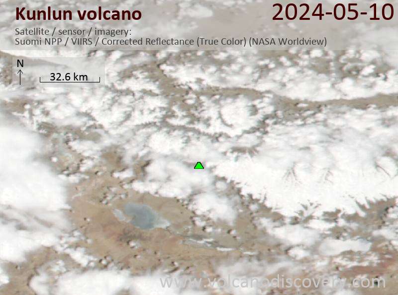
Dernières images satellite

Kunlun image satellite sat1Kunlun image satellite sat2

Kunlun Volcan Cartes

Below is a selection of maps showing the location and surroundings of the volcano at various resolutions based on aerial-imagery / terrain maps. Feel free to use them for non-commercial purposes on your blog or website as long as you credit them with a link back to this page (click to copy it).
Satellite/aerial-type map of Kunlun volcano (world scale)
Terrain-type map of Kunlun volcano (world scale)
Satellite/aerial-type map of Kunlun volcano (region scale large)
Terrain-type map of Kunlun volcano (region scale large)
Satellite/aerial-type map of Kunlun volcano (region scale medium)
Terrain-type map of Kunlun volcano (region scale medium)
Satellite/aerial-type map of Kunlun volcano (region scale small)
Terrain-type map of Kunlun volcano (region scale small)
Satellite/aerial-type map of Kunlun volcano (local scale large)
Terrain-type map of Kunlun volcano (local scale large)
Satellite/aerial-type map of Kunlun volcano (local scale medium)
Terrain-type map of Kunlun volcano (local scale medium)
Satellite/aerial-type map of Kunlun volcano (local scale small)
Terrain-type map of Kunlun volcano (local scale small)
Satellite/aerial-type map of Kunlun volcano (scale of 10s of km)
Terrain-type map of Kunlun volcano (scale of 10s of km)
Satellite/aerial-type map of Kunlun volcano (scale of 20-40 km)
Terrain-type map of Kunlun volcano (scale of 20-40 km)
Satellite/aerial-type map of Kunlun volcano (scale of approx. 10-20 km)
Terrain-type map of Kunlun volcano (scale of approx. 10-20 km)
Satellite/aerial-type map of Kunlun volcano (scale of 5-10 km)
Satellite/aerial-type map of Kunlun volcano (scale of few kilometers)
Volcanoes & Earthquakes - new app for Android
Départs garantis:
9-25 juin 2025: Volcans et Épices - Mer des Moluques (Sulawesi, Indonésie)
7-22 juil. 2025: Du Krakatau à Bali - Java (Indonésie)
7-23 juil. 2025: Volcans et Épices - Mer des Moluques (Sulawesi, Indonésie)
1-17 août 2025: Volcans et Épices - Mer des Moluques (Sulawesi, Indonésie)
1-14 oct. 2025: Désert, sels et volcans - Désert de Danakil (Éthiopie)
4-12 oct. 2025: Montagnes de Feu - du Stromboli à l'Etna - Eoliennes + Etna
6-21 oct. 2025: Du Krakatau à Bali - Java (Indonésie)
3-19 nov. 2025: Volcans et Épices - Mer des Moluques (Sulawesi, Indonésie)
= Places libres   = Départ garanti   = Quelques places disponibles   = Groupe fermé
Actualités
mer., 10 mars 2021, 20:22

SO2 cloud detected in the area of Kunlun volcano, Tibet - could it be from a volcanic eruption?

Detected SO2 cloud in the area of Kunlun volcano, NW Tibet (image: SACS)
Update: It appears that the SO2 plume is from one of the recent paroxysms at Etna volcano. There is no sign of unusual activity at Kunlun volcano. ... Tout lire

Sur cette page:

Try our free app!
Volcanoes & Earthquakes - new app for Android
Android | iOS version

More on VolcanoDiscovery

Why is there advertising on this site?

Support us - Help us upgrade our services!

We truly love working to bring you the latest volcano and earthquake data from around the world. Maintaining our website and our free apps does require, however, considerable time and resources.
We need financing to increase hard- and software capacity as well as support our editor team. We're aiming to achieve uninterrupted service wherever an earthquake or volcano eruption unfolds, and your donations can make it happen! Every donation will be highly appreciated. If you find the information useful and would like to support our team in integrating further features, write great content, and in upgrading our soft- and hardware, please make a donation (PayPal).

Planned features:Thanks to your past donations, these features have been added recently:
Download and Upgrade the Volcanoes & Earthquakes app to get one of the fastest seismic and volcano alerts online:
Android | IOS
Thank you!
Copyright: VolcanoDiscovery ou autres sources indiquées.
Utilisation des documents: Les textes, les images et les vidéos de ce site internet sont protégées par copyright. Toute reproduction et tout usage sans accord préalable ne sont pas autorisés. Si vous désirez acquérir pour certains documents (photos, vidéos, textes ou autres) le droit de reproduction, d'édition et, plus généralement, de toute utilisation destinée à un usage public, qu'elle soit commerciale ou pas, vous êtes priés de nous contacter.
Volcanoes & Earthquakes
VolcanoDiscovery Home
Volcans | Séismes | Photos | Actualités | | Shop | App
Adventure & Study Travel
Tours to Volcanoes and Volcanic Areas: walking tours, photo tours, study tours
Voyages |
Get our newsletter!
Company info
Contact | Mentions légales | Terms & conditions
Follow us
Follow us on facebook Follow us on Instagram Follow us on Bluesky Follow us on Twitter Visit our Youtube channel
EN | DE | EL | ES | FR | IT | RU
VolcanoDiscovery GmbH, Germany, Reg. nr.: HRB 103744, EU Tax Id: DE 297 465 123 owned and created by
Dr. Tom Pfeiffer, volcanologist, volcano photographer, tour organizer member of
IAVCEI
IAVCEI
Vulkanologische Gesellschaft
Volcanological Society
Ecotourism Greece
Ecotourism Greece
RUV insurance
Insured by R+V
VolcanoDiscovery © 2004- All Rights Reserved | Privacy - Changer Préférences