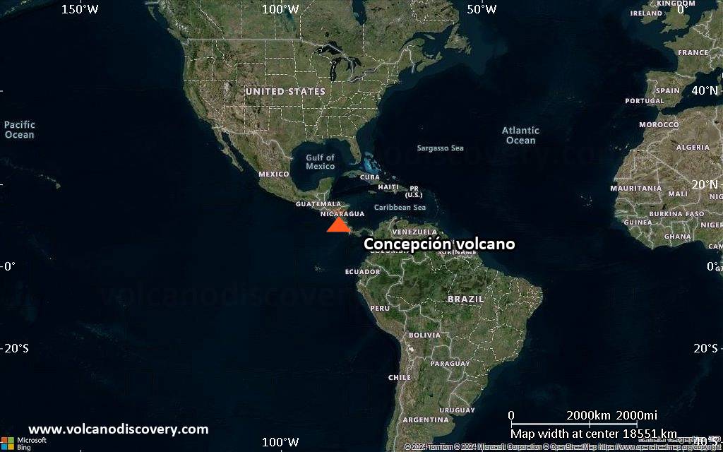
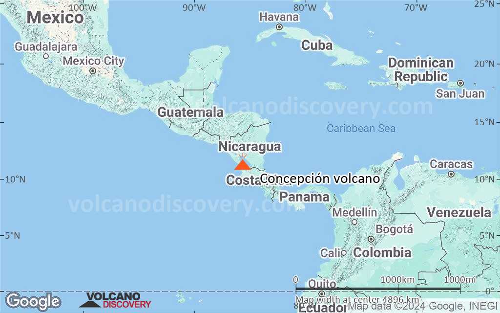
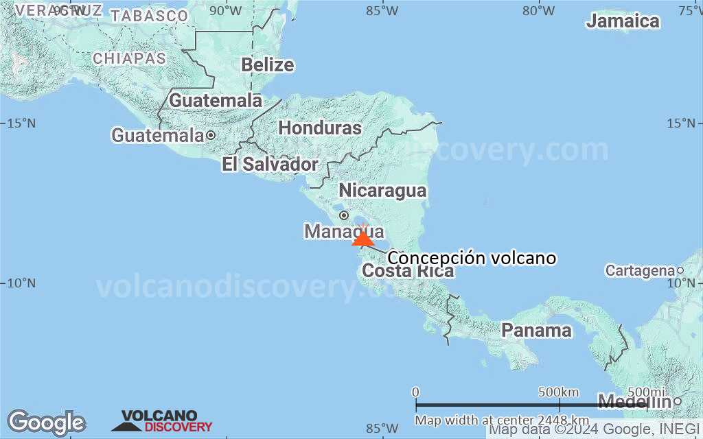
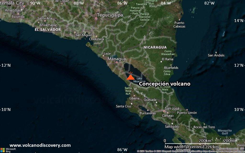
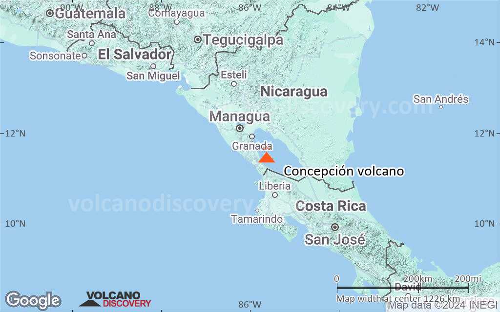
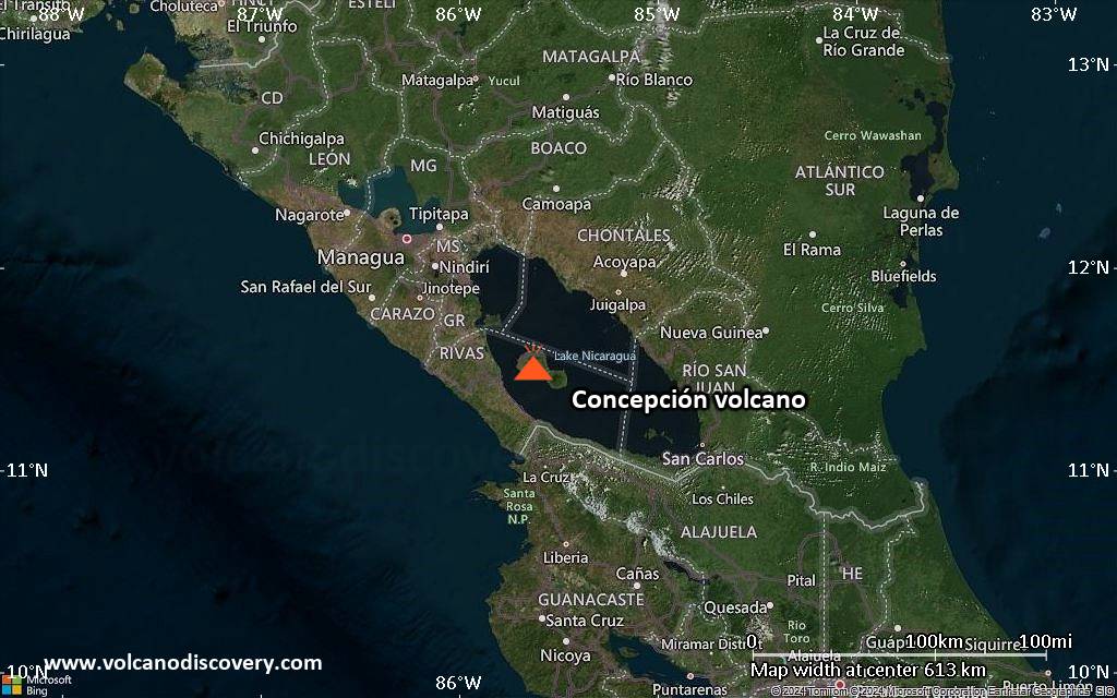
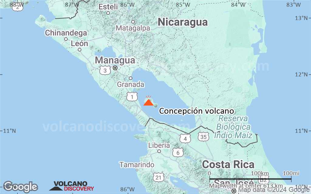
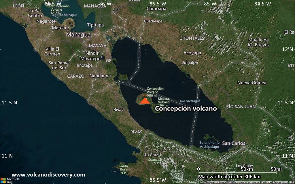
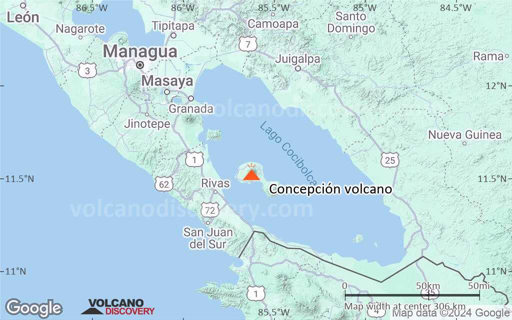
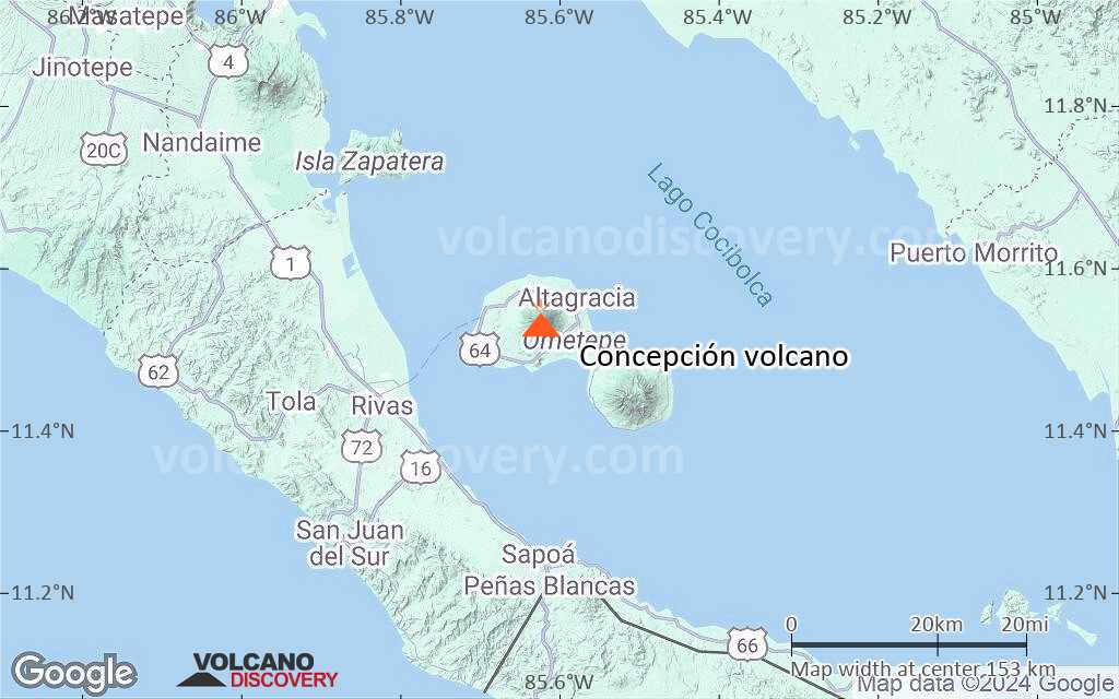
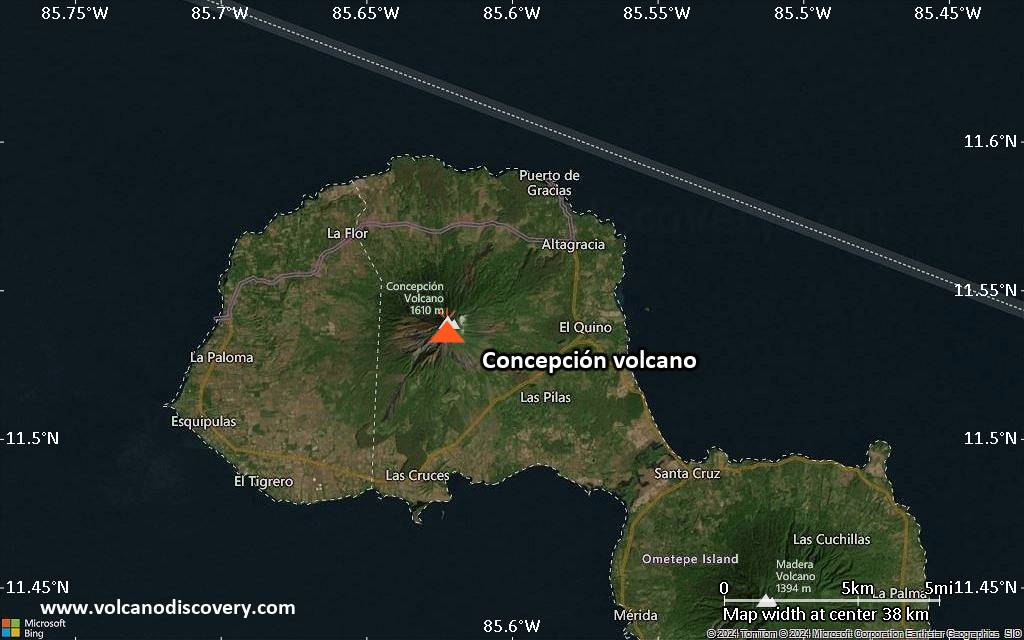
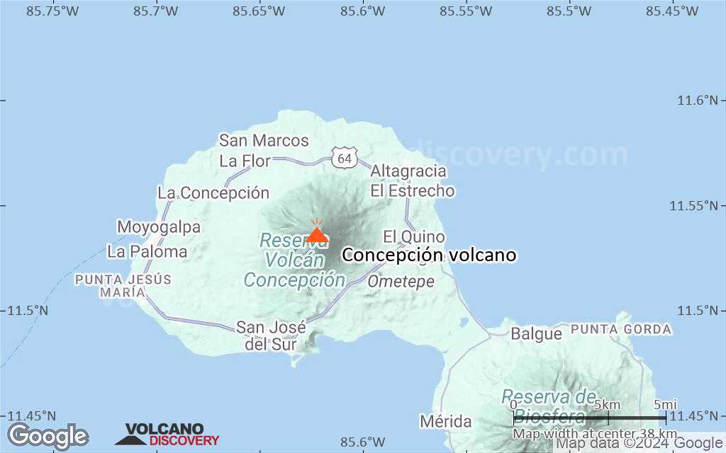
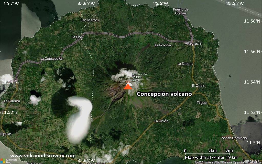
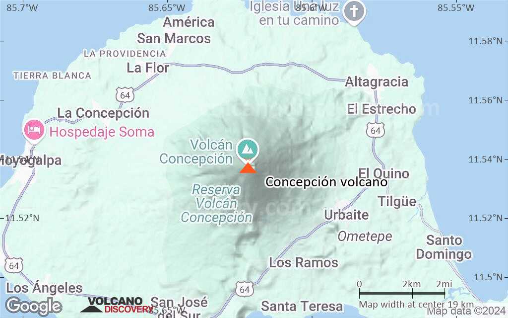
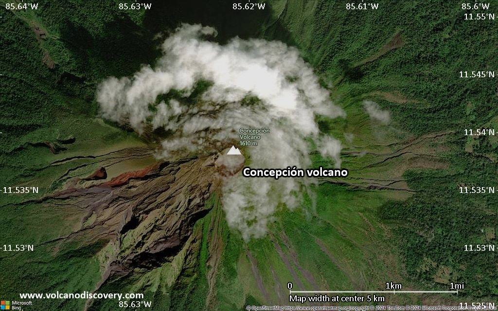
Concepción Volcan

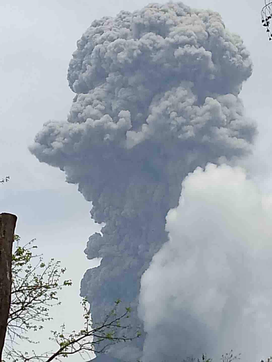
Concepción volcano is a steep symmetrical stratovolcano with a perfect shape and one of the most active volcanoes of Nicaragua. During the past 100 years, it has been in a near-constant state of small to medium ash explosions at irregular intervals.
Together with its neighbor Madera volcano Concepción forms the NW half of the dumbbell-shaped island of Ometepe in Lake Nicaragua. Both volcanoes are connected by a narrow isthmus.
Frequent explosive eruptions during the past decades have increased the height of its summit significantly (more than 100 m) and outdated the existing topographic maps. Because of the frequent ash eruptions, the upper half of the summit cone lacks vegetation.
The basaltic-to-dacitic Concepción volcano contains a steep-walled 250 m summit crater with a higher western rim. Flank vents are aligned on N-S-trending fractures and contain chains of spatter cones, cinder cones, lava domes, and maars on the NW, NE, SE, and southern sides. Some of these vents are found down to Lake Nicaragua.
Eruptions du volcan Concepción: 2012, 2009-11, 2008, 2007, 2006, 2005, 1999, 1988, 1985-86, 1984-85, 1983, 1982, 1978, 1977, 1973-74, 1963, 1962, 1961, 1957, 1951-55, 1948-50, 1944-45, 1935, 1929, 1928, 1921-26, 1918-19, 1907-10, 1902, 1891, 1884-86, 1883, 1800 ± 50 years, 770 BC ± 50 years (radiocarbon)
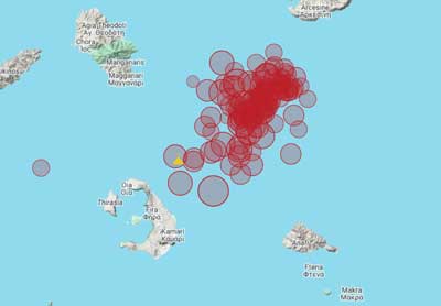
Derniers séismes proches
Introduction
Volcán Concepción was constructed after Lake Nicaragua and rises 1600 m above a package of about 1000 m of lake sediments. The modern cone is built upon a caldera of an older generation of the volcano. A small remnant of this caldera forms a break in slope about halfway up the north flank.Due to its particular setting above lake sediments rich in mobile clay, the volcano has been experiencing gravity-induced spreading of its edifice.
Geologic evolution
It has been proposed that Concepción undergoes cycles of magma evolution from basaltic to evolved dacitic and andesitic magma. It is possible that the current activity which is mainly basaltic is at the beginning of a 5th cycle.
1 Sub-lacrustine eruptions
The earliest volcanic layers are found on the northwest and southeast shores of Lake Nicaragua and overly directly mudstone. Magma intruded the crust and erupted basaltic rocks at the surface of the lake floor.
2 Building a first cone
A cone is built above the lake and its weight starts to deform the base, while pyroclastic sediments form an apron around the cone. Magma starts collects in a shallow chamber and evolves towards dacitic compositions during this phase.
3 Destructive phase
A major plinian explosive eruption causes the collapse of a small caldera, which is now buried, and the formation of several fault systems, which facilitate future eruptions. At the same time, the lateral spreading of the volcano is temporarily halted because of the redistribution of load. The pumice and ash layer from this eruption is known as the Tierra Blanca layer.
4 Second building phase
A new cone is built and magma evolves again with time. Magmas are erupted with greater ease than during the previous phase and evolve from
high-alumina basalt to silicic andesite. After reaching a critical mass, the sedimentary substratum start to subside and the volcano spreads. Lowered pressure and stress on the shallow reservoir seems to have prevented the magma to evolve further than andesite. Numerous intrusions form diapirs beneath the lower flanks.
5 Future spreading phase
The complex of intrusions at the base of the lake sediments will eventually begin to spread. The pure E-W extension observed today on the fault that cuts the summit could be a sign of this incipient creeping. This extension of may eventually decrease the stress on the crust sufficiently to allow the eruption of basaltic magmas. This phase may be beginning now.
Volcanic deposits
The prevailing trade winds carry most ash to the west, where they form thick layers, 50 m think at Moyogalpa 8 km west of the crater. Almost no ash is found in the coastal plain north and south of the volcano. Lava flows have mainly been deposited to the east.
Sources:
Borgia, A., van Wyk de Vries, B. (2003) "The volcano-tectonic evolution of Concepción, Nicaragua", Bull Volc, v. 65, pp. 248–266
Éruptions volcaniques importantes: volcano Concepción
Additionally, there are 2 uncertain or discredited eruptions from Concepción volcano.
| Date | Note | VEI | Morts | Dommages | |
|---|---|---|---|---|---|
Obs./docs historiques | ? | inconnu | |||
Obs./docs historiques | 1 | inconnu | |||
Obs./docs historiques | 1 | inconnu | |||
Obs./docs historiques | 2? | inconnu | |||
Obs./docs historiques | 1 | inconnu | |||
Obs./docs historiques | 2 | inconnu | |||
Obs./docs historiques | 2 | inconnu | |||
Obs./docs historiques | 1 | inconnu | |||
Obs./docs historiques | 2 | inconnu | |||
Obs./docs historiques | 1 | inconnu | |||
Obs./docs historiques | 2 | inconnu | |||
Obs./docs historiques | 2 | inconnu | |||
Obs./docs historiques | 2 | inconnu | |||
Obs./docs historiques | 2 | inconnu | |||
Obs./docs historiques | 2 | inconnu | |||
Obs./docs historiques | 2 | inconnu | |||
Obs./docs historiques | 1 | inconnu | |||
Obs./docs historiques | 2 | inconnu | |||
?? | Éruption incertaine | 2? | inconnu | ||
Obs./docs historiques | 2 | inconnu | |||
Obs./docs historiques | 2 | inconnu | |||
Obs./docs historiques | 1 | inconnu | |||
Obs./docs historiques | 2 | inconnu | |||
Obs./docs historiques | 2 | inconnu | |||
Obs./docs historiques | 2 | inconnu | |||
Obs./docs historiques | 2 | inconnu | |||
Obs./docs historiques | 2 | inconnu | |||
Obs./docs historiques | 2 | inconnu | |||
Obs./docs historiques | 2 | inconnu | |||
Obs./docs historiques | 2 | inconnu | |||
Eruptions du volcan Concepción
Eruptions at Concepción during 2007-09 consisted of intermittent small ash explosions, often many months apart. Eruptions occurred on 9 February, 8 April, and 22 April 2007, during June-July 2007, November-December 2007, July 2008, and December 2009.
A series of small ash eruptions occurred in September 2006. ...plus d'info
An ash explosion occurred on 28 July and ash fell on Moyagalpa town 8 km W of the summit, as well as at San Jorge, Buenos Aires, Potosí, and Belén in the western sector of the country.
An eruption occurred on 27 December, producing a small 300 m tall ash column. The next day, ash fall was observed in San Jorge 25 km SW of Concepción.
During the next 5 years, no other eruptions seem to have occurred.
On 10 January 1993, geologists climbed Concepción in unusually clear conditions, allowing a survey of the summit crater:
"The crater is almost circular, 300 m in diameter and about 250 m deep. The upper part has a funnel shape, which descends into a pit crater. The N and E sides have a break in slope half way down; the SW side is a vertical cliff. This cliff is the head scarp of a landslide that fell into the crater in December 1992, forming a 100-m-wide scree slope infilling part of the pit crater. A 30-m-wide elliptical area plastered with yellow sulfur and containing two small sulfur mounds is at the lowest point."
(Smithsonian / GVP monthly reporty)
A strong ash eruption began on 15 March 1983 and continued until 24 March, but caused no damage.
Small ash eruptions were observed in December 1984. A stronger explosion occurred on 2 January 1985, damaging tobacco and sesame crops and causing ash fall in the towns of Esquipulas, Los Angeles, and Moyogalpa.
More ash eruptions occurred between 4 February and 8 April 1986. They killed vegetation was killed over a distance of 3 km on the western side of the volcano. Some people living near the village of San José 8 km SW of the summit evacuated their houses.
Strong ash eruptions occurred in late March 1978. Ashfall made life "intolerable" for persons living near the volcano, a newspaper wrote. Ash fell as far as Belén, on the Pacific Coast 28 km SW of Concepción.
A strong eruptino occurred on 4 April 1977. The eruption lasted 1-2 minutes and lit the sky "like daylight". Earthquakes were felt at about 1.5 hours and at 2 minutes prior to the eruption and about 9 hours afterwards. During the next several weeks, frequent small ash eruptions, separated by periods of gas emission, caused light ashfalls on Isla de Ometepe.
16 separate explosions occurred between 29 April and 1 May. Some produced incandescent ash rising more than 1500 m above the summit. Ash fell intermittently at Rivas, 25 km SW of Concepción.
A few minor ash clouds were reported on 3 May.
(adapted from: Smithsonian/GVP monthly reports)
Small ash eruptions occurred on 24 December 1973 and 12 January 1974.
The historic activity up to 1977 was characterised by mild Strombolian or small Plinian eruptions of basalt to silicic andesite about every 10 years and silicic andesite lava flows about every 20 years. This activity has built most of the visible part of the cone. Since 1977, only minor ash eruptions and degassing episodes have been recorded. (from: Borgia & van Wyk de Vries, 2003)
Concepción Volcano FAQ
+When was the last eruption of Concepción volcano?
The last confirmed eruption of Concepción occurred in 2024.
+How often does Concepción volcano erupt?
Since 1883, Concepción volcano has had at least 32 historically documented eruptions. This means that it erupts on average every 4.4 years.
Many eruptions of Concepción have lasted more than one year. In total, the volcano has been in eruption during 53 out of 142 years until now. In other words, Concepción has been active at least one in 2.7 years on average. Note that this value is likely an underestimate, because the known history of eruptions from Concepción is likely incomplete, especially further back in time.
+How active is Concepción volcano at present?
Concepción volcano is very active: Since 1900, it has had 48 eruptions, and been active during 48 years out of 126 as of now. This means, Concepción has been in eruption one in 2.6 years on average. The last eruption was in 2024 and ended 11 months ago.
+When was the largest eruption of Concepción volcano?
The largest eruption known from the younger geological history of Concepción volcano occurred around 770 BC. It ranks as a strombolian to vulcanian eruption with a magnitude 2 on the VEI (Volcanic Explosivity Index) scale.
Dernières images satellite
Concepción Volcan Cartes