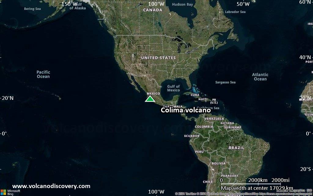
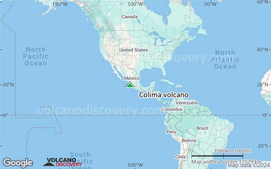
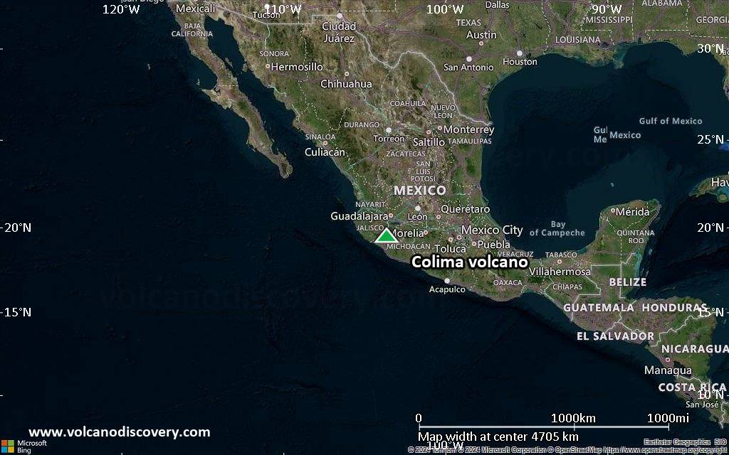
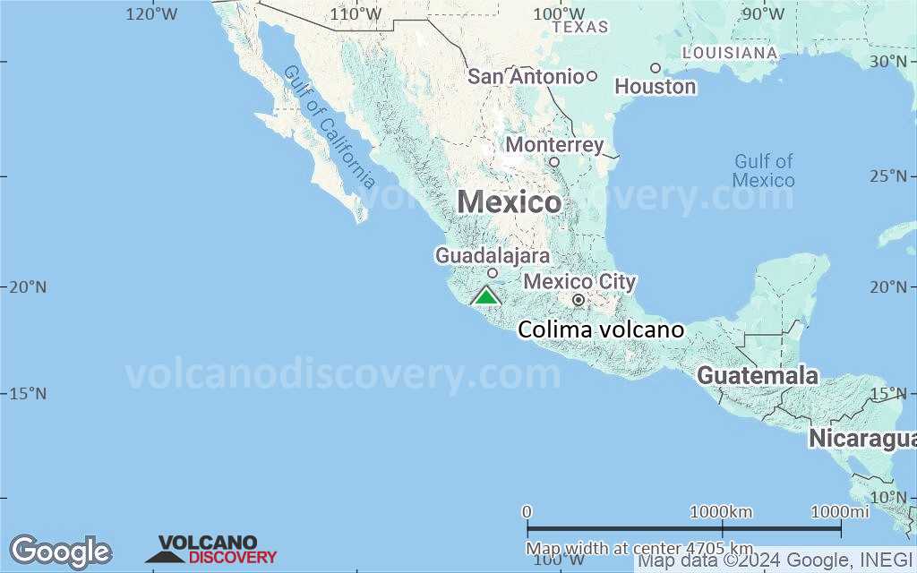
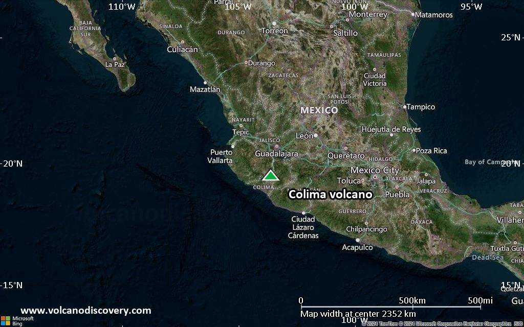
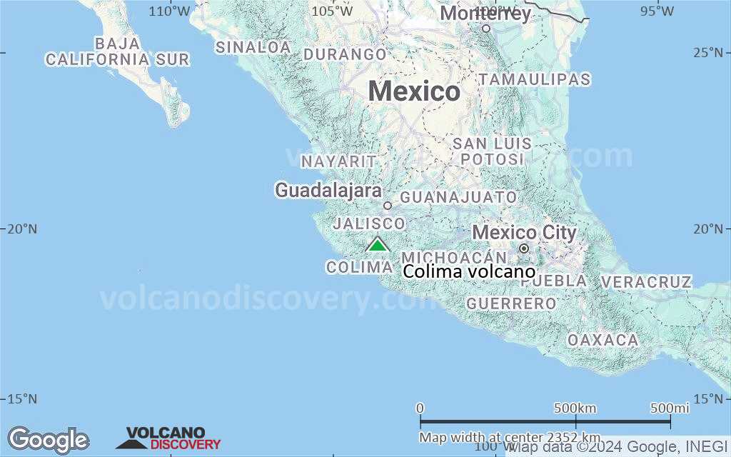
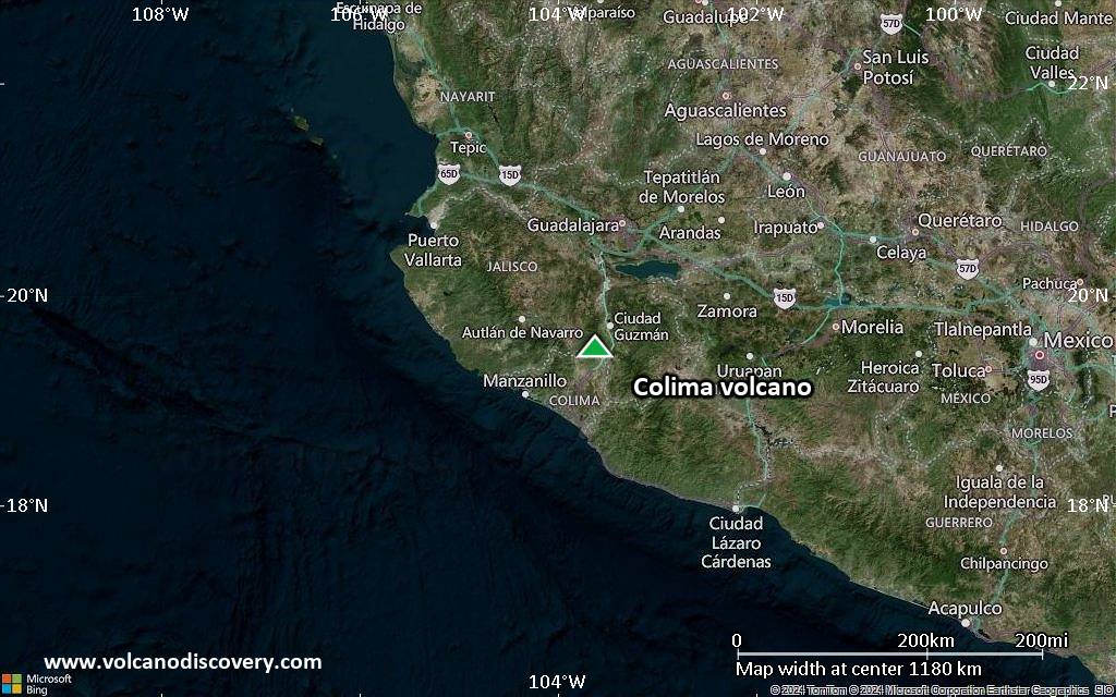
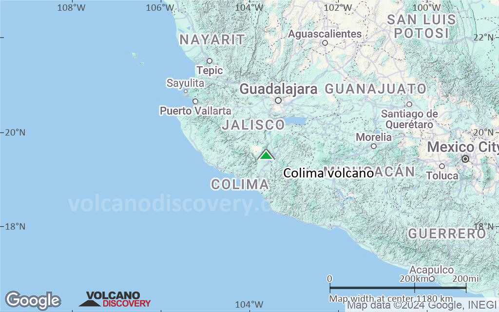
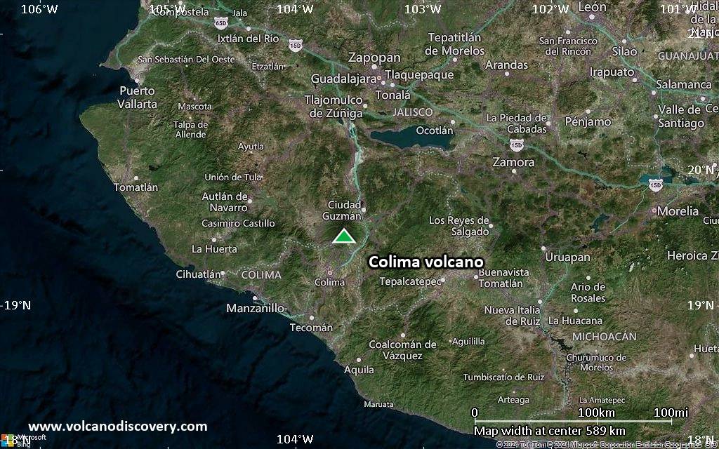
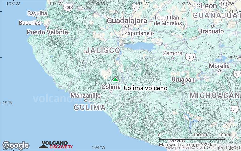
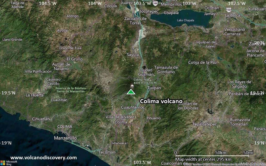
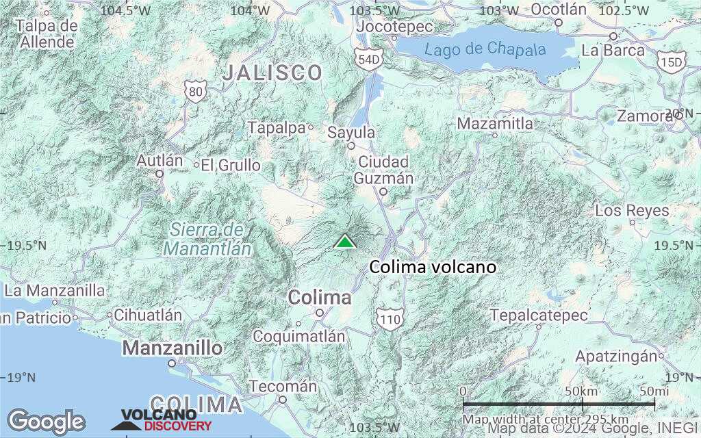
| RSS | EN | DE | EL | ES | FR | IT | RU

Colima Volcan

Updated: 26 avril. 2025 05:33 GMT -
Stratovolcano
Western Mexico, 19.51°N / -103.62°W
Summit height: 3850 m / 12,631 ft
Condition actuelle: normal / en sommeil (1 sur 5)
Last update: 18 oct. 2023 (Smithsonian / USGS Weekly Volcanic Activity Report)
Strong explosion at Colima volcano in Feb 2015

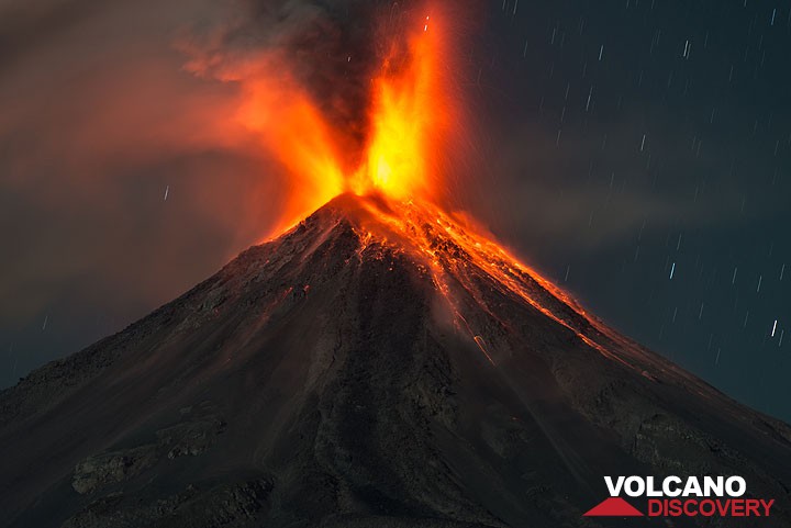
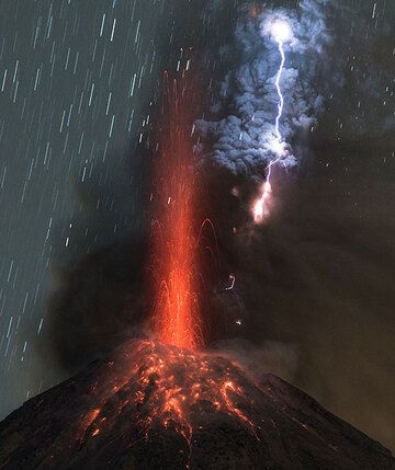
Colima volcano is one of the most active volcanoes in North America and one of the potentially most dangerous ones. It has had more than 30 periods of eruptions since 1585, including several significant eruptions in the late 1990s. Scientific monitoring of the volcano began 20 years ago.

[smaller] [larger]
Style éruptif tipique: Dominantly explosive. Construction of lava domes, vulcanian eruptions and strombolian activity. In near-constant activity since 1994.
Eruptions du volcan Colima: 1519, 1560, 1576, 1585, 1590, 1602(?), 1606, 1611-1613, 1622, 1690, 1711, 1743(?), 1744, 1749(?),1769, 1770, 1771, 1780, 1794, 1795, 1804, 1806-1809, 1818, 1819, 1866, 1869, 1870-71, 1872-73, 1874, 1875-78, 1879-80, 1880-81, 1882-84, 1885-1886, 1887, 1889-90, 1890, 1891-92, 1893-1902, 1903, 1904-1906, 1908-09, 1913, 1926-1931(?), 1941(?), 1957-1960, 1961-62, 1963-70, 1973(?), 1975-76, 1977-1982, 1983(?), 1985-86, 1987, 1988(?), 1991, 1994, 1997-2011, 2013-ongoing

Derniers séismes proches

Date et l'heureMag / Prof.Distance / Lieux
19 avril 03:44 (GMT -6)
3.0

3.4 km
21 km à l'est 14 km au sud de Ciudad Guzmán, Jalisco, MexiqueI FELT IT Info
vendredi, 18 avril 2025 GMT (1 séisme)
18 avril 14:45 (GMT -6)
3.4

1.9 km
17 km au nord-est 10.8 km au sud de Ciudad Guzmán, Jalisco, Mexique Info
jeudi, 17 avril 2025 GMT (2 séismes)
17 avril 06:32 (GMT -6)
3?

8.5 km
20 km à l'est Jalisco, Mexico (non confirmé) Info
17 avril 02:53 (GMT -6)
3?

80 km
14 km au sud Jalisco, Mexico (non confirmé) Info
mercredi, 16 avril 2025 GMT (9 séismes)
16 avril 16:30 (GMT -6)
3.0

5 km
28 km à l'est 5 km au sud-est de Tuxpan, Jalisco, Mexique Info
16 avril 16:09 (GMT -6)
3.0

10 km
24 km au nord-est 13 km au sud-est de Ciudad Guzmán, Jalisco, Mexique Info
16 avril 06:36 (GMT -6)
3?

11 km
17 km au nord-est Jalisco, Mexico (non confirmé) Info
16 avril 03:45 (GMT -6)
3.4

5.6 km
11 km à l'est 18 km au sud de Ciudad Guzmán, Jalisco, Mexique Info
16 avril 03:36 (GMT -6)
3.2

1.2 km
14 km à l'est 20 km au sud de Ciudad Guzmán, Jalisco, Mexique Info

Introduction

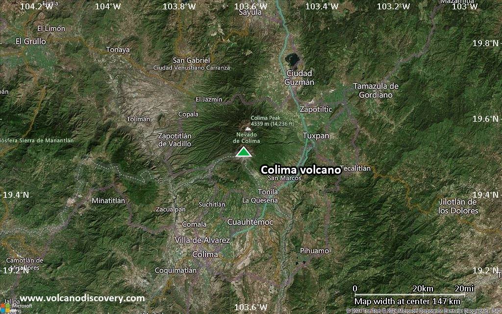
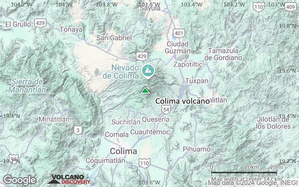
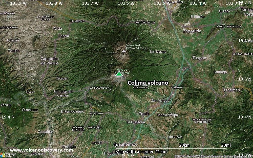
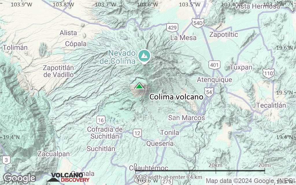
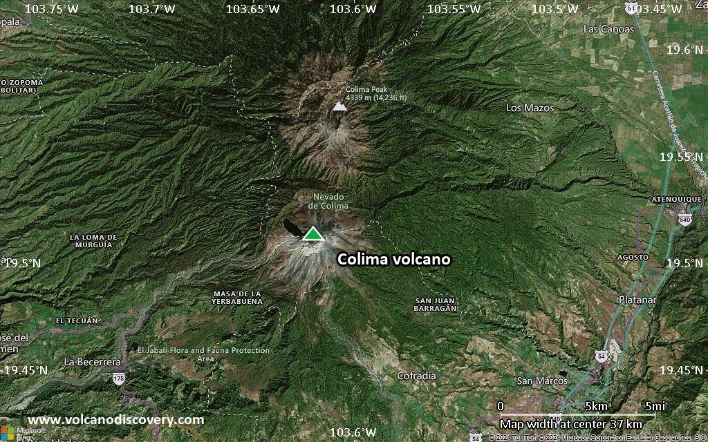
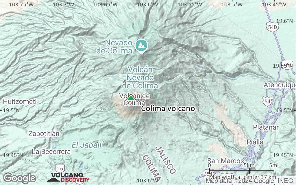
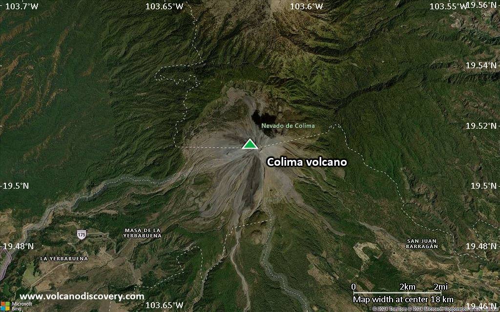
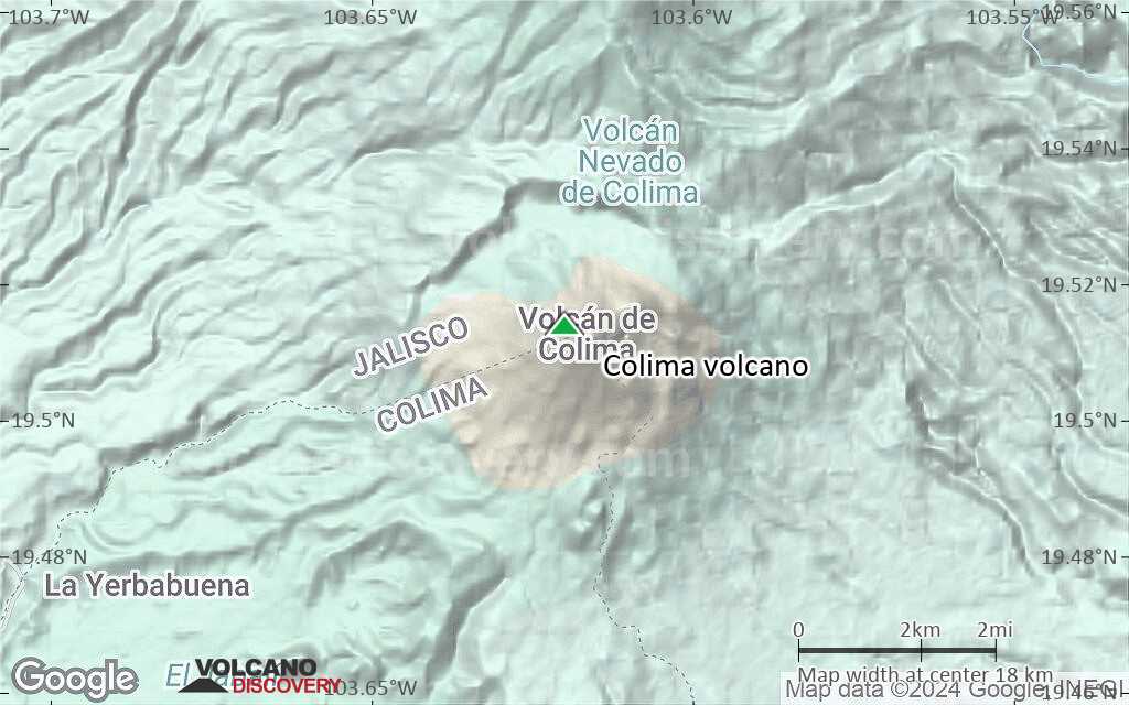
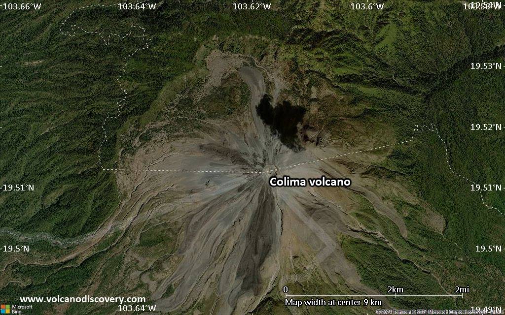
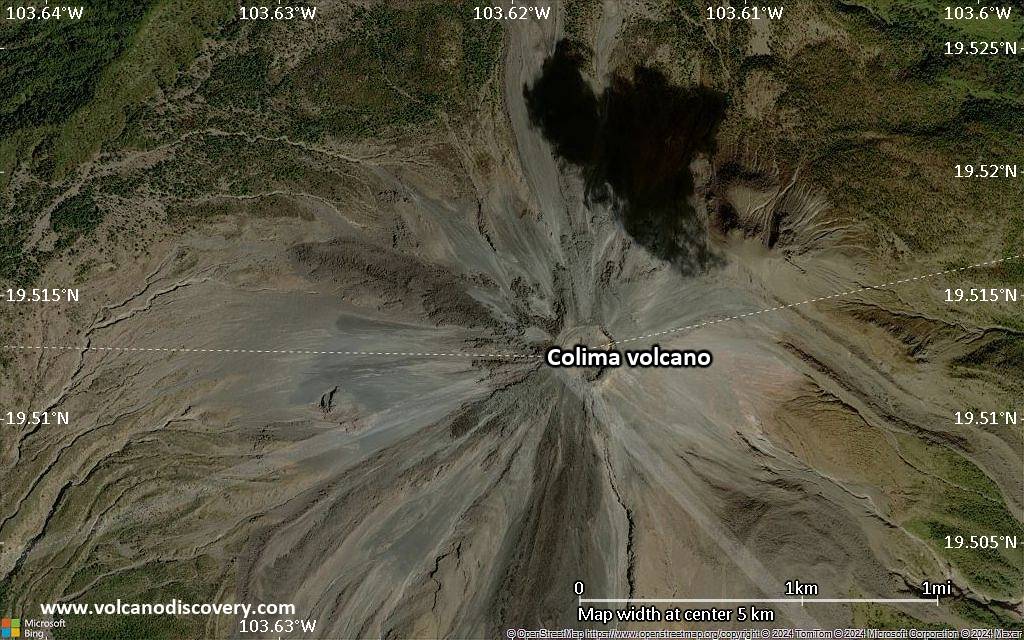
The Colima volcanic complex is the most prominent volcanic center of the western Mexican Volcanic Belt. It consists of two southward-younging volcanoes, Nevado de Colima (the 4320 m high point of the complex) on the north and the 3850-m-high historically active Volcán de Colima at the south.

A group of cinder cones of probable late-Pleistocene age is located on the floor of the Colima graben west and east of the Colima complex. Volcán de Colima (also known as Volcán Fuego) is a youthful stratovolcano constructed within a 5-km-wide caldera, breached to the south, that has been the source of large debris avalanches. Major slope failures have occurred repeatedly from both the Nevado and Colima cones, and have produced a thick apron of debris-avalanche deposits on three sides of the complex. Frequent historical eruptions date back to the 16th century. Occasional major explosive eruptions (most recently in 1913) have destroyed the summit and left a deep, steep-sided crater that was slowly refilled and then overtopped by lava dome growth.

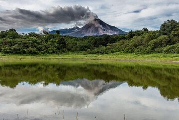
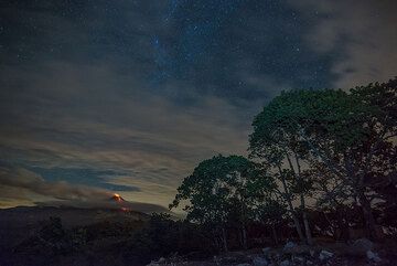
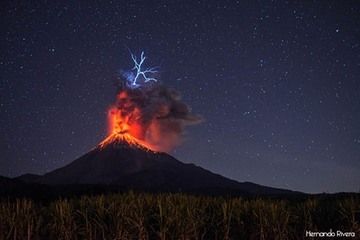
Colima Volcano Photos

Éruptions volcaniques importantes: volcano Colima

In the past 10,000 years, Colima has had at least 79 confirmed volcanic eruptions, out of which 53 are documented by historical records, while the others can be inferred from geological evidence.
Additionally, there are 7 uncertain or discredited eruptions from Colima volcano.
The table below lists all known eruptions (date in bold face) of Colima volcano since around 1900. Updates on the most recent volcanic activity of Colima can be found on the news page of Colima volcano.
DateNoteVEIMortsDommages
2019 Mai 11 - Jul 12
Obs./docs historiques
1
inconnu
2013 Jan 6 - 2017 Mar 7Summit crater
Obs./docs historiques
3
inconnu
1997 Nov 22 - 2011 Jun 211994 crater
Obs./docs historiques
3
inconnu
1994 Jul 21West of 1987 explosion crater
Obs./docs historiques
1
inconnu
1991 Mar 1 - Oct 16 ±15 d.
Obs./docs historiques
2
inconnu
?? 1988 Jun 15 ±180 d.
Éruption incertaine
2?
inconnu
1987 Jul 2East side of summit lava dome
Obs./docs historiques
1
inconnu
1985 Jul 2 ±182 d. - 1986 Jan 5 ±4 d.
Obs./docs historiques
1
inconnu
?? 1983 Fév 11 - Fév 15
Éruption incertaine
1?
inconnu
1977 Déc 16 ±15 d. - 1982 Jun 16 ±15 d.
Obs./docs historiques
1
inconnu
1975 Déc 11 ? - 1976 Jun 20
Obs./docs historiques
2
inconnu
?? 1973 Jan 30
Éruption incertaine
1
inconnu
1963 Jul 2 ±182 d. - 1970 Jul 2 ±182 d.
Obs./docs historiques
1
inconnu
1961 Jul 2 ±182 d. - 1962 Déc 1 ±30 d.
Obs./docs historiques
1
inconnu
1957 Mai 14 - 1960 Jul 2 ±182 d.
Obs./docs historiques
1
inconnu
?? 1941 Avr 15
Éruption incertaine
3?
inconnu
1926 ±4 y. - 1931 ?
Obs./docs historiques
1?
inconnu
1913 Jan 17 - Jan 24
Obs./docs historiques
4
inconnu
1913 Jan 20
(éruption 1913 Jan 17 - Jan 24)
Obs./docs historiques
413
inconnu
Infos
1908 Déc 18 - 1909 Jul 1 ±30 d.
Obs./docs historiques
3
inconnu
1904 - 1906
Obs./docs historiques
1?
inconnu
1903 Fév 15 - Oct 30
Obs./docs historiques
3
inconnu
1893 Déc 4 - 1902
Obs./docs historiques
2
inconnu
Remark:
Our list of volcanic eruptions closely follows the database of eruptions of the Smithsonian's Global Volcanism Project (GVP), the internationally most recognized data source for volcanic eruptions, but also includes significant eruptive episodes or related volcano events. "Volcanic eruptions" are usually to be understood as sequences of individual eruptive episodes that can follow each other, or even overlap (if several vents are involved), and can last many years, decades or even longer. For example, the current activity of Stromboli volcano is understood as a single eruption that has been ongoing since 1934.
Sources: NOAA National Centers for Environmental Information (NCEI), Global Significant Volcanic Eruptions Database. doi:10.7289/V5TD9V7K | Global Volcanism Project / Smithsonian Institution

Colima Volcano FAQ

+When was the last eruption of Colima volcano?

+How often does Colima volcano erupt?

+How active is Colima volcano at present?

+When was the largest eruption of Colima volcano?

Dernières images satellite

Colima image satellite sat1Colima image satellite sat2
Colima Voyages aux Volcans
5 days expedition to observe and photograph Colima volcano, Mexico
5 days / 4 nights - Facile
Prix open
Départs sur commande possibles
on request on custom dates

Colima Volcan Cartes

Below is a selection of maps showing the location and surroundings of the volcano at various resolutions based on aerial-imagery / terrain maps. Feel free to use them for non-commercial purposes on your blog or website as long as you credit them with a link back to this page (click to copy it).
Satellite/aerial-type map of Colima volcano (world scale)
Terrain-type map of Colima volcano (world scale)
Satellite/aerial-type map of Colima volcano (region scale large)
Terrain-type map of Colima volcano (region scale large)
Satellite/aerial-type map of Colima volcano (region scale medium)
Terrain-type map of Colima volcano (region scale medium)
Satellite/aerial-type map of Colima volcano (region scale small)
Terrain-type map of Colima volcano (region scale small)
Satellite/aerial-type map of Colima volcano (local scale large)
Terrain-type map of Colima volcano (local scale large)
Satellite/aerial-type map of Colima volcano (local scale medium)
Terrain-type map of Colima volcano (local scale medium)
Satellite/aerial-type map of Colima volcano (local scale small)
Terrain-type map of Colima volcano (local scale small)
Satellite/aerial-type map of Colima volcano (scale of 10s of km)
Terrain-type map of Colima volcano (scale of 10s of km)
Satellite/aerial-type map of Colima volcano (scale of 20-40 km)
Terrain-type map of Colima volcano (scale of 20-40 km)
Satellite/aerial-type map of Colima volcano (scale of approx. 10-20 km)
Terrain-type map of Colima volcano (scale of approx. 10-20 km)
Satellite/aerial-type map of Colima volcano (scale of 5-10 km)
Satellite/aerial-type map of Colima volcano (scale of few kilometers)
Volcanoes & Earthquakes - new app for Android
Départs garantis:
9-25 juin 2025: Volcans et Épices - Mer des Moluques (Sulawesi, Indonésie)
7-22 juil. 2025: Du Krakatau à Bali - Java (Indonésie)
7-23 juil. 2025: Volcans et Épices - Mer des Moluques (Sulawesi, Indonésie)
1-17 août 2025: Volcans et Épices - Mer des Moluques (Sulawesi, Indonésie)
1-14 oct. 2025: Désert, sels et volcans - Désert de Danakil (Éthiopie)
4-12 oct. 2025: Montagnes de Feu - du Stromboli à l'Etna - Eoliennes + Etna
6-21 oct. 2025: Du Krakatau à Bali - Java (Indonésie)
3-19 nov. 2025: Volcans et Épices - Mer des Moluques (Sulawesi, Indonésie)
= Places libres   = Départ garanti   = Quelques places disponibles   = Groupe fermé
Locaton of Colima volcano
mer., 18 oct. 2023, 14:00

Colima volcano (Mexico) - Smithsonian / USGS Weekly Volcanic Activity Report for 11 October-17 October 2023 (Continuing Activity)

On 13 October the Centro Universitario de Estudios Vulcanológicos (CUEV) - Universidad de Colima reported that during the previous week three lahars descended the Zarco (WSW), Montegrande (S), and La Arena drainages, triggered by Hurricane Lidia. In general, steam-and-gas emissions were low and rose from the NE part of the crater. ... Tout lire
mar., 17 mai 2022, 09:33

Colima volcano (Mexico) activity update: all remains calm

The volcano remains in a state of calm. The monitoring network of the Colima State University detected 4 high frequency events and 5 landslides, but nothing else that could suggest a reawakening of the volcano in a near future. ... Tout lire

Sur cette page:

Try our free app!
Volcanoes & Earthquakes - new app for Android
Android | iOS version

More on VolcanoDiscovery

Why is there advertising on this site?

Support us - Help us upgrade our services!

We truly love working to bring you the latest volcano and earthquake data from around the world. Maintaining our website and our free apps does require, however, considerable time and resources.
We need financing to increase hard- and software capacity as well as support our editor team. We're aiming to achieve uninterrupted service wherever an earthquake or volcano eruption unfolds, and your donations can make it happen! Every donation will be highly appreciated. If you find the information useful and would like to support our team in integrating further features, write great content, and in upgrading our soft- and hardware, please make a donation (PayPal).

Planned features:Thanks to your past donations, these features have been added recently:
Download and Upgrade the Volcanoes & Earthquakes app to get one of the fastest seismic and volcano alerts online:
Android | IOS
Thank you!
Copyright: VolcanoDiscovery ou autres sources indiquées.
Utilisation des documents: Les textes, les images et les vidéos de ce site internet sont protégées par copyright. Toute reproduction et tout usage sans accord préalable ne sont pas autorisés. Si vous désirez acquérir pour certains documents (photos, vidéos, textes ou autres) le droit de reproduction, d'édition et, plus généralement, de toute utilisation destinée à un usage public, qu'elle soit commerciale ou pas, vous êtes priés de nous contacter.
Volcanoes & Earthquakes
VolcanoDiscovery Home
Volcans | Séismes | Photos | Actualités | | Shop | App
Adventure & Study Travel
Tours to Volcanoes and Volcanic Areas: walking tours, photo tours, study tours
Voyages |
Get our newsletter!
Company info
Contact | Mentions légales | Terms & conditions
Follow us
Follow us on facebook Follow us on Instagram Follow us on Bluesky Follow us on Twitter Visit our Youtube channel
EN | DE | EL | ES | FR | IT | RU
VolcanoDiscovery GmbH, Germany, Reg. nr.: HRB 103744, EU Tax Id: DE 297 465 123 owned and created by
Dr. Tom Pfeiffer, volcanologist, volcano photographer, tour organizer member of
IAVCEI
IAVCEI
Vulkanologische Gesellschaft
Volcanological Society
Ecotourism Greece
Ecotourism Greece
RUV insurance
Insured by R+V
VolcanoDiscovery © 2004- All Rights Reserved | Privacy - Changer Préférences