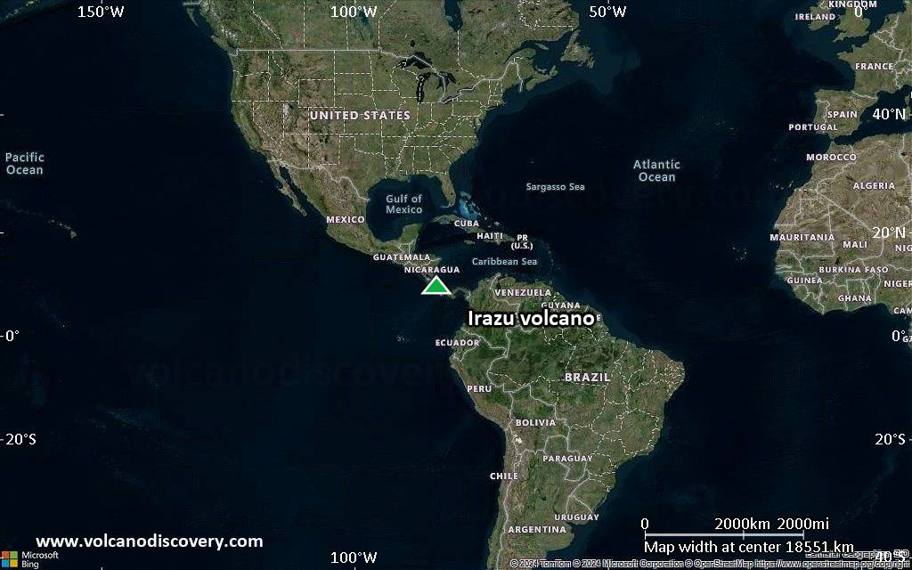
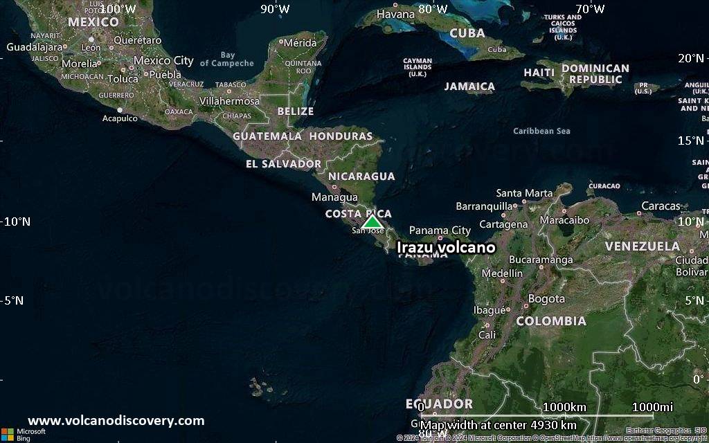
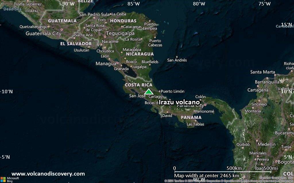
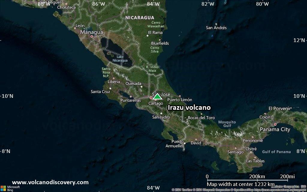
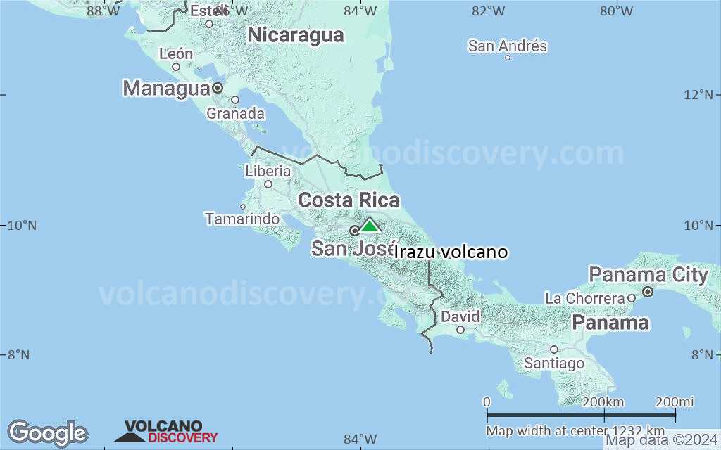
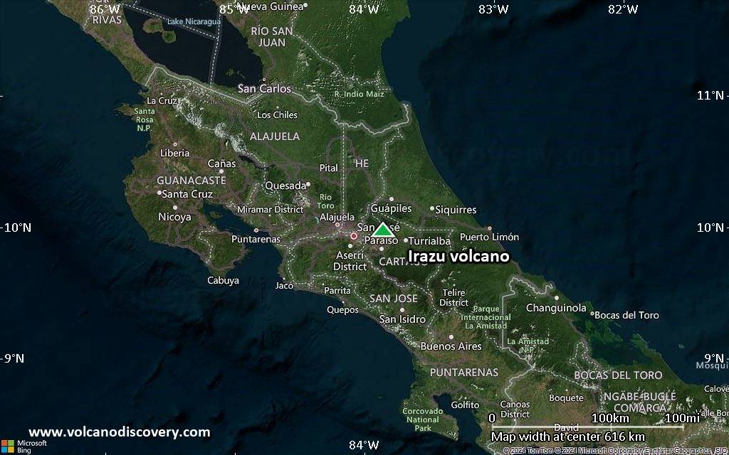
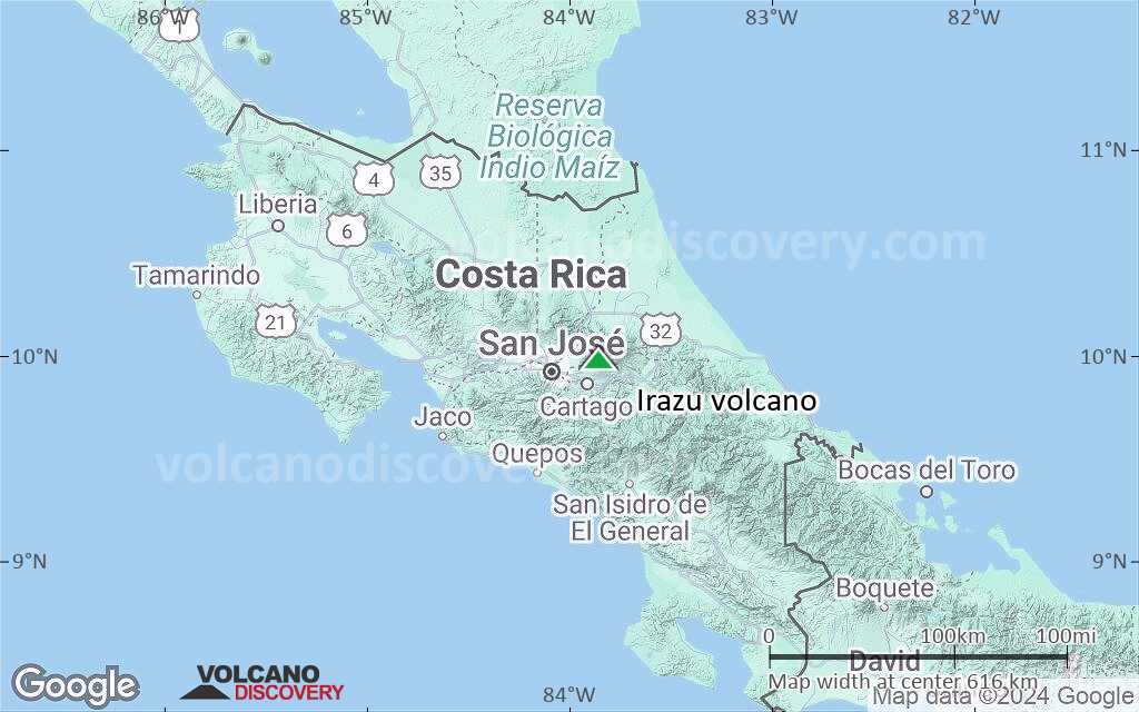
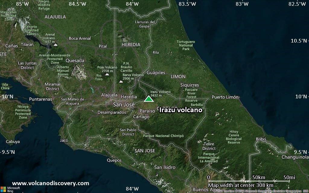
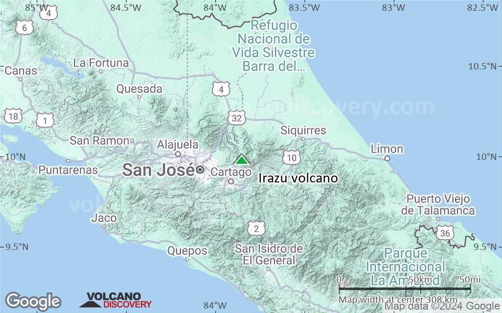
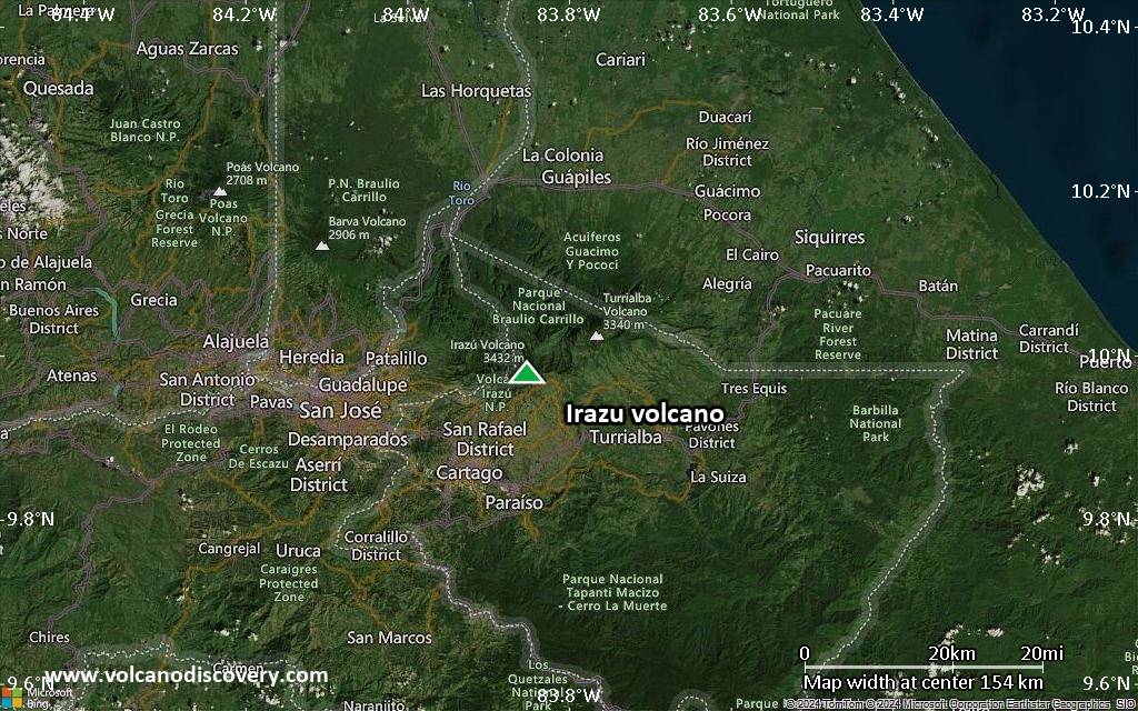
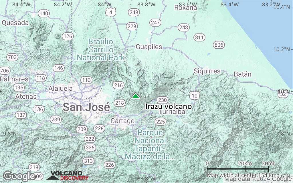
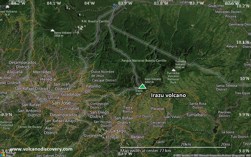
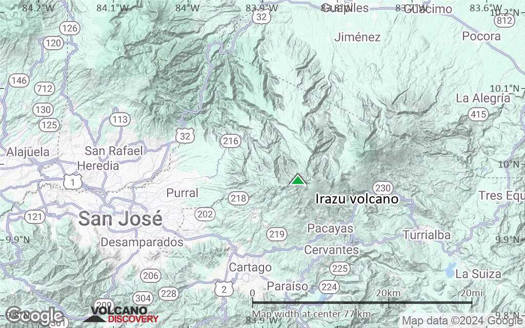
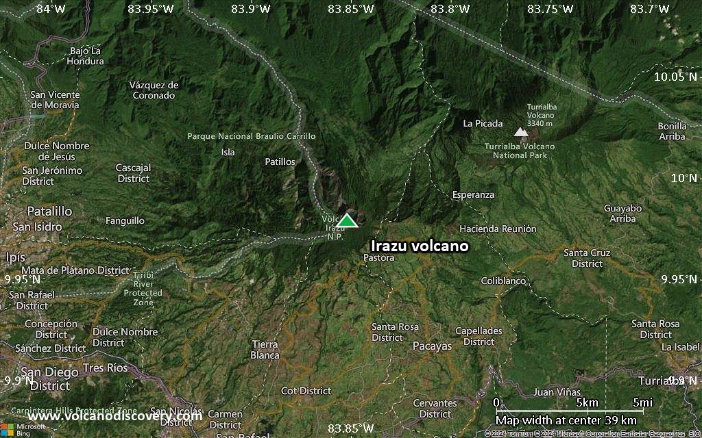
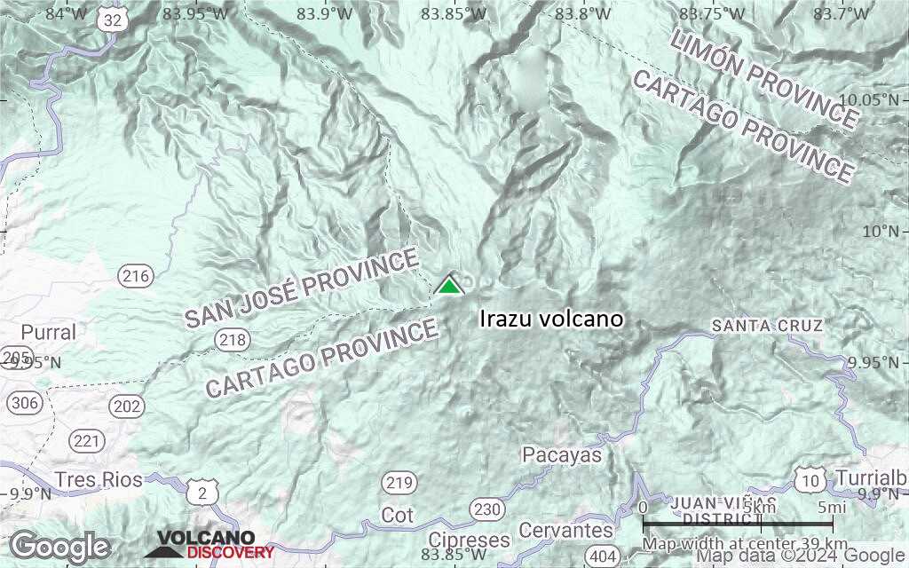
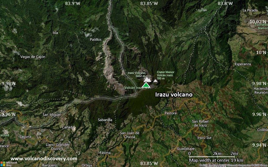
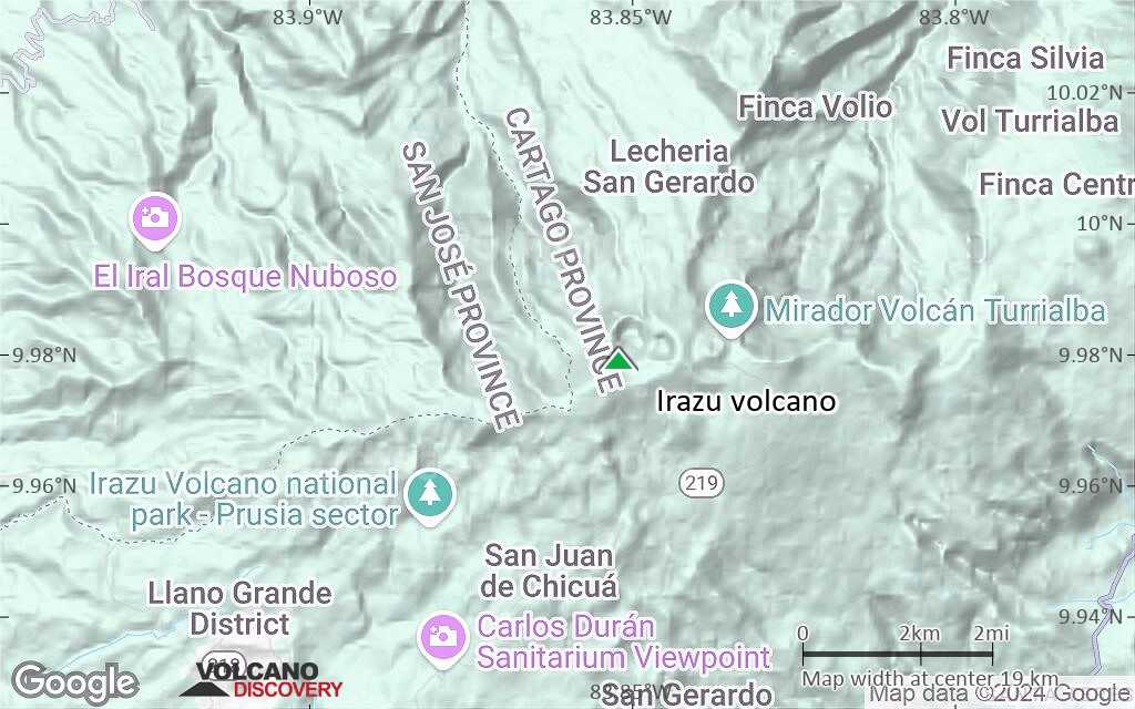
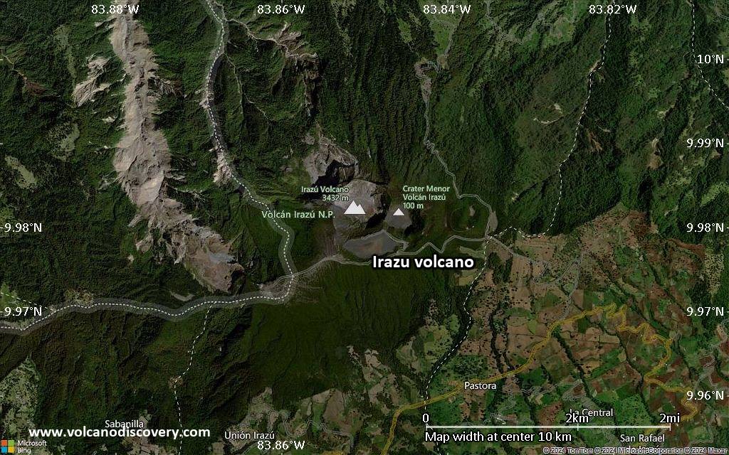
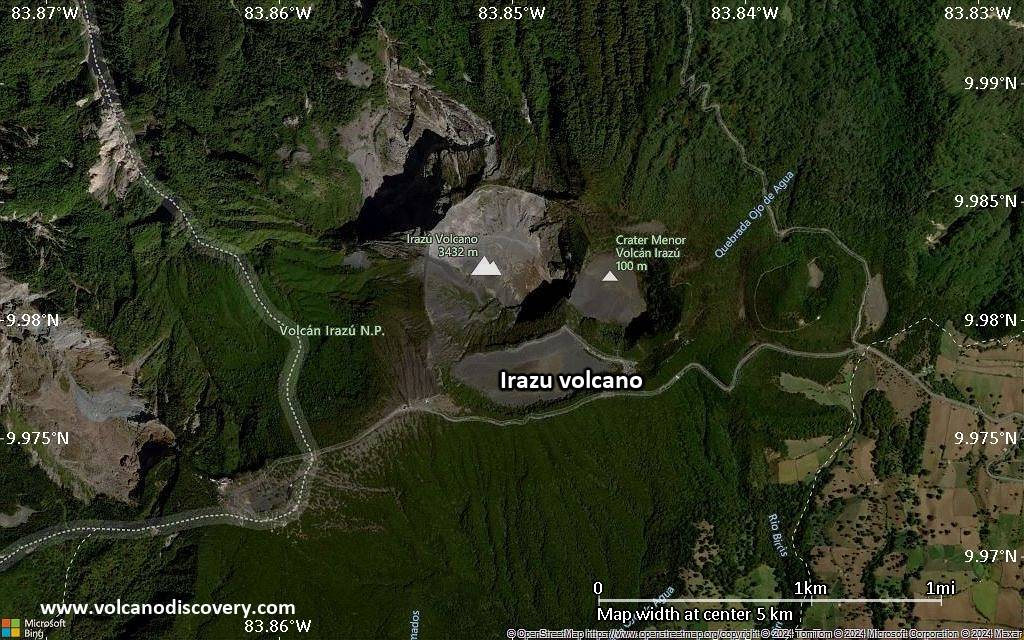
| RSS | EN | DE | EL | ES | FR | IT | RU

Irazu Volcán

Updated: 25 abr. 2025 22:54 GMT -
Stratovolcano
Costa Rica, 9.98°N / -83.85°W
Summit height: 3432 m / 11,260 ft
Current status: normal or dormant (1 out of 5)
Last update: 22 dic 2021 (Smithsonian / USGS Weekly Volcanic Activity Report)

Irazú (3432 m) immediately east of the capital San José is Costa Rica's highest and one of its most active volcanoes. Tephra fall (ash) during the last major eruption of Irazú in 1963-65 caused heavy damage to infrastructure and life in San José and its surroundings.

[smaller] [larger]
Typical eruption style: Explosive.
Erupciones del volcán Irazu: 1726, 1775(?), 1821(?), 1822, 1823, 1826(?), 1842, 1844(?), 1847, 1864, 1875, 1882(?), 1909(?), 1914(?), 1917-21, 1924, 1928, 1930, 1933, 1939-40, 1963-65, 1977, 1994

Latest nearby earthquakes

Fecha y horaMag / Prof.Distancia / Ubicación
19 abr 21:53 (Tiempo Universal)
2.4

10 km
29 km al suroeste 1 km Al Norte De Aserri, San Jose. Más
lunes, 14 abril 2025 GMT (2 sismos)
13 abr 22:24 (GMT -6)
2?

99 km
13 km al oeste Costa Rica (inconfirmado) Más
13 abr 22:24 (Costa Rica)
3.5

75 km
16 km al oeste 10 km al este de San José, San José, Costa Rica Más
domingo, 13 abril 2025 GMT (1 sismo)
13 abr 13:50 (Costa Rica)
4.0

11 km
21 km al este 46 km al este de San José, San José, Costa Rica 9 reportsMás

Background

Irazú is a massive stratovolcano covering more than 500 sq km with at least 10 flank cones on the southern flank, all being older than at least 14,000 years when a massive lava flow (the "Ceravantes" flow) was erupted.
All known eruptions from Irazú during the past 10,000 years have been explosive and originated from the summit craters that show a migration to the W over time. The historically active crater contains a small acid lake of changing size and color.
---
Source: GVP, Smithsonian Institution

Irazu Volcano Photos

Erupciones volcánicas significativas: Irazu volcano

In the past 10,000 years, Irazu has had at least 24 confirmed volcanic eruptions, out of which 19 are documented by historical records, while the others can be inferred from geological evidence.
Additionally, there are 15 uncertain or discredited eruptions from Irazu volcano.
The table below lists all known eruptions (date in bold face) of Irazu volcano since around 1800. Updates on the most recent volcanic activity of Irazu can be found on the news page of Irazu volcano.
FechaNotaVEIFallecidosDaños
2019 may 2
(episodio eruptivo 2019 may 2)
Tsunami registrado
Obs. históricas/documentos
0
desconocido
Información
?? 1994 dic 8
Erupción incierta
Obs. históricas/documentos
2
desconocido
1977 mar 3
Obs. históricas/documentos
1
desconocido
1974 mar 2 - mar 7
Erupción desacreditada
1967 ago 7
Erupción desacreditada
1963 mar 13 - 1965 feb 13
Obs. históricas/documentos
3
desconocido
1963 dic 10
(erupción 1963 mar 13 - 1965 feb 13)
Obs. históricas/documentos
340
moderado
Información
1963 mar 17
(erupción 1963 mar 13 - 1965 feb 13)
Obs. históricas/documentos
315
desconocido
Información
1962 ago 9
Erupción desacreditada
1939 may 18 - 1940 feb
Obs. históricas/documentos
2
desconocido
1933 mar 22 ? - jul 25
Obs. históricas/documentos
2
desconocido
1930 oct
Obs. históricas/documentos
2
desconocido
1928 feb 14 - may 26 ±5 d.
Obs. históricas/documentos
2
desconocido
1924 mar - abr
Obs. históricas/documentos
2
desconocido
1917 sep 27 - 1921
Obs. históricas/documentos
3
desconocido
?? 1914 feb 21
Erupción incierta
?
desconocido
1910
Erupción desacreditada
?? 1909
Erupción incierta
2
desconocido
1899
Erupción desacreditada
1894
Erupción desacreditada
1889 feb 28
Erupción desacreditada
1886
Obs. históricas/documentos
2?
desconocido
1885
Obs. históricas/documentos
2?
desconocido
1883 ene 3
Erupción desacreditada
?? 1882
Erupción incierta
2
desconocido
1875 ±5 y.
Obs. históricas/documentos
2
desconocido
1864 sep 16 - sep 17
Obs. históricas/documentos
2
desconocido
1847 may 18
Obs. históricas/documentos
2
desconocido
?? 1844 may
Erupción incierta
2
desconocido
1842
Obs. históricas/documentos
2
desconocido
?? 1826
Erupción incierta
?
desconocido
1823
Obs. históricas/documentos
2?
desconocido
1822 may 7
Obs. históricas/documentos
2
desconocido
?? 1821 may
Erupción incierta
2
desconocido
Remark:
Our list of volcanic eruptions closely follows the database of eruptions of the Smithsonian's Global Volcanism Project (GVP), the internationally most recognized data source for volcanic eruptions, but also includes significant eruptive episodes or related volcano events. "Volcanic eruptions" are usually to be understood as sequences of individual eruptive episodes that can follow each other, or even overlap (if several vents are involved), and can last many years, decades or even longer. For example, the current activity of Stromboli volcano is understood as a single eruption that has been ongoing since 1934.
Fuentes: NOAA National Centers for Environmental Information (NCEI), Global Significant Volcanic Eruptions Database. doi:10.7289/V5TD9V7K | Global Volcanism Project / Smithsonian Institution

Irazu Volcano FAQ

+When was the last eruption of Irazu volcano?

+How often does Irazu volcano erupt?

+How active is Irazu volcano at present?

+When was the largest eruption of Irazu volcano?

Últimas imágenes satelitales

Irazu imagen satelital sat1Irazu imagen satelital sat2

Irazu Volcán Mapas

Below is a selection of maps showing the location and surroundings of the volcano at various resolutions based on aerial-imagery / terrain maps. Feel free to use them for non-commercial purposes on your blog or website as long as you credit them with a link back to this page (click to copy it).
Satellite/aerial-type map of Irazu volcano (world scale)
Terrain-type map of Irazu volcano (world scale)
Satellite/aerial-type map of Irazu volcano (region scale large)
Terrain-type map of Irazu volcano (region scale large)
Satellite/aerial-type map of Irazu volcano (region scale medium)
Terrain-type map of Irazu volcano (region scale medium)
Satellite/aerial-type map of Irazu volcano (region scale small)
Terrain-type map of Irazu volcano (region scale small)
Satellite/aerial-type map of Irazu volcano (local scale large)
Terrain-type map of Irazu volcano (local scale large)
Satellite/aerial-type map of Irazu volcano (local scale medium)
Terrain-type map of Irazu volcano (local scale medium)
Satellite/aerial-type map of Irazu volcano (local scale small)
Terrain-type map of Irazu volcano (local scale small)
Satellite/aerial-type map of Irazu volcano (scale of 10s of km)
Terrain-type map of Irazu volcano (scale of 10s of km)
Satellite/aerial-type map of Irazu volcano (scale of 20-40 km)
Terrain-type map of Irazu volcano (scale of 20-40 km)
Satellite/aerial-type map of Irazu volcano (scale of approx. 10-20 km)
Terrain-type map of Irazu volcano (scale of approx. 10-20 km)
Satellite/aerial-type map of Irazu volcano (scale of 5-10 km)
Satellite/aerial-type map of Irazu volcano (scale of few kilometers)
Volcanoes & Earthquakes - new app for Android
Guaranteed tours
9-25 jun 2025: Volcanoes and Spices - Halmahera N-Sulawesi (Indonesia)
27 jun - 6 jul 2025: Iceland Volcano Special - Iceland
7-22 jul 2025: From Krakatau to Bali - Java (Indonesia)
7-23 jul 2025: Volcanoes and Spices - Halmahera N-Sulawesi (Indonesia)
1-17 ago 2025: Volcanoes and Spices - Halmahera N-Sulawesi (Indonesia)
1-14 oct 2025: Desert, salt and volcanoes - Danakil desert (Ethiopia)
4-12 oct 2025: From Stromboli to Etna - Sicily and Eolian Islands (Italy)
6-21 oct 2025: From Krakatau to Bali - Java (Indonesia)
3-19 nov 2025: Volcanoes and Spices - Halmahera N-Sulawesi (Indonesia)
= spaces available   = guaranteed   = few spaces left   = booked out
mié, 4 nov 2020, 06:00

Irazu volcano (Costa Rica) - Smithsonian / USGS Weekly Volcanic Activity Report for 4 November-10 November 2020 (Continuing Activity)

OVSICORI-UNA reported that Irazú's seismic network recorded a significant landslide in the W part of the volcano on 4 November along with a lahar. A small thermal anomaly was detected in MODIS (Moderate Resolution Imaging Spectroradiometer) satellite data. ... Leer todo
mié, 26 ago 2020, 06:00

Irazu volcano (Costa Rica) - Smithsonian / USGS Weekly Volcanic Activity Report for 26 August-1 September 2020 (Continuing Activity)

OVSICORI-UNA reported that Irazú's seismic network recorded land movement 1.2 km SW of the SW crater rim in a high area used for radio and television antennas. Landslides in the area had been observed since 2014, but activity accelerated in the previous months. The number of events indicating landslides began to exponentially increase particularly after 20 August. ... Leer todo

En esta página:

Try our free app!
Volcanoes & Earthquakes - new app for Android
Android | iOS version

More on VolcanoDiscovery

Why is there advertising on this site?

Support us - Help us upgrade our services!

We truly love working to bring you the latest volcano and earthquake data from around the world. Maintaining our website and our free apps does require, however, considerable time and resources.
We need financing to increase hard- and software capacity as well as support our editor team. We're aiming to achieve uninterrupted service wherever an earthquake or volcano eruption unfolds, and your donations can make it happen! Every donation will be highly appreciated. If you find the information useful and would like to support our team in integrating further features, write great content, and in upgrading our soft- and hardware, please make a donation (PayPal).

Planned features:Thanks to your past donations, these features have been added recently:
Download and Upgrade the Volcanoes & Earthquakes app to get one of the fastest seismic and volcano alerts online:
Android | IOS
Thank you!
Sources: VolcanoDiscovery / VolcanoAdventures and other sources as noted.
Use of material: Most text and images on our websites are owned by us. Re-use is generally not permitted without authorization. Contact us for licensing rights.
Volcanoes & Earthquakes
VolcanoDiscovery Home
Volcanes | Sismos | Fotos | News | | Shop | App
Adventure & Study Travel
Tours to Volcanoes and Volcanic Areas: walking tours, photo tours, study tours
Tours & Dates | FAQ | About us
Get our newsletter!
Company info
Contact | Legal info | Terms & conditions
Follow us
Follow us on facebook Follow us on Instagram Follow us on Bluesky Follow us on Twitter Visit our Youtube channel
EN | DE | EL | ES | FR | IT | RU
VolcanoDiscovery GmbH, Germany, Reg. nr.: HRB 103744, EU Tax Id: DE 297 465 123 owned and created by
Dr. Tom Pfeiffer, volcanologist, volcano photographer, tour organizer member of
IAVCEI
IAVCEI
Vulkanologische Gesellschaft
Volcanological Society
Ecotourism Greece
Ecotourism Greece
RUV insurance
Insured by R+V
VolcanoDiscovery © 2004- All Rights Reserved | Privacy - Cookie Settings