| Fecha | Volcán | VEI | Región | Fallecidos | Daños | |
|---|---|---|---|---|---|---|
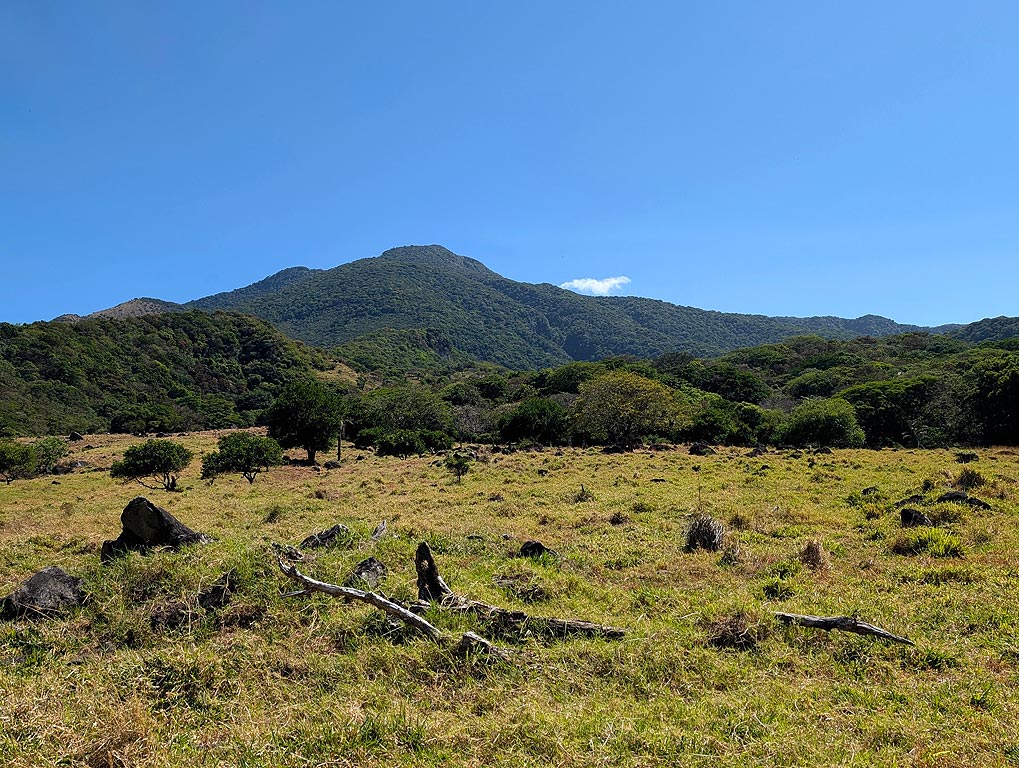
| Rincón de la Vieja | 2 | Costa Rica | desconocido | |||
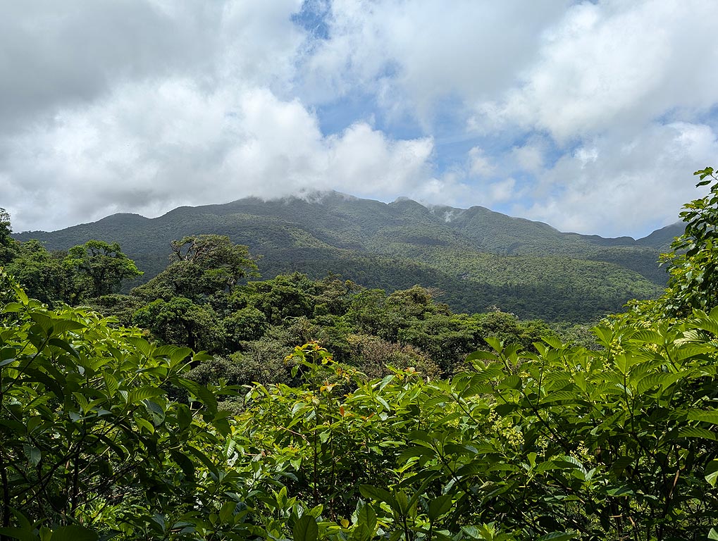
| Poas | 1 | Costa Rica | desconocido | |||
| Poas | 1 | Costa Rica | desconocido | |||
| Turrialba | 1 | Costa Rica | desconocido | |||
| Poas Crater lake - Fumarola Naranja | 1 | Costa Rica | desconocido | |||
| Turrialba | 1 | Costa Rica | desconocido | |||
| Turrialba | 1 | Costa Rica | desconocido | |||
| Rincón de la Vieja | 2 | Costa Rica | desconocido | |||
| Turrialba | 1 | Costa Rica | desconocido | |||
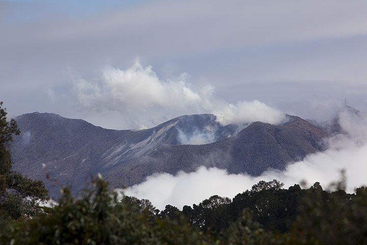
| Turrialba Cráter Central, Cráter Oeste | 3 | Costa Rica | desconocido | |||
| Poas | 2 | Costa Rica | desconocido | |||
| Rincón de la Vieja | 1 | Costa Rica | desconocido | |||
| Rincón de la Vieja Crater lake | 1 | Costa Rica | desconocido | |||
| Poas Laguna Caliente Crater | 1 | Costa Rica | desconocido | |||
| Poas Lake in summit crater | 1 | Costa Rica | desconocido | |||
| Rincón de la Vieja Crater lake | 1 | Costa Rica | desconocido | |||
| Turrialba West Crater | 2 | Costa Rica | desconocido | |||
| Rincón de la Vieja Crater lake | 1 | Costa Rica | desconocido | |||
| Poas | 1 | Costa Rica | desconocido | |||
| Turrialba West Crater | 1 | Costa Rica | desconocido | |||
| Rincón de la Vieja Crater lake | 1 | Costa Rica | desconocido | |||
| Rincón de la Vieja Crater lake | 1 | Costa Rica | desconocido | |||
| Turrialba West Crater (SE flank) | 2 | Costa Rica | desconocido | |||
| Rincón de la Vieja Crater lake | 1 | Costa Rica | desconocido | |||
| Turrialba West Crater | 1 | Costa Rica | desconocido | |||
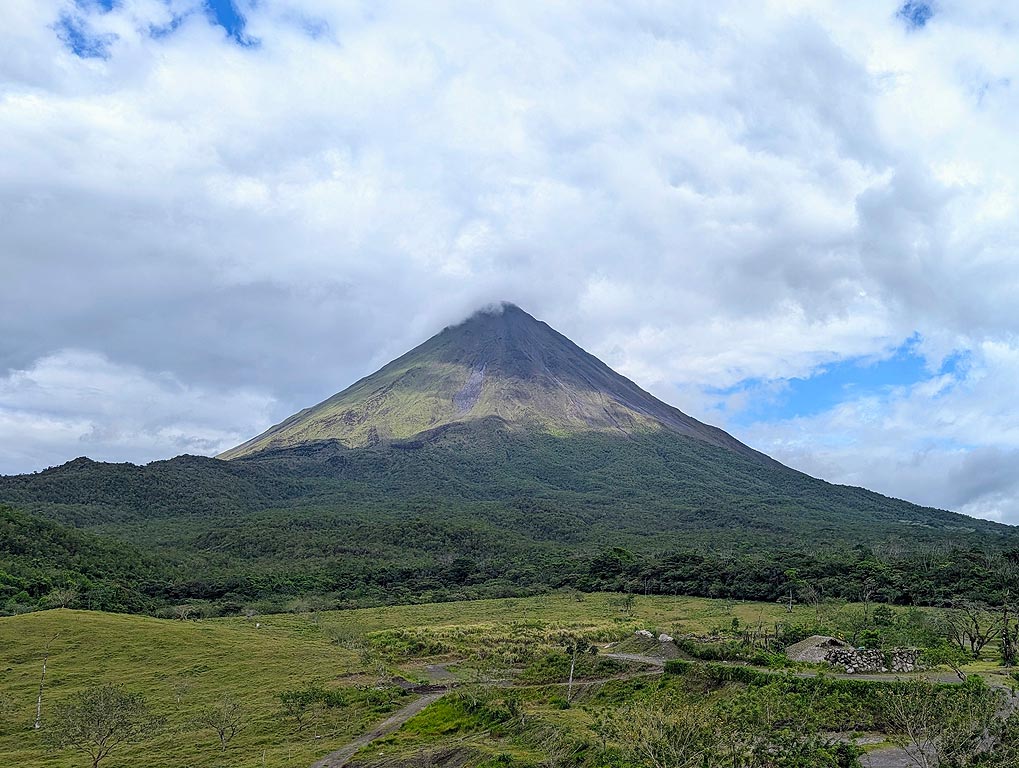
| Arenal W flank & summit | 3 | Costa Rica | desconocido | |||
| Turrialba SW crater | 2 | Costa Rica | desconocido | |||
| 2000 ago 23 (erupción | Arenal | 3 | Costa Rica | 2 | desconocido | Información |
| 1968 jul 29 (erupción | Arenal | 3 | Costa Rica | 80 | ligero | Información |
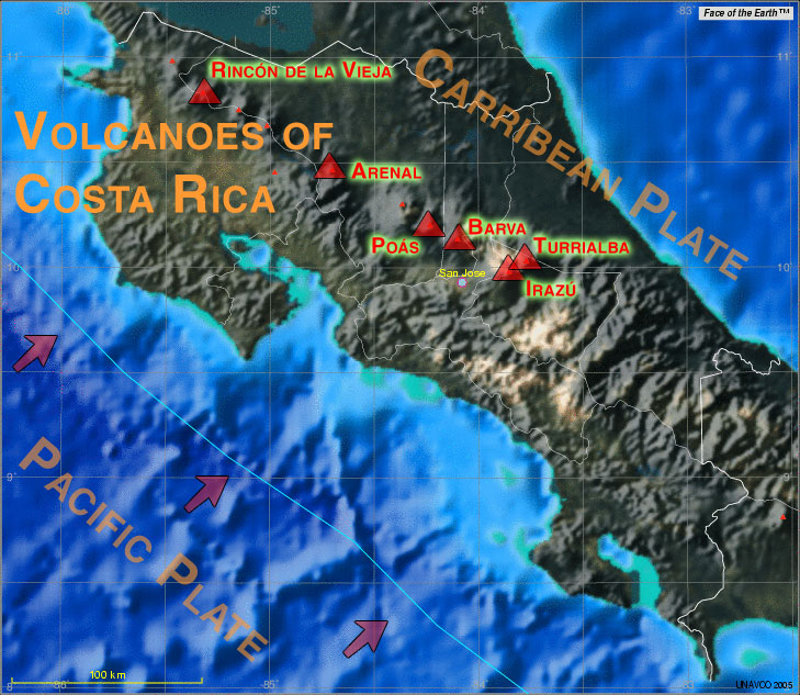
The last volcanic eruption en la Costa Rica was from Poas volcano during 2023 - 2024.
The first historically documented eruption occurred 1723 from Irazu volcano.
Since 1723, Costa Rica has seen at least 116 historically documented eruptions. This means that a volcano erupts on average every 2.6 years.
Costa Rica is volcanically extremely active: Since 1900, at least 6 volcanoes en la Costa Rica have been active. Almost every year, at least one volcano has erupted en la Costa Rica. The last volcano to erupt en la Costa Rica was Poas volcano. Its was active from 2023 until 2024 and ended 12 months ago.
The largest eruption en la Costa Rica in historic times was from Turrialba volcano. It occurred during 2015 - 2019. It ranks as a "vulcanian" eruption with a magnitude 3 on the VEI (Volcanic Explosivity Index) scale.
| Fecha y hora | Mag / Prof. | Volcán más cercano / Ubicación | |||
|---|---|---|---|---|---|
| 26 abr 05:52 (GMT -6) | 3.8 8 km | 122 km S de | South of Panama I FELT IT | Más | |
| 26 abr 02:02 (GMT -6) | 3.7 32 km | 157 km SO de | Off Coast of Costa Rica I FELT IT - 1 report | Más | |
| 25 abr 22:37 (GMT -5) | 4.2 9 km | 114 km S de | South of Panama I FELT IT - 1 report | Más | |
| viernes, 25 abril 2025 GMT (2 sismos) | |||||
| 25 abr 05:00 (GMT -6) | 3.8 23 km | 128 km SO de | Costa Rica I FELT IT | Más | |
| 24 abr 18:09 (GMT -6) | 3.9 23 km | 120 km SO de | Off Coast of Costa Rica I FELT IT | Más | |
| lunes, 21 abril 2025 GMT (1 sismo) | |||||
| 21 abr 08:03 (GMT -6) | 3.7 27 km | 106 km SO de | Off Coast of Costa Rica I FELT IT | Más | |
| Fecha | Mag | Región | Fallecidos | Daños | |
|---|---|---|---|---|---|
| 2009 Jan 8 | 6.1 | La Paz | 23 | pesado | Info |
| 1991 Apr 22 | 7.6 | Limon, Pandora; Panama | 90 | muy pesado | Info |
| 1973 Apr 14 | 6.5 | Tilaran, Arenal, Rio Chiquito | 26 | desconocido | Info |
| 1955 Sep 1 | 5.8 | Costa Rica | 10 | moderado | Info |
| 1952 Dec 30 | ? | Costa Rica | 29 | desconocido | Info |
| 1910 May 4 | ? | Cartago, San Jose | 700 | pesado | Info |
| 1910 Apr 13 | ? | Cartago | 1,750 | moderado | Info |
El terremoto más mortífero en la Costa Rica desde 1900 fue a strong earthquake (magnitude unknown) en la ![]() Costa Rica, Cartago on abril, 13, 1910. Resultó en 1,750 muertes y un número desconocido de personas heridas.
Costa Rica, Cartago on abril, 13, 1910. Resultó en 1,750 muertes y un número desconocido de personas heridas.
El terremoto que causó más daños fue the magnitude 7.6 earthquake en la ![]() Costa Rica, Provincia de Limón on abril, 22, 1991. Causó 90 muertes y $510 millones de dólares US (el equivalente actual) en daños económicos totales.
Costa Rica, Provincia de Limón on abril, 22, 1991. Causó 90 muertes y $510 millones de dólares US (el equivalente actual) en daños económicos totales.
Desde 1900, al menos 15 terremotos se han cobrado un total estimado de 2,658 muertes en la Costa Rica.
Ha habido 22 terremotos dañinos durante este período que han causado pérdidas económicas de aprox. $644.7 millones de dólares US combinado.