| RSS | EN | DE | EL | ES | FR | IT | RU

Ebeko Volcano

Updated: Mar 31, 2025 18:57 GMT -
somma volcano
Paramushir Island (Kuril Islands), 50.68°N / 156.02°E
Summit height: 1156 m / 3,793 ft
Current status: erupting (4 out of 5)
Last update: 22 Jan 2025 (Smithsonian / USGS Weekly Volcanic Activity Report)

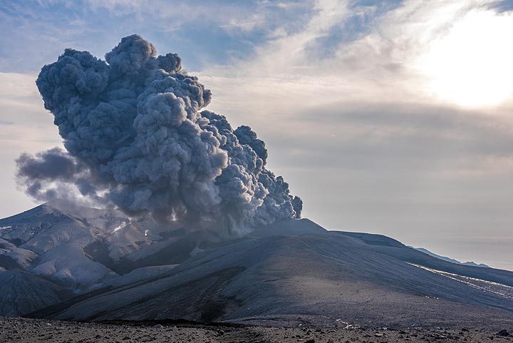
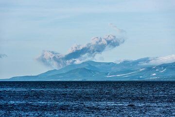
Ebeko is one of the most active volcanoes in the Kurile Islands, located in northern Paramushir Island south of Kamchatka.
Ebeko volcano has a flat top with 3 summit craters aligned SSW-NNE. The eastern part of the southern crater contains a large boiling spring. The middle crater has a hot lake with solfataras along its shore. The lower northern crater has a small, cold lake and is separated from the middle crater by a narrow ridge.
Historical activity has been recorded since the late 18th century and consisted in small to moderate explosive eruptions from the summit craters. Intense fumarolic activity occurs in the summit craters of Ebeko and on the outer flanks of the cone, as well as inside lateral explosion craters.

[smaller] [larger]
Typical eruption style: explosive
Ebeko volcano eruptions: 2016-ongoing, 2009, 2005, 1991, 1989-90, 1987-88, 1971, 1969, 1967, 1965-66, 1963, 1934-35, 1859, 1793

Latest nearby earthquakes

Date and TimeMag / DepthDistance / Location

Background

Ebeko volcano is at the northern end of a complex of 5 volcanic cones. Blocky lava flows extend west from Ebeko and SE from the neighboring Nezametnyi cone.
Ebeko volcano with its prominent fumaroles, solfataras, hot springs etc. has a very intense, interesting and complex hydrothermal system which is the subject to a large number of scientific studies. During heightened periods of activity, the chemical characteristics of fluids appear to change, such as decreasing rations of S/C, S/Cl, F/Cl and increasing ratios of H2S/SO2. It is hypothesized that there is a sea-water aquifer above the shallow magma chamber at Ebeko volcano, which sometimes allows magmatic intrusions to ascend to the surface through the aquifers without giving much seismic signals
Sources:
GVP Ebeko volcano information
Menyailova et al (1985) "Results of geochemical monitoring of the activity of Ebeko volcano (Kurile Islands) used for eruption prediction", Journal of Geodynamics, v. 3 (3-4), pp. 259-274)

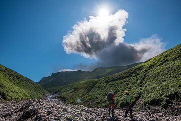
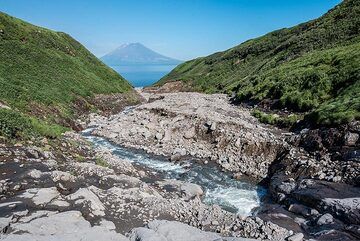
Ebeko Volcano Photos

Significant volcanic eruptions: Ebeko volcano

In the past 10,000 years, Ebeko has had at least 20 confirmed volcanic eruptions, out of which 16 are documented by historical records, while the others can be inferred from geological evidence.
There is one uncertain or discredited eruption in 1971 from Ebeko volcano.
The table below lists all known eruptions (date in bold face) of Ebeko volcano since around 1000 BC. Updates on the most recent volcanic activity of Ebeko can be found on the news page of Ebeko volcano.
DateNoteVEIDeathsDamage
2022 Jun 11 - ongoing
Historical obs./docs.
2
2016 Oct 20 - 2021 Nov 9Sredniy Crater (middle part) and Severny Crater (N part)
Historical obs./docs.
2
2010 Jul 2 - Jul 9 ±7 d.Summit craters
Historical obs./docs.
1
2009 Feb 11 - Jul 13 ?
Historical obs./docs.
1
2005 Jan 29 - Feb 16
Historical obs./docs.
2
1991 Jan 16 ±15 d.Northern crater
Historical obs./docs.
1
1989 Feb 2 - 1990 Apr 15 ±5 d.Northern crater and upper east flank
Historical obs./docs.
2
1987 Oct 14 - 1988 Jan 16 ±15 d.Northern crater
Historical obs./docs.
1
?? 1971 Jul 2 ±182 d.
Uncertain Eruption
1
1969 Feb 16 ±15 d.Northern crater
Historical obs./docs.
1
1967 Jan 16 ±15 d. - Apr 16 ±15 d.Northern crater
Historical obs./docs.
1
1965 Aug 16 ±15 d.Middle Crater
Historical obs./docs.
1
1963 Mar 8 - 1964 Jul 2 ±182 d.North wall of east amphitheater
Historical obs./docs.
1
1934 Oct 4 - 1935 Oct 15 ±45 d.Sredniy crater
Historical obs./docs.
2
1859 Sep 27
Historical obs./docs.
2
1833 Dec 31 ±365 d.
Historical obs./docs.
2
1793
Historical obs./docs.
2
1670 ? AD?
1650 ? AD?
1600 ? AD?
390 ±75 y. BC?
Remark:
Our list of volcanic eruptions closely follows the database of eruptions of the Smithsonian's Global Volcanism Project (GVP), the internationally most recognized data source for volcanic eruptions, but also includes significant eruptive episodes or related volcano events. "Volcanic eruptions" are usually to be understood as sequences of individual eruptive episodes that can follow each other, or even overlap (if several vents are involved), and can last many years, decades or even longer. For example, the current activity of Stromboli volcano is understood as a single eruption that has been ongoing since 1934.
Sources: NOAA National Centers for Environmental Information (NCEI), Global Significant Volcanic Eruptions Database. doi:10.7289/V5TD9V7K | Global Volcanism Project / Smithsonian Institution

Eruptions of Ebeko volcano


2009 eruption
An ash eruption of Ebeko volcano occurred at 09h59 local time on 27 October 2009. The ash plume drifted eastwards.

2005 eruption
Ebeko volcano erupted on 29 January 2005 from a vent on the NE side of the active crater. A yellow gray ash column rose 300 m above the crater. A small 7 x 12 m turquoise lake disappeared from the crater on 30 January. On 15-16 February a dark-gray column rose up to 500 m above the crater.
(GVP monthly reports)

1989-90 eruptions
An eruption began from the north crater on 3 February 1989. Ash was ejected to a height of 2.5 km. In August and September ash reached a height of 800 m above the crater.

1987-88 eruptions
Explosive ash eruptions began at Ebeko volcano on 14 October 1987 and continued until January 1988. The eruption occurred from 2 of the 3summit craters. Ash was emitted up to 1200 m above the crater. (GVP monthly reports)

1969 gas emissions
Gas emissions were observed in 1969.

1967 eruption
A phreatic eruption occurred from the northern crater in February 1967. A funnel was formed on the floor of the crater and andesitic ash was emitted.
Source: Menyailova et al (1985) "Results of geochemical monitoring of the activity of Ebeko volcano (Kurile Islands) used for eruption prediction", Journal of Geodynamics
v 3 (3-4), pp 259-274

1963 eruption
Ebeko volcano had a weak phreatic eruption in 1963 from the funnel-like vent on the eastern slope of the volcano. Liquid sulfur flows were observed and a new fumarole, Gremuchaya solfatara, was formed after the eruption.

1934-35 eruptions
Activity occurred from the middle crater and erupted andesitic ash and scoria bombs. Large amounts of sulfur gas emissions caused mass poisoning among local residents and loss of cattle.
Source: Kuril Island volcano eruption threatens health of locals (RIANOVOSTI)

Ebeko Volcano FAQ

+When was the last eruption of Ebeko volcano?

+How often does Ebeko volcano erupt?

+How active is Ebeko volcano at present?

+When was the largest eruption of Ebeko volcano?

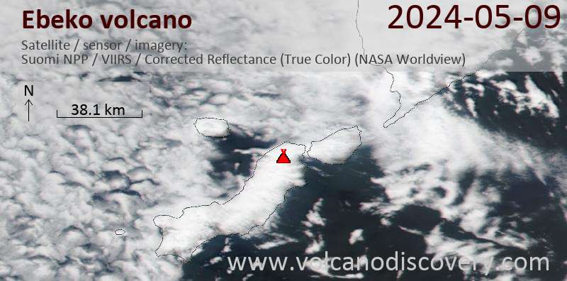
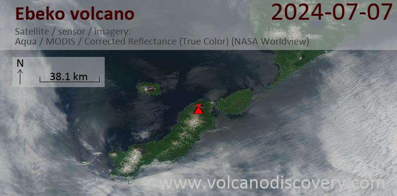
Latest satellite images

Ebeko satellite image sat1Ebeko satellite image sat2

Ebeko Volcano Maps

Below is a selection of maps showing the location and surroundings of the volcano at various resolutions based on aerial-imagery / terrain maps. Feel free to use them for non-commercial purposes on your blog or website as long as you credit them with a link back to this page (click to copy it).
Satellite/aerial-type map of Ebeko volcano (world scale)
Terrain-type map of Ebeko volcano (world scale)
Satellite/aerial-type map of Ebeko volcano (region scale large)
Terrain-type map of Ebeko volcano (region scale large)
Satellite/aerial-type map of Ebeko volcano (region scale medium)
Terrain-type map of Ebeko volcano (region scale medium)
Satellite/aerial-type map of Ebeko volcano (region scale small)
Terrain-type map of Ebeko volcano (region scale small)
Satellite/aerial-type map of Ebeko volcano (local scale large)
Terrain-type map of Ebeko volcano (local scale large)
Satellite/aerial-type map of Ebeko volcano (local scale medium)
Terrain-type map of Ebeko volcano (local scale medium)
Satellite/aerial-type map of Ebeko volcano (local scale small)
Terrain-type map of Ebeko volcano (local scale small)
Satellite/aerial-type map of Ebeko volcano (scale of 10s of km)
Terrain-type map of Ebeko volcano (scale of 10s of km)
Satellite/aerial-type map of Ebeko volcano (scale of 20-40 km)
Terrain-type map of Ebeko volcano (scale of 20-40 km)
Satellite/aerial-type map of Ebeko volcano (scale of approx. 10-20 km)
Terrain-type map of Ebeko volcano (scale of approx. 10-20 km)
Satellite/aerial-type map of Ebeko volcano (scale of 5-10 km)
Satellite/aerial-type map of Ebeko volcano (scale of few kilometers)
Volcanoes & Earthquakes - new app for Android
Guaranteed tours
6-19 Apr 2025: Desert, salt and volcanoes - Danakil desert (Ethiopia)
12-19 Apr 2025: Europe's Volcanic Outpost - Canary Islands
9-25 Jun 2025: Volcanoes and Spices - Sulawesi/Halmahera (Indonesia)
27 Jun - 6 Jul 2025: Iceland Volcano Special - Iceland
7-23 Jul 2025: Volcanoes and Spices - Sulawesi/Halmahera (Indonesia)
1-17 Aug 2025: Volcanoes and Spices - Sulawesi/Halmahera (Indonesia)
13-26 Sep 2025: Green Volcanoes - Azores (Portugal)
1-14 Oct 2025: Desert, salt and volcanoes - Danakil desert (Ethiopia)
4-12 Oct 2025: From Stromboli to Etna - Sicily and Eolian Islands (Italy)
= spaces available   = guaranteed   = few spaces left   = booked out
Wed, 22 Jan 2025, 15:00

Ebeko volcano (Russia) - Smithsonian / USGS Weekly Volcanic Activity Report for 15 January-21 January 2025 (Continuing Activity)

The Kamchatkan Volcanic Eruption Response Team (KVERT) reported that moderate activity was ongoing at Ebeko during 9-16 January. An explosion on 13 January generated an ash plume that rose as high as 2.5 km (8,200 ft) a.s.l. and drifted SE, according to volcanologists in Severo-Kurilsk (Paramushir Island, about 7 km E). ... Read all

On this page:

Why is there advertising on this site?
Sources: VolcanoDiscovery / VolcanoAdventures and other sources as noted.
Use of material: Most text and images on our websites are owned by us. Re-use is generally not permitted without authorization. Contact us for licensing rights.
Volcanoes & Earthquakes
VolcanoDiscovery Home
Volcanoes | Earthquakes | Photos | Volcano News | App
Adventure & Study Travel
Tours to Volcanoes and Volcanic Areas: walking tours, photo tours, study tours
Tours & Dates | FAQ | About us
Get our newsletter!
Company info
Contact | Legal info | Terms & conditions
Follow us
Follow us on facebook Follow us on Instagram Follow us on Bluesky Follow us on Twitter Visit our Youtube channel
EN | DE | EL | ES | FR | IT | RU
VolcanoDiscovery GmbH, Germany, Reg. nr.: HRB 103744, EU Tax Id: DE 297 465 123 owned and created by
Dr. Tom Pfeiffer, volcanologist, volcano photographer, tour organizer member of
IAVCEI
IAVCEI
Vulkanologische Gesellschaft
Volcanological Society
Ecotourism Greece
Ecotourism Greece
RUV insurance
Insured by R+V
VolcanoDiscovery © 2004- All Rights Reserved | Privacy - Cookie Settings