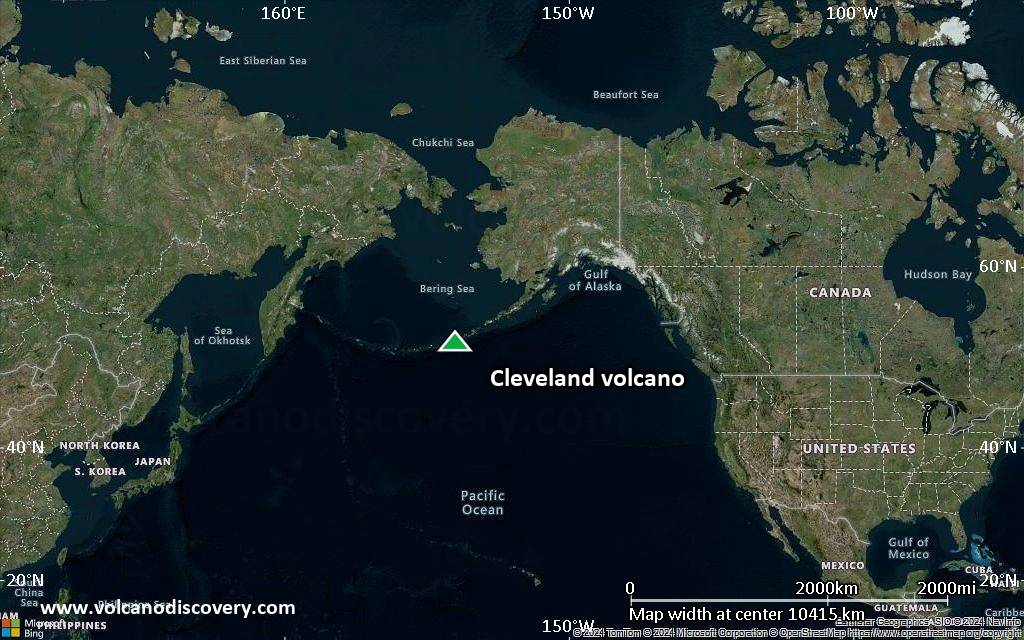
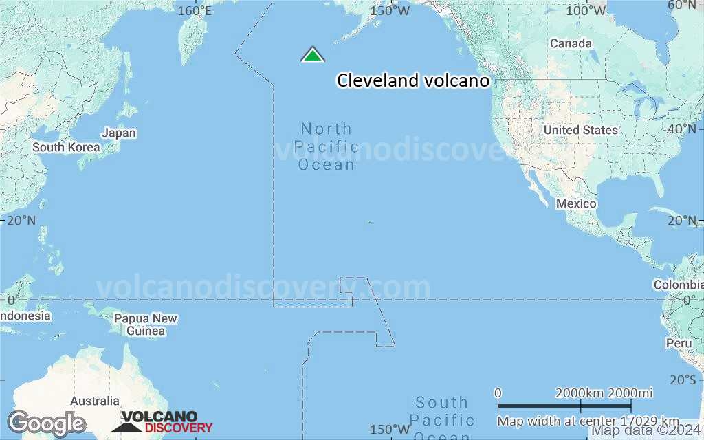
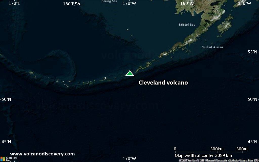
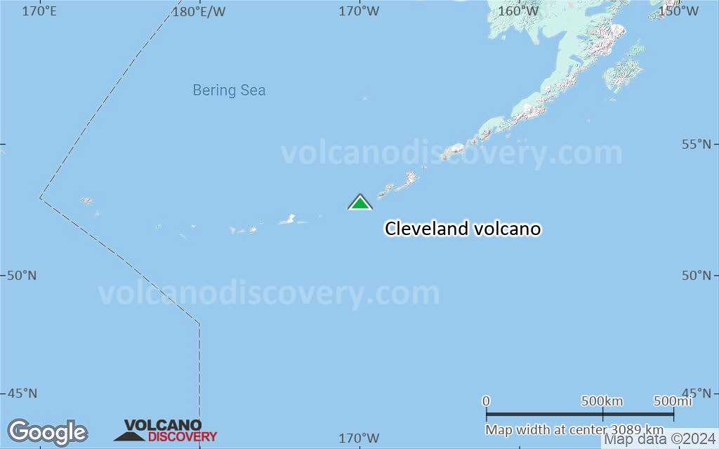
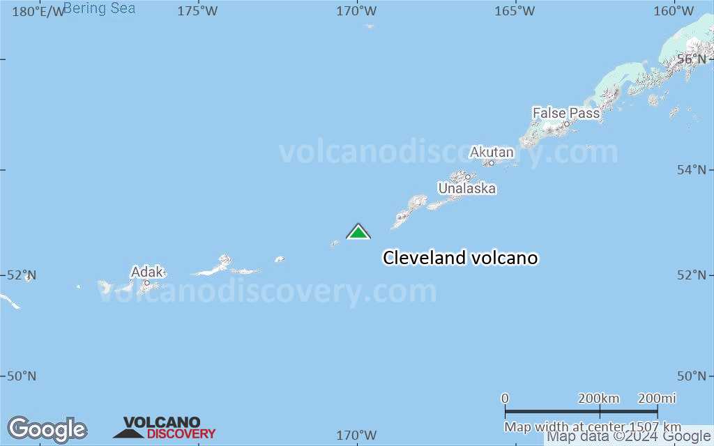
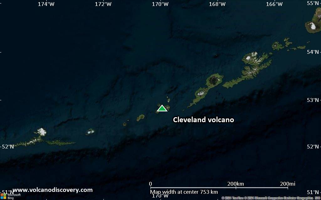
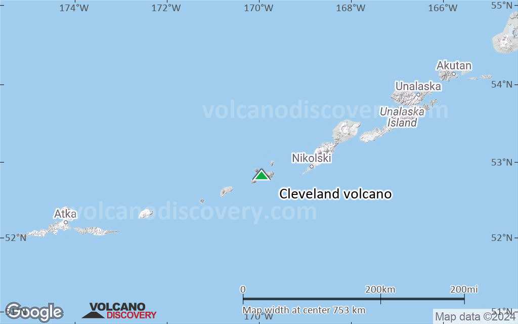
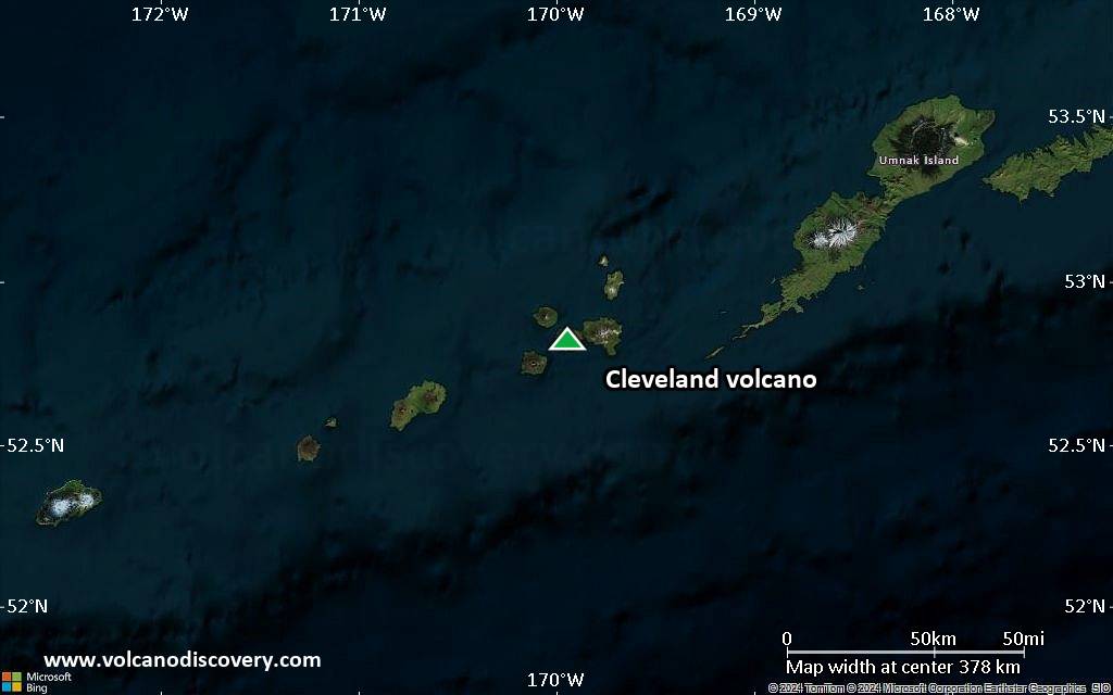
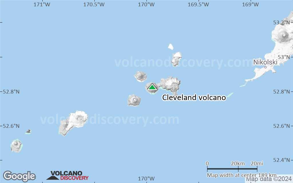
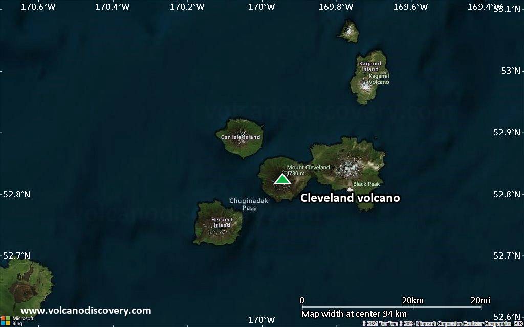
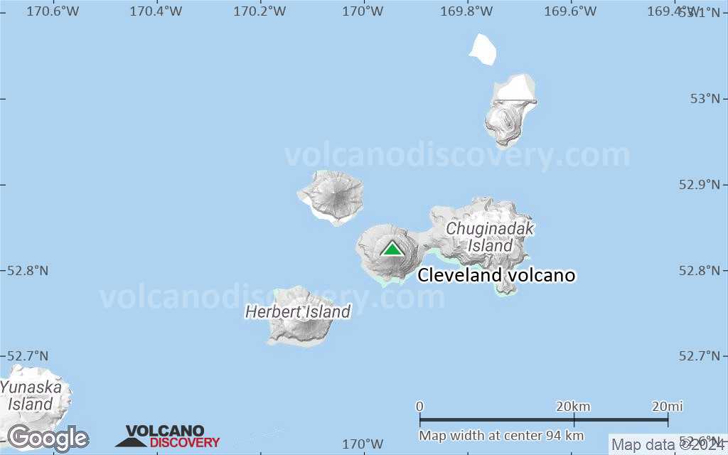
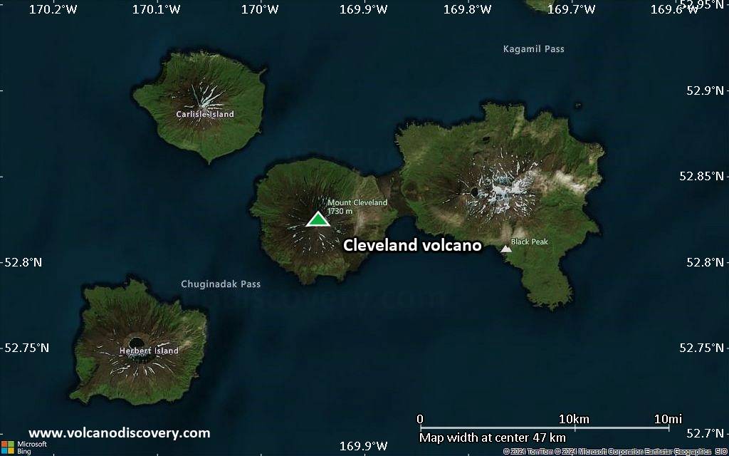
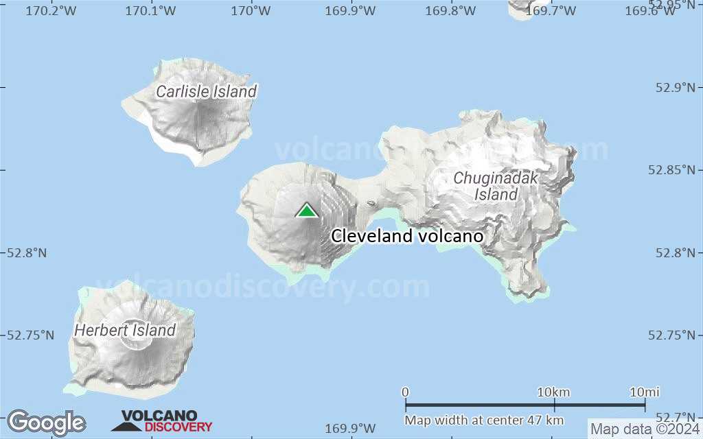
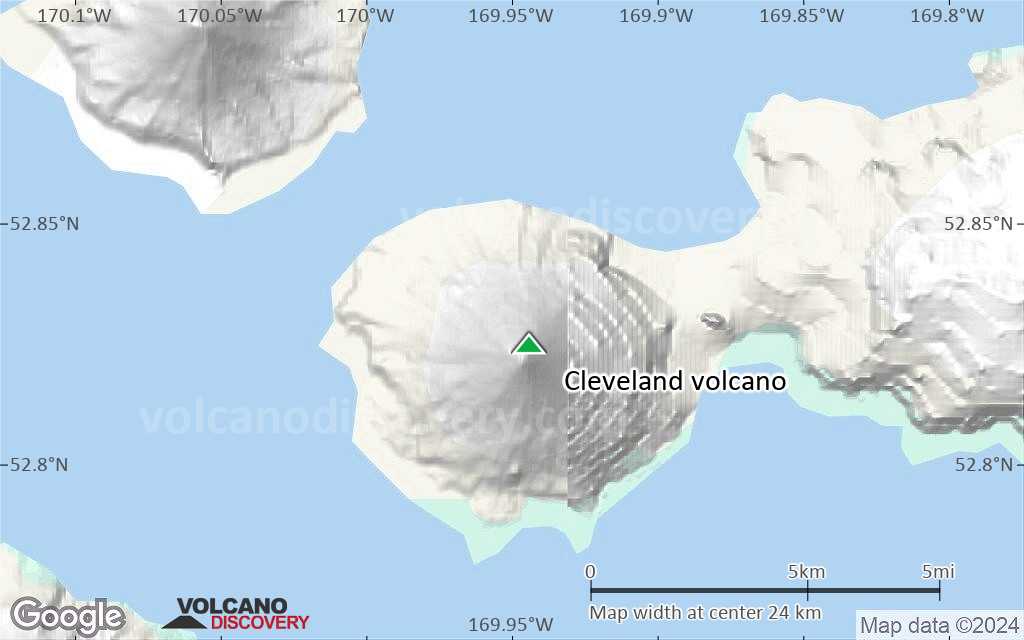
| RSS | EN | DE | EL | ES | FR | IT | RU

Cleveland Volcano

Updated: Mar 26, 2025 22:13 GMT -
Stratovolcano
Aleutian Islands, Alaska, 52.83°N / -169.94°W
Summit height: 1730 m (5,676 ft)
Current status: normal or dormant (1 out of 5)
Last update: 10 Jul 2024 (Smithsonian / USGS Weekly Volcanic Activity Report)

The beautifully symmetrical Mount Cleveland stratovolcano forms the western half of the uninhabited Chuginadak Island in the central Aleutians, connected to the eastern half of the island by a narrow isthmus. It is one of the regions most active volcanoes, but at present has no seismic network. Monitoring of its activity is largely based on satellite observation.

[smaller] [larger]
Typical eruption style: Explosive
Cleveland volcano eruptions: 1893, 1897, 1929(?), 1932, 1938, 1944, 1951(?), 1953(?), 1975(?), 1984, 1985(?), 1986, 1987, 1989(?), 1994, 2001, 2006, 2008, 2010, 2011, 2012, 2013, 2014, 2015, 2016, 2017

Latest nearby earthquakes

Date and TimeMag / DepthDistance / Location
Mar 25, 01:28 am (GMT -9)
0.6

1.7 km
1.6 km (1 mi) to the SE 73 km WSW of Nikolski, Alaska Info

Background

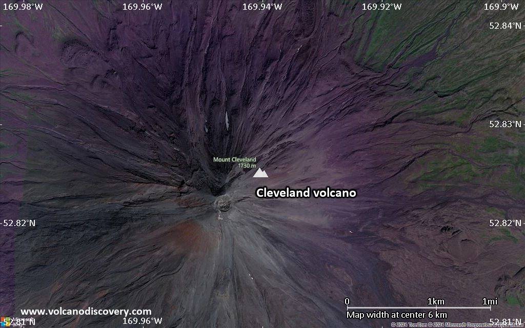
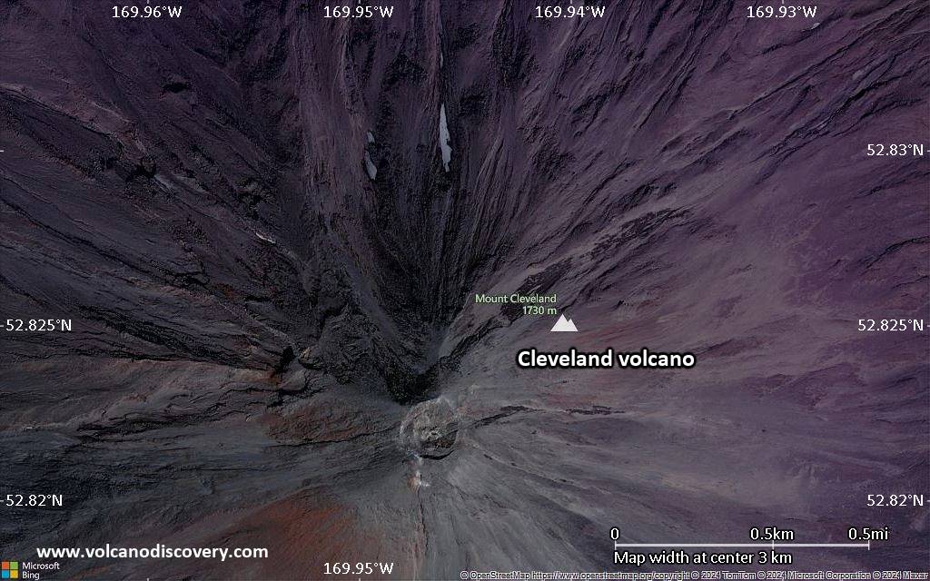
The 1730-m-high Mount Cleveland has the native name of Chuginadak, referring to the Aleut goddess of fire, who was thought to reside on the volcano. Numerous large lava flows descend the steep-sided flanks of the volcano.

It is possible that some 18th to 19th century eruptions attributed to Carlisle should be ascribed to Cleveland (Miller et al., 1998). In 1944 Cleveland produced the only known fatality from an Aleutian eruption. Recent eruptions from Mount Cleveland have been characterized by short-lived explosive ash emissions, at times accompanied by lava fountaining and lava flows down the flanks. In February, 2001, Cleveland had 3 explosive events that produced ash clouds as high as 12 km (39,000 ft) above sea level. That eruption also produced a rubbly lava flow and hot avalanche that reached the sea.
---
Sources: AVO/USGS, Smithsonian Institution

Significant volcanic eruptions: Cleveland volcano

In the past 10,000 years, Cleveland has had at least 22 confirmed eruptions, all documented by historical records or observations. Additionally, there are 8 uncertain or discredited eruptions from Cleveland volcano.
The table below lists all known eruptions (date in bold face) of Cleveland volcano since around 1900. Updates on the most recent volcanic activity of Cleveland can be found on the news page of Cleveland volcano.
DateNoteVEIDeathsDamage
2020 Jun 1
Historical obs./docs.
3
?? 2019 Nov 7 - Dec 7 ?
Uncertain Eruption
Historical obs./docs.
?
2016 Apr 16 - 2019 Jan 20 ±4 d.Summit crater
Historical obs./docs.
2
2011 Jul 19 ±7 d. - 2015 Aug 18Summit crater
Historical obs./docs.
2
?? 2010 Sep 11 - Sep 12
Uncertain Eruption
Historical obs./docs.
2?
2010 May 30 - Jun 2 ?Summit crater
Historical obs./docs.
2
2009 Oct 2 - Dec 12 ?
Historical obs./docs.
2
2009 Jun 25
Historical obs./docs.
2
2009 Jan 2 - Jan 21
Historical obs./docs.
2
2007 Jun 17 ? - 2008 Aug 12 ?
Historical obs./docs.
2?
2006 Feb 6 - Oct 28
Historical obs./docs.
3
2005 Mar 13 ? - Nov 27 ±1 d.
Historical obs./docs.
2
2001 Feb 2 or before - Apr 15 ?
Historical obs./docs.
3?
1997 May 5
Historical obs./docs.
2?
1994 Oct 20
Historical obs./docs.
1?
1994 May 25
Historical obs./docs.
3
?? 1989 Oct 25 ±3 d.
Uncertain Eruption
?
1987 Jun 19 - Aug 28
Historical obs./docs.
3
1986 Apr 28 - May 27 or later
Historical obs./docs.
2
?? 1985 Dec 10
Uncertain Eruption
1
1984 Jul 12
Historical obs./docs.
1
?? 1975 Sep 16 ±15 d.
Uncertain Eruption
?
?? 1953 Jun 25
Uncertain Eruption
?
?? 1951 Nov 1 - Dec 16 ±15 d.
Uncertain Eruption
?
1944 Jun 10 - Jun 12
Historical obs./docs.
3
1944 Jun 10
(eruption 1944 Jun 10 - Jun 12)
Historical obs./docs.
31
Info
1938
Historical obs./docs.
?
1932 Jan 1
Historical obs./docs.
?
?? 1929 Mar
Uncertain Eruption
?
Remark:
Our list of volcanic eruptions closely follows the database of eruptions of the Smithsonian's Global Volcanism Project (GVP), the internationally most recognized data source for volcanic eruptions, but also includes significant eruptive episodes or related volcano events. "Volcanic eruptions" are usually to be understood as sequences of individual eruptive episodes that can follow each other, or even overlap (if several vents are involved), and can last many years, decades or even longer. For example, the current activity of Stromboli volcano is understood as a single eruption that has been ongoing since 1934.
Sources: NOAA National Centers for Environmental Information (NCEI), Global Significant Volcanic Eruptions Database. doi:10.7289/V5TD9V7K | Global Volcanism Project / Smithsonian Institution

Cleveland Volcano FAQ

+When was the last eruption of Cleveland volcano?

+How often does Cleveland volcano erupt?

+How active is Cleveland volcano at present?

+When was the largest eruption of Cleveland volcano?

Latest satellite images

Cleveland satellite image sat1Cleveland satellite image sat2

Cleveland Volcano Maps

Below is a selection of maps showing the location and surroundings of the volcano at various resolutions based on aerial-imagery / terrain maps. Feel free to use them for non-commercial purposes on your blog or website as long as you credit them with a link back to this page (click to copy it).
Satellite/aerial-type map of Cleveland volcano (world scale)
Terrain-type map of Cleveland volcano (world scale)
Satellite/aerial-type map of Cleveland volcano (region scale large)
Terrain-type map of Cleveland volcano (region scale large)
Satellite/aerial-type map of Cleveland volcano (region scale medium)
Terrain-type map of Cleveland volcano (region scale medium)
Satellite/aerial-type map of Cleveland volcano (region scale small)
Terrain-type map of Cleveland volcano (region scale small)
Satellite/aerial-type map of Cleveland volcano (local scale large)
Terrain-type map of Cleveland volcano (local scale large)
Satellite/aerial-type map of Cleveland volcano (local scale medium)
Terrain-type map of Cleveland volcano (local scale medium)
Satellite/aerial-type map of Cleveland volcano (local scale small)
Terrain-type map of Cleveland volcano (local scale small)
Satellite/aerial-type map of Cleveland volcano (scale of 10s of km)
Terrain-type map of Cleveland volcano (scale of 10s of km)
Satellite/aerial-type map of Cleveland volcano (scale of 20-40 km)
Terrain-type map of Cleveland volcano (scale of 20-40 km)
Satellite/aerial-type map of Cleveland volcano (scale of approx. 10-20 km)
Terrain-type map of Cleveland volcano (scale of approx. 10-20 km)
Satellite/aerial-type map of Cleveland volcano (scale of 5-10 km)
Satellite/aerial-type map of Cleveland volcano (scale of few kilometers)
Volcanoes & Earthquakes - new app for Android
Guaranteed tours
6-19 Apr 2025: Desert, salt and volcanoes - Danakil desert (Ethiopia)
12-19 Apr 2025: Europe's Volcanic Outpost - Canary Islands
9-25 Jun 2025: Volcanoes and Spices - Sulawesi/Halmahera (Indonesia)
27 Jun - 6 Jul 2025: Iceland Volcano Special - Iceland
7-23 Jul 2025: Volcanoes and Spices - Sulawesi/Halmahera (Indonesia)
1-17 Aug 2025: Volcanoes and Spices - Sulawesi/Halmahera (Indonesia)
13-26 Sep 2025: Green Volcanoes - Azores (Portugal)
1-14 Oct 2025: Desert, salt and volcanoes - Danakil desert (Ethiopia)
4-12 Oct 2025: From Stromboli to Etna - Sicily and Eolian Islands (Italy)
= spaces available   = guaranteed   = few spaces left   = booked out
Location map of Cleveland volcano, Alaska (image: Janet Schaefer, Alaska Volcano Observatory / Alaska Division of Geological & Geophysical Surveys)
Wed, 10 Jul 2024, 14:00

Cleveland volcano - Smithsonian / USGS Weekly Volcanic Activity Report for 3 July-9 July 2024 (New Activity / Unrest)

AVO reported that sulfur dioxide emissions were detected by local gas monitoring sensors at Cleveland starting on 21 June. The emission rate increased during 24-30 June and then declined to background levels on 1 July. Although sulfur dioxide emissions had declined, vigorous steaming and moderately elevated surface temperatures at the summit were detected in satellite images the following days. ... Read all
Tue, 9 Jul 2024, 14:09

Cleveland volcano (Alaska): alert status lowered back to GREEN

The Alaska Volcano Observatory (AVO) lowered the Aviation Color Code to GREEN and Volcano Alert Level to NORMAL. Sulfur dioxide gas emissions continue to be detected on local gas monitoring sensors, however, gas emission rates are now typical to average values since local monitoring began 2 years ago. Steaming from the summit, slightly elevated surface temperatures in the summit crater, and occasional local earthquakes are still seen at Mount Cleveland, but this activity represents background behavior at this highly active Aleutian volcano. Read all

On this page:

Why is there advertising on this site?
Sources: VolcanoDiscovery / VolcanoAdventures and other sources as noted.
Use of material: Most text and images on our websites are owned by us. Re-use is generally not permitted without authorization. Contact us for licensing rights.
Volcanoes & Earthquakes
VolcanoDiscovery Home
Volcanoes | Earthquakes | Photos | Volcano News | App
Adventure & Study Travel
Tours to Volcanoes and Volcanic Areas: walking tours, photo tours, study tours
Tours & Dates | FAQ | About us
Get our newsletter!
Company info
Contact | Legal info | Terms & conditions
Follow us
Follow us on facebook Follow us on Instagram Follow us on Bluesky Follow us on Twitter Visit our Youtube channel
EN | DE | EL | ES | FR | IT | RU
VolcanoDiscovery GmbH, Germany, Reg. nr.: HRB 103744, EU Tax Id: DE 297 465 123 owned and created by
Dr. Tom Pfeiffer, volcanologist, volcano photographer, tour organizer member of
IAVCEI
IAVCEI
Vulkanologische Gesellschaft
Volcanological Society
Ecotourism Greece
Ecotourism Greece
RUV insurance
Insured by R+V
VolcanoDiscovery © 2004- All Rights Reserved | Privacy - Cookie Settings
Cookie-free, privacy-friendly web stats