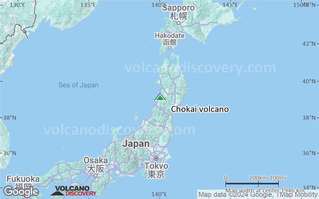
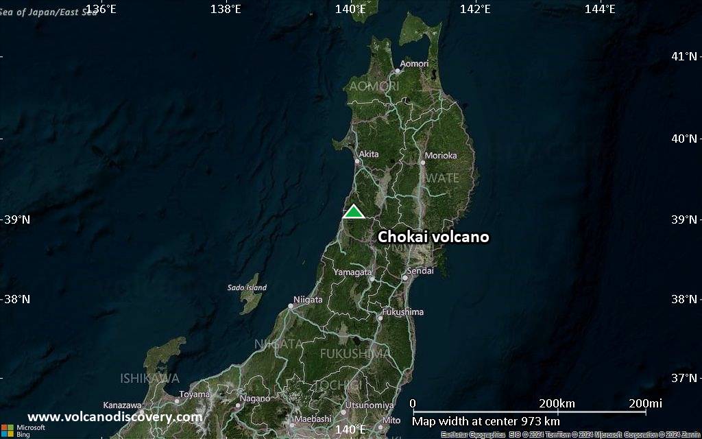
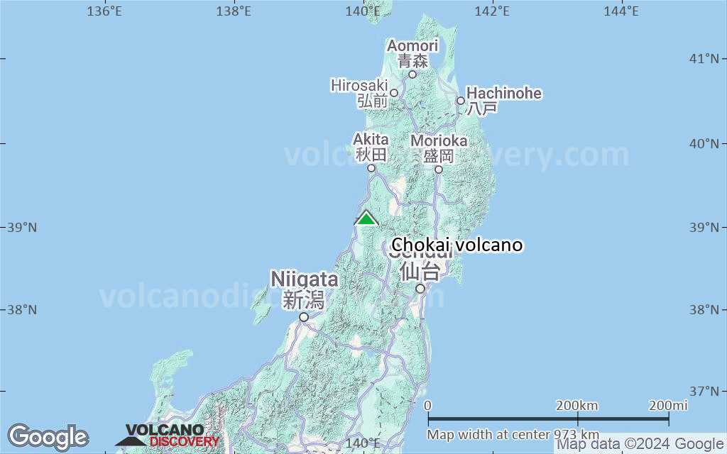
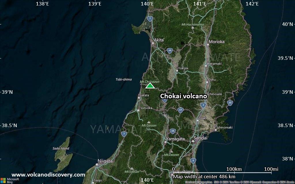
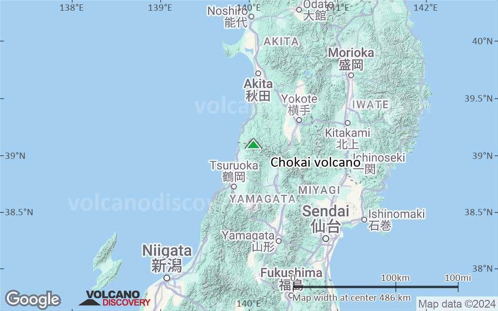
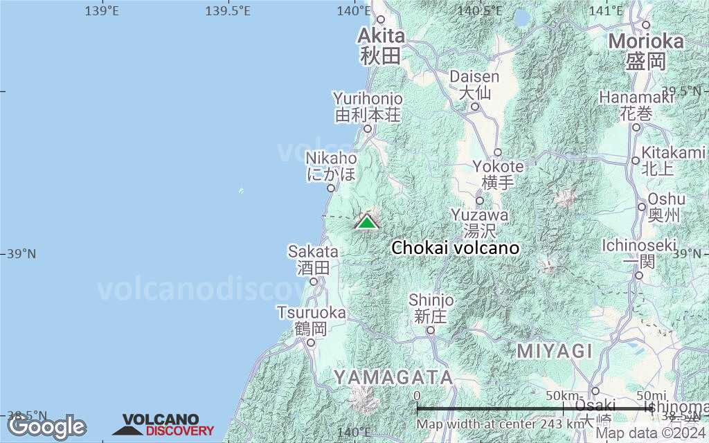
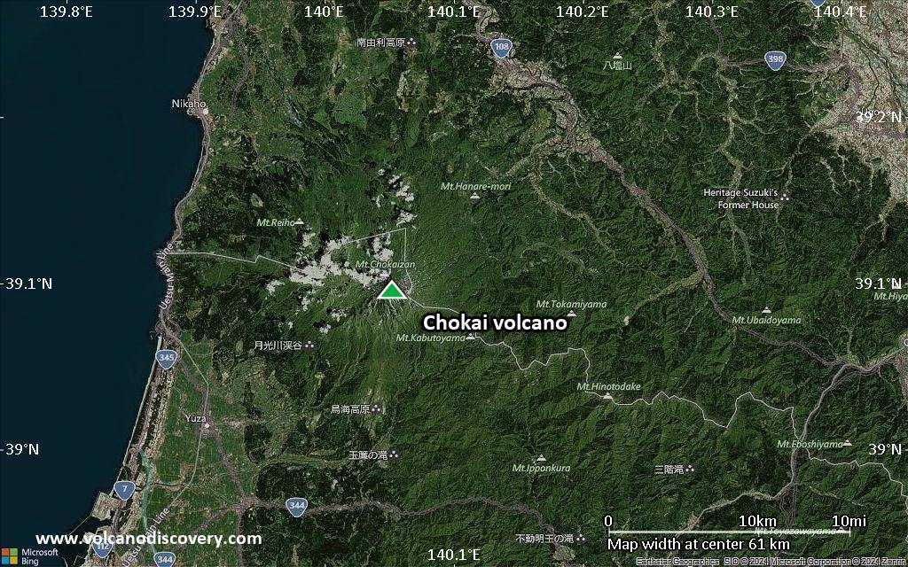
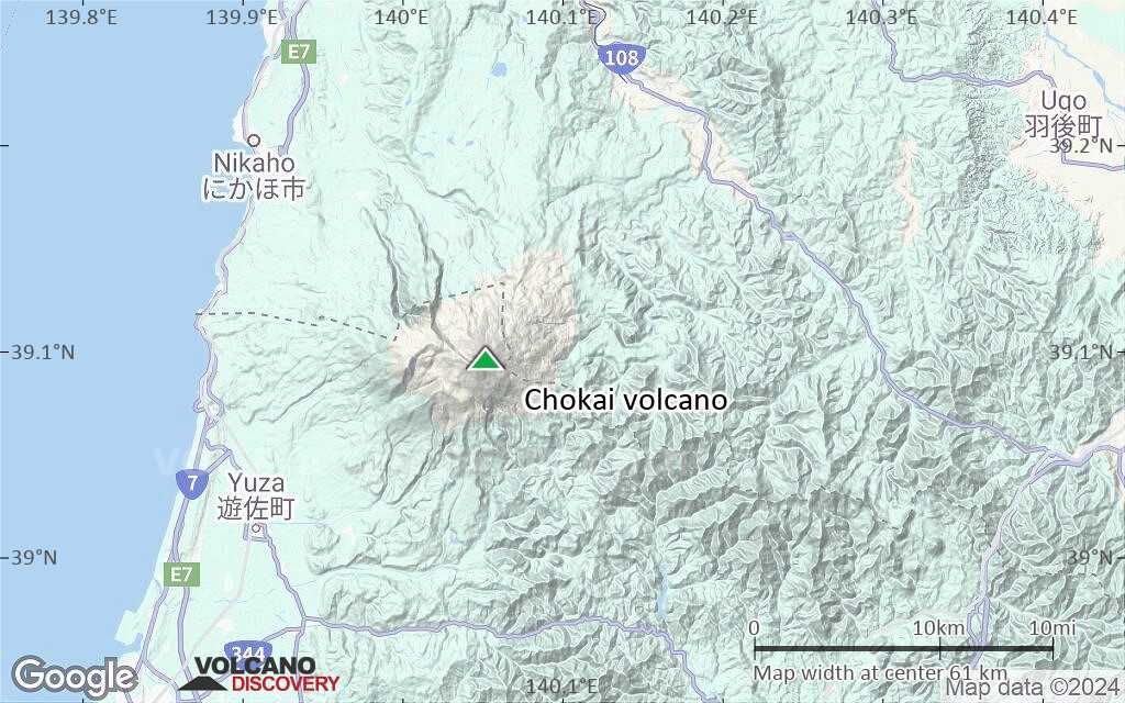
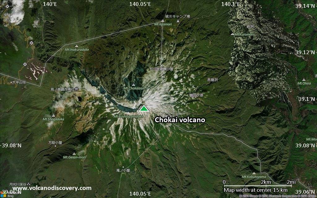
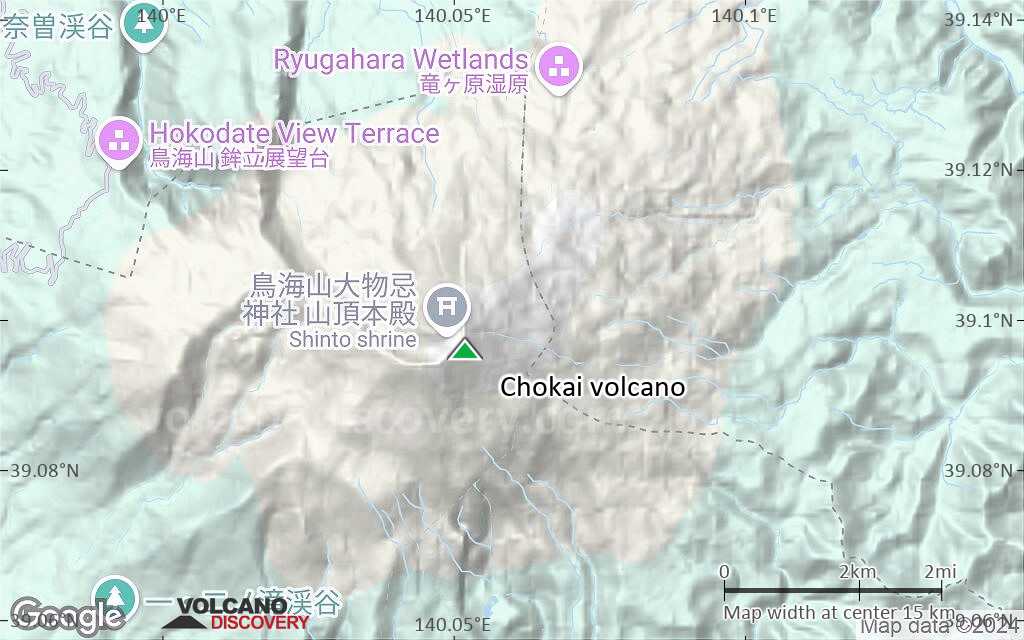
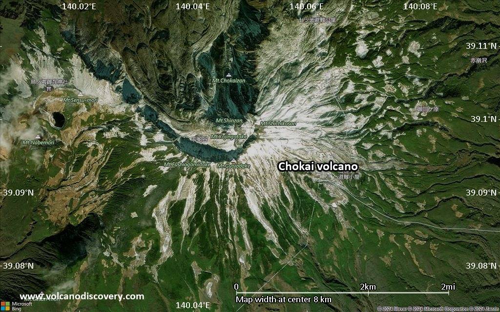
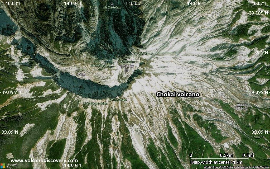
| RSS | EN | DE | EL | ES | FR | IT | RU

Chokai Volcano

Updated: Apr 29, 2025 08:13 GMT -
stratovolcanoes
Honshu, Japan, 39.1°N / 140.05°E
Summit height: 2233 m / 7,326 ft
Current status: normal or dormant (1 out of 5)
Chokai volcano
Chokai volcano

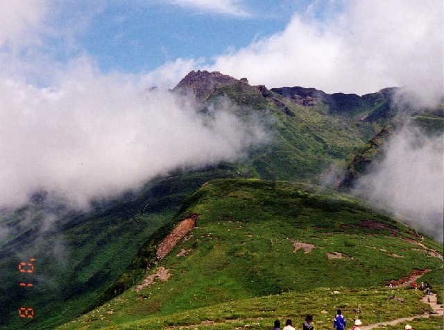
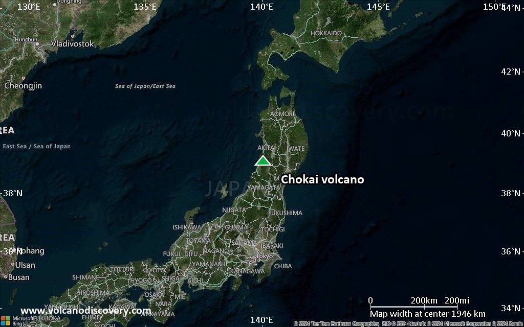
Chokai or Chokaisan volcano (鳥海山 Chōkai-san) is the largest volcano of NE Honshu.
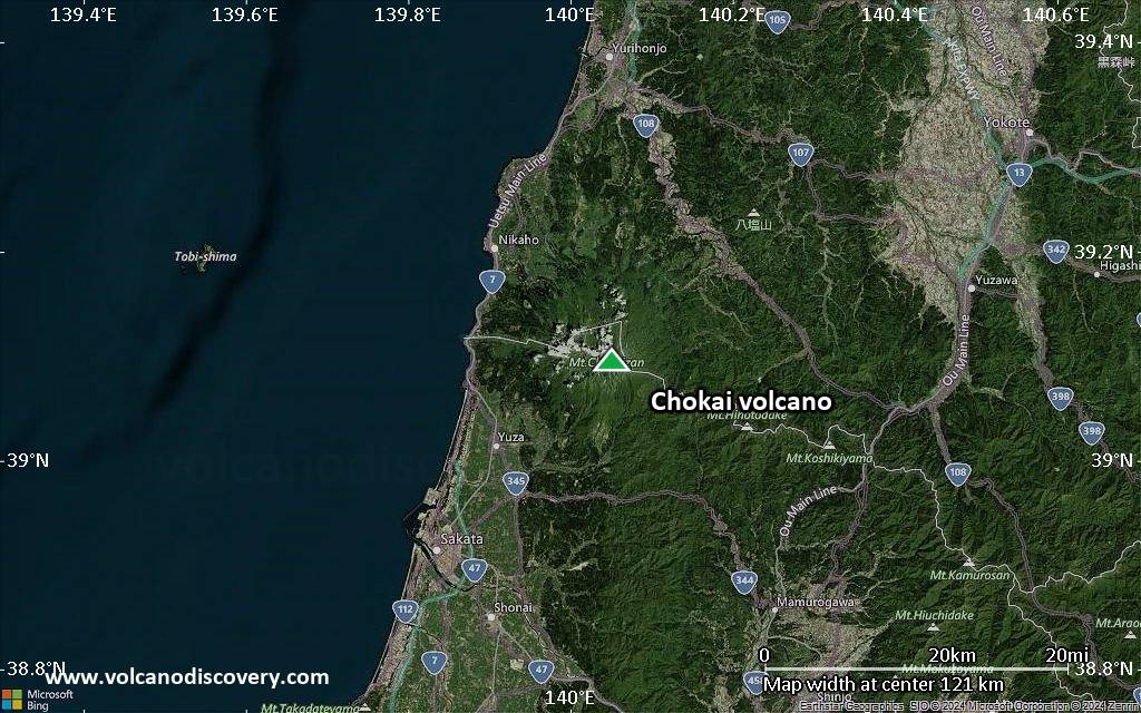
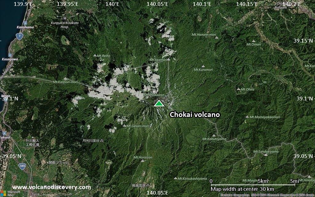
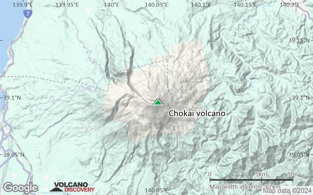
It is a massive stratovolcano with a broad conical profile which is why it is called locally Akita-Fuji or Dewa-Fuji. Its height measures from the WNW elongated 15x20 km base about 2000 m.
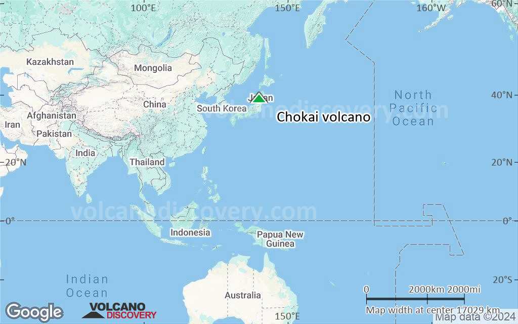
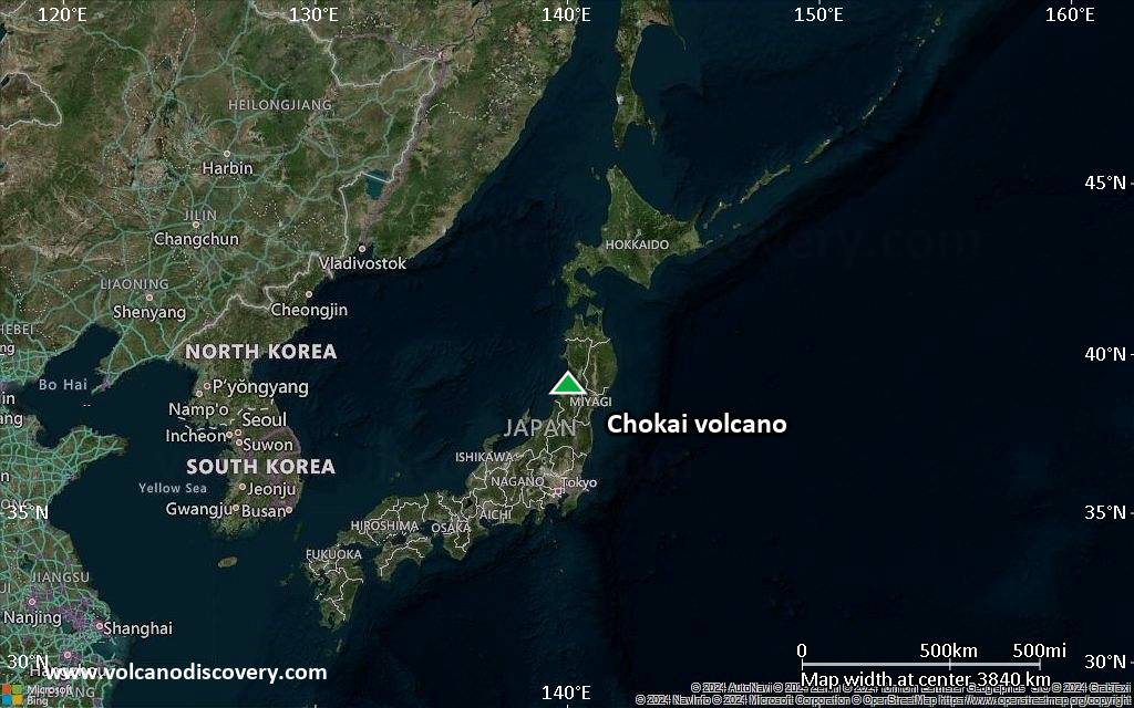
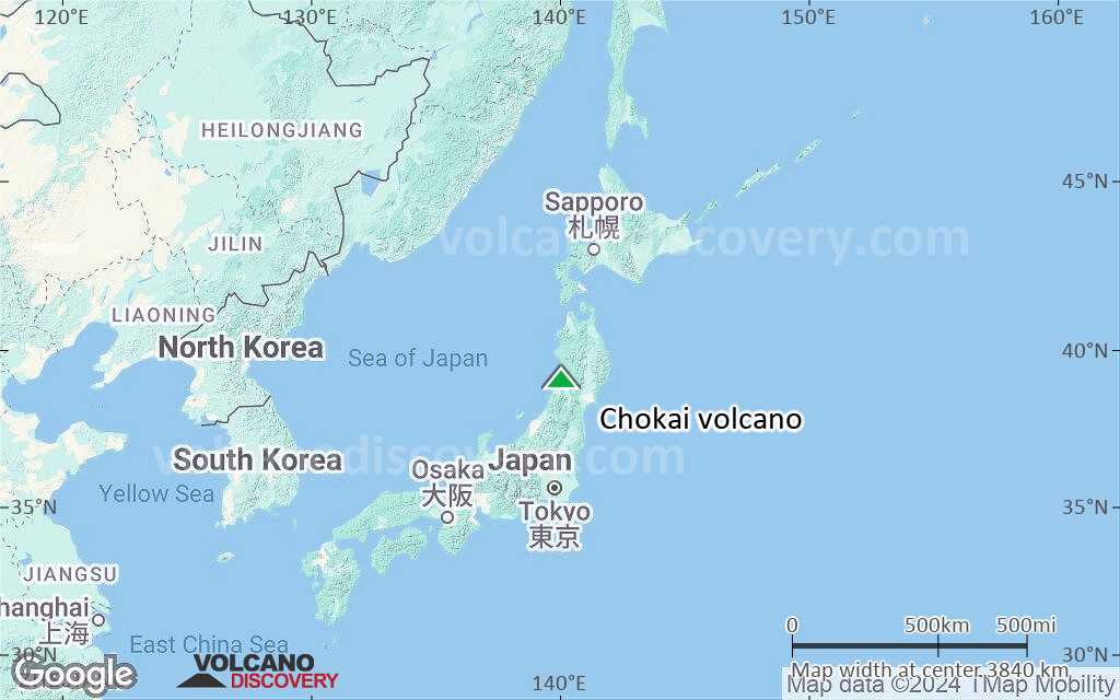
The volcano is located about 60 km west behind the main volcanic front of the Honshu arc and towers above the Japan Sea.
Chokai consists of 2 overlapping volcanoes, the western and older volcano Nishi-Chokai and the younger eastern volcano Higashi-Chokai, forming the 2 distinct peaks. Historic records of eruptions, mostly phreatic explosions, go back to the 6th century AD.

[smaller] [larger]
Typical eruption style: phreatic explosions
Chokai volcano eruptions: March-April 1974: phreatic ash explosions and mud flows
1834: phreatic explosions and mud flows
1821: phreatic explosions
1800-04, 1764 (?), 1740-47, 1738±1 (?), 1735 (?), 1659-63, 1560 (?), 1477 (?), 999 AD (?), 948±1, 939, (915: no eruption, was from Towada volcano), 884 (?), 871, 861 (?), 857 (?), 856 (?), 839 (?), 830, 817 AD ± 7 years, 804-06, 717 (?), 711± 3 years, 610± 18 years (?), 577-78 (?), 573 (?), 450 BC, 650 BC, 1050 BC (?)

Latest nearby earthquakes

Date and TimeMag / DepthDistance / Location
Apr 28, 02:47 am (GMT +9)
3.1

17 km
18 km (10.9 mi) to the S Japan: Northern Yamagata Pref  I FELT IT Info
Apr 28, 02:47 am (GMT +9)
3.0

17 km
18 km (11 mi) to the S Tottori, 14 km east of Sakata, Yamagata, JapanI FELT IT Info

Background

The older Nishi-Chokai volcano suffered flank collapse leaving a large horseshoe-shaped caldera open to the south. Lava domes grew on the caldera floor. A younger stratovolcano grew successively to the east, building Higashi-Chokai from about 20,000 years ago. This volcano, too, partly collapsed about 2600 years ago and left a caldera breached to the north. The collapse produced the voluminous Kisakata debris avalanche, which reached the Pacific coast.

Significant volcanic eruptions: Chokai volcano

In the past 10,000 years, Chokai has had at least 14 confirmed volcanic eruptions, out of which 11 are documented by historical records, while the others can be inferred from geological evidence.
Additionally, there are 18 uncertain or discredited eruptions from Chokai volcano.
The table below lists all known eruptions (date in bold face) of Chokai volcano in historic times and during the past 10,000 years. Updates on the most recent volcanic activity of Chokai can be found on the news page of Chokai volcano.
DateNoteVEIDeathsDamage
1974 Mar 1 - Apr 30E side of Shinzan, W of Kojin-yama
Historical obs./docs.
1
1834 Jul 9 - Jul
Historical obs./docs.
2?
1821 May 23Near Shinzan and Shichiko-zan
Historical obs./docs.
2?
1800 Dec - 1804 JulShinzan (foot of Kojin-yama)
Historical obs./docs.
2
1801 Aug 14
(eruption 1800 Dec - 1804 Jul)
Historical obs./docs.
28
Info
?? 1764
Uncertain Eruption
2
1740 Jun - 1747 ?Small crater at foot of Kojin-yama
Historical obs./docs.
2?
?? 1738 Dec 31 ±365 d.
Uncertain Eruption
2
?? 1735
Uncertain Eruption
2
1659 AD Apr - 1663 ±1 y.
Historical obs./docs.
?
?? 1560 AD
Uncertain Eruption
?
?? 1477 AD
Uncertain Eruption
?
?? 999 AD
Uncertain Eruption
?
?? 948 AD Dec 31 ±365 d.
Uncertain Eruption
?
939 AD May 15
Historical obs./docs.
?
915 AD Aug 23 - Sep 1
Discredited Eruption
?? 884 AD Jul 26 - Aug
Uncertain Eruption
?
871 AD May 5
Historical obs./docs.
2
?? 861 AD May
Uncertain Eruption
3
?? 857 AD May
Uncertain Eruption
?
?? 856 AD
Uncertain Eruption
?
?? 839 AD Oct 14
Uncertain Eruption
?
830 AD Jan
Historical obs./docs.
?
817 ±7 y. AD
Historical obs./docs.
?
?? 804 AD - 806
Uncertain Eruption
?
?? 717 AD Jul
Uncertain Eruption
?
711 ±3 y. AD
Historical obs./docs.
?
?? 610 ±18 y. AD
Uncertain Eruption
?
?? 577 AD Dec 1 ±30 d. - 578 Jul 15 ±45 d.
Uncertain Eruption
?
?? 573 AD Mar
Uncertain Eruption
?
Remark:
Our list of volcanic eruptions closely follows the database of eruptions of the Smithsonian's Global Volcanism Project (GVP), the internationally most recognized data source for volcanic eruptions, but also includes significant eruptive episodes or related volcano events. "Volcanic eruptions" are usually to be understood as sequences of individual eruptive episodes that can follow each other, or even overlap (if several vents are involved), and can last many years, decades or even longer. For example, the current activity of Stromboli volcano is understood as a single eruption that has been ongoing since 1934.
Sources: NOAA National Centers for Environmental Information (NCEI), Global Significant Volcanic Eruptions Database. doi:10.7289/V5TD9V7K | Global Volcanism Project / Smithsonian Institution

Eruptions of Chokai volcano


1974 eruption
"After a long period of inactivity (since 1821), Tyokai volcano blew up on 1 March" reads the beginning of a bulletin received by the Smithsonian Institution on 1 April 1974.
The eruption took place in 2 phases, at the beginning of March and at the end of April 1974 and consisted in phreatic explosions generating mud flows at the snow-covered summit of Chokai volcano. It followed 153 years of dormancy. No magma reached the surface, but a very shallow intrusion was the cause of the eruptionn. ...more info

1800-1804 eruption and fatalities
An eruption began at Kojin-yama crater and built a lava dome (Shinzan). The eruption caused fatalities when climbers were killed by ballistic blocks ejected during an explosion in 1801.

Chokai Volcano FAQ

+When was the last eruption of Chokai volcano?

+How often does Chokai volcano erupt?

+How active is Chokai volcano at present?

+When was the largest eruption of Chokai volcano?

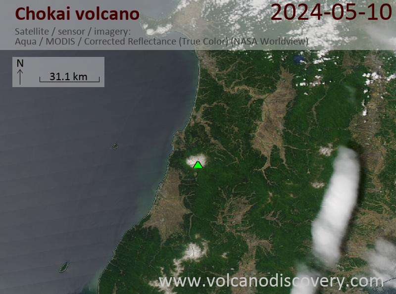
Latest satellite images
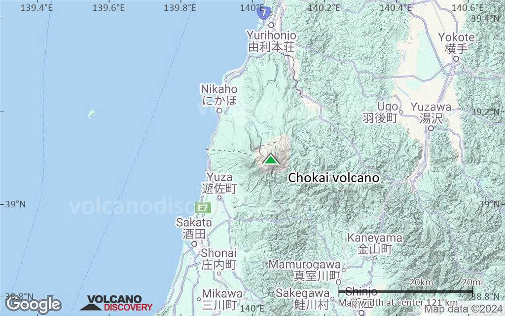
Chokai satellite image sat1Chokai satellite image sat2

Chokai Volcano Maps

Below is a selection of maps showing the location and surroundings of the volcano at various resolutions based on aerial-imagery / terrain maps. Feel free to use them for non-commercial purposes on your blog or website as long as you credit them with a link back to this page (click to copy it).
Satellite/aerial-type map of Chokai volcano (world scale)
Terrain-type map of Chokai volcano (world scale)
Satellite/aerial-type map of Chokai volcano (region scale large)
Terrain-type map of Chokai volcano (region scale large)
Satellite/aerial-type map of Chokai volcano (region scale medium)
Terrain-type map of Chokai volcano (region scale medium)
Satellite/aerial-type map of Chokai volcano (region scale small)
Terrain-type map of Chokai volcano (region scale small)
Satellite/aerial-type map of Chokai volcano (local scale large)
Terrain-type map of Chokai volcano (local scale large)
Satellite/aerial-type map of Chokai volcano (local scale medium)
Terrain-type map of Chokai volcano (local scale medium)
Satellite/aerial-type map of Chokai volcano (local scale small)
Terrain-type map of Chokai volcano (local scale small)
Satellite/aerial-type map of Chokai volcano (scale of 10s of km)
Terrain-type map of Chokai volcano (scale of 10s of km)
Satellite/aerial-type map of Chokai volcano (scale of 20-40 km)
Terrain-type map of Chokai volcano (scale of 20-40 km)
Satellite/aerial-type map of Chokai volcano (scale of approx. 10-20 km)
Terrain-type map of Chokai volcano (scale of approx. 10-20 km)
Satellite/aerial-type map of Chokai volcano (scale of 5-10 km)
Satellite/aerial-type map of Chokai volcano (scale of few kilometers)
Volcanoes & Earthquakes - new app for Android
Guaranteed tours
9-25 Jun 2025: Volcanoes and Spices - Sulawesi/Halmahera (Indonesia)
27 Jun - 6 Jul 2025: Iceland Volcano Special - Iceland
7-22 Jul 2025: From Krakatau to Bali - Java (Indonesia)
7-23 Jul 2025: Volcanoes and Spices - Sulawesi/Halmahera (Indonesia)
1-17 Aug 2025: Volcanoes and Spices - Sulawesi/Halmahera (Indonesia)
1-14 Oct 2025: Desert, salt and volcanoes - Danakil desert (Ethiopia)
4-12 Oct 2025: From Stromboli to Etna - Sicily and Eolian Islands (Italy)
6-21 Oct 2025: From Krakatau to Bali - Java (Indonesia)
3-19 Nov 2025: Volcanoes and Spices - Sulawesi/Halmahera (Indonesia)
= spaces available   = guaranteed   = few spaces left   = booked out

No news in this list.

On this page:

Try our free app!
Volcanoes & Earthquakes - new app for Android
Android | iOS version

More on VolcanoDiscovery

Why is there advertising on this site?

Support us - Help us upgrade our services!

We truly love working to bring you the latest volcano and earthquake data from around the world. Maintaining our website and our free apps does require, however, considerable time and resources.
We need financing to increase hard- and software capacity as well as support our editor team. We're aiming to achieve uninterrupted service wherever an earthquake or volcano eruption unfolds, and your donations can make it happen! Every donation will be highly appreciated. If you find the information useful and would like to support our team in integrating further features, write great content, and in upgrading our soft- and hardware, please make a donation (PayPal).

Planned features:Thanks to your past donations, these features have been added recently:
Download and Upgrade the Volcanoes & Earthquakes app to get one of the fastest seismic and volcano alerts online:
Android | IOS
Thank you!
Sources: VolcanoDiscovery / VolcanoAdventures and other sources as noted.
Use of material: Most text and images on our websites are owned by us. Re-use is generally not permitted without authorization. Contact us for licensing rights.
Volcanoes & Earthquakes
VolcanoDiscovery Home
Volcanoes | Earthquakes | Photos | Volcano News | | Shop | App
Adventure & Study Travel
Tours to Volcanoes and Volcanic Areas: walking tours, photo tours, study tours
Tours & Dates | FAQ | About us
Get our newsletter!
Company info
Contact | Legal info | Terms & conditions
Follow us
Follow us on facebook Follow us on Instagram Follow us on Bluesky Follow us on Twitter Visit our Youtube channel
EN | DE | EL | ES | FR | IT | RU
VolcanoDiscovery GmbH, Germany, Reg. nr.: HRB 103744, EU Tax Id: DE 297 465 123 owned and created by
Dr. Tom Pfeiffer, volcanologist, volcano photographer, tour organizer member of
IAVCEI
IAVCEI
Vulkanologische Gesellschaft
Volcanological Society
Ecotourism Greece
Ecotourism Greece
RUV insurance
Insured by R+V
VolcanoDiscovery © 2004- All Rights Reserved | Privacy - Cookie Settings