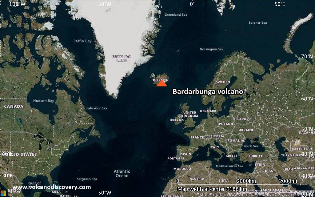
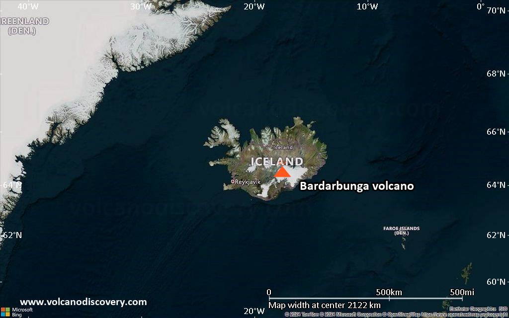
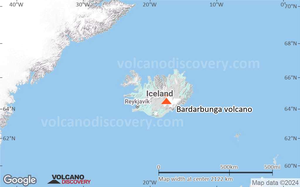
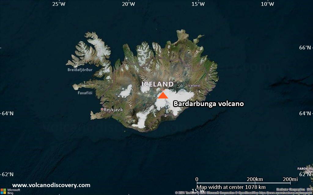
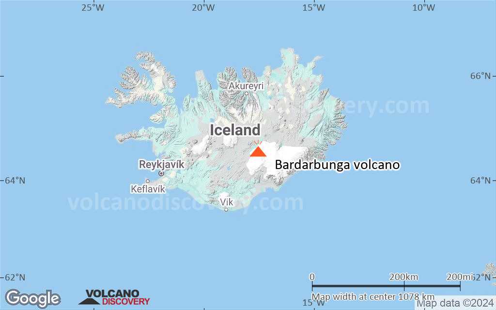
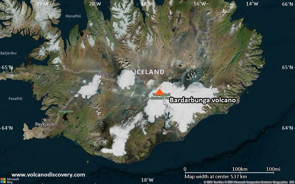
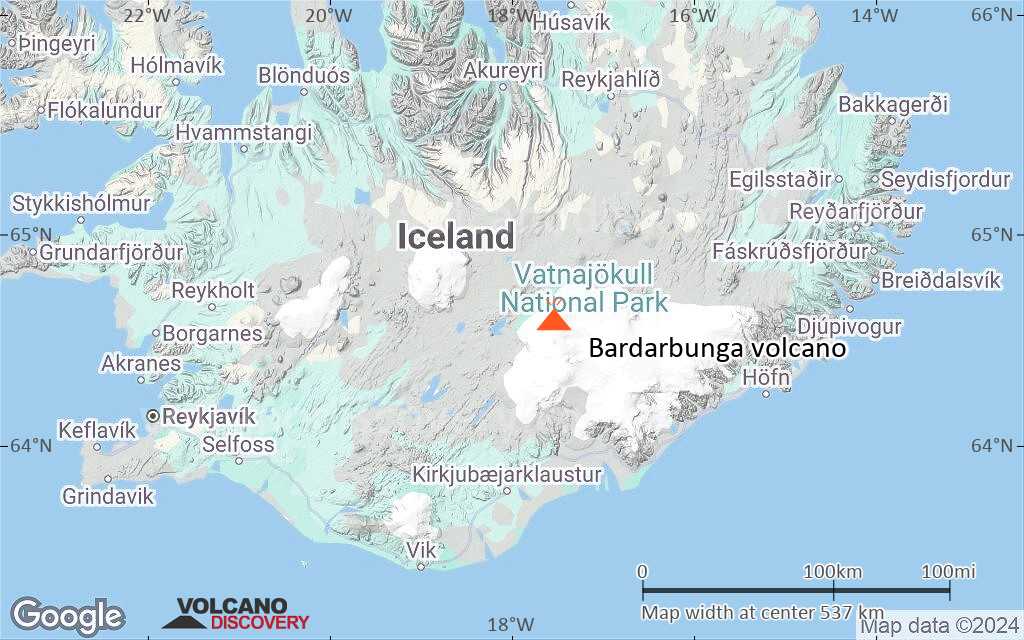
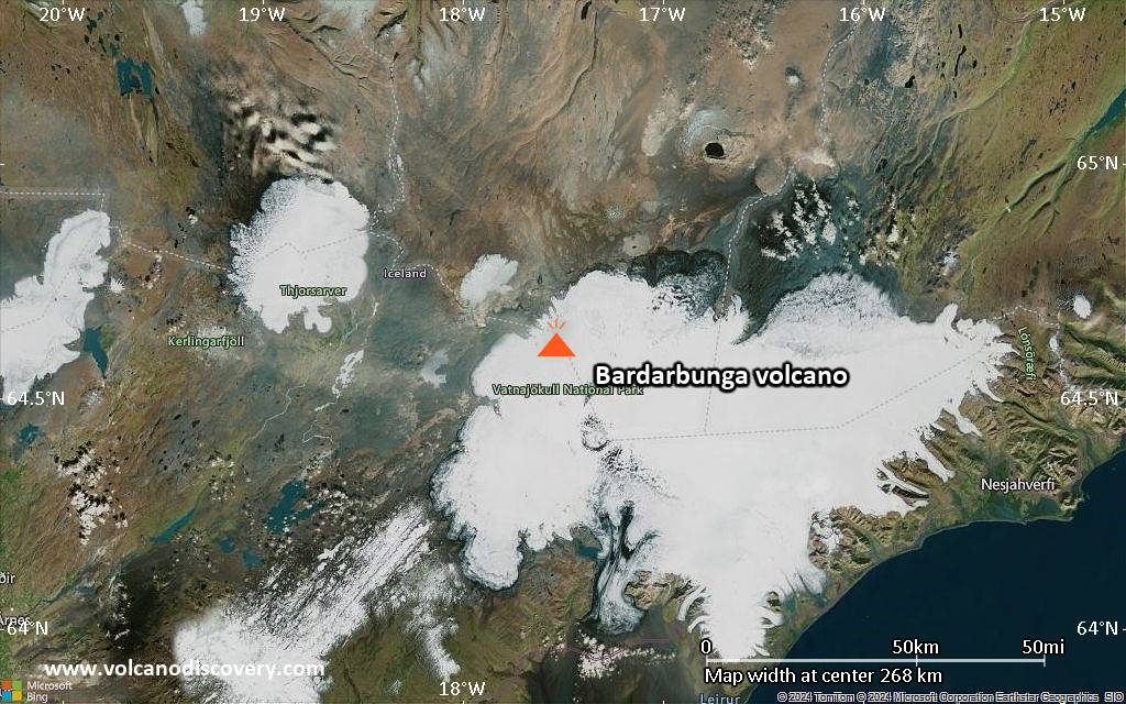
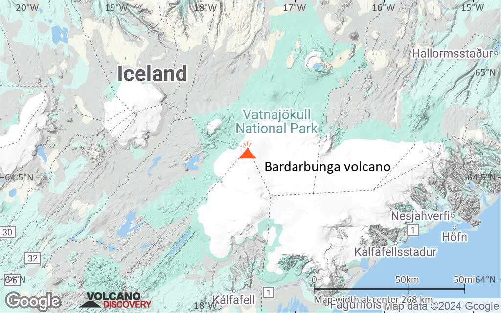
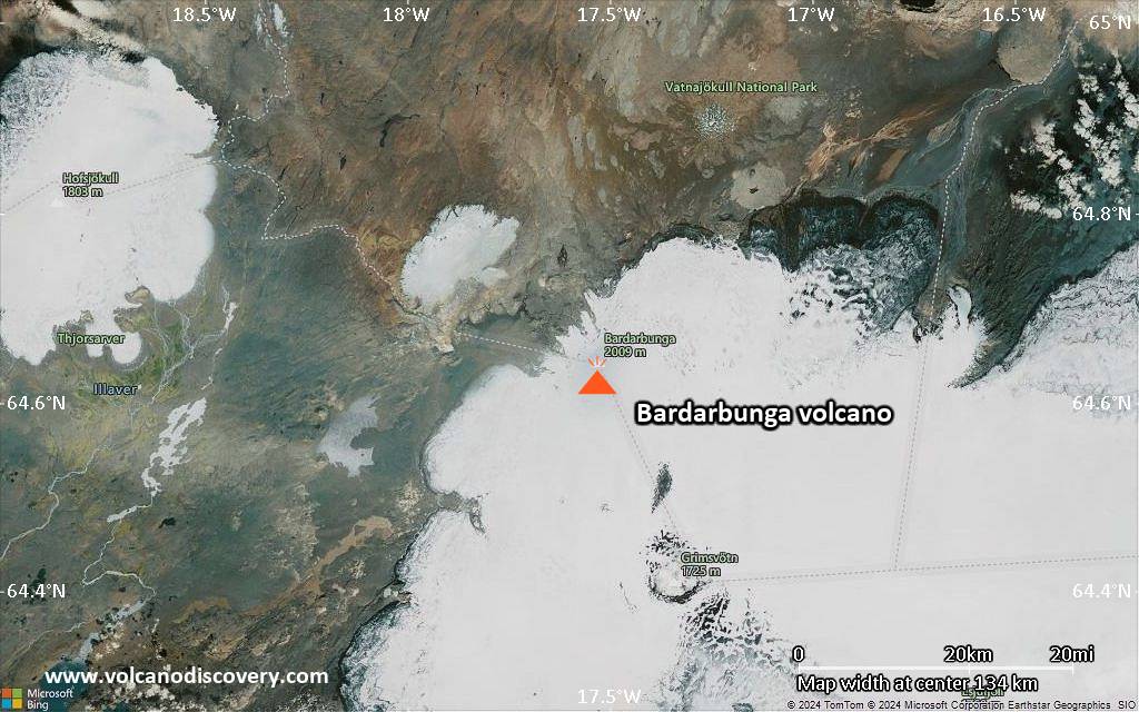
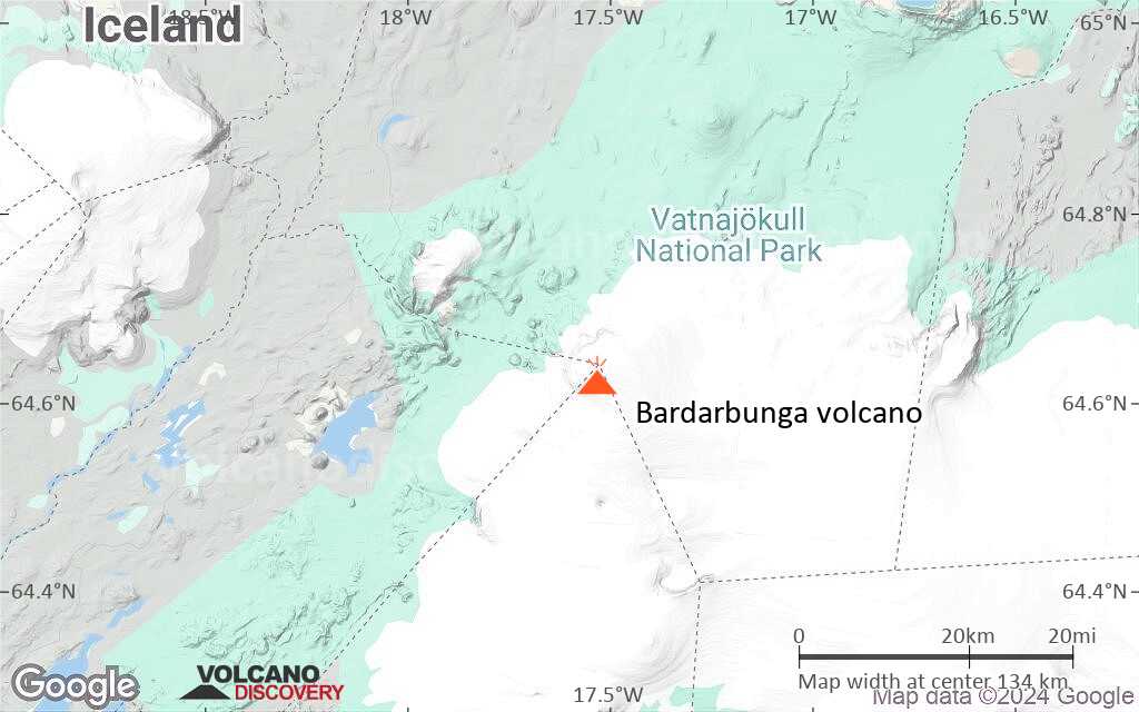
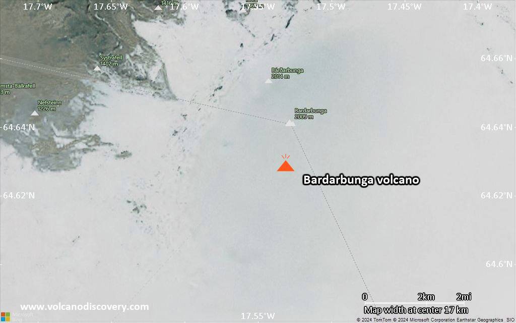
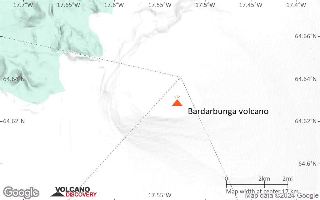
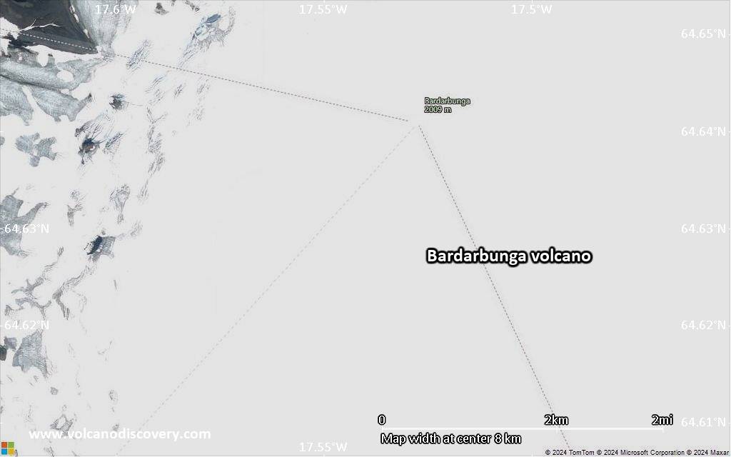
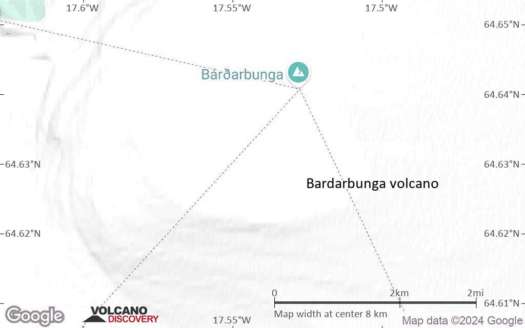
| RSS | EN | DE | EL | ES | FR | IT | RU

Bardarbunga Volcano

Updated: Mar 25, 2025 11:35 GMT -
Stratovolcano
Central Iceland, 64.63°N / -17.53°W
Summit height: approx. 2000 m / ca. 6,560 ft
Current status: minor activity or eruption warning (3 out of 5)
Last update: 22 Jan 2025 (Smithsonian / USGS Weekly Volcanic Activity Report)
Lava fountains from the Holuhraun fissure eruption August 2014

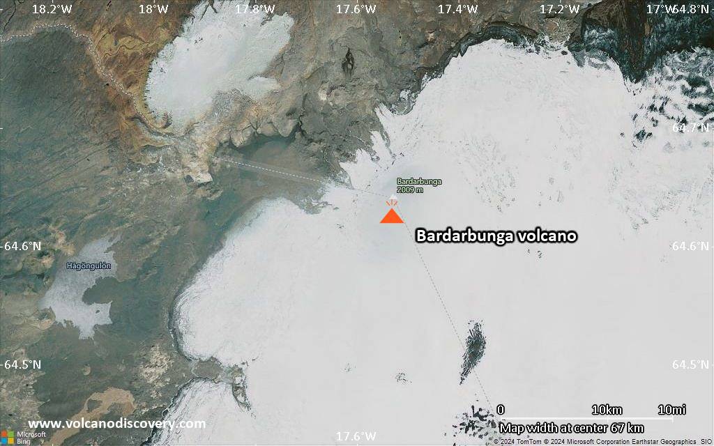
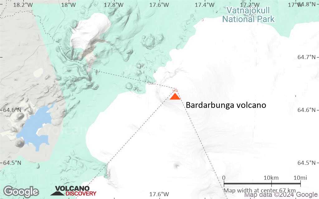
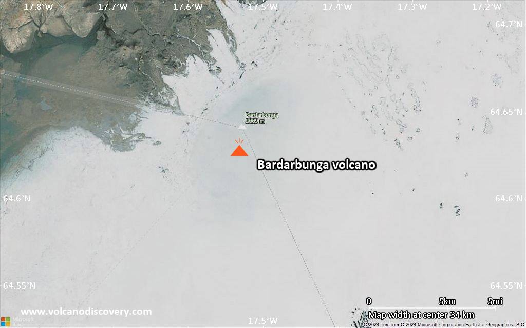
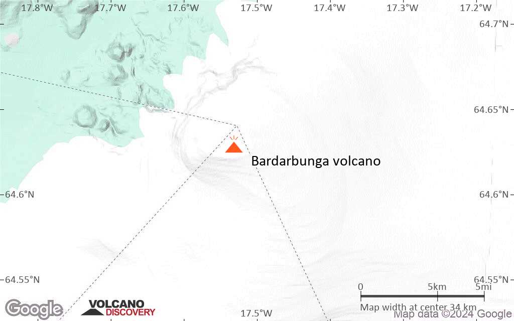
Bardarbunga (Bárðarbunga) is a large central volcano lying underneath Iceland's 500-m thick Vatnajokull glacier in the center of the country. It is located at the junction between the eastern and northern volcanic rift zones in the area where the present-day center of the mantle hot spot beneath Iceland is thought to be.
Bardarbunga has had about 300-400 eruptions during the past 10,000 years which includes only 23 eruptions historic times (approx the past 1000 years), i.e. it seems to erupt currently at rates of approx. twice per century, the last one having occurred in 1910. A massive explosive-effusive eruption (VEI 6) in 1477 resulted in a large ash and pumice fall-out deposit.
Approx 8600 years ago, Bardarbunga produced the largest known lava flow during the past 10,000 years on earth (more than 21 cubic kilometers of volume). The lava was erupted from the Veidivötn fissure system and traveled more than 100 km to the south coast.

[smaller] [larger]
Typical eruption style: Large effusive eruptions, some explosive activity.
Bardarbunga volcano eruptions: 1080(?), 1159(?), ca. 1210, ca. 1270, ca. 1350, ca. 1410(?), 1477 (very large effusive-explosive eruption), 1697, 1702, 1706, 1712, 1716, 1717, 1720, 1726, 1729, 1739, 1750, 1766, 1769, 1797, 1807(?), 1862-64, 1872(?), 1902-03, 1910, 2014-15 (Holuhraun fissure eruption)

Latest nearby earthquakes

Date and TimeMag / DepthDistance / Location
Mar 25, 03:11 am (Universal Time)
1.1

8.9 km
14 km (8.9 mi) to the S 9.7 km ENE of Hamarinn Info
Monday, March 24, 2025 GMT (2 quakes)
Mar 24, 12:54 pm (Reykjavik)
0.2

5 km
3.1 km (2 mi) to the N Iceland: 2.0 km N of Bárðarbunga Info
Mar 24, 01:18 am (Reykjavik)
0.7

4.7 km
5.2 km (3.2 mi) to the N Iceland: 4.0 km N of Bárðarbunga Info
Sunday, March 23, 2025 GMT (2 quakes)
Mar 23, 08:23 pm (Reykjavik)
1.4

7.5 km
30 km (18 mi) to the S Iceland: 6.4 km SW of Grímsfjall Info
Mar 23, 02:01 pm (Universal Time)
1.2

3.1 km
14 km (8.5 mi) to the S 13.3 km E of Hamarinn Info
Saturday, March 22, 2025 GMT (2 quakes)
Mar 22, 09:41 pm (Universal Time)
0.6

13 km
28 km (17 mi) to the S 4.8 km WSW of Grímsfjall Info
Mar 22, 07:22 pm (Universal Time)
1.7

8 km
22 km (14 mi) to the SE 5.4 km NNW of Grímsfjall Info
Wednesday, March 19, 2025 GMT (2 quakes)
Mar 19, 08:21 am (Reykjavik)
4.2

4.7 km
4.7 km (2.9 mi) to the E Iceland  I FELT IT Info
Mar 19, 08:06 am (Universal Time)
2.9

4 km
6.5 km (4 mi) to the E 223 km east of Reykjavik, Capital, IcelandI FELT IT Info

Background

The volcano is hidden beneath the northwestern part of the Vatnajökull glacier, and contains a 700-m-deep caldera that is hidden beneath ice and has extensive flank fissures, from where eruptions have taken place: the Veidivötn fissure extends for over 100 km to the SW, almost reaching Torfajökull volcano, while the Trollagigar fissure extends 50 km to the NE touching Askja volcano.

A major risk from Bárdarbunga are jökulhlaups (glacier-outburst floods), that can be hazardous for areas in all directions around Bárdarbunga.

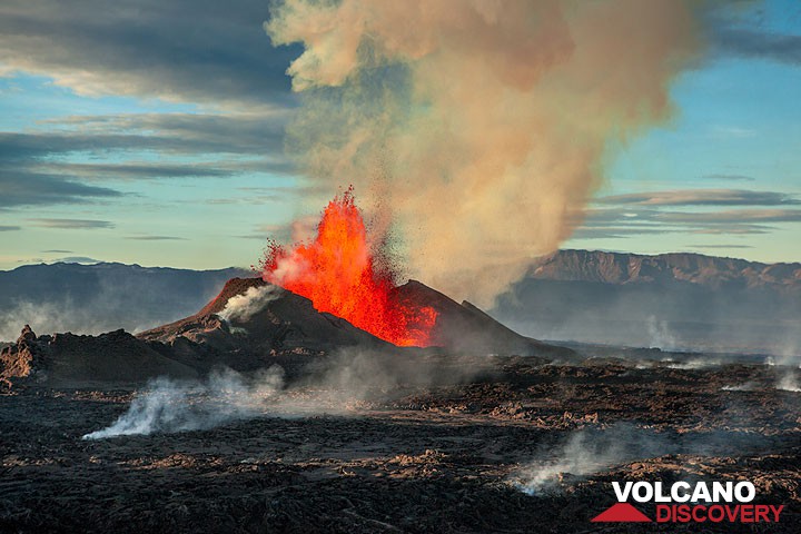
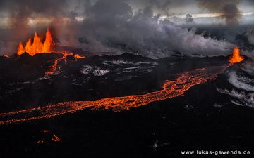
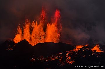
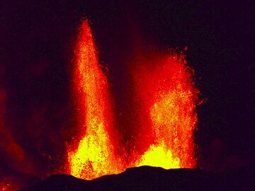
Bardarbunga Volcano Photos
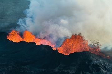
Significant volcanic eruptions: Bardarbunga volcano

In the past 10,000 years, Bardarbunga has had at least 44 confirmed volcanic eruptions, out of which 13 are documented by historical records, while the others can be inferred from geological evidence.
Additionally, there are 11 uncertain or discredited eruptions from Bardarbunga volcano.
The table below lists all known eruptions (date in bold face) of Bardarbunga volcano since around 1700. Updates on the most recent volcanic activity of Bardarbunga can be found on the news page of Bardarbunga volcano.
DateNoteVEIDeathsDamage
2014 Aug 29 - 2015 Feb 27Holuhraun vent, 45 km NE
Historical obs./docs.
0
?? 2008 Aug 16 ±15 d.
Uncertain Eruption
?
?? 2006 Apr 16 ±15 d.
Uncertain Eruption
?
?? 2005 Jul 16 ±15 d. - Aug 16 ±15 d.
Uncertain Eruption
?
?? 2002 Jul 16 ±15 d. - Sep 16 ±15 d.
Uncertain Eruption
?
?? 2000 Aug 16 ±15 d.
Uncertain Eruption
?
?? 1997 Aug 16 ±15 d.
Uncertain Eruption
?
?? 1996 Aug 16 ±15 d.
Uncertain Eruption
?
?? 1995 Jul 16 ±15 d.
Uncertain Eruption
?
?? 1991 Aug 12
Uncertain Eruption
?
?? 1986 Nov 29 - Dec 1 ?
Uncertain Eruption
?
1910 Jun 18 - OctLoki-Fögrufjöll (East Loki cauldron)
Historical obs./docs.
2
1902 Dec - 1903 JunVolcano Uncertain: Dyngjuhals ?2?
1872 ?Volcano Uncertain: Dyngjuhals ??
1862 Jun 30 - 1864 Oct 15 ±45 d.Trollagigar
Historical obs./docs.
2
?? 1807
Uncertain Eruption
?
1797Volcano Uncertain?
1794
Historical obs./docs.
?
1769Volcano Uncertain: Bárdarbunga or Grímsvötn2
1766 Jul
Historical obs./docs.
2
1750 ±10 y.?
17392
1729 Feb 1
(eruption 1729)
Historical obs./docs.
1
light
Info
1729Volcano Uncertain: Dyngjuhals ?1
1726 Feb 1 ±30 d. - May 1 ±30 d.Dyngjujökull, Dyngjuhal ?
Historical obs./docs.
1?
1726 Feb 1
(eruption 1726 Feb 1 ±30 d. - May 1 ±30 d.)
Historical obs./docs.
1
light
Info
17202
1717 Aug 4 - Sep 17 or later
Historical obs./docs.
3?
1717 Aug 4
(eruption 1717 Aug 4 - Sep 17 or later)
Historical obs./docs.
3
light
Info
1716 Oct 5 ±4 d.
Historical obs./docs.
2
1716 Oct 5
(eruption 1716 Oct 5 ±4 d.)
Historical obs./docs.
2
light
Info
1712 Jan 15 ±45 d.
Historical obs./docs.
2
1712 Jan 15
(eruption 1712 Jan 15 ±45 d.)
Historical obs./docs.
2
light
Info
1707
Historical obs./docs.
2
1706
Historical obs./docs.
2
1702Volcano Uncertain: Dyngjuhals ?2
Remark:
Our list of volcanic eruptions closely follows the database of eruptions of the Smithsonian's Global Volcanism Project (GVP), the internationally most recognized data source for volcanic eruptions, but also includes significant eruptive episodes or related volcano events. "Volcanic eruptions" are usually to be understood as sequences of individual eruptive episodes that can follow each other, or even overlap (if several vents are involved), and can last many years, decades or even longer. For example, the current activity of Stromboli volcano is understood as a single eruption that has been ongoing since 1934.
Sources: NOAA National Centers for Environmental Information (NCEI), Global Significant Volcanic Eruptions Database. doi:10.7289/V5TD9V7K | Global Volcanism Project / Smithsonian Institution

Bardarbunga Volcano FAQ

+When was the last eruption of Bardarbunga volcano?

+How often does Bardarbunga volcano erupt?

+How active is Bardarbunga volcano at present?

+When was the largest eruption of Bardarbunga volcano?

Latest satellite images

bardarbunga satellite image sat1bardarbunga satellite image sat2

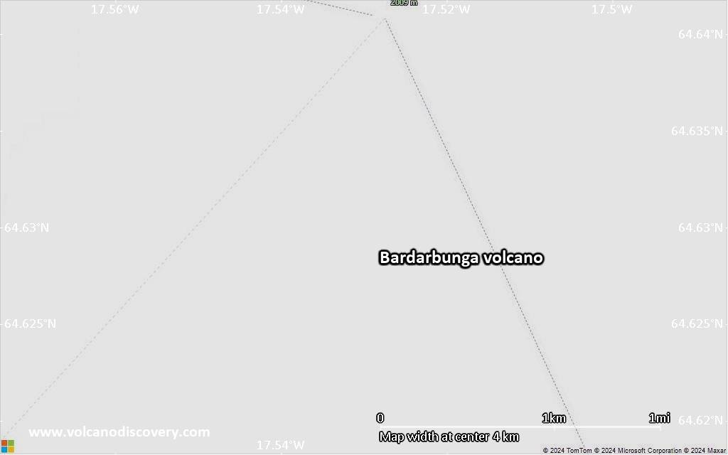
Bardarbunga Volcano Maps

Below is a selection of maps showing the location and surroundings of the volcano at various resolutions based on aerial-imagery / terrain maps. Feel free to use them for non-commercial purposes on your blog or website as long as you credit them with a link back to this page (click to copy it).
Satellite/aerial-type map of Bardarbunga volcano (world scale)
Terrain-type map of Bardarbunga volcano (world scale)
Satellite/aerial-type map of Bardarbunga volcano (region scale large)
Terrain-type map of Bardarbunga volcano (region scale large)
Satellite/aerial-type map of Bardarbunga volcano (region scale medium)
Terrain-type map of Bardarbunga volcano (region scale medium)
Satellite/aerial-type map of Bardarbunga volcano (region scale small)
Terrain-type map of Bardarbunga volcano (region scale small)
Satellite/aerial-type map of Bardarbunga volcano (local scale large)
Terrain-type map of Bardarbunga volcano (local scale large)
Satellite/aerial-type map of Bardarbunga volcano (local scale medium)
Terrain-type map of Bardarbunga volcano (local scale medium)
Satellite/aerial-type map of Bardarbunga volcano (local scale small)
Terrain-type map of Bardarbunga volcano (local scale small)
Satellite/aerial-type map of Bardarbunga volcano (scale of 10s of km)
Terrain-type map of Bardarbunga volcano (scale of 10s of km)
Satellite/aerial-type map of Bardarbunga volcano (scale of 20-40 km)
Terrain-type map of Bardarbunga volcano (scale of 20-40 km)
Satellite/aerial-type map of Bardarbunga volcano (scale of approx. 10-20 km)
Terrain-type map of Bardarbunga volcano (scale of approx. 10-20 km)
Satellite/aerial-type map of Bardarbunga volcano (scale of 5-10 km)
Satellite/aerial-type map of Bardarbunga volcano (scale of few kilometers)
Volcanoes & Earthquakes - new app for Android
Guaranteed tours
6-19 Apr 2025: Desert, salt and volcanoes - Danakil desert (Ethiopia)
12-19 Apr 2025: Europe's Volcanic Outpost - Canary Islands
9-25 Jun 2025: Volcanoes and Spices - Sulawesi/Halmahera (Indonesia)
27 Jun - 6 Jul 2025: Iceland Volcano Special - Iceland
7-23 Jul 2025: Volcanoes and Spices - Sulawesi/Halmahera (Indonesia)
1-17 Aug 2025: Volcanoes and Spices - Sulawesi/Halmahera (Indonesia)
13-26 Sep 2025: Green Volcanoes - Azores (Portugal)
1-14 Oct 2025: Desert, salt and volcanoes - Danakil desert (Ethiopia)
4-12 Oct 2025: From Stromboli to Etna - Sicily and Eolian Islands (Italy)
= spaces available   = guaranteed   = few spaces left   = booked out
Wed, 22 Jan 2025, 15:00

Bardarbunga volcano (Iceland) - Smithsonian / USGS Weekly Volcanic Activity Report for 15 January-21 January 2025 (New Activity / Unrest)

The Icelandic Meteorological Office (IMO) reported that the seismic swarm that began at Bárdarbunga on 14 January in the NW part of the caldera did not escalate further. Only two earthquakes were recorded during 15-16 January, with magnitudes of 2.4 and 1.6, on each day respectively. At 1605 on 16 January the Aviation Color Code was lowered back to Green (the lowest color on a four-color scale). ... Read all
Wed, 15 Jan 2025, 15:00

Bardarbunga volcano (Iceland) - Smithsonian / USGS Weekly Volcanic Activity Report for 8 January-14 January 2025 (New Activity / Unrest)

The Icelandic Meteorological Office (IMO) reported that an earthquake swarm began at Bárdarbunga at 0610 on 14 January in the NW part of the caldera. Initial estimates indicated that there were three earthquakes larger than an M 3 and one above an M 4; at 0705 the Aviation Color Code was raised to Yellow (the second lowest color on a four-color scale). The swarm continued though the morning and at 0805 a M 5 earthquake was detected. ... Read all

On this page:

Why is there advertising on this site?
Sources: VolcanoDiscovery / VolcanoAdventures and other sources as noted.
Use of material: Most text and images on our websites are owned by us. Re-use is generally not permitted without authorization. Contact us for licensing rights.
Volcanoes & Earthquakes
VolcanoDiscovery Home
Volcanoes | Earthquakes | Photos | Volcano News | App
Adventure & Study Travel
Tours to Volcanoes and Volcanic Areas: walking tours, photo tours, study tours
Tours & Dates | FAQ | About us
Get our newsletter!
Company info
Contact | Legal info | Terms & conditions
Follow us
Follow us on facebook Follow us on Instagram Follow us on Bluesky Follow us on Twitter Visit our Youtube channel
EN | DE | EL | ES | FR | IT | RU
VolcanoDiscovery GmbH, Germany, Reg. nr.: HRB 103744, EU Tax Id: DE 297 465 123 owned and created by
Dr. Tom Pfeiffer, volcanologist, volcano photographer, tour organizer member of
IAVCEI
IAVCEI
Vulkanologische Gesellschaft
Volcanological Society
Ecotourism Greece
Ecotourism Greece
RUV insurance
Insured by R+V
VolcanoDiscovery © 2004- All Rights Reserved | Privacy - Cookie Settings
Cookie-free, privacy-friendly web stats