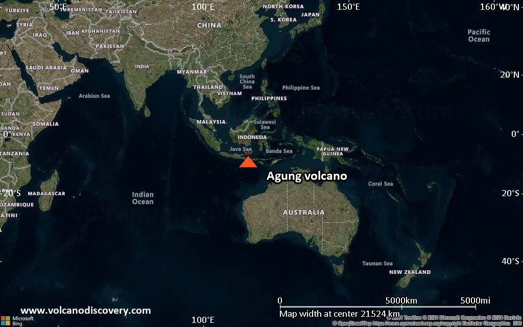
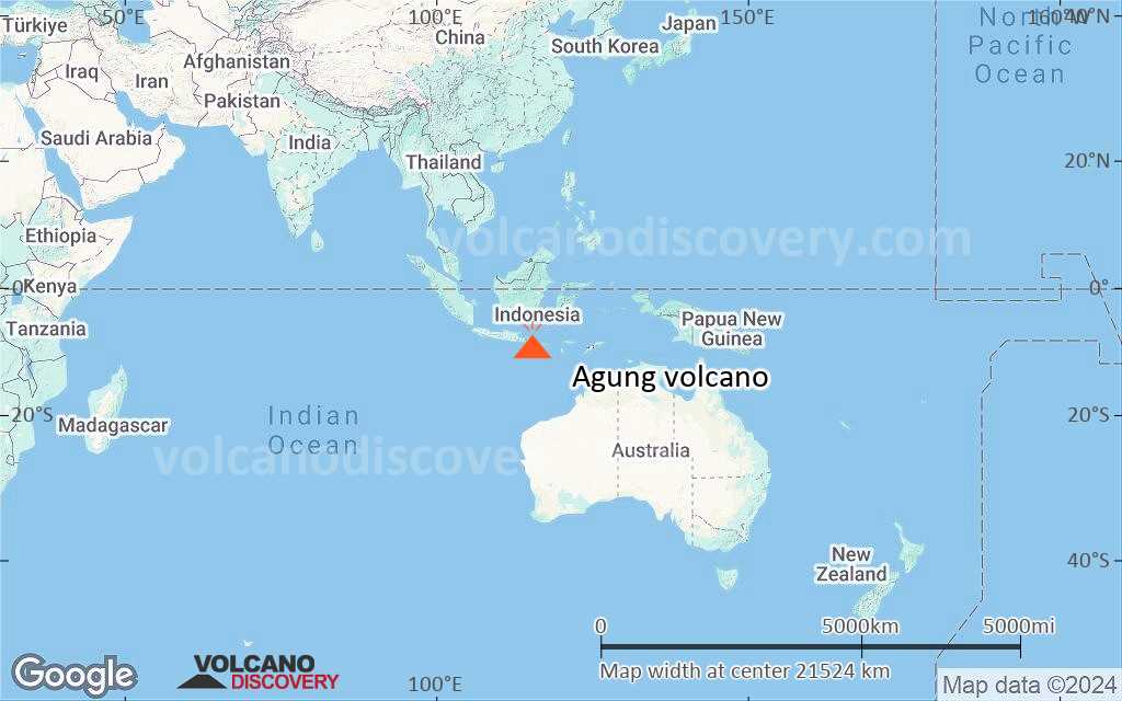
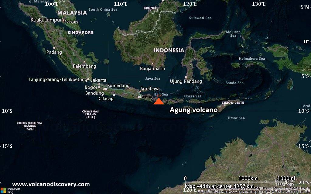
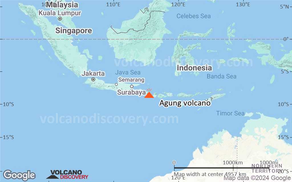
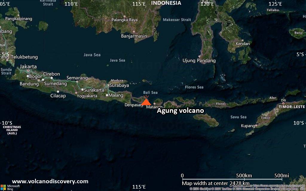
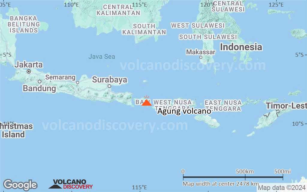
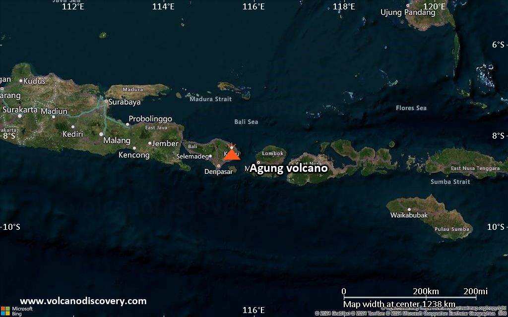
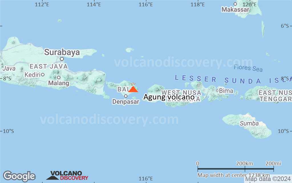
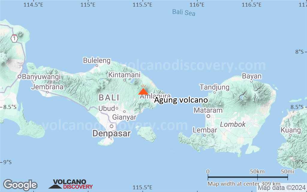
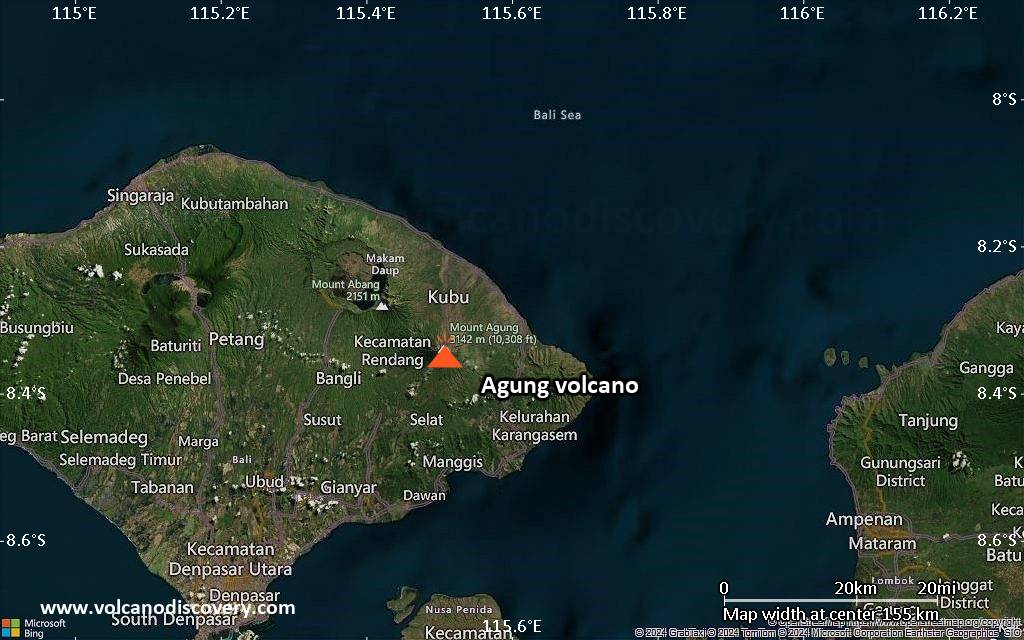
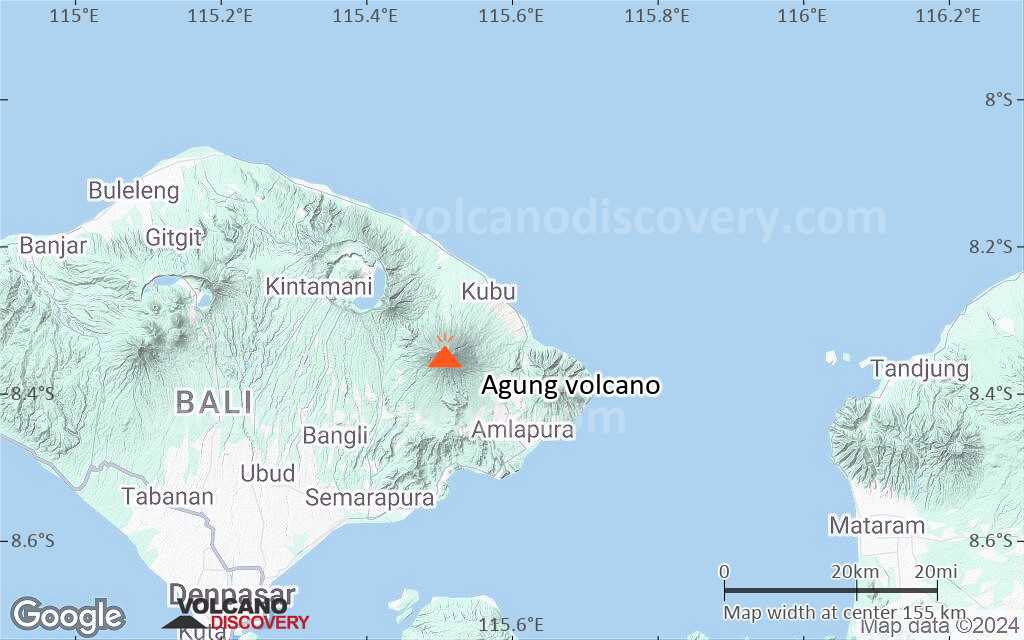
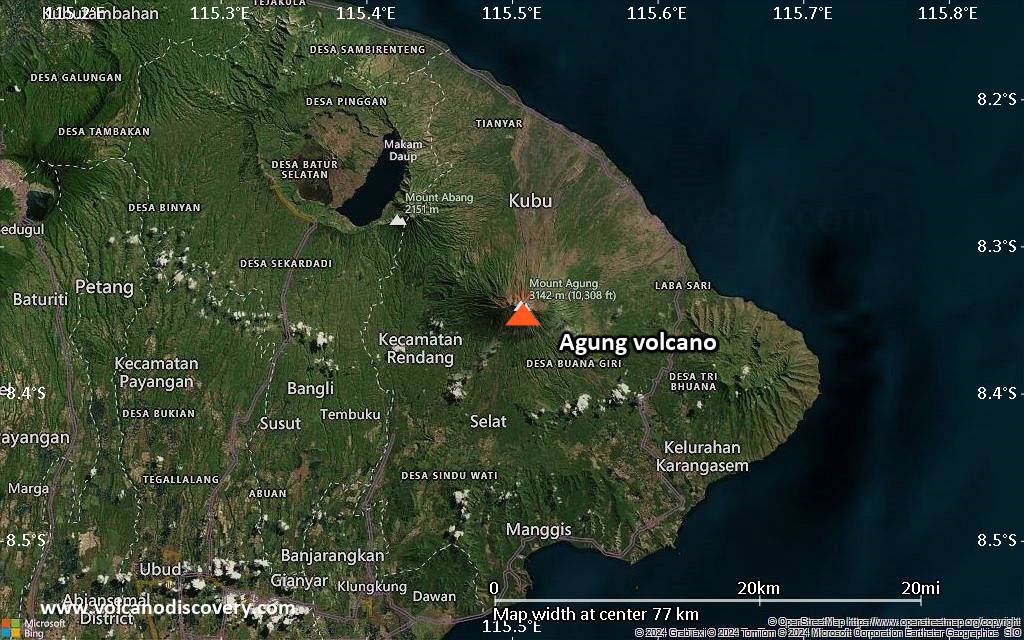
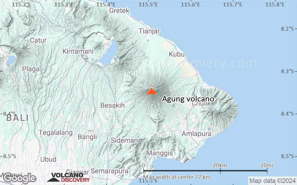
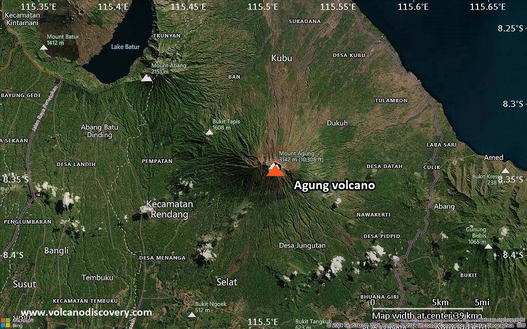
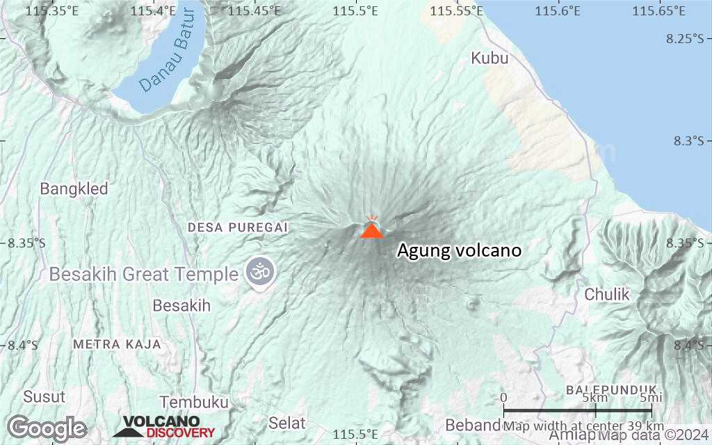
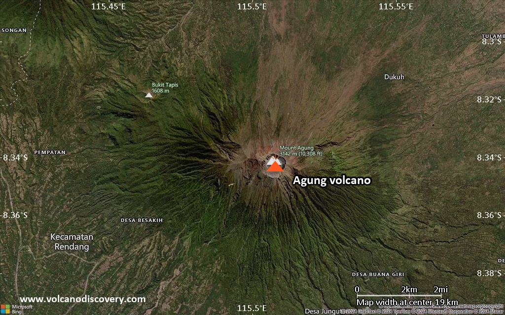
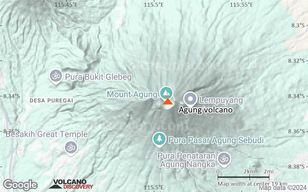
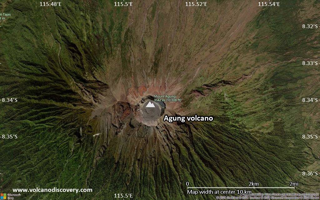
| RSS | EN | DE | EL | ES | FR | IT | RU

Agung Volcano

Updated: Apr 25, 2025 04:29 GMT -
Stratovolcano
Bali (Indonesia), -8.34°S / 115.51°E
Summit height: 3142 m (10,308 ft)
Current status: minor activity or eruption warning (3 out of 5)
Last update: 11 Dec 2024 (Volcanic Ash Advisory)
Mount Agung, Bali, Indonesia - Photo by Thomas Heuer

Mount Agung or Gunung Agung is a active volcano in Bali. This stratovolcano is the highest point on the island. It dominates the surrounding area influencing the climate. The clouds come from the west and Agung takes their water so that the west is lush and green and the east dry and barren.

[smaller] [larger]
Typical eruption style: Highly explosive.
Agung volcano eruptions: 1808, 1821(?), 1843, 1963-64 (large Plinian eruption on March 16, 1963), 2017-ongoing

Latest nearby earthquakes

Date and TimeMag / DepthDistance / Location

Background

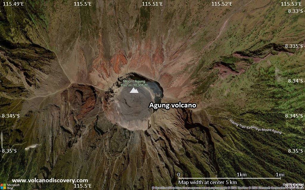
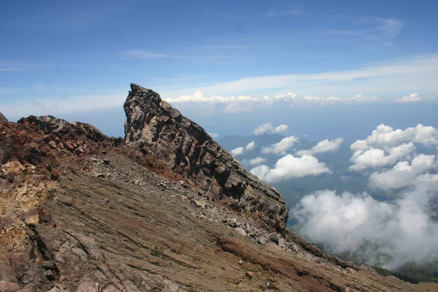
Mount Agung or Gunung Agung is a mountain in Bali. This stratovolcano is the highest point on the island. It dominates the surrounding area influencing the climate. The clouds come from the west and Agung takes their water so that the west is lush and green and the east dry and barren.

Gunung Agung last erupted in 1963-64 and is still active, with a large and very deep crater which occasionally belches smoke and ash. From a distance, the mountain appears to be perfectly conical, despite the existence of the large crater.

From the peak of the mountain, it is possible to see the peak of Mount Rinjani on the island of Lombok, although both mountains are frequently covered in cloud.

The 1963 eruption of Agung volcano
After more than 100 years of slumber, Mt. Agung came back to life on February 18, 1963. Loud noises and a cloud rising from the crater were noticed, then the ejection of bombs and blocks.
On February 24, 1963, highly viscous lava flows began to travel down the northern flank of the volcano, reaching a length of 7 km in about 18 to 20 days and an elevation of 510 m above sea level. The flows were about 0.5-0.8 km wide and 30-40 m thick. Rough estimates indicate a total volume of these flows of about 50 million cubic meters.
After that phase, the eruption became more and more explosive, and on March 17, 1963, the paroxysmal sub-Plinian eruption took place, generating a eruptino column of 8-10 km height that collapsed to form devastating pyroclastic flows. These flows reached distances of up to 15 km from the crater following vallezs to the south and east, at speeds of about 60 km/hour. Many villages were destroyed and more than 1000 people lost their lives. Heavy tephra fall occurred in areas west of the volcano, where up to 50-70 cm of ash were deposited.
In May, the south peak of the crater wall collapsed, lowering its height for about 200 meters. The lowest crater wall at present is the upper end of Langon river (2600 m).

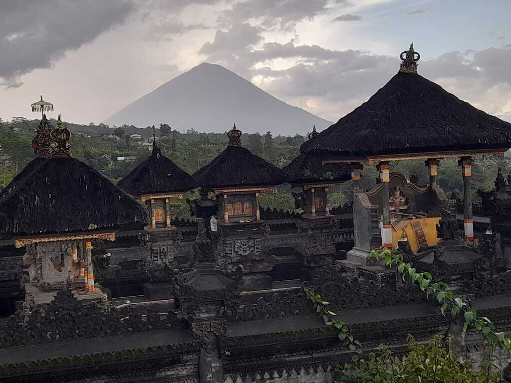
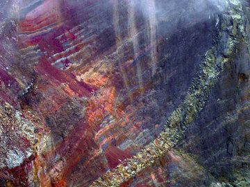
Agung Volcano Photos

Significant volcanic eruptions: Agung volcano

In the past 10,000 years, Agung has had at least 4 confirmed eruptions, all documented by historical records or observations. There is one uncertain or discredited eruption in 1821 from Agung volcano.
The table below lists all known eruptions (date in bold face) of Agung volcano in historic times and during the past 10,000 years. Updates on the most recent volcanic activity of Agung can be found on the news page of Agung volcano.
DateNoteVEIDeathsDamage
2017 Nov 21 - 2019 Jun 13Summit crater
Historical obs./docs.
3
1963 Feb 18 - 1964 Jan 27
Historical obs./docs.
5
1963 May 16
(eruption 1963 Feb 18 - 1964 Jan 27)
Historical obs./docs.
3120
Info
1963 Mar 18
(eruption 1963 Feb 18 - 1964 Jan 27)
Tsunami recorded
Historical obs./docs.
51,028
Info
1843
Historical obs./docs.
5
?? 1821 Mar 16
Uncertain Eruption
2
1808
Historical obs./docs.
2
Remark:
Our list of volcanic eruptions closely follows the database of eruptions of the Smithsonian's Global Volcanism Project (GVP), the internationally most recognized data source for volcanic eruptions, but also includes significant eruptive episodes or related volcano events. "Volcanic eruptions" are usually to be understood as sequences of individual eruptive episodes that can follow each other, or even overlap (if several vents are involved), and can last many years, decades or even longer. For example, the current activity of Stromboli volcano is understood as a single eruption that has been ongoing since 1934.
Sources: NOAA National Centers for Environmental Information (NCEI), Global Significant Volcanic Eruptions Database. doi:10.7289/V5TD9V7K | Global Volcanism Project / Smithsonian Institution

Agung Volcano FAQ

+When was the last eruption of Agung volcano?

+How often does Agung volcano erupt?

+How active is Agung volcano at present?

+When was the largest eruption of Agung volcano?

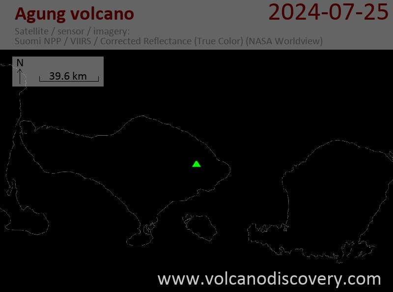
Latest satellite images

Agung satellite image sat1Agung satellite image sat2

Agung Volcano Maps

Below is a selection of maps showing the location and surroundings of the volcano at various resolutions based on aerial-imagery / terrain maps. Feel free to use them for non-commercial purposes on your blog or website as long as you credit them with a link back to this page (click to copy it).
Satellite/aerial-type map of Agung volcano (world scale)
Terrain-type map of Agung volcano (world scale)
Satellite/aerial-type map of Agung volcano (region scale large)
Terrain-type map of Agung volcano (region scale large)
Satellite/aerial-type map of Agung volcano (region scale medium)
Terrain-type map of Agung volcano (region scale medium)
Satellite/aerial-type map of Agung volcano (region scale small)
Terrain-type map of Agung volcano (region scale small)
Satellite/aerial-type map of Agung volcano (local scale large)
Terrain-type map of Agung volcano (local scale large)
Satellite/aerial-type map of Agung volcano (local scale medium)
Terrain-type map of Agung volcano (local scale medium)
Satellite/aerial-type map of Agung volcano (local scale small)
Terrain-type map of Agung volcano (local scale small)
Satellite/aerial-type map of Agung volcano (scale of 10s of km)
Terrain-type map of Agung volcano (scale of 10s of km)
Satellite/aerial-type map of Agung volcano (scale of 20-40 km)
Terrain-type map of Agung volcano (scale of 20-40 km)
Satellite/aerial-type map of Agung volcano (scale of approx. 10-20 km)
Terrain-type map of Agung volcano (scale of approx. 10-20 km)
Satellite/aerial-type map of Agung volcano (scale of 5-10 km)
Satellite/aerial-type map of Agung volcano (scale of few kilometers)
Volcanoes & Earthquakes - new app for Android
Guaranteed tours
9-25 Jun 2025: Volcanoes and Spices - Sulawesi/Halmahera (Indonesia)
27 Jun - 6 Jul 2025: Iceland Volcano Special - Iceland
7-22 Jul 2025: From Krakatau to Bali - Java (Indonesia)
7-23 Jul 2025: Volcanoes and Spices - Sulawesi/Halmahera (Indonesia)
1-17 Aug 2025: Volcanoes and Spices - Sulawesi/Halmahera (Indonesia)
1-14 Oct 2025: Desert, salt and volcanoes - Danakil desert (Ethiopia)
4-12 Oct 2025: From Stromboli to Etna - Sicily and Eolian Islands (Italy)
6-21 Oct 2025: From Krakatau to Bali - Java (Indonesia)
3-19 Nov 2025: Volcanoes and Spices - Sulawesi/Halmahera (Indonesia)
= spaces available   = guaranteed   = few spaces left   = booked out

On this page:

Try our free app!
Volcanoes & Earthquakes - new app for Android
Android | iOS version

More on VolcanoDiscovery

Why is there advertising on this site?

Support us - Help us upgrade our services!

We truly love working to bring you the latest volcano and earthquake data from around the world. Maintaining our website and our free apps does require, however, considerable time and resources.
We need financing to increase hard- and software capacity as well as support our editor team. We're aiming to achieve uninterrupted service wherever an earthquake or volcano eruption unfolds, and your donations can make it happen! Every donation will be highly appreciated. If you find the information useful and would like to support our team in integrating further features, write great content, and in upgrading our soft- and hardware, please make a donation (PayPal).

Planned features:Thanks to your past donations, these features have been added recently:
Download and Upgrade the Volcanoes & Earthquakes app to get one of the fastest seismic and volcano alerts online:
Android | IOS
Thank you!
Sources: VolcanoDiscovery / VolcanoAdventures and other sources as noted.
Use of material: Most text and images on our websites are owned by us. Re-use is generally not permitted without authorization. Contact us for licensing rights.
Volcanoes & Earthquakes
VolcanoDiscovery Home
Volcanoes | Earthquakes | Photos | Volcano News | | Shop | App
Adventure & Study Travel
Tours to Volcanoes and Volcanic Areas: walking tours, photo tours, study tours
Tours & Dates | FAQ | About us
Get our newsletter!
Company info
Contact | Legal info | Terms & conditions
Follow us
Follow us on facebook Follow us on Instagram Follow us on Bluesky Follow us on Twitter Visit our Youtube channel
EN | DE | EL | ES | FR | IT | RU
VolcanoDiscovery GmbH, Germany, Reg. nr.: HRB 103744, EU Tax Id: DE 297 465 123 owned and created by
Dr. Tom Pfeiffer, volcanologist, volcano photographer, tour organizer member of
IAVCEI
IAVCEI
Vulkanologische Gesellschaft
Volcanological Society
Ecotourism Greece
Ecotourism Greece
RUV insurance
Insured by R+V
VolcanoDiscovery © 2004- All Rights Reserved | Privacy - Cookie Settings