Agua Volcano
Updated: Apr 22, 2025 05:51 GMT -
Stratovolcano
Guatemala, 14.47°N / -90.74°W 
Summit height: 3760 m / 12,336 ft
Current status: normal or dormant (1 out of 5)
[smaller] [larger]
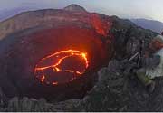
Agua volcano eruptions: unknown, no recent eruptions
Latest nearby earthquakes
| Date and Time | Mag / Depth | Distance / Location | |||
|---|---|---|---|---|---|
Background
The symmetrical, forested Volcán de Agua stratovolcano forms an impressive backdrop to the historic former capital city of Antigua Guatemala, opposite the twin volcanoes of Fuego and Acatenango. The 3760-m-high basaltic-andesite to andesite Agua volcano has an isolated position that makes it a prominent landmark from all directions. A small, 280-m-wide circular crater is breached on the NNE side. Six small pit craters are located on the NW flank, and two small cones lie on the south flank. Agua's symmetrical profile implies a relatively young age, although currently no dated Holocene tephra deposits are known. Agua has had no historical eruptions, but its name (the water volcano) originates from a devastating mudflow on September 11, 1541. The mudflow destroyed the first Guatemalan capital city established by the Spanish Conquistadors, which is now known as Ciudad Vieja. The catastrophe prompted the establishment of a new capital city at nearby Antigua.---
Smithsonian / GVP volcano information
Agua Volcano Photos
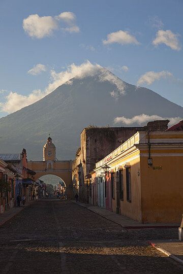
Mighty Agua volcano seen from Antigua (Photo: Tom Pfeiffer)
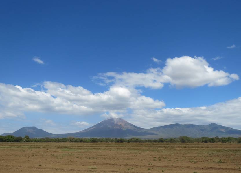
Volcanoes El Chonco, San Cristobal (highest volcano in Nicaragua) and Casita, view from Chichigalpa (Photo: WNomad)
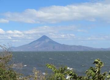
Stratovolcano Momotombo at Lake Managua, Nicaragua (Photo: WNomad)

Stratovolcano San Cristobal, view from Chichigalpa, Nicaragua (Photo: WNomad)
Significant volcanic eruptions: Agua volcano
In the past 10,000 years, Agua has had only one confirmed historic eruption ###WHEN1###|only one confirmed historic eruption ###WHEN1### and one ###WHEN2### inferred from geological evidence|only one confirmed historic eruption ###WHEN1###, but at least ###NUM_INFERRED### eruptions can be inferred from geological evidence|at least ###NUM_CONFIRMED### confirmed eruptions, all documented by historical records or observations|at least ###NUM_CONFIRMED### confirmed volcanic eruptions, out of which ###NUM_HISTORIC### are documented by historical records, while the others can be inferred from geological evidence.
No historic eruptions are known from Agua volcano, but at least one eruption ###WHEN2### can be inferred from geological evidence|evidence from at least ###NUM_CONFIRMED### eruptions during the past 10,000 years can be found in the geological record.
There is one uncertain or discredited eruption in 1541 AD from Agua volcano.
The table below lists all known eruptions (date in bold face) of Agua volcano in historic times and during the past 10,000 years. Updates on the most recent volcanic activity of Agua can be found on the news page of Agua volcano.
| Date | Note | VEI | Deaths | Damage | ||
|---|---|---|---|---|---|---|
Discredited Eruption | ||||||
Remark:
Our list of volcanic eruptions closely follows the database of eruptions of the Smithsonian's Global Volcanism Project (GVP), the internationally most recognized data source for volcanic eruptions, but also includes significant eruptive episodes or related volcano events. "Volcanic eruptions" are usually to be understood as sequences of individual eruptive episodes that can follow each other, or even overlap (if several vents are involved), and can last many years, decades or even longer. For example, the current activity of Stromboli volcano is understood as a single eruption that has been ongoing since 1934.
Sources: NOAA National Centers for Environmental Information (NCEI), Global Significant Volcanic Eruptions Database. doi:10.7289/V5TD9V7K | Global Volcanism Project / Smithsonian Institution
Latest satellite images
Agua Volcano Maps
Below is a selection of maps showing the location and surroundings of the volcano at various resolutions based on aerial-imagery / terrain maps. Feel free to use them for non-commercial purposes on your blog or website as long as you credit them with a link back to this page (click to copy it).

Satellite/aerial-type map of Agua volcano (world scale)

Terrain-type map of Agua volcano (world scale)

Satellite/aerial-type map of Agua volcano (region scale large)

Terrain-type map of Agua volcano (region scale large)

Satellite/aerial-type map of Agua volcano (region scale medium)

Terrain-type map of Agua volcano (region scale medium)

Satellite/aerial-type map of Agua volcano (region scale small)

Terrain-type map of Agua volcano (region scale small)

Satellite/aerial-type map of Agua volcano (local scale large)

Terrain-type map of Agua volcano (local scale large)

Satellite/aerial-type map of Agua volcano (local scale medium)

Terrain-type map of Agua volcano (local scale medium)

Satellite/aerial-type map of Agua volcano (local scale small)

Terrain-type map of Agua volcano (local scale small)

Satellite/aerial-type map of Agua volcano (scale of 10s of km)

Terrain-type map of Agua volcano (scale of 10s of km)

Satellite/aerial-type map of Agua volcano (scale of 20-40 km)

Terrain-type map of Agua volcano (scale of 20-40 km)

Satellite/aerial-type map of Agua volcano (scale of approx. 10-20 km)

Terrain-type map of Agua volcano (scale of approx. 10-20 km)

Satellite/aerial-type map of Agua volcano (scale of 5-10 km)

Satellite/aerial-type map of Agua volcano (scale of few kilometers)