Aegina Volcano
Updated: Apr 19, 2025 11:15 GMT -
Volcanic field
Saronic Gulf, Greece, 37.75°N / 23.5°E 
Summit height: 530 m / 1739 ft
Current status: (probably) extinct (0 out of 5)
[smaller] [larger]
Aegina volcano eruptions: None during the past 10,000 years
Less than 2.58 million years ago (Pleistocene)
Latest nearby earthquakes
| Date and Time | Mag / Depth | Distance / Location | |||
|---|---|---|---|---|---|
| Apr 18, 09:20 pm (GMT +3) | 2.3 10 km | 22 km (14 mi) to the E | Info | ||
| Wednesday, April 16, 2025 GMT (2 quakes) | |||||
| Apr 16, 11:55 am (Universal Time) | 1.9 10 km | 22 km (14 mi) to the SW | Info | ||
| Apr 16, 03:37 am (Universal Time) | 1.5 10.3 km | 23 km (14 mi) to the SW | Info | ||
| Tuesday, April 15, 2025 GMT (4 quakes) | |||||
| Apr 15, 09:25 pm (Universal Time) | 1.7 14 km | 20 km (12 mi) to the NW | Info | ||
| Apr 15, 08:31 pm (Universal Time) | 1.9 21 km | 29 km (18 mi) to the W | Info | ||
| Apr 15, 06:46 pm (Universal Time) | 1.7 40 km | 29 km (18 mi) to the N | Info | ||
| Apr 15, 06:10 pm (Universal Time) | 1.3 10 km | 28 km (18 mi) to the N | Info | ||
| Friday, April 11, 2025 GMT (1 quake) | |||||
| Apr 11, 07:42 am (Universal Time) | 2.4 42 km | 3.9 km (2.4 mi) to the NE | Info | ||
| Thursday, April 10, 2025 GMT (1 quake) | |||||
| Apr 10, 08:15 pm (GMT +3) | 2.5 0.4 km | 6.6 km (4.1 mi) to the E | Info | ||
Background
Aegina is part of the Saronic Gulf Volcanic Group, in the Hellenic Volcanic Arc. The complex consists of domes and lava flows erupted from effusive monogenetic centers with low eruption rates (0.4 km3/m.y. at Aegina) (D'Alessandro et al., 2008). Activity took place between 4.7 and 2.0 Ma, during the first part of which mostly basaltic-andesitic to rhyodacitic rocks were produced. The remaining 1 m.y. of its activity produced basaltic-andesitic rocks (D'Alessandro et al., 2008; Francalanci et al., 2007). Volcanic activity had ceased in the upper Pleistocene, but a low-temperature geothermal field presently exists (Keller, 1971; Francalanci et al., 2007).---
Smithsonian / GVP volcano information
Aegina Volcano Photos

A map of the volcanic island of Aegina near Athens. (Photo: Tobias Schorr)
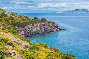
Eastern coast with view to Aegina (Photo: Tom Pfeiffer)
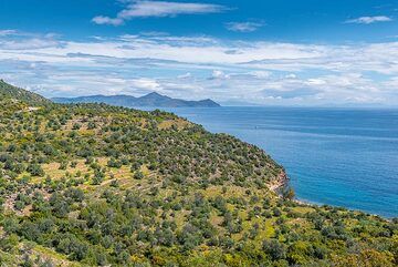
View towards Aegina (Photo: Tom Pfeiffer)
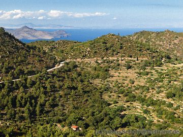
Small lava domes in western Methana and in the background the volcano Oros on Aegina island. (Photo: Tobias Schorr)
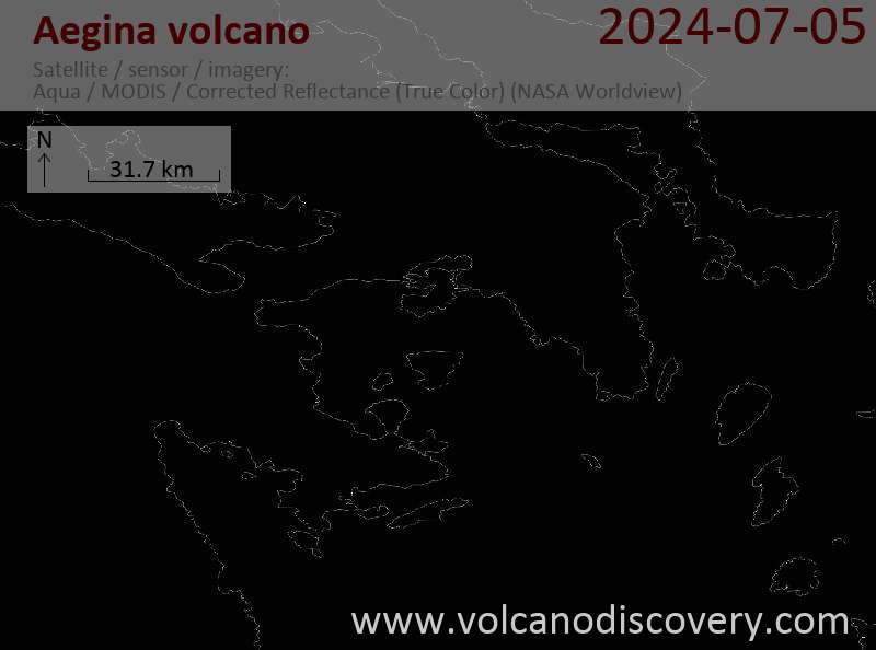
Latest satellite images

Aegina Volcano Maps
Below is a selection of maps showing the location and surroundings of the volcano at various resolutions based on aerial-imagery / terrain maps. Feel free to use them for non-commercial purposes on your blog or website as long as you credit them with a link back to this page (click to copy it).

Satellite/aerial-type map of Aegina volcano (world scale)

Terrain-type map of Aegina volcano (world scale)

Satellite/aerial-type map of Aegina volcano (region scale large)

Terrain-type map of Aegina volcano (region scale large)

Satellite/aerial-type map of Aegina volcano (region scale medium)

Terrain-type map of Aegina volcano (region scale medium)

Satellite/aerial-type map of Aegina volcano (region scale small)

Terrain-type map of Aegina volcano (region scale small)

Satellite/aerial-type map of Aegina volcano (local scale large)

Terrain-type map of Aegina volcano (local scale large)

Satellite/aerial-type map of Aegina volcano (local scale medium)

Terrain-type map of Aegina volcano (local scale medium)

Satellite/aerial-type map of Aegina volcano (local scale small)

Terrain-type map of Aegina volcano (local scale small)

Satellite/aerial-type map of Aegina volcano (scale of 10s of km)

Terrain-type map of Aegina volcano (scale of 10s of km)

Satellite/aerial-type map of Aegina volcano (scale of 20-40 km)

Terrain-type map of Aegina volcano (scale of 20-40 km)

Satellite/aerial-type map of Aegina volcano (scale of approx. 10-20 km)

Terrain-type map of Aegina volcano (scale of approx. 10-20 km)

Satellite/aerial-type map of Aegina volcano (scale of 5-10 km)

Satellite/aerial-type map of Aegina volcano (scale of few kilometers)