| RSS | EN | DE | EL | ES | FR | IT | RU

Tambora Volcán

Updated: 26 abr. 2025 02:04 GMT -
stratovolcano
Sumbawa (Indonesia), -8.25°S / 118°E
Summit height: 2850 m / 9,350 ft
Current status: normal or dormant (1 out of 5)
Last update: 14 dic 2021
The large caldera of Tambora volcano seen from the air

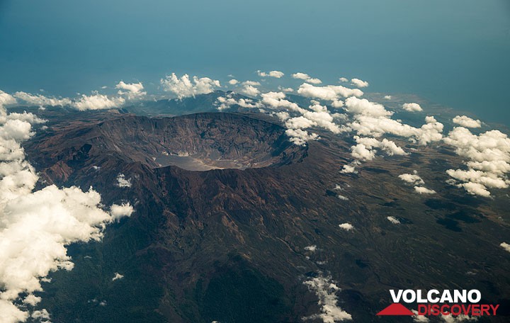
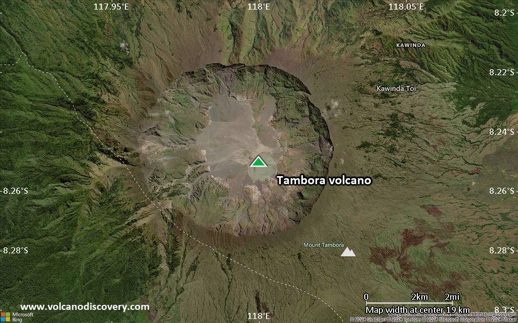
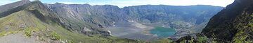
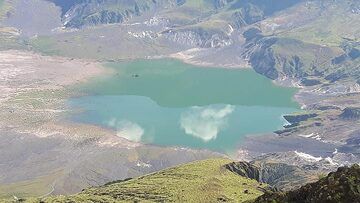
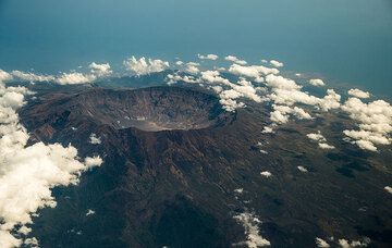
On 10 April 1815, Tambora produced the largest eruption known on the planet during the past 10,000 years. The volcano erupted more than 50 cubic kilometers of magma. Caldera collapse at the end of the eruption destroyed 30 km3 of the mountain and formed a 6 km wide and 1250 m deep caldera.
FLoating islands of pumice 3 miles long were observed in April 1815, and even 4 years later, these islands still hindered navigation.
The eruption produced global climatic effects and killed more than 100,000 people, directly and indirectly. Minor lava domes and flows have been extruded on the caldera floor at Tambora during the 19th and 20th centuries.

[smaller] [larger]
Typical eruption style: Explosive
Erupciones del volcán Tambora: 1967, 1880, 1812-15 (largest known eruption in historic times, VEI 7)

Latest nearby earthquakes

Fecha y horaMag / Prof.Distancia / Ubicación
17 abr 08:42 (Tiempo Universal)
2.4

19 km
25 km al noroeste Sumbawa Region, Indonesia Más
miércoles, 16 abril 2025 GMT (3 sismos)
17 abr 01:07 (GMT +8)
3.4

12 km
29 km al oeste Sumbawa Region, Indonesia Más
16 abr 14:35 (Tiempo Universal)
2.4

10 km
28 km al oeste Sumbawa Region, Indonesia Más
16 abr 22:07 (Makassar)
4.4

10 km
28 km al oeste Sumbawa Region, Indonesia 2 reportsMás
martes, 15 abril 2025 GMT (3 sismos)
16 abr 00:13 (GMT +8)
2.8

13 km
23 km al noroeste Sumbawa Region, Indonesia Más
15 abr 16:47 (Makassar)
3.2

10 km
30 km al oeste Sumbawa Region, Indonesia Más
15 abr 16:33 (Makassar)
4.2

10 km
29 km al oeste Sumbawa Region, Indonesia 1 reportMás
lunes, 14 abril 2025 GMT (1 sismo)
15 abr 04:28 (GMT +8)
2.6

14 km
21 km al noroeste Sumbawa Region, Indonesia Más

Background

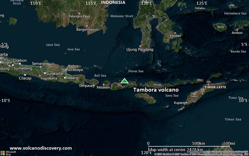
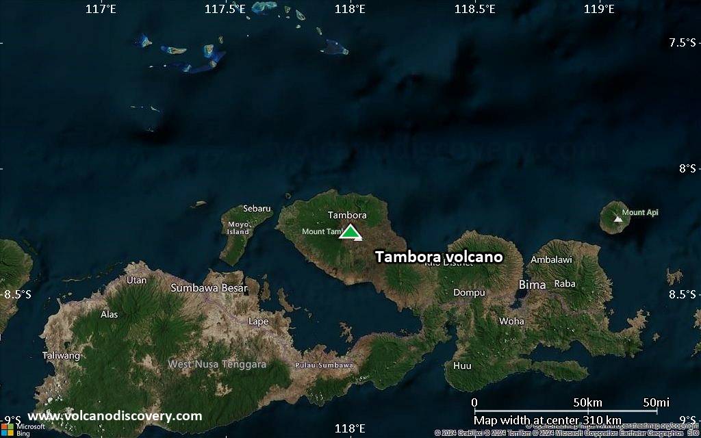
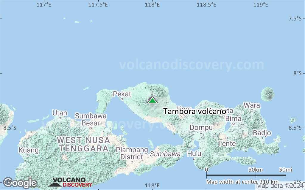
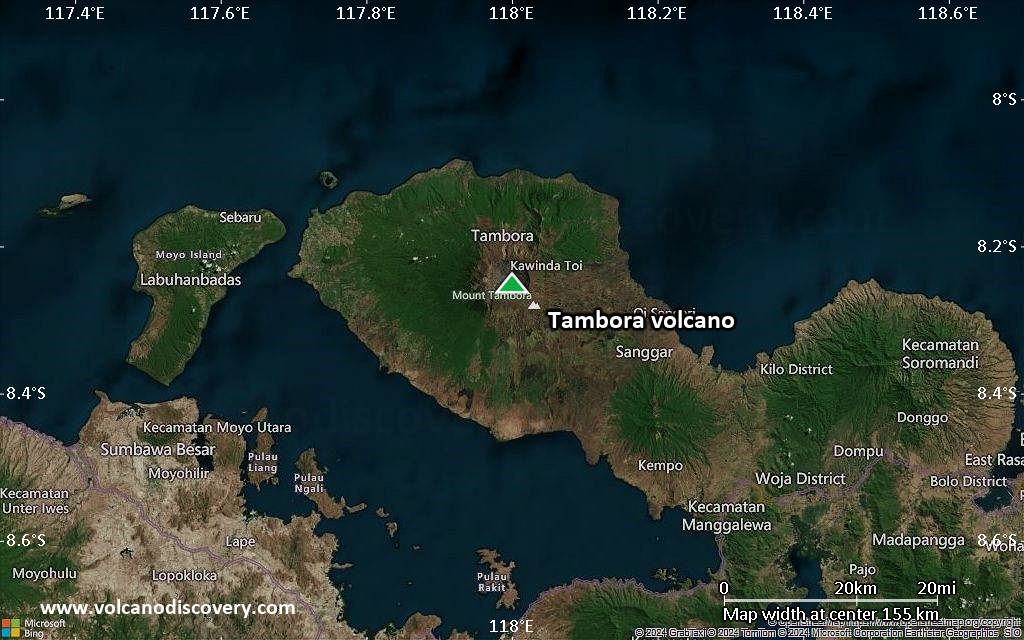
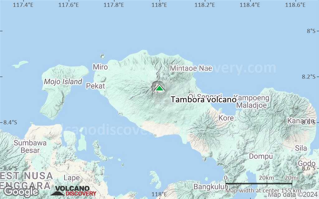
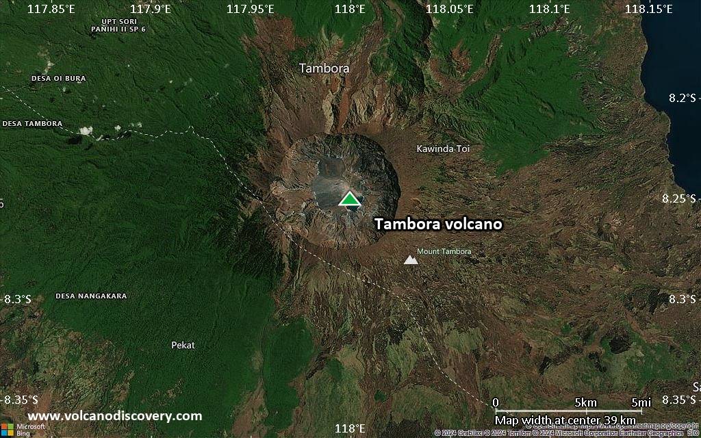
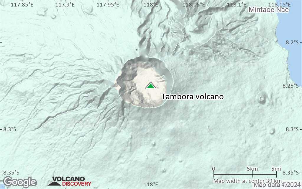
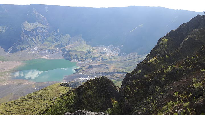
The massive Tambora stratovolcano forms the entire 60-km-wide Sanggar Peninsula on northern Sumbawa Island. The volcano originally grew to about 4000 m elevation before a major explosion destroyed its summit and left a pre-1815 caldera more than 43,000 years ago. Lava flows had largely filled the early caldera by about 10,000 years ago, before its activity changed to dominantly explosive eruptions, culminating in the 1815 eruption.

The eruption in 1815 emptied about 50-150 cubic km of magma and measures 7 on the VEI scale. It produced a giant plinian eruption column, which is estimated to have reached more 40-50 km altitude, ejecting large amounts of ash and aerosols into the stratosphere.
Pyroclastic flows reached the sea on all sides of the peninsula, and heavy tephra fall devastated croplands, causing an estimated 60,000 fatalities. Entire villages were buried under thick pumice deposits. Some of the settlements have recently been brought back to light by archaeological excavations, making the site a "Pompeii of Indonesia". Large tsunamis with wave heights of 10 or more meters might have occurred.
While the death toll of people living on Sumbawa and surrounding coastal areas was high enough, even more fatalities can be attributed to the indirect effect of global climate deterioration after the eruption. These changes turned 1816 into the "year without a summer" for much of Europe, causing widespread famine. It is estimated that it caused the death of over 100,000 people.
The reason for the climatic changes was increased absorption of sunlight due to a veil of aerosols (consisting mostly of tiny droplets of H2SO3 acid, formed by SO2 release) that were dispersed around both hemispheres by stratospheric currents from the tall eruption column. Global temperatures dropped by as much as 3 deg C in 1816 and recovered during the following years.
It is also believed that the eruption produced tsunamis with waves possibly as high as 10 meters.

Tambora Volcano Photos

Erupciones volcánicas significativas: Tambora volcano

In the past 10,000 years, Tambora has had at least 7 confirmed volcanic eruptions, out of which 4 are documented by historical records, while the others can be inferred from geological evidence.
The table below lists all known eruptions (date in bold face) of Tambora volcano in historic times and during the past 10,000 years. Updates on the most recent volcanic activity of Tambora can be found on the news page of Tambora volcano.
FechaNotaVEIFallecidosDaños
1967 ±20 y.NE part of caldera floor
Obs. históricas/documentos
0
desconocido
1880 ±30 y.SW part of caldera (Doro Afi Toi)
Obs. históricas/documentos
2
desconocido
1819 ago
Obs. históricas/documentos
2
desconocido
1812 - 1815 jul 15 ?
Obs. históricas/documentos
7
desconocido
1815 abr 10
(erupción 1812 - 1815 jul 15 ?)
Tsunami registrado
Obs. históricas/documentos
760,000
muy pesado
Información
740 ±150 y. AD?
desconocido
3050 ? BC?
desconocido
3910 ±200 y. BC?
desconocido
Remark:
Our list of volcanic eruptions closely follows the database of eruptions of the Smithsonian's Global Volcanism Project (GVP), the internationally most recognized data source for volcanic eruptions, but also includes significant eruptive episodes or related volcano events. "Volcanic eruptions" are usually to be understood as sequences of individual eruptive episodes that can follow each other, or even overlap (if several vents are involved), and can last many years, decades or even longer. For example, the current activity of Stromboli volcano is understood as a single eruption that has been ongoing since 1934.
Fuentes: NOAA National Centers for Environmental Information (NCEI), Global Significant Volcanic Eruptions Database. doi:10.7289/V5TD9V7K | Global Volcanism Project / Smithsonian Institution

Tambora Volcano FAQ

+When was the last eruption of Tambora volcano?

+How often does Tambora volcano erupt?

+How active is Tambora volcano at present?

+When was the largest eruption of Tambora volcano?

Últimas imágenes satelitales

Tambora imagen satelital sat1Tambora imagen satelital sat2

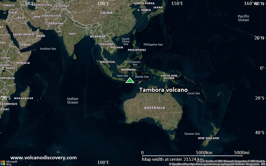
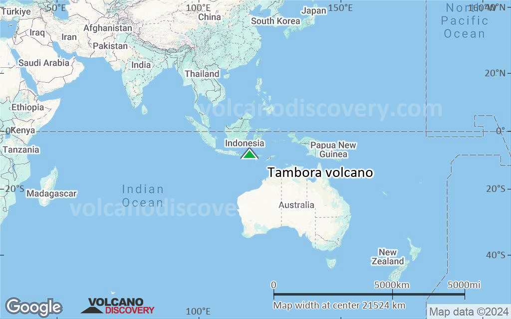
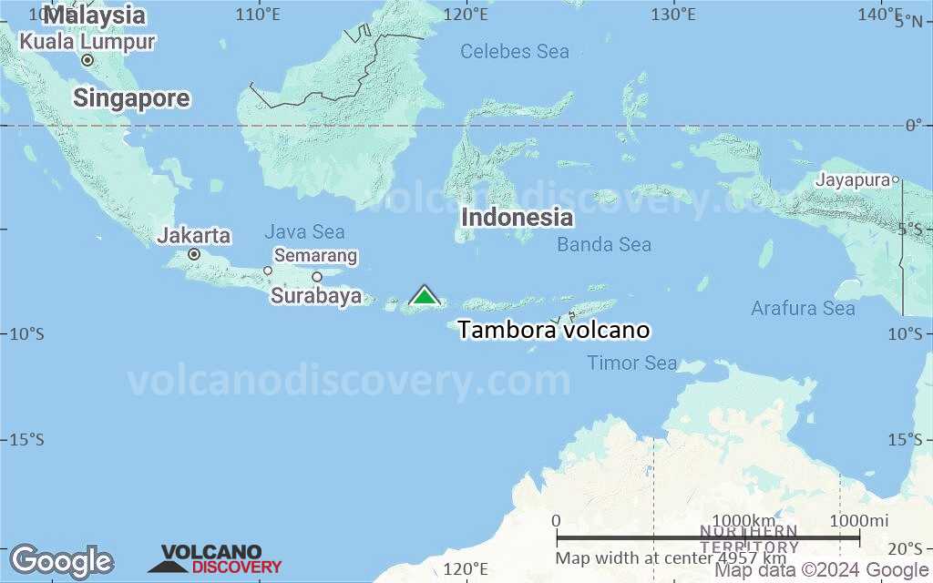
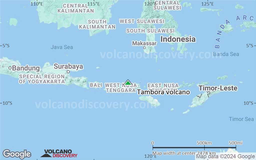
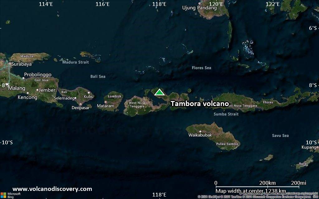
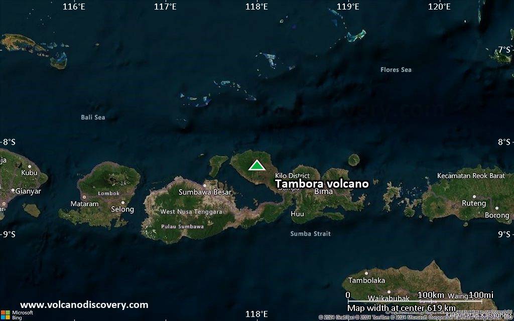
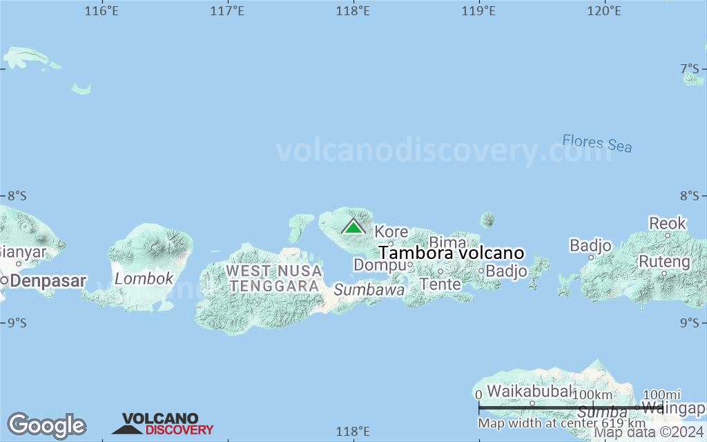
Tambora Volcán Mapas

Below is a selection of maps showing the location and surroundings of the volcano at various resolutions based on aerial-imagery / terrain maps. Feel free to use them for non-commercial purposes on your blog or website as long as you credit them with a link back to this page (click to copy it).
Satellite/aerial-type map of Tambora volcano (world scale)
Terrain-type map of Tambora volcano (world scale)
Satellite/aerial-type map of Tambora volcano (region scale large)
Terrain-type map of Tambora volcano (region scale large)
Satellite/aerial-type map of Tambora volcano (region scale medium)
Terrain-type map of Tambora volcano (region scale medium)
Satellite/aerial-type map of Tambora volcano (region scale small)
Terrain-type map of Tambora volcano (region scale small)
Satellite/aerial-type map of Tambora volcano (local scale large)
Terrain-type map of Tambora volcano (local scale large)
Satellite/aerial-type map of Tambora volcano (local scale medium)
Terrain-type map of Tambora volcano (local scale medium)
Satellite/aerial-type map of Tambora volcano (local scale small)
Terrain-type map of Tambora volcano (local scale small)
Satellite/aerial-type map of Tambora volcano (scale of 10s of km)
Terrain-type map of Tambora volcano (scale of 10s of km)
Satellite/aerial-type map of Tambora volcano (scale of 20-40 km)
Terrain-type map of Tambora volcano (scale of 20-40 km)
Satellite/aerial-type map of Tambora volcano (scale of approx. 10-20 km)
Terrain-type map of Tambora volcano (scale of approx. 10-20 km)
Satellite/aerial-type map of Tambora volcano (scale of 5-10 km)
Satellite/aerial-type map of Tambora volcano (scale of few kilometers)
Volcanoes & Earthquakes - new app for Android
Guaranteed tours
9-25 jun 2025: Volcanoes and Spices - Halmahera N-Sulawesi (Indonesia)
27 jun - 6 jul 2025: Iceland Volcano Special - Iceland
7-22 jul 2025: From Krakatau to Bali - Java (Indonesia)
7-23 jul 2025: Volcanoes and Spices - Halmahera N-Sulawesi (Indonesia)
1-17 ago 2025: Volcanoes and Spices - Halmahera N-Sulawesi (Indonesia)
1-14 oct 2025: Desert, salt and volcanoes - Danakil desert (Ethiopia)
4-12 oct 2025: From Stromboli to Etna - Sicily and Eolian Islands (Italy)
6-21 oct 2025: From Krakatau to Bali - Java (Indonesia)
3-19 nov 2025: Volcanoes and Spices - Halmahera N-Sulawesi (Indonesia)
= spaces available   = guaranteed   = few spaces left   = booked out
sáb, 6 abr 2013, 14:09

Tambora volcano (Sumbawa Island, Indonesia): alert raised to yellow

VSI elevó el nivel de alerta a 2 (Waspada) en una escala de 1-4, pero no especifica la razón (probable aumento de la actividad sísmica). No hay más detalles se conocen por el momento. ... Leer todo
mié, 3 abr 2013, 06:00

Tambora volcano (Sumbawa Island, Indonesia) - Smithsonian / USGS Weekly Volcanic Activity Report for 3 April-9 April 2013 (New Activity / Unrest)

Based on visual observations and seismic data, CVGHM raised the Alert Level for Tambora to 2 (on a scale of 1-4) on 5 April. ... Leer todo

En esta página:

Try our free app!
Volcanoes & Earthquakes - new app for Android
Android | iOS version

More on VolcanoDiscovery

Why is there advertising on this site?

Support us - Help us upgrade our services!

We truly love working to bring you the latest volcano and earthquake data from around the world. Maintaining our website and our free apps does require, however, considerable time and resources.
We need financing to increase hard- and software capacity as well as support our editor team. We're aiming to achieve uninterrupted service wherever an earthquake or volcano eruption unfolds, and your donations can make it happen! Every donation will be highly appreciated. If you find the information useful and would like to support our team in integrating further features, write great content, and in upgrading our soft- and hardware, please make a donation (PayPal).

Planned features:Thanks to your past donations, these features have been added recently:
Download and Upgrade the Volcanoes & Earthquakes app to get one of the fastest seismic and volcano alerts online:
Android | IOS
Thank you!
Sources: VolcanoDiscovery / VolcanoAdventures and other sources as noted.
Use of material: Most text and images on our websites are owned by us. Re-use is generally not permitted without authorization. Contact us for licensing rights.
Volcanoes & Earthquakes
VolcanoDiscovery Home
Volcanes | Sismos | Fotos | News | | Shop | App
Adventure & Study Travel
Tours to Volcanoes and Volcanic Areas: walking tours, photo tours, study tours
Tours & Dates | FAQ | About us
Get our newsletter!
Company info
Contact | Legal info | Terms & conditions
Follow us
Follow us on facebook Follow us on Instagram Follow us on Bluesky Follow us on Twitter Visit our Youtube channel
EN | DE | EL | ES | FR | IT | RU
VolcanoDiscovery GmbH, Germany, Reg. nr.: HRB 103744, EU Tax Id: DE 297 465 123 owned and created by
Dr. Tom Pfeiffer, volcanologist, volcano photographer, tour organizer member of
IAVCEI
IAVCEI
Vulkanologische Gesellschaft
Volcanological Society
Ecotourism Greece
Ecotourism Greece
RUV insurance
Insured by R+V
VolcanoDiscovery © 2004- All Rights Reserved | Privacy - Cookie Settings