| RSS | EN | DE | EL | ES | FR | IT | RU

Volcanes en Nicaragua (23)

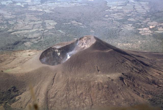
Nicaragua has 19 active volcanoes which form a NW-SE running chain mostly inside the Nicaraguan Depression graben. The volcanoes and graben structure are related to the northeastward subduction of the Cocos Plate beneath the Caribbean Plate along the Middle American Trench.

[ocultar/mostrar sismos] | [menor] [más grande]

Erupciones volcánicas significativas: Nicaragua

In historic times, at least 8 volcanoes have been active en Nicaragua, including San Cristobal, Concepción y Telica volcanoes. A total of 191 eruptions have been witnessed and documented since alrededor de 1524 AD.
The table below lists the most recent volcanic eruptions, significant eruptive episodes or related events en Nicaragua since around 2010.
FechaVolcánVEIRegiónFallecidosDaños
2015 oct 3 - en cursoMasaya
Santiago crater
1Nicaragua
desconocido
2024 jul 5 - jul 7San Cristobal?Nicaragua
desconocido
2024 may 16Concepción?Nicaragua
desconocido
2023 jul 5San Cristobal1Nicaragua
desconocido
2020 dic 27 ? - 2022 jun 26San Cristobal2Nicaragua
desconocido
2021 abr 21 - 2022 mar 29Telica1Nicaragua
desconocido
2020 jul 20 - dic 9Telica1Nicaragua
desconocido
2019 mar 4San Cristobal1Nicaragua
desconocido
2018 jun 21 - ago 15Telica1Nicaragua
desconocido
2018 abr 22San Cristobal1Nicaragua
desconocido
2017 ago 18 - nov 11San Cristobal
Summit crater
3Nicaragua
desconocido
2017 feb 18 - abr 19San Cristobal
Summit crater
1Nicaragua
desconocido
2015 sep 23 - 2016 may 11Telica
Telica crater
2Nicaragua
desconocido
2016 abr 22San Cristobal
Summit crater
2Nicaragua
desconocido
2015 dic 1 - 2016 abr 7Momotombo
Summit crater and NW flank
2Nicaragua
desconocido
2015 mar 5 - jun 12San Cristobal
Summit crater
2Nicaragua
desconocido
2015 may 7 - may 28Telica
Telica crater
2Nicaragua
desconocido
2014 jul 20 - oct 1San Cristobal
Summit crater
1Nicaragua
desconocido
2014 feb 4 - abr 12San Cristobal
Summit crater
1Nicaragua
desconocido
2013 sep 25Telica
Telica crater
1Nicaragua
desconocido
2013 jun 7San Cristobal
Summit crater
1Nicaragua
desconocido
2012 dic 26 - dic 28San Cristobal
Summit crater
2Nicaragua
desconocido
2012 sep 8 - sep 15San Cristobal
Summit crater
2Nicaragua
desconocido
2012 abr 30 - jun 8Masaya
Santiago Crater
1Nicaragua
desconocido
2011 ago 21 ? - oct 23San Cristobal
Summit crater
1Nicaragua
desconocido
2011 mar 7 - jun 14Telica
Southern crater
2Nicaragua
desconocido
2009 dic 11 - 2011 mar 12Concepción1Nicaragua
desconocido
2010 jun 9 - 2011 ene 13San Cristobal
Summit crater
2Nicaragua
desconocido
Remark:
Our list of volcanic eruptions closely follows the database of eruptions of the Smithsonian's Global Volcanism Project (GVP), the internationally most recognized data source for volcanic eruptions, but also includes significant eruptive episodes or related volcano events. "Volcanic eruptions" are usually to be understood as sequences of individual eruptive episodes that can follow each other, or even overlap (if several vents are involved), and can last many years, decades or even longer. For example, the current activity of Stromboli volcano is understood as a single eruption that has been ongoing since 1934.
Fuentes: NOAA National Centers for Environmental Information (NCEI), Global Significant Volcanic Eruptions Database. doi:10.7289/V5TD9V7K | Global Volcanism Project / Smithsonian Institution

Nicaragua FAQ

+When was the last volcanic eruption en Nicaragua?

+When was the first documented volcanic eruption en Nicaragua?

+How often do volcanoes en Nicaragua erupt?

+How active are the volcanoes en Nicaragua?

+When was the largest volcanic eruption en Nicaragua?

Terremotos más recientes: Nicaragua

En los últimos 7 días, Nicaragua tuvo 1 sismo de magnitud 4.4, 14 sismos de magnitud 3+ y 18 sismos de magnitud 2+. También hubo 3 temblores pequeños por debajo de la magnitud 2.0 que la gente normalmente no siente.
Un Magnitud 3.4 sismo ocurrió en Océano Pacífico Norte, Nicaragua .
Fecha y horaMag / Prof.Volcán más cercano / Ubicación
19 abr 17:04 (Costa Rica)
4.4

60 km
121 km SO deOcéano Pacífico Norte, 47 km al norte de Tamarindo, Guanacaste, Costa RicaI FELT IT - 7 reportsMás
19 abr 17:02 (GMT -6)
3.6

17 km
95 km SO deOcéano Pacífico Norte, 99 km al suroeste de Chinandega, Chinandega, NicaraguaI FELT IT Más
19 abr 06:33 (GMT -6)
3.6

98 km
36 km SO deNear Coast of Nicaragua  I FELT IT Más
viernes, 18 abril 2025 GMT (2 sismos)
18 abr 08:35 (GMT -6)
3.9

33 km
59 km S deNear Coast of Nicaragua  I FELT IT Más
18 abr 02:53 (GMT -6)
3.8

35 km
64 km SO deNear Coast of Nicaragua  I FELT IT Más
jueves, 17 abril 2025 GMT (1 sismo)
17 abr 15:20 (Tiempo Universal)
3.8

11 km
216 km SO deOff Coast of Costa Rica  I FELT IT Más

Terremotos significativos en Nicaragua desde 1900


El terremoto más mortífero en Nicaragua desde 1900 fue the magnitude 6.2 earthquake en  Nicaragua, Managua on diciembre, 23, 1972. Resultó en 10,000 muertes y 20,000 personas heridas. Este fue el terremoto más desastroso en Nicaragua jamás registrado. Este también fue el terremoto más dañino que ocurrió en este tiempo: las pérdidas económicas totales se estimaron en el equivalente a $3 mil millones de dólares estadounidenses. Un número desconocido casas y otros edificios fueron destruidos y un número desconocido gravemente dañados.

FechaMagRegiónFallecidosDaños
1992 Sep 27.6 Masachapa; Costa Rica170
pesado
Info
1972 Dec 236.2 Managua10,000
catastrófico
Info
1951 May 66.5El Salvador: Jucuapa1,100
pesado
Info
1931 Mar 315.6 Managua2,450
pesado
Info
1930 Mar 31? Managua1,000
pesado
Info
Fuente: NOAA National Centers for Environmental Information (NCEI), Global Significant Earthquake Database. doi:10.7289/V5TD9V7K

Mapa

Sismos más antiguos (hasta 1960) en amarillo, los más recientes (desde el 2000) en rojo.
[sismos -] [sismos +] [menor] [más grande]

Terremotos significativos en Nicaragua FAQ

+¿Cuál fue el sismo más mortífero? en Nicaragua desde 1900?

+¿Cuántas personas murieron por los sismos en Nicaragua desde 1900?

+¿Cuánto daño causaron los sismos en Nicaragua desde 1900?

Lista de volcanes

Apoyeque

(pyroclastic shield 518 m / 1,699 ft)
Apoyeque volcano forms the broad Chiltepe Peninsula in western Nicaragua and extends into south central Lake Managua
The Apoyeque volcano is part of a larger volcanic complex and consists of a low 500 m high shield cut by a 2.8 km wide and 400 deep lake-filled caldera and a... [más info]

Apoyo

(Caldera 600 m / 1969 ft)
[más info]

Cerro el Ciguatepe

(stratovolcano 603 m / 1,978 ft)
Cerro el Ciguatepe volcano is located in the Nicaraguan interior highlands, east of the Nicaraguan depression and one of several Quarternary volcanoes in this area.
It contains a well-reserved 1.5 km wide summit crater, which contains a blocky lava dome and a young lava fl... [más info]

Cerro Negro

(cinder cones 728 m / 2,388 ft)
Cerro Negro, Central America's youngest volcano was born in April 1850 and is one of the region's most active volcanoes. It has been producing frequent strombolian eruptions, occasional lava fountains and lava flows, and powerful explosive eruptions every few decades.
Cerro... [más info]

Cerro San Jacinto

(Stratovolcano 300 m / 984 ft)
[más info]

Concepción

(stratovolcano 1700 m / 5,577 ft)
The steep stratovolcano Conception in January 2012 (photo: Antony / www.facebook.com/antony.van)
Concepción volcano is a steep symmetrical stratovolcano with a perfect shape and one of the most active volcanoes of Nicaragua. During the past 100 years, it has been in a near-constant state of small to medium ash explosions at irregular intervals.
Together with its neighb... [más info]

Cosigüina

(stratovolcano 872 m / 2,861 ft)
Cosigüina (or Cosegüina) volcano in western Nicaragua forms a large peninsula into the Gulf of Fonseca. The last eruption of the volcano was in 1959, but periods of unrest have occurred in recent years and in 1835, it produced the largest known historic eruption in Nicaragua. más info]

Esteli

(volcanic field 899 m / 2,949 ft)
Esteli volcano is a group of young fissure vents, cones and lava flows located 36 km south of Honduras in the northern interior highlands between the town of Estelí and the border. The volcanic center is not on the main volcanic front of Nicaragua, but 70 km NE of the main volcan... [más info]

Granada

(fissure vents 300+ m / 984 ft)
Granada volcano is a system of N-S trending fissure vents, cinder cones and craters located in western Nicaragua between the city of Granada (the oldest city founded by Europeans on the American continent) on the northwestern shore of Lake Nicaragua and the northern flanks of Mom... [más info]

Las Lajas

(shield volcano 926 m / 3,038 ft)
Las Lajas is a basaltic shield volcano 20 km north of Lake Nicaragua. La Lajas is the youngest of a group of volcanoes east of the Nicaraguan graben. Based on its fresh morphology, it could be still active.
Las Lajas volcano has a 7 km wide and 650 m deep caldera, which co... [más info]

Las Pilas

(volcanic field 1088 m / 3,570 ft)
Las Pilas volcano is a volcanic complex near Cerro Negro volcano 75 km NW of the capital Managua.
The volcano consists of several cones around the central vent, Las Pilas, which contains a 700 m wide and 120 m deep crater and is the site of the recent activity.
El Ho... [más info]

Maderas

(stratovolcano 1394 m / 4,573 ft)
Maderas volcano is a basaltic to dacitic stratovolcano on the SE end of Ometepe island in Lake Nicaragua. It has a a 800 m wide summit crater which contains the small lake Laguna de Maderas at the bottom.
Maderas is still active, but the latest activity dates back more than... [más info]

Malpaisillo

(Pyroclastic shield 181 m / 594 ft)
[más info]

Masaya

(caldera 635 m / 2,083 ft)
Masaya volcano 25 km SE from Managua is one of Nicaragua's most active and usual volcanoes.
In contrast to most other volcanoes in subduction zones, it has been erupting mainly fluid basaltic lava. At the time of the Spanish Conquistadors, it contained an active lava lake ... [más info]

Mombacho

(stratovolcano 1344 m / 4,409 ft)
Mombacho volcano is an active andesitic and basaltic stratovolcano located about 10 km south of the city of Granada, west of Lake Nicaragua and a few kilometers SE of Laguna Apoyo.
A possible historic eruption occurred in 1570, when a debris avalanche destroyed a village on... [más info]

Momotombo

(stratovolcano 1297 m / 4,255 ft)
Momotombo volcano is a symmetrical stratovolcano rising as a peninsula above the NW part of Lake Managua, Nicaragua. It is one of the most known volcanoes of the country.
Momotombo is located at the SE end of the Marrabios Range. It consists of the remnant of an older volca... [más info]

Nejapa-Miraflores

(fissure vents 360 m / 1,181 ft)
Nejapa-Miraflores volcano is an alignment of fissure vents, maars and cinder cones extending from Lake Managua until the western part of Managua city.
About 40 eruptions have occurred from this system during the past 30,000 years, and the most recent one produced Asososca ... [más info]

Rota

(stratovolcano 832 m / 2,730 ft)
Rota (also known as Orota) volcano in Nicaragua is located between the more active Cerro Negro and Telica volcanoes in the central Marrabios Range. It is a symmetrical stratovolcano truncated by a 1 km wide circular crater.
There are no recent eruptions from Rota, and the c... [más info]

San Cristobal

(stratovolcano 1745 m / 5,725 ft)
San Cristobal volcano, also known as El Viejo, is the highest and one of the most active volcanoes in Nicaragua. It is located near the northwest corner of the country near the city of Chinandega, 110 km WSW of the capital Managua.
San Cristobal has had frequent small to m... [más info]

Tambor Grande

(Caldera 648 m / 2126 ft)
[más info]

Telica

(Stratovolcano(es) 1061 m / 3,481 ft)
Telica volcano (image: GVP)
Telica, one of the most active volcanoes in Nicaragua, is a group of overlapping cones and craters on a broad NW line. The most prominent vent is a 700 m wide and 120 m deep double crater at the summit. Its southern summit crater has been the source of Telica's recent eruptions. ... [más info]

Volcán Azul

(cinder cones 201 m / 659 ft)
Volcán Azul (also known as Volcán Blue) a group of 3 cinder cones located on the Atlantic coastal plain of Nicaragua. The volcanic cones are in an area covered by dense rainforest and were discovered during an aerial survey in the 1960s.

Note: There is another más info]

Zapatera

(shield volcano 629 m / 2,064 ft)
Zapatera volcano is a low shield volcano forming a 7 x 10 km wide densely forested island on the western part of Lake Nicaragua. The island is located opposite Mombacho volcano and separated by a narrow strait from the mainland.
Zapatera volcano... [más info]
Volcanoes & Earthquakes - new app for Android
Tours garantizados
9-25 jun 2025: Volcanoes and Spices - Halmahera N-Sulawesi (Indonesia)
27 jun - 6 jul 2025: Iceland Volcano Special - Iceland
7-23 jul 2025: Volcanoes and Spices - Halmahera N-Sulawesi (Indonesia)
1-17 ago 2025: Volcanoes and Spices - Halmahera N-Sulawesi (Indonesia)
1-14 oct 2025: Desert, salt and volcanoes - Danakil desert (Ethiopia)
4-12 oct 2025: From Stromboli to Etna - Sicily and Eolian Islands (Italy)
3-19 nov 2025: Volcanoes and Spices - Halmahera N-Sulawesi (Indonesia)
= spaces available   = guaranteed   = few spaces left   = booked out
Últimas noticias
mié, 5 mar 2025, 15:00

Telica volcano (Nicaragua) - Smithsonian / USGS Weekly Volcanic Activity Report for 26 February-4 March 2025 (New Activity / Unrest)

Based on webcam and satellite images, the Washington VAAC reported that at 0720 on 25 February a narrow plume from Telica, possibly containing ash, extended more than 11 km SW at an altitude of 1.2 km (4,000 ft) a.s.l. ... Leer todo
mié, 26 feb 2025, 15:00

Telica volcano (Nicaragua) - Smithsonian / USGS Weekly Volcanic Activity Report for 19 February-25 February 2025 (New Activity / Unrest)

Based on webcam and satellite images, the Washington VAAC reported that on 19 and 22 February ash emissions at Telica rose as high as 1.5 km (5,000 ft) a.s.l. and drifted SW and W. ... Leer todo
Try our free app!
Volcanoes & Earthquakes - new app for Android
Android | iOS version

More on VolcanoDiscovery

Why is there advertising on this site?

Support us - Help us upgrade our services!

We truly love working to bring you the latest volcano and earthquake data from around the world. Maintaining our website and our free apps does require, however, considerable time and resources.
We need financing to increase hard- and software capacity as well as support our editor team. We're aiming to achieve uninterrupted service wherever an earthquake or volcano eruption unfolds, and your donations can make it happen! Every donation will be highly appreciated. If you find the information useful and would like to support our team in integrating further features, write great content, and in upgrading our soft- and hardware, please make a donation (PayPal).

Planned features:Thanks to your past donations, these features have been added recently:
Download and Upgrade the Volcanoes & Earthquakes app to get one of the fastest seismic and volcano alerts online:
Android | IOS
Thank you!
Sources: VolcanoDiscovery / VolcanoAdventures and other sources as noted.
Use of material: Most text and images on our websites are owned by us. Re-use is generally not permitted without authorization. Contact us for licensing rights.
Volcanoes & Earthquakes
VolcanoDiscovery Home
Volcanes | Sismos | Fotos | News | | Shop | App
Adventure & Study Travel
Tours to Volcanoes and Volcanic Areas: walking tours, photo tours, study tours
Tours & Dates | FAQ | About us
Get our newsletter!
Company info
Contact | Legal info | Terms & conditions
Follow us
Follow us on facebook Follow us on Instagram Follow us on Bluesky Follow us on Twitter Visit our Youtube channel
EN | DE | EL | ES | FR | IT | RU
VolcanoDiscovery GmbH, Germany, Reg. nr.: HRB 103744, EU Tax Id: DE 297 465 123 owned and created by
Dr. Tom Pfeiffer, volcanologist, volcano photographer, tour organizer member of
IAVCEI
IAVCEI
Vulkanologische Gesellschaft
Volcanological Society
Ecotourism Greece
Ecotourism Greece
RUV insurance
Insured by R+V
VolcanoDiscovery © 2004- All Rights Reserved | Privacy - Cookie Settings