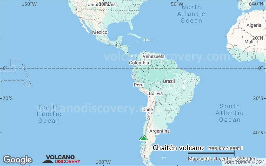
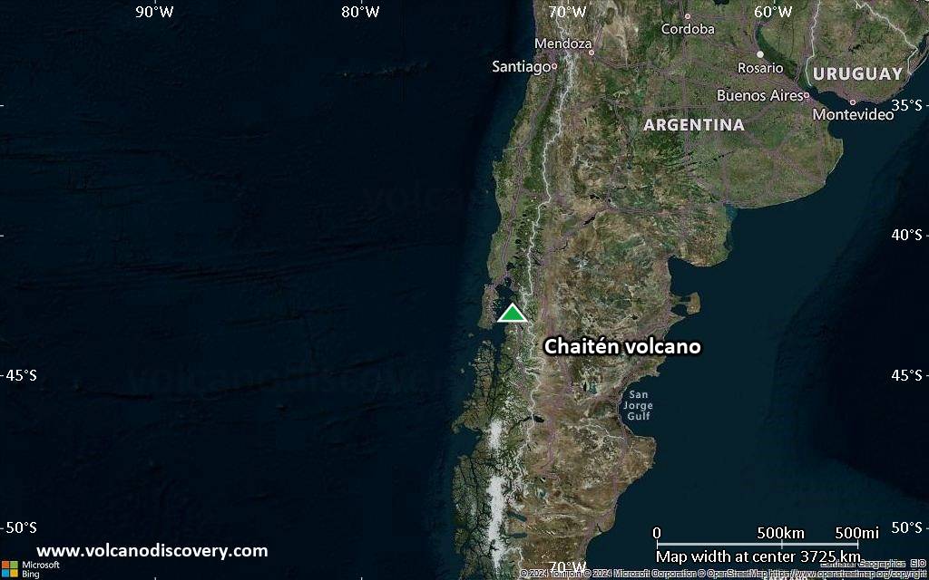
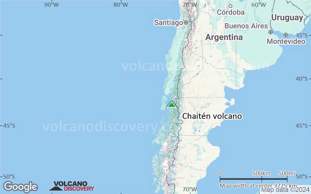
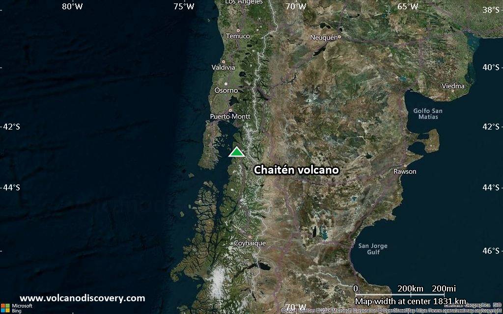
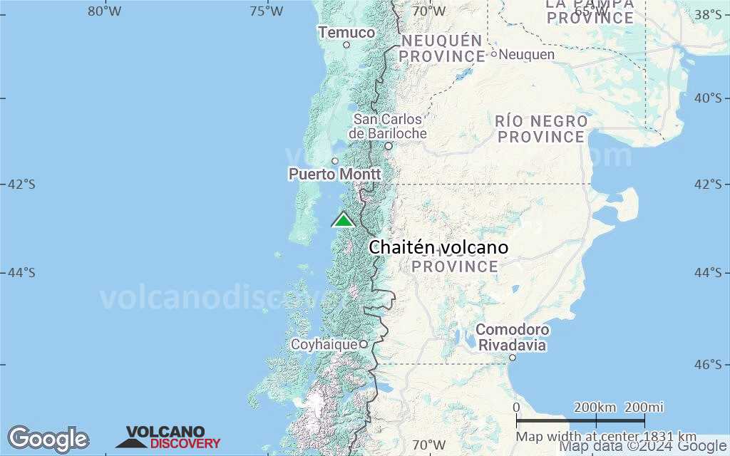
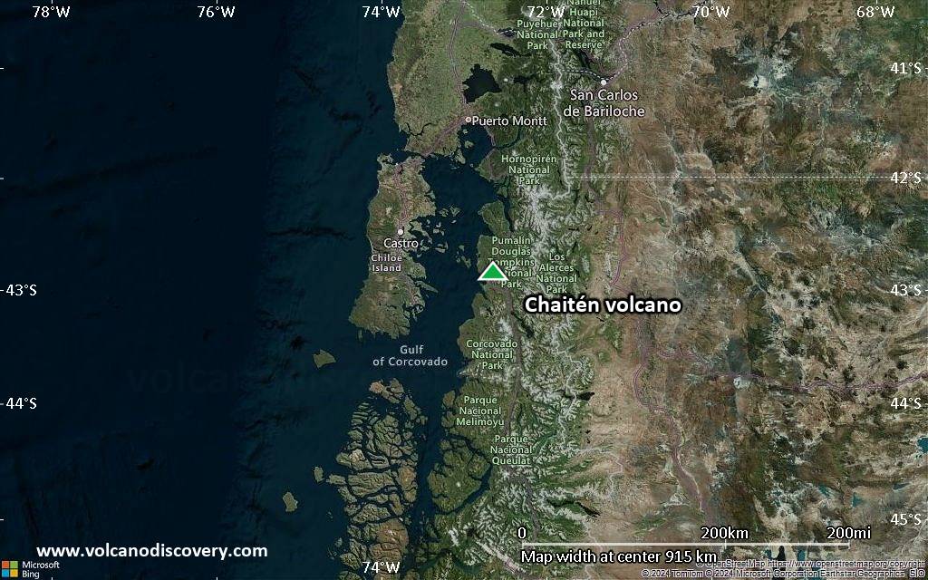
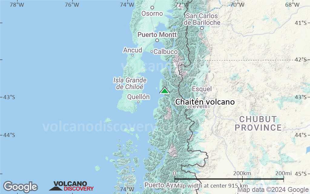
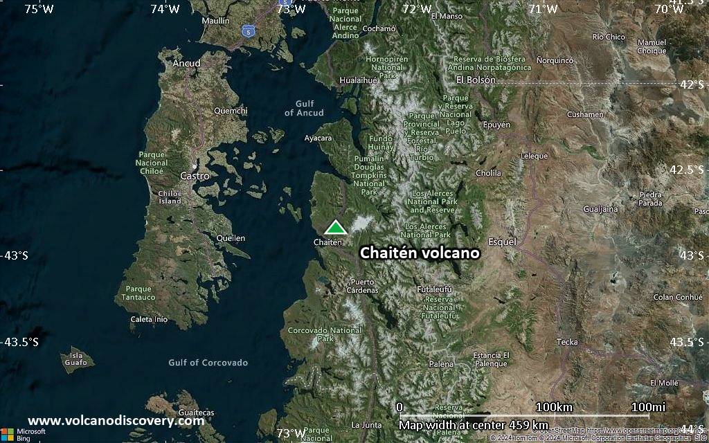
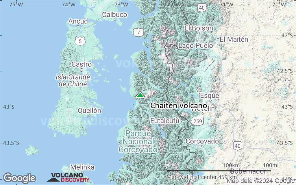
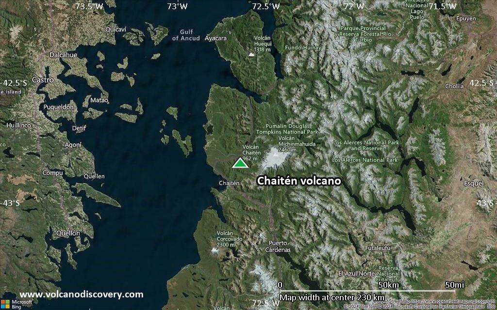
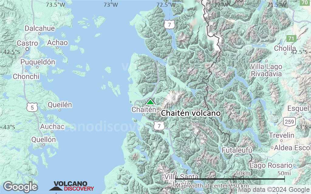
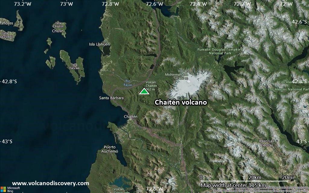
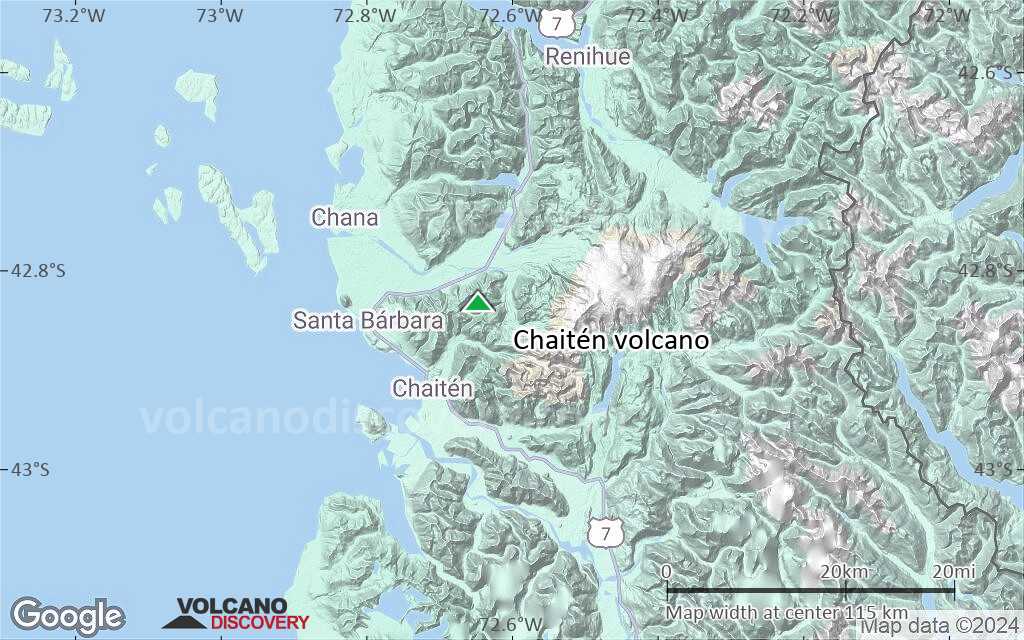
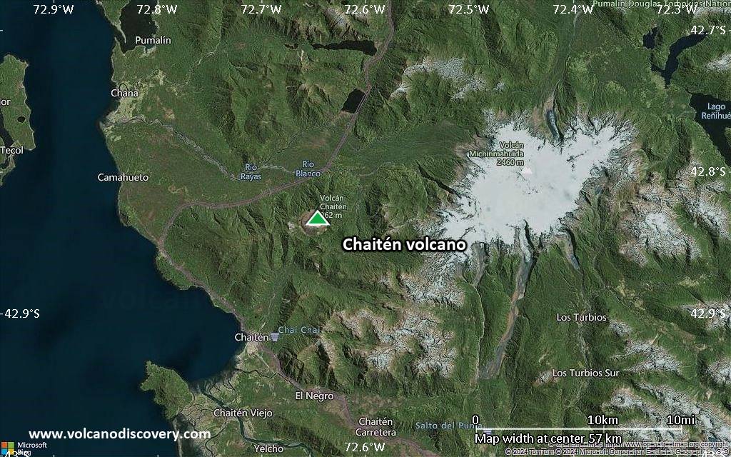
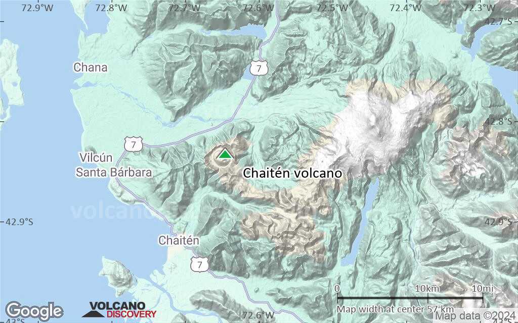
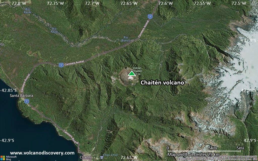
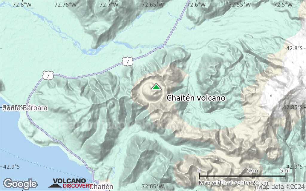
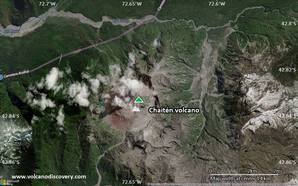
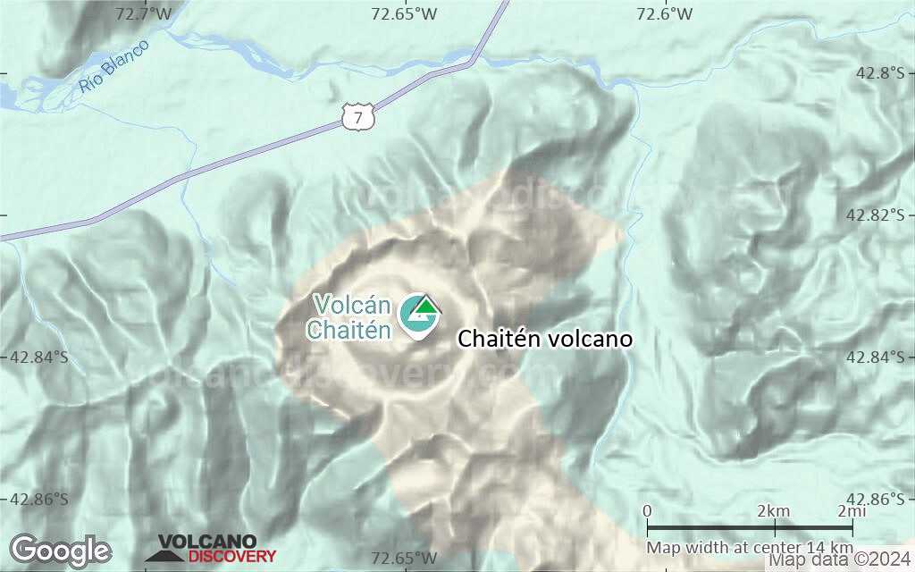
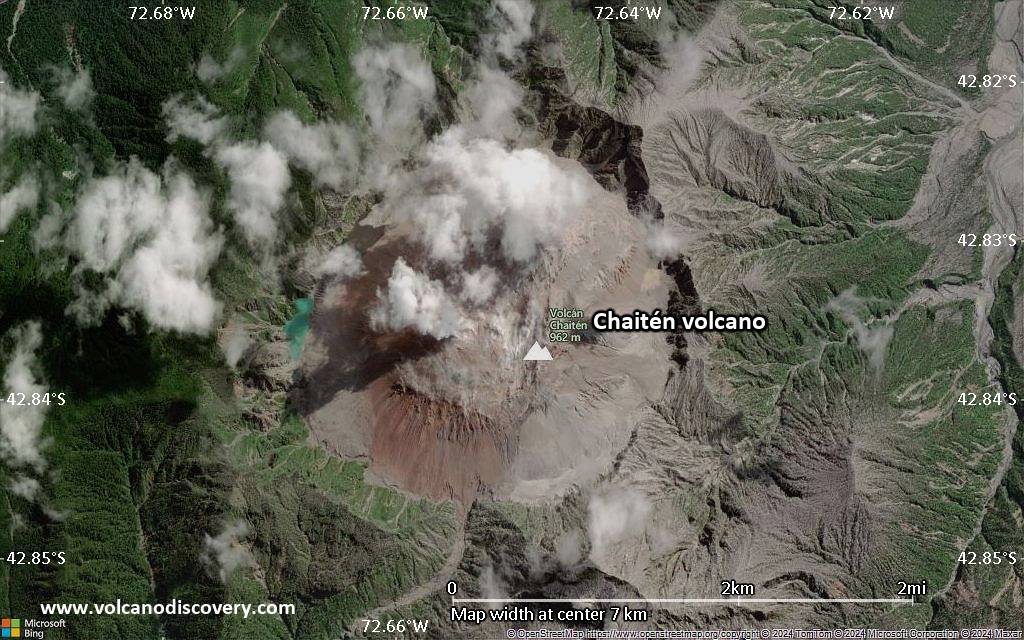
| RSS | EN | DE | EL | ES | FR | IT | RU

Chaitén Volcán

Updated: 25 abr. 2025 22:43 GMT -
Caldera, lava dome
Sur de Chile y Argentina (Sur America), -42.83°S / -72.65°W
Summit height: 1122 m
Current status: normal or dormant (1 out of 5)
Last update: 11 dic 2021
Image of the rhyolitic lava dome of Chaitén Volcano during its 2008-2010 eruption (photo: Sam Beebe)

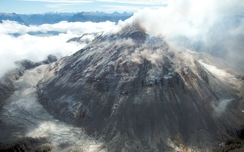
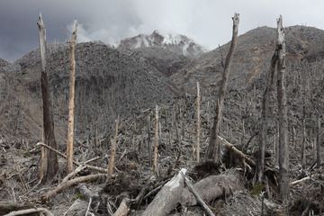
Chaiten is a caldera volcano in southern Chile that had its first historic eruption on May 2, 2008 when it erupted violently. Ash fall and lahars during the eruption largely damaged the town of Chaitén, which had been evacuated as the eruption started.

[smaller] [larger]
Typical eruption style: Explosive, lava dome growth
Erupciones del volcán Chaitén: 2 May 2008 (plinian eruption) - 2011

Latest nearby earthquakes

Fecha y horaMag / Prof.Distancia / Ubicación

Background

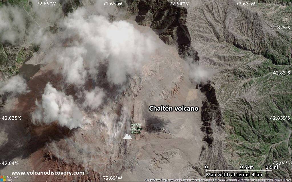
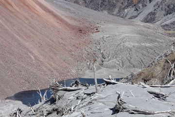
Chaitén is a small, glacier-free late-Pleistocene caldera with a Holocene lava dome located 10 km NE of the town of Chaitén on the Gulf of Corcovado. The north side of the rhyolitic, 962-m-high obsidian lava dome occupying the 3.5-km-wide caldera is unvegetated. Obsidian cobbles from this dome found in the Blanco River are the source of prehistorical artifacts from archaeological sites along the Pacific coast as far as 400 km away from the volcano to the north and south. The caldera is breached on the SW side by a river that drains to the bay of Chaitén, and the high point on its southern rim reaches 1,122 m. Two small lakes occupy the caldera floor on the west and north sides of the lava dome. Moreno (1985 pers. comm.) noted that the nearby volcano of Yelcho listed by the International Association of Volcanology and Chemistry of the Earth's Interior (1973) does not exist.
---
Source: Global Volcanism Program at www.volcano.si.edu/world/volcano.cfm

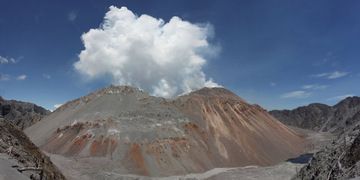
Chaitén Volcano Photos

Erupciones volcánicas significativas: Chaitén volcano

In the past 10,000 years, Chaitén has had only one confirmed historic eruption during 2008 - 2011, but at least 4 eruptions can be inferred from geological evidence.
The table below lists all known eruptions (date in bold face) of Chaitén volcano in historic times and during the past 10,000 years. Updates on the most recent volcanic activity of Chaitén can be found on the news page of Chaitén volcano.
FechaNotaVEIFallecidosDaños
2008 may 2 - 2011 may 31 ±3 d.
Obs. históricas/documentos
4
desconocido
2008 may 2
(erupción 2008 may 2 - 2011 may 31 ±3 d.)
01
desconocido
Información
1640 ±18 y. AD4?
desconocido
3100 ±220 y. BC5
desconocido
6650 ±1300 y. BC?
desconocido
7750 ±200 y. BC5
desconocido
Remark:
Our list of volcanic eruptions closely follows the database of eruptions of the Smithsonian's Global Volcanism Project (GVP), the internationally most recognized data source for volcanic eruptions, but also includes significant eruptive episodes or related volcano events. "Volcanic eruptions" are usually to be understood as sequences of individual eruptive episodes that can follow each other, or even overlap (if several vents are involved), and can last many years, decades or even longer. For example, the current activity of Stromboli volcano is understood as a single eruption that has been ongoing since 1934.
Fuentes: NOAA National Centers for Environmental Information (NCEI), Global Significant Volcanic Eruptions Database. doi:10.7289/V5TD9V7K | Global Volcanism Project / Smithsonian Institution

Chaitén Volcano FAQ

+When was the last eruption of Chaitén volcano?

+How often does Chaitén volcano erupt?

+How active is Chaitén volcano at present?

+When was the largest eruption of Chaitén volcano?

Últimas imágenes satelitales

Chait%C3%A9n imagen satelital sat1Chait%C3%A9n imagen satelital sat2

Chaitén Volcán Mapas

Below is a selection of maps showing the location and surroundings of the volcano at various resolutions based on aerial-imagery / terrain maps. Feel free to use them for non-commercial purposes on your blog or website as long as you credit them with a link back to this page (click to copy it).
Satellite/aerial-type map of Chaitén volcano (world scale)
Terrain-type map of Chaitén volcano (world scale)
Satellite/aerial-type map of Chaitén volcano (region scale large)
Terrain-type map of Chaitén volcano (region scale large)
Satellite/aerial-type map of Chaitén volcano (region scale medium)
Terrain-type map of Chaitén volcano (region scale medium)
Satellite/aerial-type map of Chaitén volcano (region scale small)
Terrain-type map of Chaitén volcano (region scale small)
Satellite/aerial-type map of Chaitén volcano (local scale large)
Terrain-type map of Chaitén volcano (local scale large)
Satellite/aerial-type map of Chaitén volcano (local scale medium)
Terrain-type map of Chaitén volcano (local scale medium)
Satellite/aerial-type map of Chaitén volcano (local scale small)
Terrain-type map of Chaitén volcano (local scale small)
Satellite/aerial-type map of Chaitén volcano (scale of 10s of km)
Terrain-type map of Chaitén volcano (scale of 10s of km)
Satellite/aerial-type map of Chaitén volcano (scale of 20-40 km)
Terrain-type map of Chaitén volcano (scale of 20-40 km)
Satellite/aerial-type map of Chaitén volcano (scale of approx. 10-20 km)
Terrain-type map of Chaitén volcano (scale of approx. 10-20 km)
Satellite/aerial-type map of Chaitén volcano (scale of 5-10 km)
Satellite/aerial-type map of Chaitén volcano (scale of few kilometers)
Volcanoes & Earthquakes - new app for Android
Guaranteed tours
9-25 jun 2025: Volcanoes and Spices - Halmahera N-Sulawesi (Indonesia)
27 jun - 6 jul 2025: Iceland Volcano Special - Iceland
7-22 jul 2025: From Krakatau to Bali - Java (Indonesia)
7-23 jul 2025: Volcanoes and Spices - Halmahera N-Sulawesi (Indonesia)
1-17 ago 2025: Volcanoes and Spices - Halmahera N-Sulawesi (Indonesia)
1-14 oct 2025: Desert, salt and volcanoes - Danakil desert (Ethiopia)
4-12 oct 2025: From Stromboli to Etna - Sicily and Eolian Islands (Italy)
6-21 oct 2025: From Krakatau to Bali - Java (Indonesia)
3-19 nov 2025: Volcanoes and Spices - Halmahera N-Sulawesi (Indonesia)
= spaces available   = guaranteed   = few spaces left   = booked out
vie, 22 may 2015, 07:01

Chaitén volcano (Chile): alert level raised, seismic unrest

El nivel de alerta del volcán fue elevado a "amarillo", después de que se detectó un incremento en la actividad sísmica. Leer todo

En esta página:

Try our free app!
Volcanoes & Earthquakes - new app for Android
Android | iOS version

More on VolcanoDiscovery

Why is there advertising on this site?

Support us - Help us upgrade our services!

We truly love working to bring you the latest volcano and earthquake data from around the world. Maintaining our website and our free apps does require, however, considerable time and resources.
We need financing to increase hard- and software capacity as well as support our editor team. We're aiming to achieve uninterrupted service wherever an earthquake or volcano eruption unfolds, and your donations can make it happen! Every donation will be highly appreciated. If you find the information useful and would like to support our team in integrating further features, write great content, and in upgrading our soft- and hardware, please make a donation (PayPal).

Planned features:Thanks to your past donations, these features have been added recently:
Download and Upgrade the Volcanoes & Earthquakes app to get one of the fastest seismic and volcano alerts online:
Android | IOS
Thank you!
Sources: VolcanoDiscovery / VolcanoAdventures and other sources as noted.
Use of material: Most text and images on our websites are owned by us. Re-use is generally not permitted without authorization. Contact us for licensing rights.
Volcanoes & Earthquakes
VolcanoDiscovery Home
Volcanes | Sismos | Fotos | News | | Shop | App
Adventure & Study Travel
Tours to Volcanoes and Volcanic Areas: walking tours, photo tours, study tours
Tours & Dates | FAQ | About us
Get our newsletter!
Company info
Contact | Legal info | Terms & conditions
Follow us
Follow us on facebook Follow us on Instagram Follow us on Bluesky Follow us on Twitter Visit our Youtube channel
EN | DE | EL | ES | FR | IT | RU
VolcanoDiscovery GmbH, Germany, Reg. nr.: HRB 103744, EU Tax Id: DE 297 465 123 owned and created by
Dr. Tom Pfeiffer, volcanologist, volcano photographer, tour organizer member of
IAVCEI
IAVCEI
Vulkanologische Gesellschaft
Volcanological Society
Ecotourism Greece
Ecotourism Greece
RUV insurance
Insured by R+V
VolcanoDiscovery © 2004- All Rights Reserved | Privacy - Cookie Settings