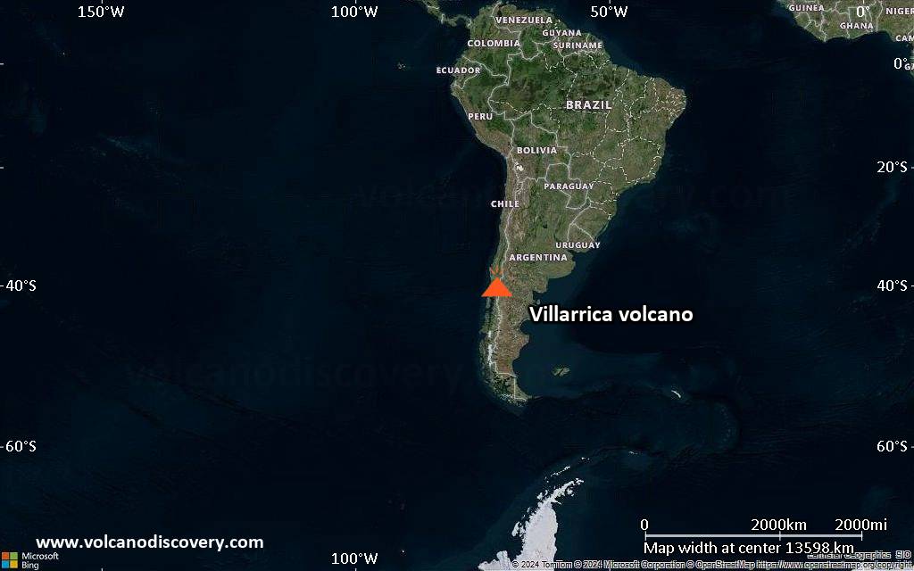
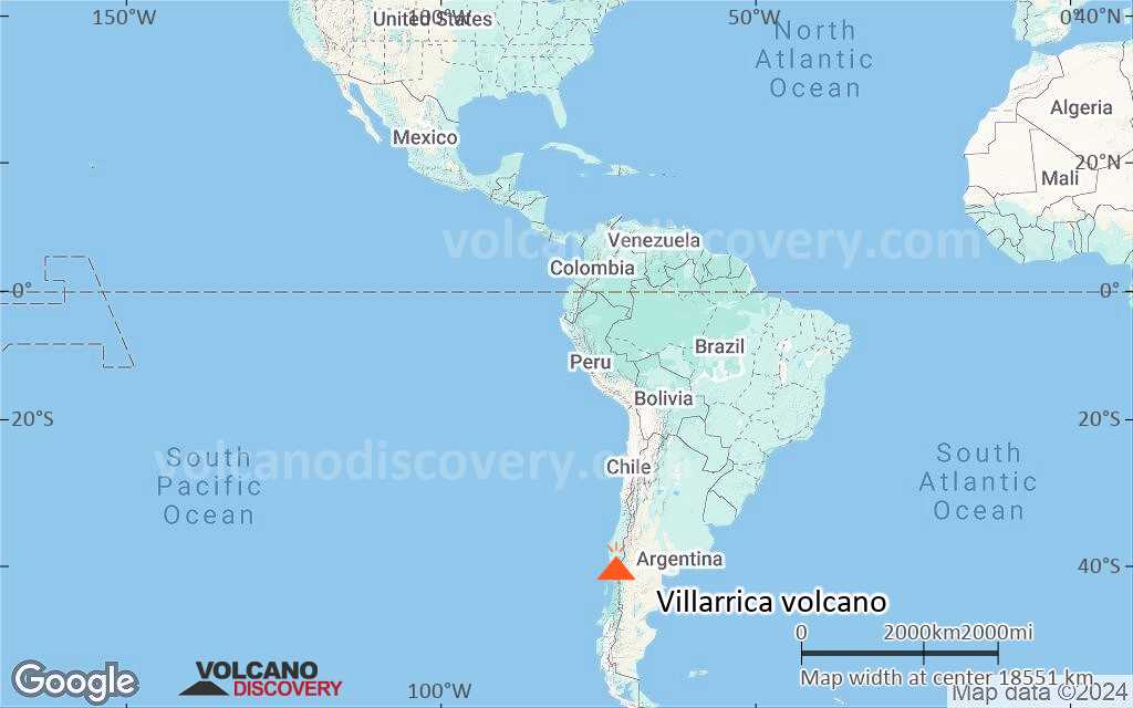
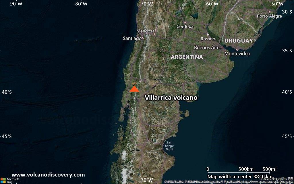
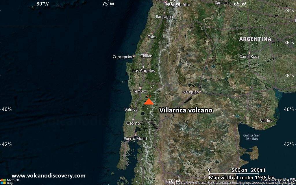
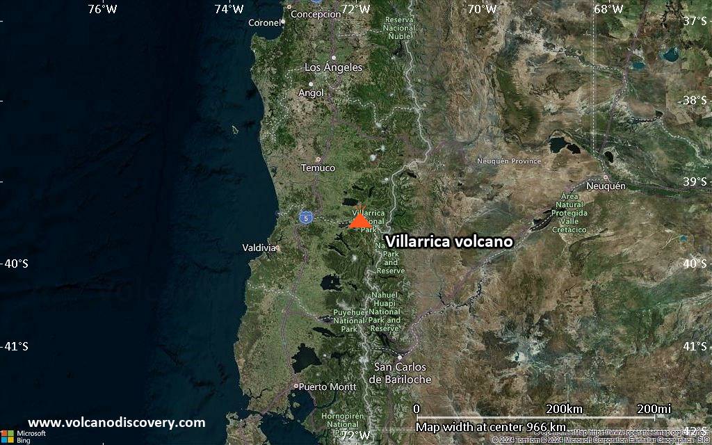
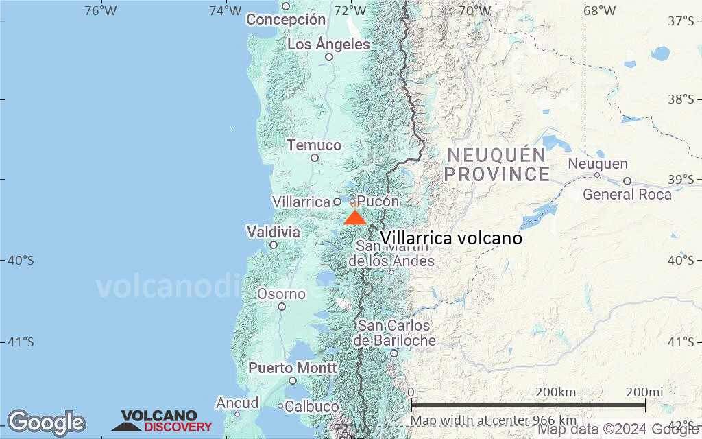
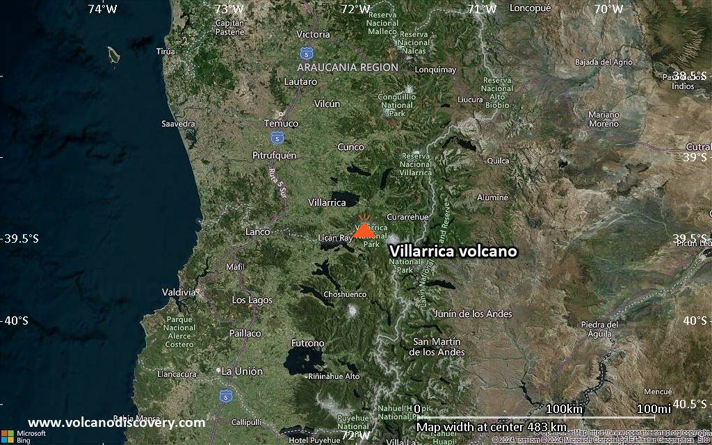
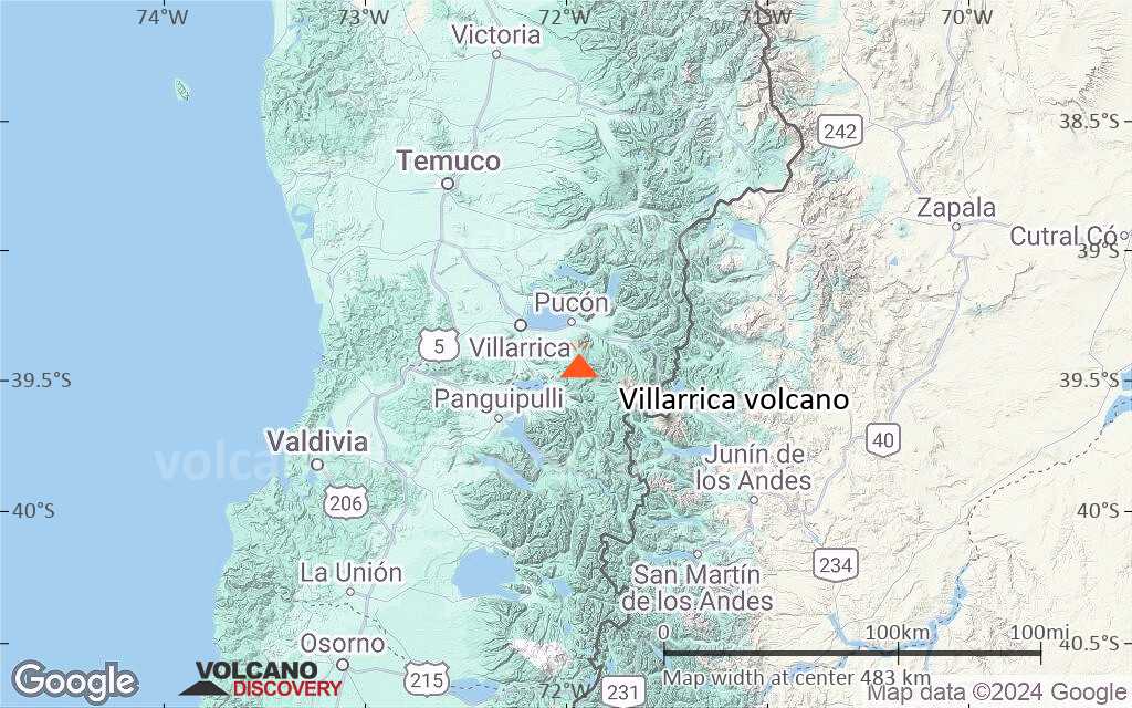
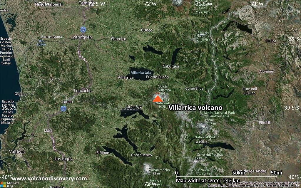
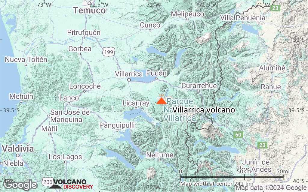
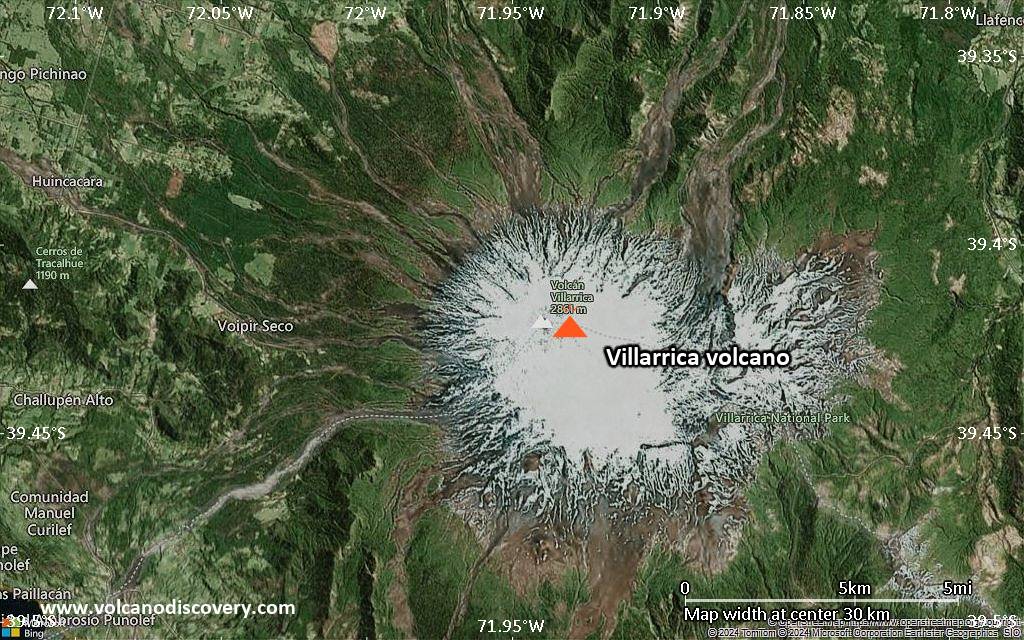
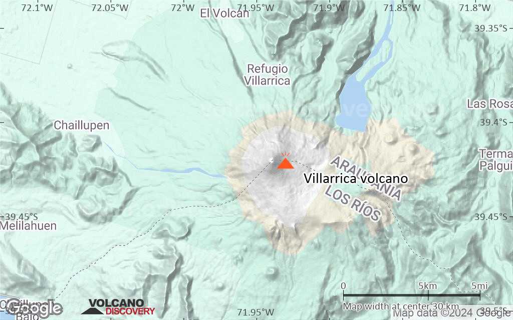
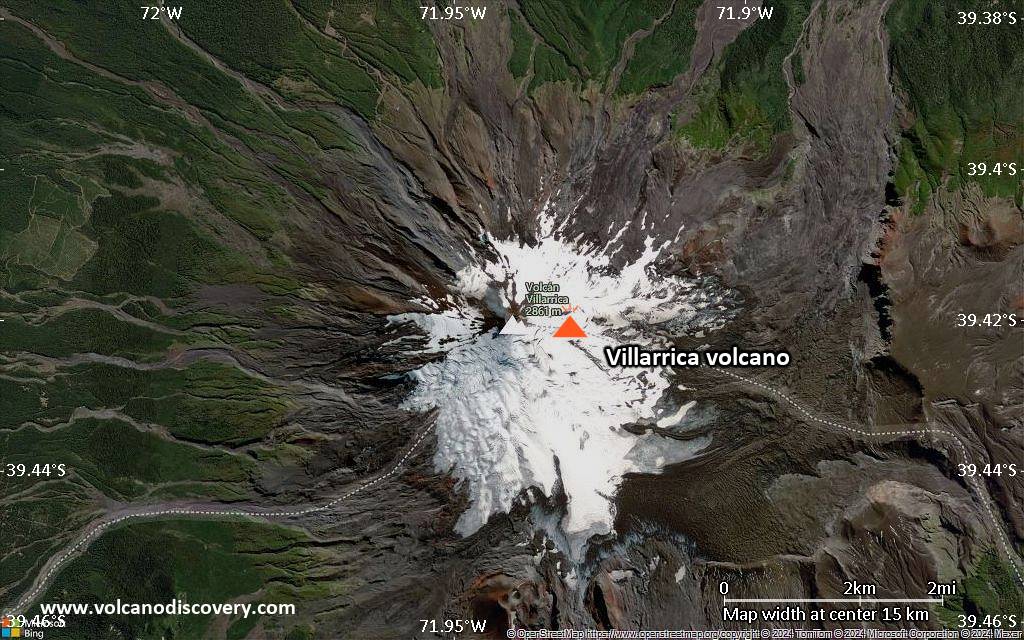
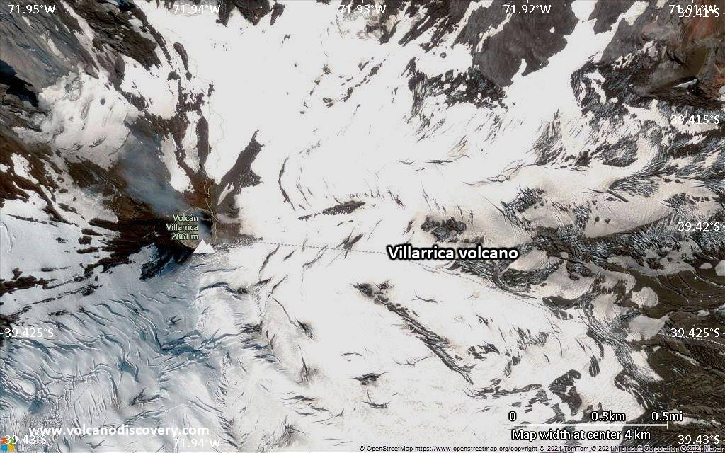
| RSS | EN | DE | EL | ES | FR | IT | RU

Villarrica Vulkan

Updated: 24. Apr. 2025 02:56 GMT -
Stratovolcano
Central Chile, -39.42°S / -71.93°W
Summit height: 2847 m / 9,340 ft
Aktueller Status: Schwache Aktivität oder Ausbruchswarnung (3 von 5)
Last update: 15 Jan 2025 (Smithsonian / USGS Weekly Volcanic Activity Report)

Snow-covered Villarrica, one of Chile's most active volcanoes, rises above the lake and town of the same name. It erupts basaltic lava and is one of the few permanently active volcanoes in the world, with frequent strombolian activity and sometimes a small lava lake present in its summit crater.

[smaller] [larger]
Typische Aktivität: Mildly explosive, strombolian activity, small lava lake in the summit crater
Ausbrüche des Villarrica: 2010-2012, 2008, 2005, 1985-2001 (lava lake), 1984-85, 1983, 1980, 1977, 1971-72, 1964, 1963(?), 1960-61, 1958-59, 1950(?), 1948-49, 1938, 1935, 1933, 1929, 1921, 1920-29, 1919(?), 1915-18(?), 1910?, 1909, 1908, 1907, 1906, 1904, 1897-98(?), 1893-94(?), 1883, 1879, 1877, 1875-76, 1874, 1869(?), 1867-68, 1864, 1859-60, 1853, 1852(?), 1837, 1832, 1822, 1815-18, 1806, 1801, 1799, 1796, 1792, 1790, 1787, 1780, 1777, 1759, 1751, 1745, 1742, 1737, 1716, 1688, 1657?, 1647?, 1640, 1594, 1562, 1558

Letzte Erdbeben in der Nähe

Datum und UhrzeitMag / TiefeDistanz / Ort
20. Apr. 22:06 (GMT -4)
3.3

103 km
27 km südwestlich 15 km nordöstlich von Panguipulli, Valdivia, Región de Los Ríos, ChileI FELT IT Info

Beschreibung

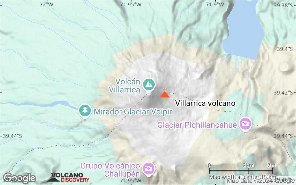
The volcano is also known as Rucapillán, a Mapuche word meaning "House of the Pillán". It is the westernmost of three large stratovolcanoes that trend perpendicular to the Andean chain along the Gastre Fault.
The volcanic edifice was built at the rim of two overlapping calderas: one 6-km wide caldera formed about 10,000 years ago, and a second, 2 km wide caldera about 3500 years ago. The volcano is located at the NW margin of the older caldera. More than 30 scoria cones and fissure vents dot Villarrica's flanks. Plinian eruptions and pyroclastic flows that have extended up to 20 km from the volcano have been produced during the past few thousands years. Lava flows up to 18 km long have issued from summit and flank vents. Historical eruptions, documented since 1558, have consisted largely of mild-to-moderate explosive activity with occasional lava effusion. Glaciers cover 40 sq km of the volcano. Hazards from Villarrica include massive lahars (mud flows) caused by melting of snow and glacier ice as well as rainfalls, such as during the eruptions of 1964 and 1971 when large lahars damaged towns on its flanks.
Villarrica, along with Quetrupillán and the Chilean portion of Lanín, are protected within Villarrica National Park. Ascents of the volcano are popular with several guided ascents reaching the top during summer.

Bedeutende Vulkanausbrüche: Villarrica volcano

In the past 10,000 years, Villarrica has had at least 152 confirmed volcanic eruptions, out of which 74 are documented by historical records, while the others can be inferred from geological evidence.
Additionally, there are 12 uncertain or discredited eruptions from Villarrica volcano.
The table below lists all known eruptions (date in bold face) of Villarrica volcano since around 1900. Updates on the most recent volcanic activity of Villarrica can be found on the news page of Villarrica volcano.
DatumHinweisVEITodesopferSchaden
2014 Dez 2 ±7 d. - anhaltendSummit crater
Hist. dokumentiert
3
unbekannt
2013 Jul 25 - Jul 29 ?Summit crater
Hist. dokumentiert
1
unbekannt
?? 2012 Nov 14
Unsicherer Ausbruch
Hist. dokumentiert
1
unbekannt
2009 Nov 22 - 2012 Apr 20
Hist. dokumentiert
1
unbekannt
2009 Jan 29 - Mär 24 ?
Hist. dokumentiert
1
unbekannt
2008 Okt 26
Hist. dokumentiert
1
unbekannt
2004 Aug 5 ? - 2007 Dez 24 ?
Hist. dokumentiert
1
unbekannt
2003 Mai 23 ? - 2004 Mär 25 ?
Hist. dokumentiert
1
unbekannt
1998 Feb 24 ±4 d. - 2002 Jun 16 ±15 d.
Hist. dokumentiert
1
unbekannt
1996 Sep 14 - 1997 Aug 16 ±15 d.
Hist. dokumentiert
1
unbekannt
1996 Jan 16 ±15 d.
Hist. dokumentiert
1
unbekannt
1995 Apr 15 ±5 d. - Jun 2 oder danach
Hist. dokumentiert
1
unbekannt
1994 Sep 26 - Dez 30
Hist. dokumentiert
1
unbekannt
1992 Sep 11 - Dez 16 ±15 d.
Hist. dokumentiert
1
unbekannt
1991 Aug 30 - Sep 17
Hist. dokumentiert
2
unbekannt
1984 Aug 11 - 1985 Nov 18
Hist. dokumentiert
2
unbekannt
1983 Okt 14 - Okt 16
Hist. dokumentiert
1
unbekannt
1980 Jun 20 - Sep 24
Hist. dokumentiert
2
unbekannt
1977 Jan 26 - Jan 30
Hist. dokumentiert
1
unbekannt
1971 Okt 29 - 1972 Feb 21Summit, NE and SW flanks
Hist. dokumentiert
2
unbekannt
1971 Okt 29
(Ausbruch 1971 Okt 29 - 1972 Feb 21)
Hist. dokumentiert
215
unbekannt
Info
1964 Mär 2 - Apr 21
Hist. dokumentiert
2
unbekannt
1964 Mär 3
(Ausbruch 1964 Mär 2 - Apr 21)
Hist. dokumentiert
225
unbekannt
Info
1963 Feb 25 ? - Sep 21 oder danachSummit and upper SW flank
Hist. dokumentiert
3?
unbekannt
1963 Mai 21
(Ausbruch 1963 Feb 25 ? - Sep 21 oder danach)
Hist. dokumentiert
21-50 (*)
unbekannt
Info
1961 Jul 2 ±182 d.
Hist. dokumentiert
1
unbekannt
?? 1960 Jul 2 ±182 d.
Unsicherer Ausbruch
1?
unbekannt
1958 Nov 6 - 1959 Dez 21
Hist. dokumentiert
1
unbekannt
1956 Okt 3 - Nov 16 ±45 d.
Hist. dokumentiert
1
unbekannt
?? 1950 Jul 2 ±182 d.
Unsicherer Ausbruch
?
unbekannt
1948 Okt 9 - 1949 Feb 3
Hist. dokumentiert
3
unbekannt
1949 Jan 1
(Ausbruch 1948 Okt 9 - 1949 Feb 3)
Hist. dokumentiert
354
mittel
Info
1948 Apr 10
Hist. dokumentiert
2?
unbekannt
1947
Hist. dokumentiert
1
unbekannt
1938 Dez 1 ±30 d. - 1939 Feb 1 ±30 d.
Hist. dokumentiert
2
unbekannt
?? 1938 Feb 11
Unsicherer Ausbruch
1?
unbekannt
1935 Dez 1 ±30 d. - 1936 Jun 27
Hist. dokumentiert
1?
unbekannt
1933 Jan 5 - Jan 18 ±12 d.
Hist. dokumentiert
2
unbekannt
1929 Dez 27
Hist. dokumentiert
1
unbekannt
1927 - 1928
Hist. dokumentiert
2
unbekannt
1922 Okt 24 - Nov 27 ±20 d.
Hist. dokumentiert
2
unbekannt
?? 1921 Dez 10
Unsicherer Ausbruch
2?
unbekannt
1920 Dez 10 - Dez 13
Hist. dokumentiert
2
unbekannt
?? 1919
Unsicherer Ausbruch
?
unbekannt
1915 - 1918
Hist. dokumentiert
1
unbekannt
1913
Diskreditierter Ausbruch
1909 Aug 19 - 1910
Hist. dokumentiert
2
unbekannt
1908 Okt 31 - Dez 12 ?
Hist. dokumentiert
2
unbekannt
1907 Mai 5 ±4 d. - Mai 26 ?
Hist. dokumentiert
2
unbekannt
1906 Apr 22 - Dez
Hist. dokumentiert
2
unbekannt
1904
Hist. dokumentiert
2
unbekannt
19022?
unbekannt
(*) Geschätzte Zahlen
Anmerkung:
Unsere Liste von Vulkanausbrüchen orientiert sich eng an der Datenbank des Global Volcanism Project (GVP) des Smithsonian Instituts, der international anerkanntesten globalen Datenquelle für Vulkanausbrüche. Sie schließt aber auch bedeutende Eruptionsepisoden oder damit zusammenhängende Vulkanereignisse ein. Unter "Vulkanausbrüchen" versteht man in der Regel meist Serien einzelner Eruptionsepisoden, die zeitlich aufeinander folgen oder sich (bei mehreren beteiligten Ausbruchspunkten an einem Vulkan) auch überlappen können und unter Umständen viele Jahre, Jahrzehnte oder noch länger andauern können. So ist z.B. die aktuelle Tätigkeit des Stromboli als ein einziger Ausbruch verstanden, der seit 1934 anhält.
Quellen: NOAA National Centers for Environmental Information (NCEI), Global Significant Volcanic Eruptions Database. doi:10.7289/V5TD9V7K | Global Volcanism Project / Smithsonian Institution

Villarrica Volcano FAQ

+When was the last eruption of Villarrica volcano?

+How often does Villarrica volcano erupt?

+How active is Villarrica volcano at present?

+When was the largest eruption of Villarrica volcano?

Neueste Satellitenbilder

Villarrica Satellitenbild sat1Villarrica Satellitenbild sat2

Villarrica Vulkan Karten

Below is a selection of maps showing the location and surroundings of the volcano at various resolutions based on aerial-imagery / terrain maps. Feel free to use them for non-commercial purposes on your blog or website as long as you credit them with a link back to this page (click to copy it).
Satellite/aerial-type map of Villarrica volcano (world scale)
Terrain-type map of Villarrica volcano (world scale)
Satellite/aerial-type map of Villarrica volcano (region scale large)
Terrain-type map of Villarrica volcano (region scale large)
Satellite/aerial-type map of Villarrica volcano (region scale medium)
Terrain-type map of Villarrica volcano (region scale medium)
Satellite/aerial-type map of Villarrica volcano (region scale small)
Terrain-type map of Villarrica volcano (region scale small)
Satellite/aerial-type map of Villarrica volcano (local scale large)
Terrain-type map of Villarrica volcano (local scale large)
Satellite/aerial-type map of Villarrica volcano (local scale medium)
Terrain-type map of Villarrica volcano (local scale medium)
Satellite/aerial-type map of Villarrica volcano (local scale small)
Terrain-type map of Villarrica volcano (local scale small)
Satellite/aerial-type map of Villarrica volcano (scale of 10s of km)
Terrain-type map of Villarrica volcano (scale of 10s of km)
Satellite/aerial-type map of Villarrica volcano (scale of 20-40 km)
Terrain-type map of Villarrica volcano (scale of 20-40 km)
Satellite/aerial-type map of Villarrica volcano (scale of approx. 10-20 km)
Terrain-type map of Villarrica volcano (scale of approx. 10-20 km)
Satellite/aerial-type map of Villarrica volcano (scale of 5-10 km)
Satellite/aerial-type map of Villarrica volcano (scale of few kilometers)
Volcanoes & Earthquakes - new app for Android
Garantierte Reisen
9.-25. Jun 2025: Volcanoes and Spices - N-Sulawesi + Halmahera (Indonesien)
7.-23. Jul 2025: Volcanoes and Spices - N-Sulawesi + Halmahera (Indonesien)
1.-17. Aug 2025: Volcanoes and Spices - N-Sulawesi + Halmahera (Indonesien)
1.-14. Okt 2025: Wüste, Salz und Vulkane - Danakilwüste (Äthiopien)
4.-12. Okt 2025: Feuerberge Siziliens - vom Stromboli zum Ätna - Äolische Inseln + Ätna
3.-19. Nov 2025: Volcanoes and Spices - N-Sulawesi + Halmahera (Indonesien)
= Plätze frei   = garantiert   = Wenig freie Plätze   = Ausgebucht
Mi, 15. Jan 2025, 15:00

Villarrica volcano (Chile) - Smithsonian / USGS Weekly Volcanic Activity Report for 8 January-14 January 2025 (Continuing Activity)

The Servicio Nacional de Geología y Minería (SERNAGEOMIN) reported that at 1605 on 11 January a long-period (LP) earthquake at Villarrica was accompanied by a gas-and-ash plume that rose 200 m above the vent and drifted S. The Volcanic Alert Level remained at Green (the lowest level on a four-level scale). ... Alles lesen
Mi, 8. Jan 2025, 15:00

Villarrica (Chile) volcano - Smithsonian / USGS Weekly Volcanic Activity Report for 1 January-7 January 2025 (Continuing Activity)

The Servicio Nacional de Geología y Minería (SERNAGEOMIN) reported that a couple of small explosions at Villarrica were recorded on 7 January. Webcam images showed white and gray plumes rising from the crater. The Volcanic Alert Level remained at Green (the lowest level on a four-level scale). ... Alles lesen

Auf dieser Seite:

Try our free app!
Volcanoes & Earthquakes - new app for Android
Android | iOS version

More on VolcanoDiscovery

Warum gibt es Werbung auf dieser Seite?

Unterstützen Sie unsere Arbeit!

Diese Webseite und die dazugehörigen Apps und Tools instandzuhalten und kostenlos Nachrichten zu Vulkanen, Erdbeben und anderen Themen bereitzustellen, verschlingt enorm viel Zeit und auch Geld.
Wenn Sie die Infos mögen und uns in der Arbeit dazu unterstützen wollen, würden wir uns über eine Spende (über PayPal) sehr freuen.
Online Zahlung (Kreditkarte)
Damit können wir Ihnen auch in Zukunft neue Features entwickeln und Bestehende laufend verbessern.Vielen Dank!
Sources: VolcanoDiscovery / VolcanoAdventures and other sources as noted.
Use of material: Most text and images on our websites are owned by us. Re-use is generally not permitted without authorization. Contact us for licensing rights.
Volcanoes & Earthquakes
VolcanoDiscovery Home
Vulkane | Erdbeben | Fotos | News | | Shop | App
Adventure & Study Travel
Reisen zu Vulkanen und Vulkangebieten: Wanderreisen, Studienreisen, Fotoreisen
Tours & Dates | FAQ | About us
Get our newsletter!
Company info
Kontakt | Impressum | AGB
Follow us
Follow us on facebook Follow us on Instagram Follow us on Bluesky Follow us on Twitter Visit our Youtube channel
EN | DE | EL | ES | FR | IT | RU
VolcanoDiscovery GmbH, Germany, Reg. nr.: HRB 103744, EU Tax Id: DE 297 465 123 owned and created by
Dr. Tom Pfeiffer, volcanologist, volcano photographer, tour organizer member of
IAVCEI
IAVCEI
Vulkanologische Gesellschaft
Volcanological Society
Ecotourism Greece
Ecotourism Greece
RUV insurance
Insured by R+V
VolcanoDiscovery © 2004- All Rights Reserved | Datenschutz - Cookie Einstellungen