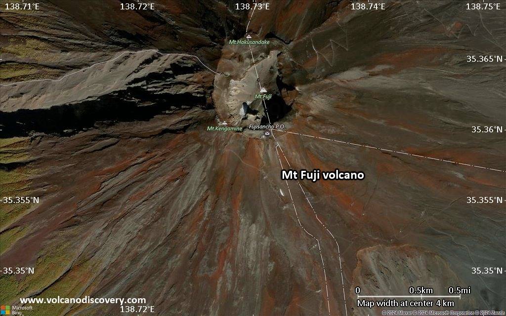
| RSS | EN | DE | EL | ES | FR | IT | RU

Mt Fuji Vulkan

Updated: 26. Apr. 2025 01:51 GMT -
stratovolcano
Honshu (Japan), 35.36°N / 138.73°E
Summit height: 3776 m / 12,388
Aktueller Status: normal / ruhend (1 von 5)
Last update: 8 Dez 2021
"Ryu sho ten" or "Ryu shoten" (Dragon rising to the heavens), also known as "Gekko Zuihitsu" (Gekko's Sketch), a Ukiyo-e print from Ogata Gekko's Views of Mt. Fuji. A dragon rises out of smoke near Mt. Fuji, ascending towards the sky.

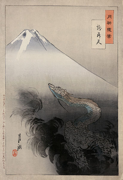
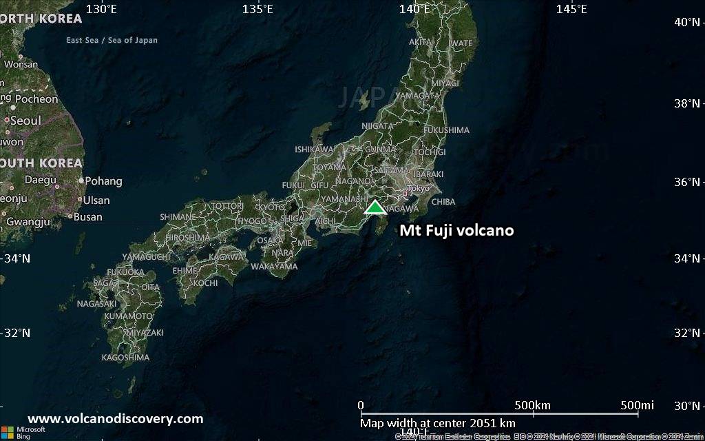
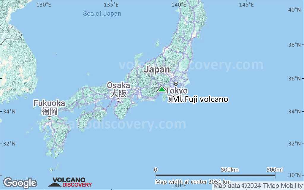
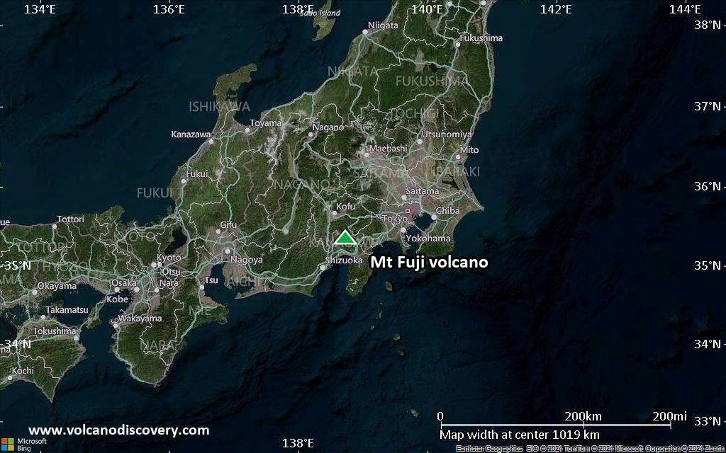
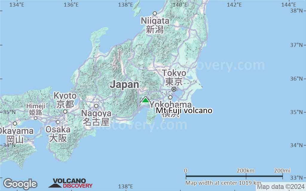
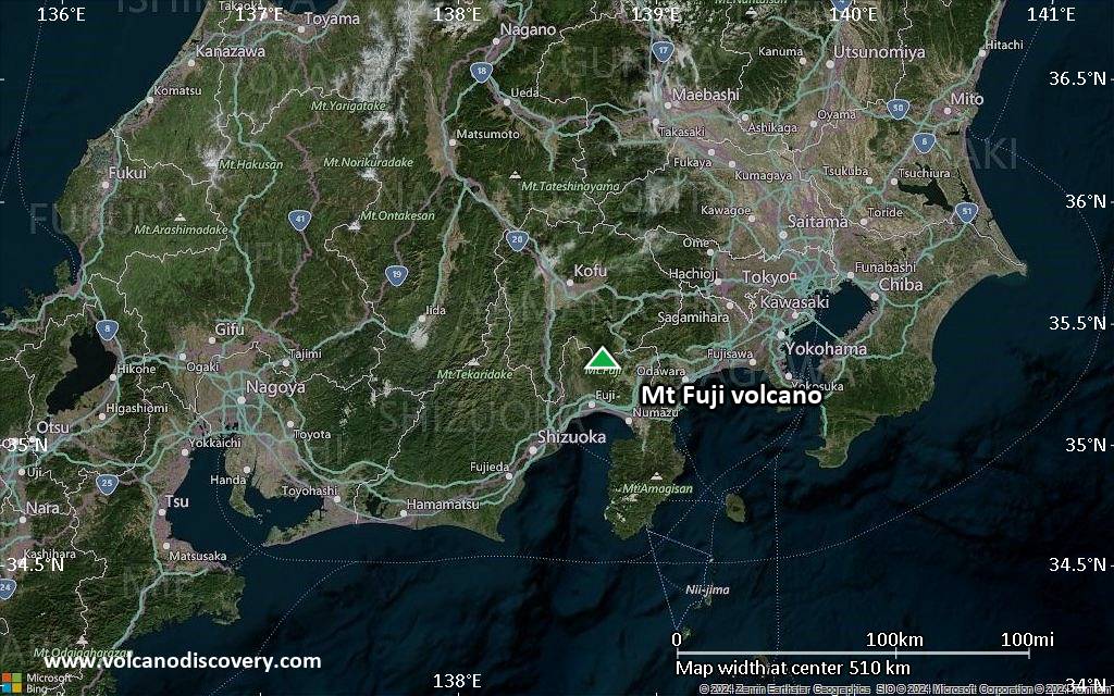
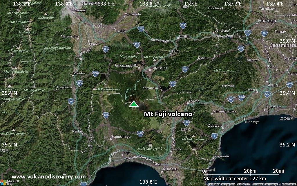
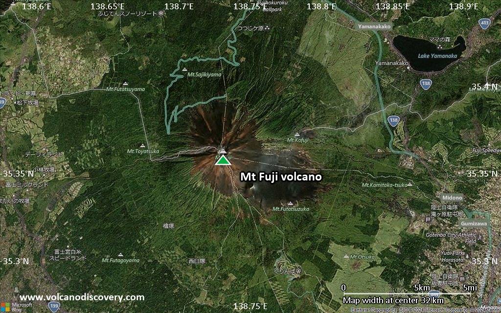
Mount Fuji (Fuji-san, 富士山 in Japanese) is the highest volcano and highest peak in Japan and considered one of the 3 Holy Mountains (along with Mount Tate and Mount Haku). Fuji is a perfect, beautiful stratovolcano about 60 miles south-west of Tokyo, with an exceptionally symmetrical shape making it into famous symbol of Japan and an important element in Japanese art. It is a popular destination for excursions. More than 200,000 people climb to the top of the Mt Fuji every year. The last eruption of Mt Fuji was in 1707–08. Between 2000 and 2001, seismic activity under the volcano was at slightly elevated levels, rising concern about a possible reawakening of the volcano.

[smaller] [larger]
Typische Aktivität: Explosive
Ausbrüche des Mt Fuji: 1707-08, 1700, 1627(?), 1560, 1511, 1427(?), 1083, 1032, 1017(?), 999(?), 993(?), 952(?), 937(?), 932, 870, 864-65, 830, 826, 802, 800, 781

Letzte Erdbeben in der Nähe

Datum und UhrzeitMag / TiefeDistanz / Ort
24. Apr. 00:09 (GMT +9)
0.3

1.9 km
25 km südöstlich 9 km südlich von Gotemba, Präfektur Shizuoka, Japan Info
23. Apr. 14:13 (GMT +9)
0.1

1.6 km
29 km nordöstlich Japan: Eastern Yamanashi Pref Info
23. Apr. 10:19 (GMT +9)
0.7

26 km
29 km nordöstlich Japan: Eastern Yamanashi Pref Info
Dienstag, 22. April 2025 GMT (1 Beben)
23. Apr. 02:28 (GMT +9)
1.1

21 km
27 km nordöstlich Japan: Eastern Yamanashi Pref Info
Montag, 21. April 2025 GMT (1 Beben)
22. Apr. 00:49 (GMT +9)
0.5

26 km
27 km nordöstlich Eastern Yamanashi Pref Info
Sonntag, 20. April 2025 GMT (3 Beben)
21. Apr. 08:15 (GMT +9)
2.3

20 km
28 km nordöstlich Japan: Eastern Yamanashi Pref Info
21. Apr. 05:17 (GMT +9)
0.1

22 km
24 km östlich Japan: Eastern Yamanashi Pref Info
21. Apr. 04:56 (GMT +9)
0.7

22 km
27 km östlich Japan: Eastern Yamanashi Pref Info
Dienstag, 15. April 2025 GMT (2 Beben)
16. Apr. 08:32 (GMT +9)
0.9

23 km
26 km nordöstlich Japan: Eastern Yamanashi Pref Info

Beschreibung

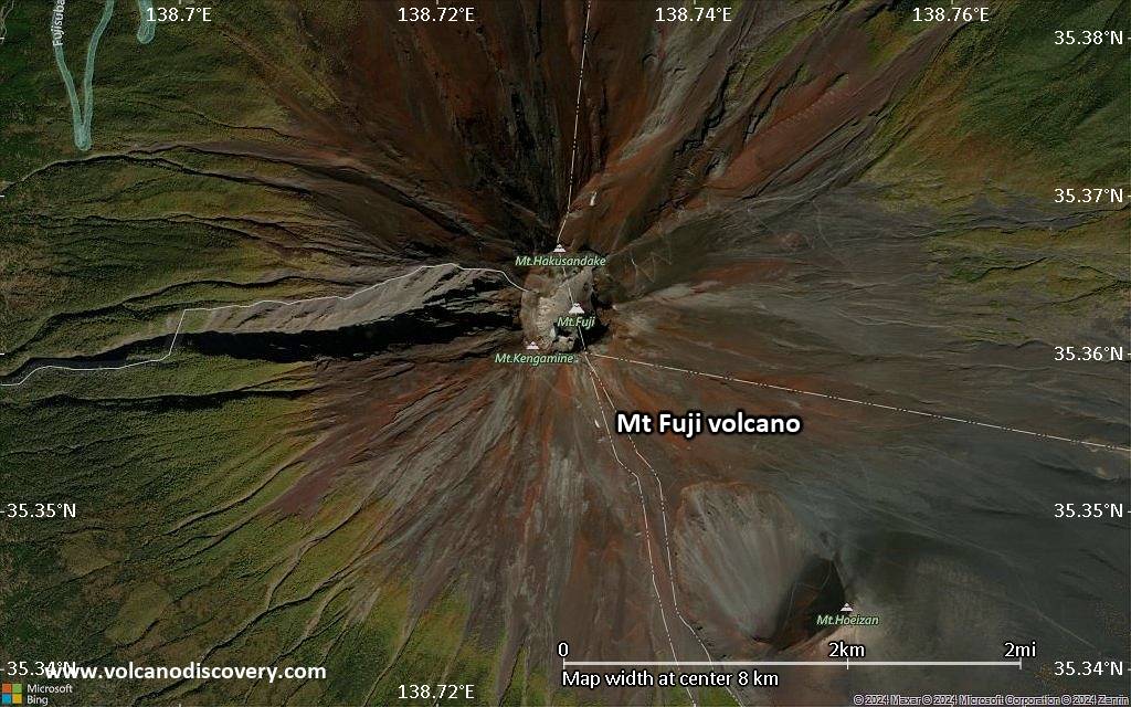
Mt Fuji has a complex geologic origin. The large stratovolcano has a base diameter of almost 50 km and culminates in a 500 m wide and 250 m deep summit crater. The volcano overlies several older volcanoes, whose remnants form irregularities on Fuji's symmetrical profile, including Komitake and Ko-Fuji (Older Fuji) which was active 100,000 - 10,000 years ago.
The present-day, mainly basaltic edifice started to grow about 11-8,000 years ago when large lava flows were erupted that still form 25% of the volume of the edifice today.
From 8000 to 4500 years ago, Fuji's activity was mainly explosive before another effusive cycle took place between 4500 to 3000 years ago. In the past 3000 years, large explosive eruptions occurred in between phases of milder effusive activity. From 3000 to 2000 years ago, most eruptions took place at the summit, while a large number of flank eruptions occurred during the past 2000 years, forming more than 100 flank cones.
The last confirmed eruption of Mt Fuji took place in 1707 and was Fuji's largest during historical time. It deposited ash as far as present-day Tokyo and formed a large new crater on the east flank.
(Source: USGS / GVP)

Mt Fuji Volcano Photos

Bedeutende Vulkanausbrüche: Mt Fuji volcano

In the past 10,000 years, Mt Fuji has had at least 58 confirmed volcanic eruptions, out of which 15 are documented by historical records, while the others can be inferred from geological evidence.
Additionally, there are 9 uncertain or discredited eruptions from Mt Fuji volcano.
The table below lists all known eruptions (date in bold face) of Mt Fuji volcano in historic times and during the past 10,000 years. Updates on the most recent volcanic activity of Mt Fuji can be found on the news page of Mt Fuji volcano.
DatumHinweisVEITodesopferSchaden
?? 1854 Dez 23 - 1855 Jan 9
Unsicherer Ausbruch
?
unbekannt
?? 1770 Sep 16
Unsicherer Ausbruch
?
unbekannt
?? 1708 Dez - 1709 Jan 16 ?
Unsicherer Ausbruch
?
unbekannt
1707 Dez 16 - 1708 Feb 24 ?SE flank (Hoei Craters)
Hist. dokumentiert
5
unbekannt
1707 Dez 16
(Ausbruch 1707 Dez 16 - 1708 Feb 24 ?)
Hist. dokumentiert
41-50 (*)
leicht
Info
1700
Hist. dokumentiert
2?
unbekannt
?? 1627 AD
Unsicherer Ausbruch
?
unbekannt
?? 1560 AD Jan 4
Unsicherer Ausbruch
?
unbekannt
1511 AD Sep 1 ±30 d.
Hist. dokumentiert
2?
unbekannt
1435 AD Dez 31 ±60 d.North flank (Onagare lava?)
Hist. dokumentiert
2?
unbekannt
?? 1427 AD Jun 28
Unsicherer Ausbruch
?
unbekannt
1083 AD Apr 17
Hist. dokumentiert
2?
unbekannt
1033 AD Jan 19 ?Summit, SSE flank (Nishi-Asakizuka)
Hist. dokumentiert
2
unbekannt
?? 1017 AD Okt 1 ±30 d.
Unsicherer Ausbruch
?
unbekannt
999 AD MärSouth flank ?
Hist. dokumentiert
2?
unbekannt
?? 993 AD Sep 1 ±30 d.
Unsicherer Ausbruch
?
unbekannt
?? 952 AD Mär
Unsicherer Ausbruch
?
unbekannt
937 AD Dez 18North flank (Kenmarubi II?)
Hist. dokumentiert
2
unbekannt
932 AD Nov 19North flank (Kenmarubi I)
Hist. dokumentiert
2?
unbekannt
870 AD Aug
Hist. dokumentiert
2?
unbekannt
864 AD Jun 12 ? - 866 Feb 1 ±30 d.NW flank (Nagao-yama, Kudari-yama)
Hist. dokumentiert
3
unbekannt
830 ADNW flank (Koriana)
Hist. dokumentiert
2
unbekannt
826 AD Dez 31 ±30 d.
Hist. dokumentiert
2?
unbekannt
800 AD Apr 11 - 802 Feb 6 oder danachSummit, NE and NW flanks (Tenjin-yama)
Hist. dokumentiert
4
unbekannt
781 AD Jul
Hist. dokumentiert
3
unbekannt
720 ±100 y. ADNW flank (Kori-ike, Hakudairyuo)2
unbekannt
530 ? ADSouth flank (Takabachi)3
unbekannt
520 ±100 y. ADSE flank (Makuiwa, Nishi-Futatsuzuka)2
unbekannt
470 ±100 y. ADSE flank (Kita-Kansu-yama)3?
unbekannt
400 ? ADSE flank (Akatsuka)2
unbekannt
370 ±200 y. ADSSE flank (Obuchi Craters)?
unbekannt
350 ±300 y. ADSE flank (Kurotsuka)3
unbekannt
300 ? ADNW flank (Oniwa-Okuniwa)1
unbekannt
250 ? ADNW flank (Kita-Koriike)2
unbekannt
240 ±150 y. ADSE flank?
unbekannt
220 ? ADNE flank (Hinokimarubi lava flow)2
unbekannt
200 ? ADNW flank (Sajiki-yama)2
unbekannt
100 ? ADNW flank (Ohira-yama)2
unbekannt
50 ? ADNW flank (Futatsuzuka)2
unbekannt
(*) Geschätzte Zahlen
Anmerkung:
Unsere Liste von Vulkanausbrüchen orientiert sich eng an der Datenbank des Global Volcanism Project (GVP) des Smithsonian Instituts, der international anerkanntesten globalen Datenquelle für Vulkanausbrüche. Sie schließt aber auch bedeutende Eruptionsepisoden oder damit zusammenhängende Vulkanereignisse ein. Unter "Vulkanausbrüchen" versteht man in der Regel meist Serien einzelner Eruptionsepisoden, die zeitlich aufeinander folgen oder sich (bei mehreren beteiligten Ausbruchspunkten an einem Vulkan) auch überlappen können und unter Umständen viele Jahre, Jahrzehnte oder noch länger andauern können. So ist z.B. die aktuelle Tätigkeit des Stromboli als ein einziger Ausbruch verstanden, der seit 1934 anhält.
Quellen: NOAA National Centers for Environmental Information (NCEI), Global Significant Volcanic Eruptions Database. doi:10.7289/V5TD9V7K | Global Volcanism Project / Smithsonian Institution

Ausbrüche des Vulkans Mt Fuji


1707 eruption of Mt Fuji
On 26th October 1707, a new eruption announced itself with a large 8.4 magnitude earthquake devastating Honshu island, followed by several smaller earthquakes felt near Mt Fuji.
The eruption started on 16th December 1707 from a new vent on the SE flank of the volcano erupting a sub-plinian column of ash and pumice, turning into basaltic lava fountaining after 6 hours into the eruption. On the first day of the eruption, 72 houses and 3 Buddhist temples were destroyed in Subassiri town 10 km from the volcano.
Ash fell all over the south Kanto plain, Tokyo, and on areas of the NW Pacific ocean 280 km from the volcano. The total volume erupted over 16 days was estimated to 0.68 cubic km of magma.
Violent explosions were recorded until 25-27 December, before the eruption calmed down and ended on 1st January 1708.

Mt Fuji Volcano FAQ

+When was the last eruption of Mt Fuji volcano?

+How often does Mt Fuji volcano erupt?

+When was the largest eruption of Mt Fuji volcano?

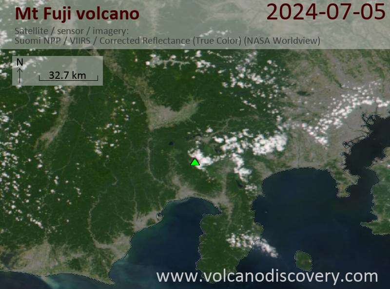
Neueste Satellitenbilder

MtFuji Satellitenbild sat1MtFuji Satellitenbild sat2

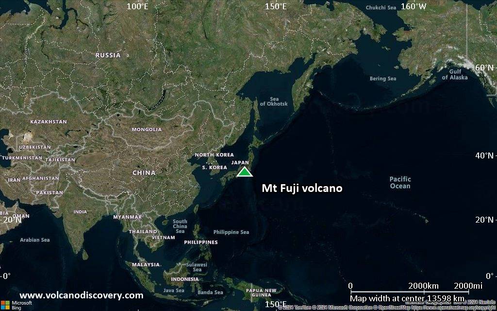
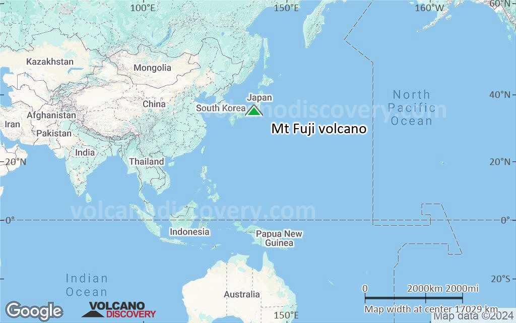
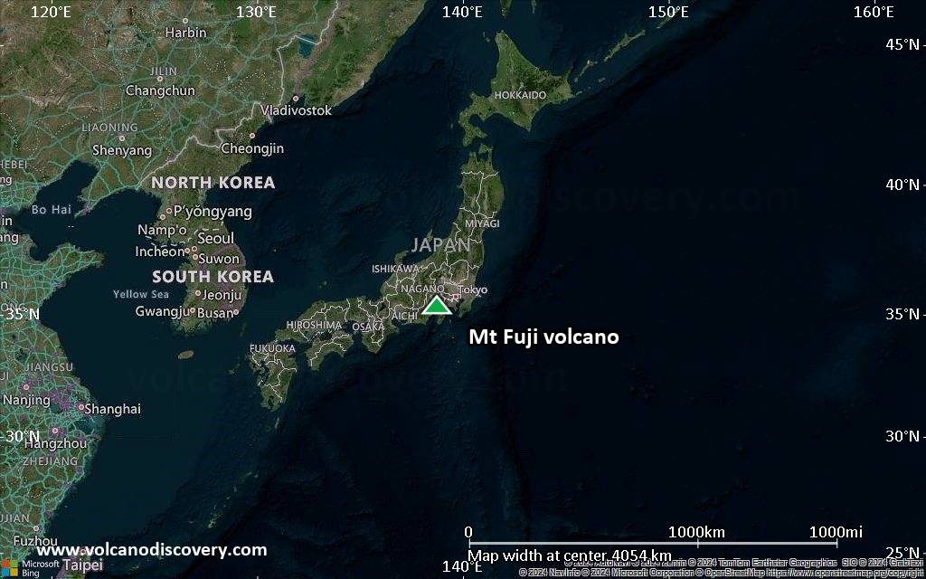
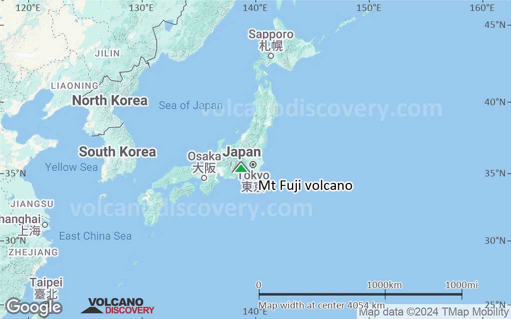
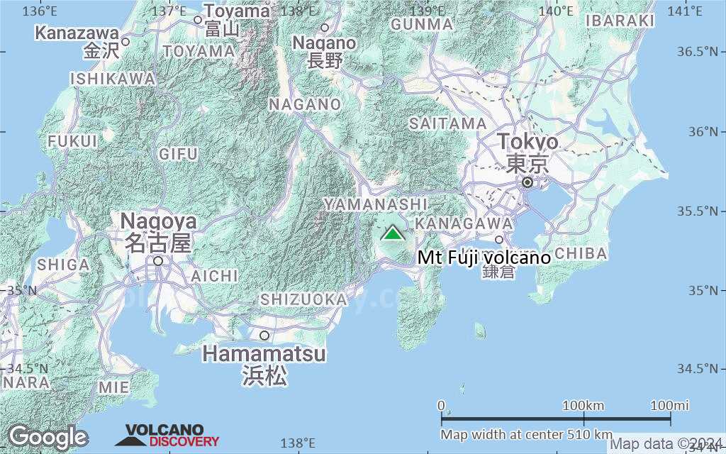
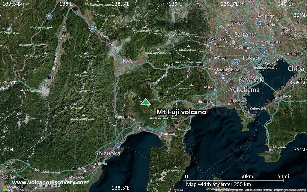
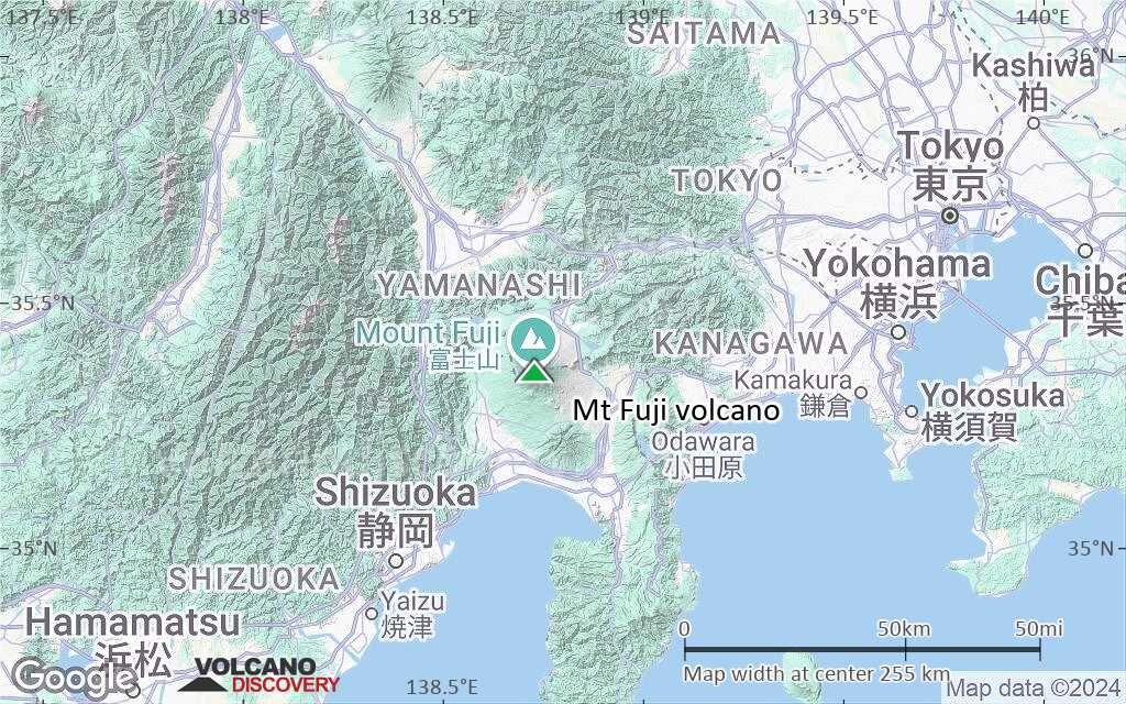
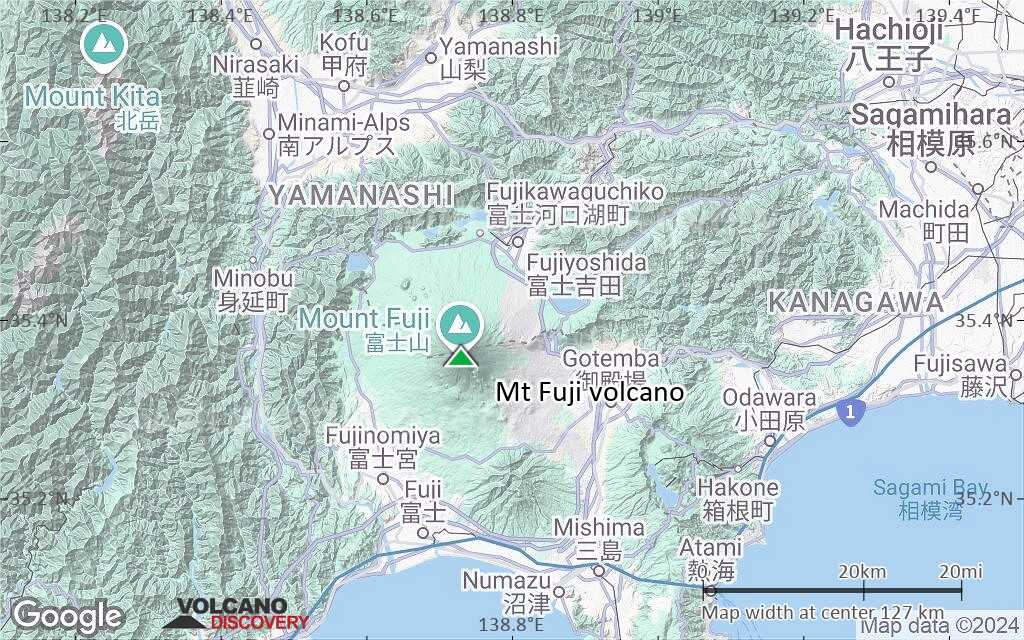
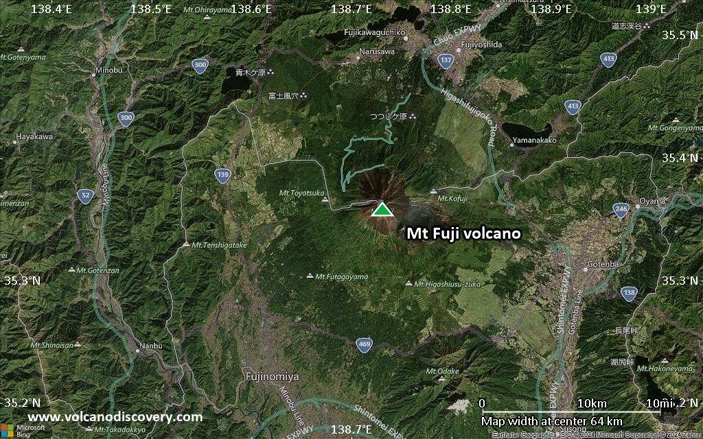
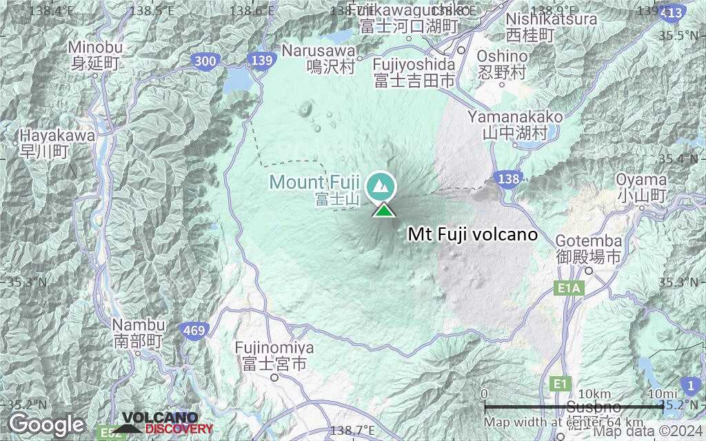
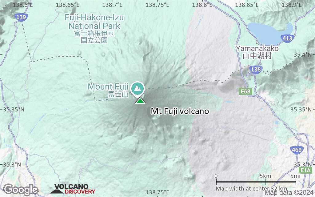
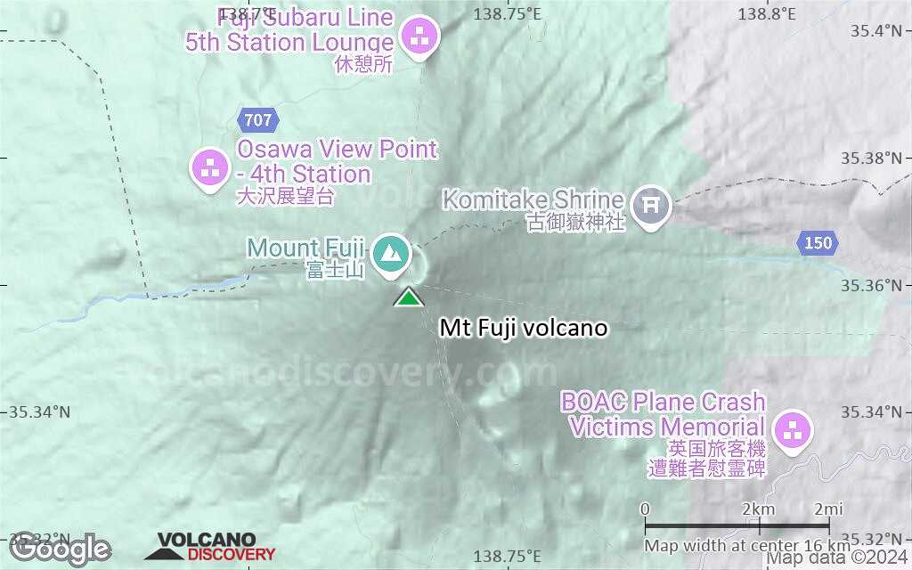
Mt Fuji Vulkan Karten

Below is a selection of maps showing the location and surroundings of the volcano at various resolutions based on aerial-imagery / terrain maps. Feel free to use them for non-commercial purposes on your blog or website as long as you credit them with a link back to this page (click to copy it).
Satellite/aerial-type map of Mt Fuji volcano (world scale)
Terrain-type map of Mt Fuji volcano (world scale)
Satellite/aerial-type map of Mt Fuji volcano (region scale large)
Terrain-type map of Mt Fuji volcano (region scale large)
Satellite/aerial-type map of Mt Fuji volcano (region scale medium)
Terrain-type map of Mt Fuji volcano (region scale medium)
Satellite/aerial-type map of Mt Fuji volcano (region scale small)
Terrain-type map of Mt Fuji volcano (region scale small)
Satellite/aerial-type map of Mt Fuji volcano (local scale large)
Terrain-type map of Mt Fuji volcano (local scale large)
Satellite/aerial-type map of Mt Fuji volcano (local scale medium)
Terrain-type map of Mt Fuji volcano (local scale medium)
Satellite/aerial-type map of Mt Fuji volcano (local scale small)
Terrain-type map of Mt Fuji volcano (local scale small)
Satellite/aerial-type map of Mt Fuji volcano (scale of 10s of km)
Terrain-type map of Mt Fuji volcano (scale of 10s of km)
Satellite/aerial-type map of Mt Fuji volcano (scale of 20-40 km)
Terrain-type map of Mt Fuji volcano (scale of 20-40 km)
Satellite/aerial-type map of Mt Fuji volcano (scale of approx. 10-20 km)
Terrain-type map of Mt Fuji volcano (scale of approx. 10-20 km)
Satellite/aerial-type map of Mt Fuji volcano (scale of 5-10 km)
Satellite/aerial-type map of Mt Fuji volcano (scale of few kilometers)
Volcanoes & Earthquakes - new app for Android
Garantierte Reisen
9.-25. Jun 2025: Volcanoes and Spices - N-Sulawesi + Halmahera (Indonesien)
7.-22. Jul 2025: Von Krakatau bis Bali - Java (Indonesien)
7.-23. Jul 2025: Volcanoes and Spices - N-Sulawesi + Halmahera (Indonesien)
1.-17. Aug 2025: Volcanoes and Spices - N-Sulawesi + Halmahera (Indonesien)
1.-14. Okt 2025: Wüste, Salz und Vulkane - Danakilwüste (Äthiopien)
4.-12. Okt 2025: Feuerberge Siziliens - vom Stromboli zum Ätna - Äolische Inseln + Ätna
6.-21. Okt 2025: Von Krakatau bis Bali - Java (Indonesien)
3.-19. Nov 2025: Volcanoes and Spices - N-Sulawesi + Halmahera (Indonesien)
= Plätze frei   = garantiert   = Wenig freie Plätze   = Ausgebucht
Mo, 4. Feb 2013, 16:48

Mt Fuji volcano (Japan): new evacuation plans in case of new eruption published

Earthquakes near Fuji in Jan 2013
The volcano remains calm. However, an increased number of small quakes near and under Mt Fuji are visible on our latest data plot of nearby earthquakes (within 30 km radius). While all of these are very small and the number is certainly not alarming, the volcano remains interesting to watch. ... Alles lesen
So, 9. Sep 2012, 08:10

Mt Fuji Vulkan (Japan) : Druckanstieg in der Magmakammer als Zeichen für einen bevorstehenden Ausbruch

Wissenschaftler haben beim berühmtesten Vulkan Japane, dem Mount Fuji auf Honshu, Hinweise auf einen möglicherweise bevorstehenden Ausbruch entdeckt. So lauten zur Zeit jedenfalls zahlreiche Schlagzeilen in der Presse. ... Alles lesen

Auf dieser Seite:

Try our free app!
Volcanoes & Earthquakes - new app for Android
Android | iOS version

More on VolcanoDiscovery

Warum gibt es Werbung auf dieser Seite?

Unterstützen Sie unsere Arbeit!

Diese Webseite und die dazugehörigen Apps und Tools instandzuhalten und kostenlos Nachrichten zu Vulkanen, Erdbeben und anderen Themen bereitzustellen, verschlingt enorm viel Zeit und auch Geld.
Wenn Sie die Infos mögen und uns in der Arbeit dazu unterstützen wollen, würden wir uns über eine Spende (über PayPal) sehr freuen.
Online Zahlung (Kreditkarte)
Damit können wir Ihnen auch in Zukunft neue Features entwickeln und Bestehende laufend verbessern.Vielen Dank!
Sources: VolcanoDiscovery / VolcanoAdventures and other sources as noted.
Use of material: Most text and images on our websites are owned by us. Re-use is generally not permitted without authorization. Contact us for licensing rights.
Volcanoes & Earthquakes
VolcanoDiscovery Home
Vulkane | Erdbeben | Fotos | News | | Shop | App
Adventure & Study Travel
Reisen zu Vulkanen und Vulkangebieten: Wanderreisen, Studienreisen, Fotoreisen
Tours & Dates | FAQ | About us
Get our newsletter!
Company info
Kontakt | Impressum | AGB
Follow us
Follow us on facebook Follow us on Instagram Follow us on Bluesky Follow us on Twitter Visit our Youtube channel
EN | DE | EL | ES | FR | IT | RU
VolcanoDiscovery GmbH, Germany, Reg. nr.: HRB 103744, EU Tax Id: DE 297 465 123 owned and created by
Dr. Tom Pfeiffer, volcanologist, volcano photographer, tour organizer member of
IAVCEI
IAVCEI
Vulkanologische Gesellschaft
Volcanological Society
Ecotourism Greece
Ecotourism Greece
RUV insurance
Insured by R+V
VolcanoDiscovery © 2004- All Rights Reserved | Datenschutz - Cookie Einstellungen