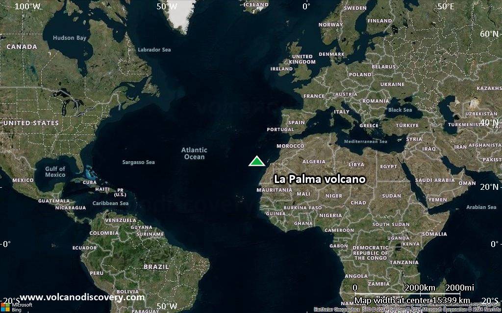
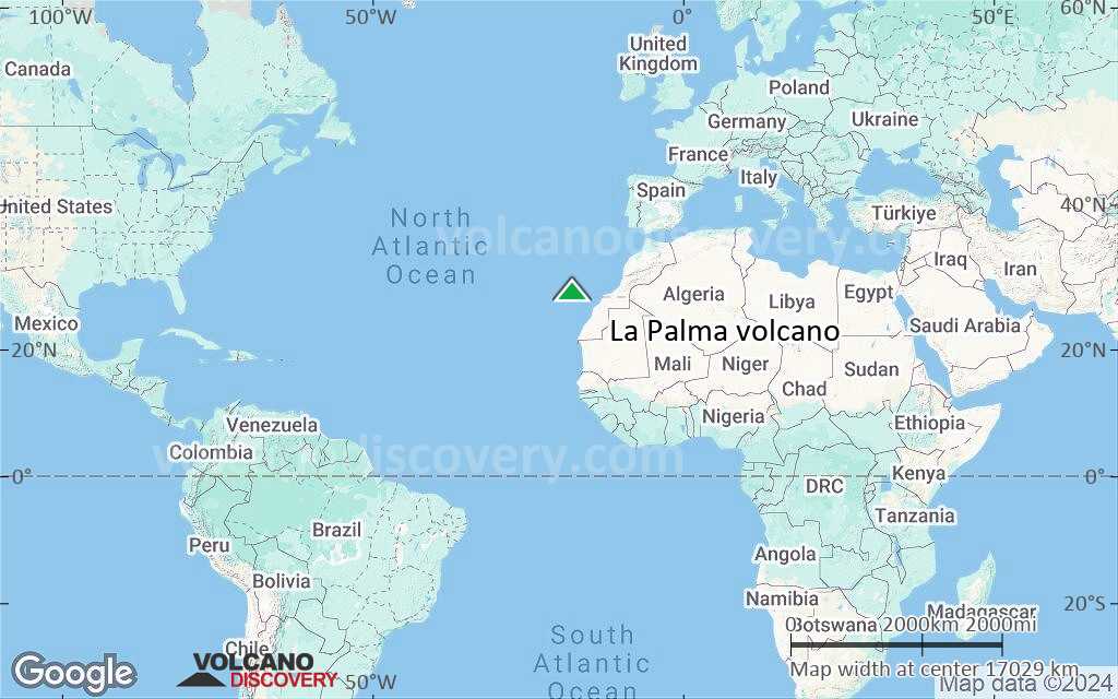
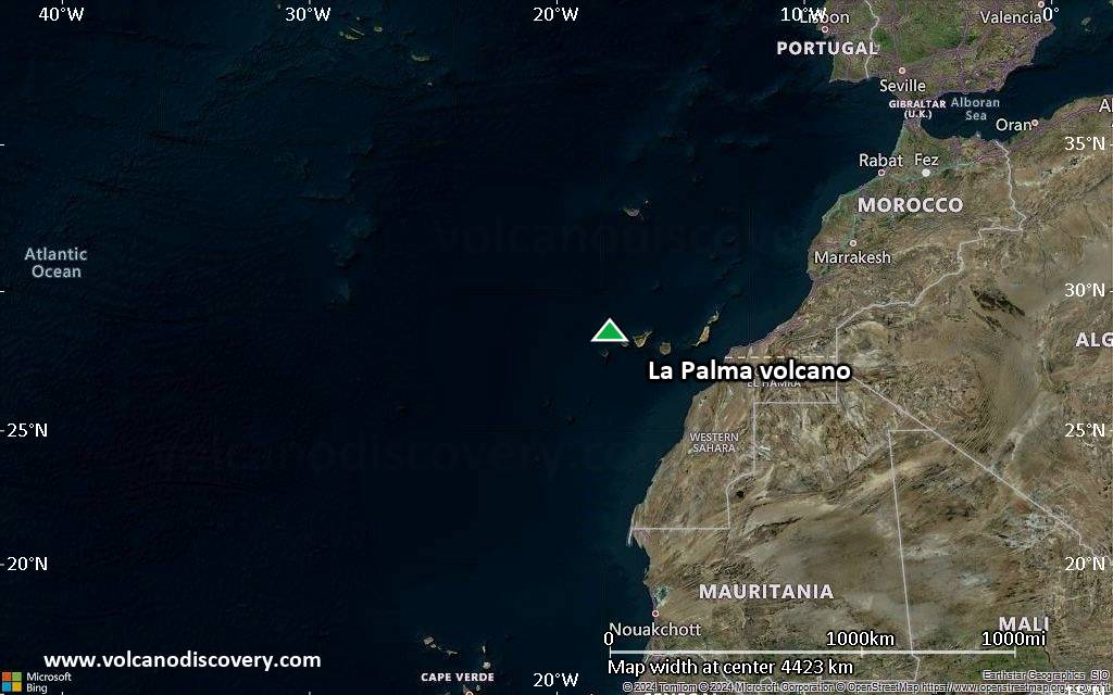
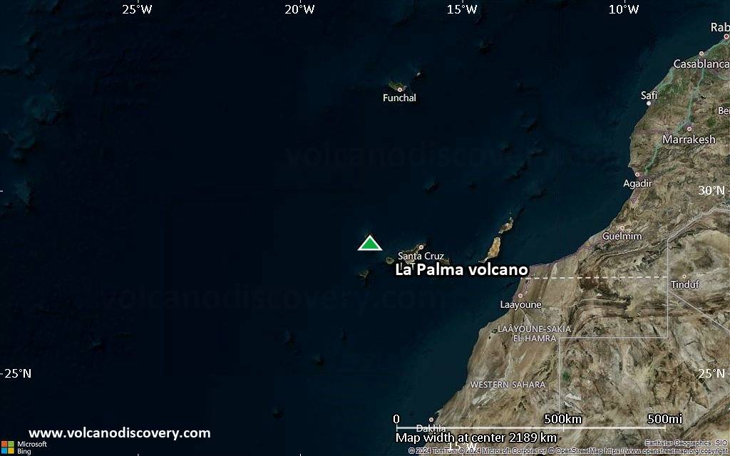
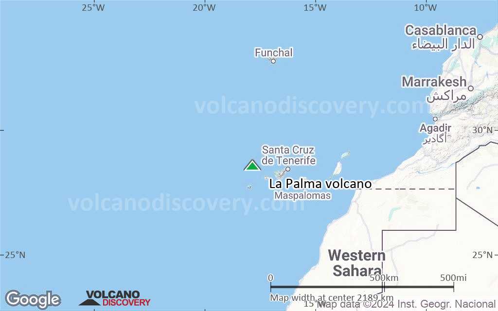
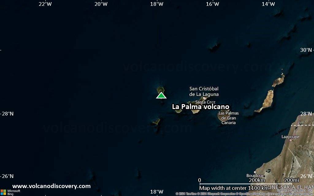
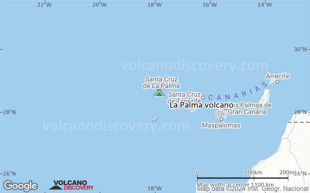
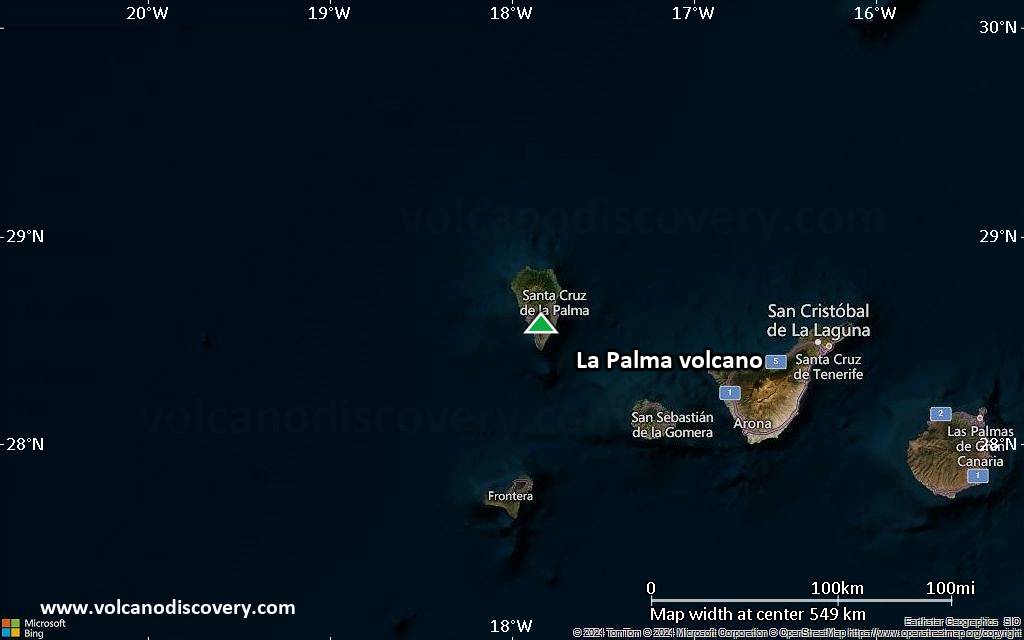
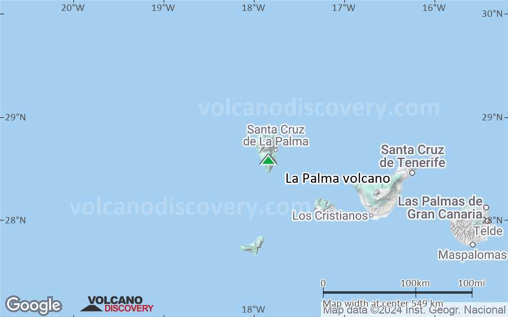
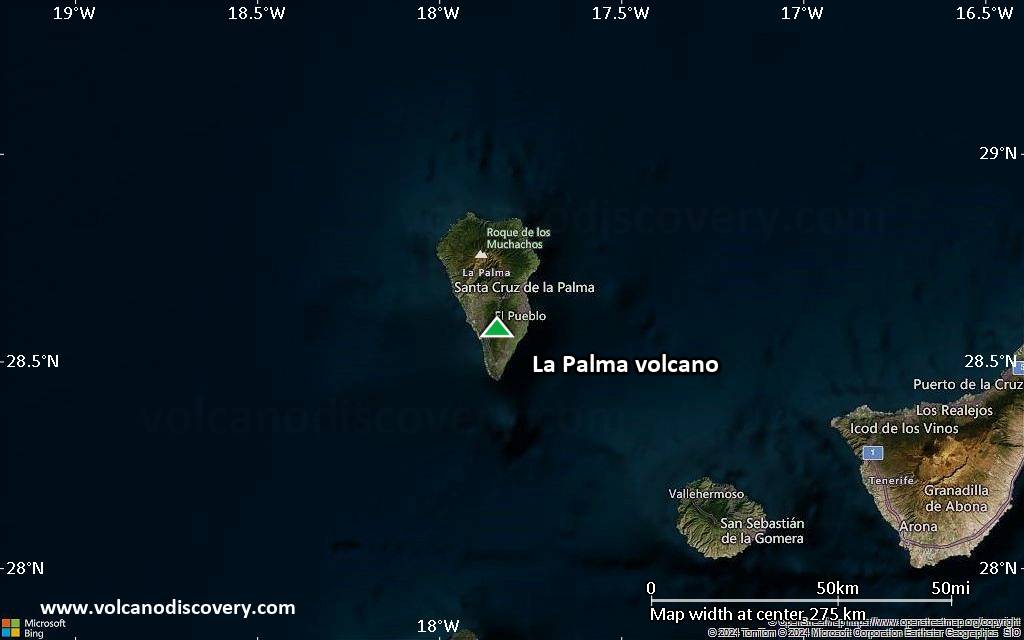
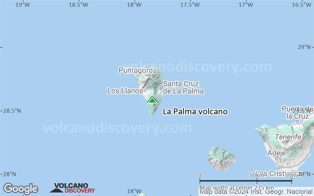
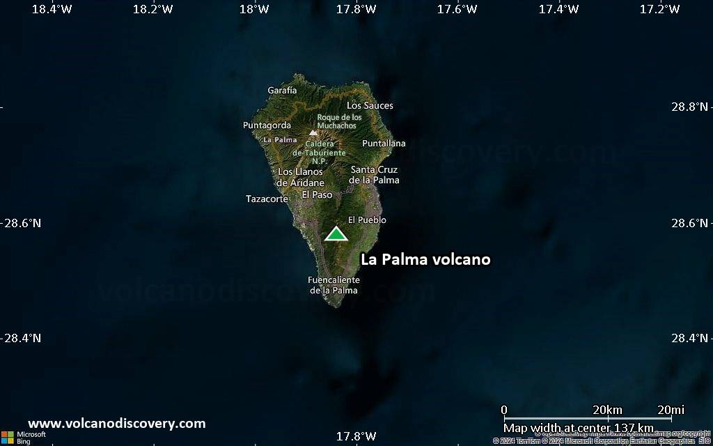
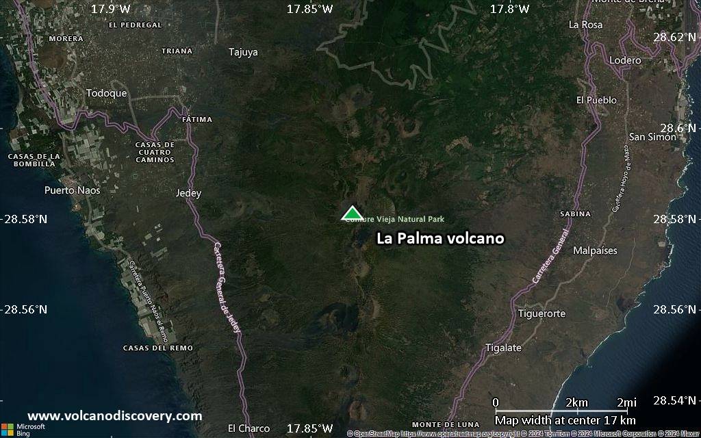
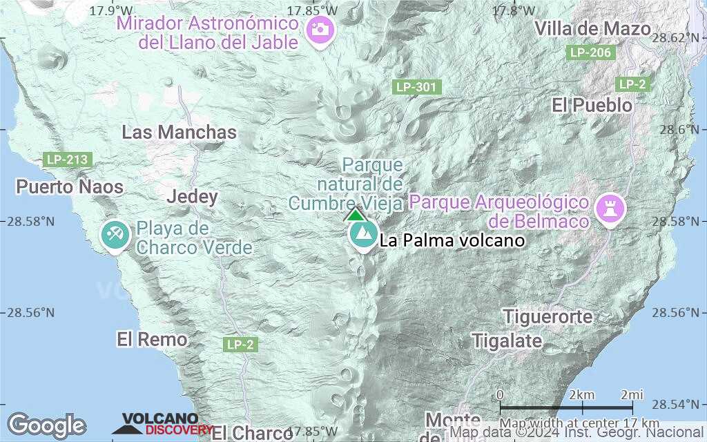
| RSS | EN | DE | EL | ES | FR | IT | RU

La Palma Vulkan

Updated: 25. Apr. 2025 04:12 GMT -
shield volcano
Canary Islands, 28.58°N / -17.84°W
Summit height: 2426 m
Aktueller Status: normal / ruhend (1 von 5)
Last update: 3 Jun 2022
Eruption of La Palma's Cumbre Vieja in Sep 2021 (image: Tom Pfeiffer)

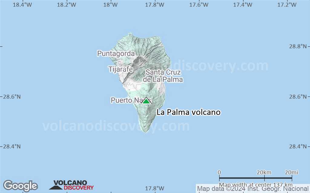
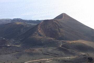
The 47-km-long wedge-shaped island of La Palma, the NW-most of the Canary Islands, is composed of two large volcanic centers.

[smaller] [larger]
Typische Aktivität: effusive
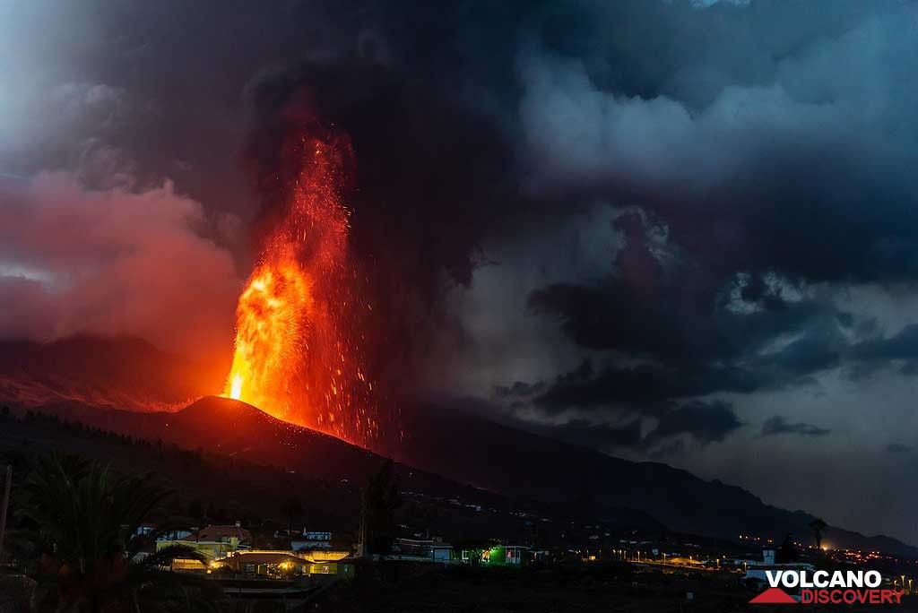
Ausbrüche des La Palma: 2021 (Sep - ongoing), 1971, 1949, 1712, 1677-1678, 1646, 1585

Letzte Erdbeben in der Nähe

Datum und UhrzeitMag / TiefeDistanz / Ort
18. Apr. 18:43 (Weltzeit)
1.3

12 km
10.4 km westlich S Tazacorte.Ilp Info
Dienstag, 15. April 2025 GMT (2 Beben)
15. Apr. 11:03 (Weltzeit)
1.0

10 km
15 km nordwestlich NW Los Llanos DE Aridane.Ilp Info
15. Apr. 00:36 (Weltzeit)
1.3

9 km
10.6 km nordwestlich SE Los Llanos DE Aridane.Ilp Info
Montag, 14. April 2025 GMT (2 Beben)
14. Apr. 06:47 (Weltzeit)
2.0

13 km
1.4 km südöstlich 13 km südöstlich von Los Llanos de Aridane, Spanien Info
14. Apr. 00:22 (Weltzeit)
1.8

17 km
4.9 km südwestlich NW Fuencaliente DE LA Palma.Il Info

Beschreibung

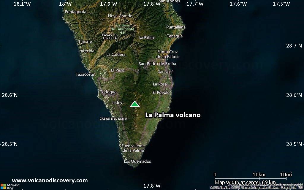
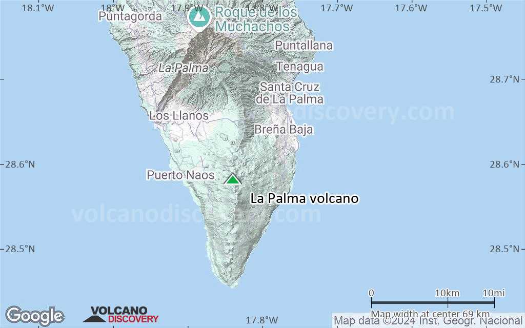
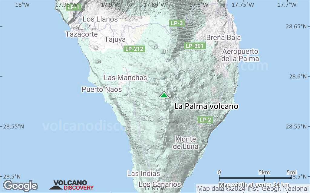
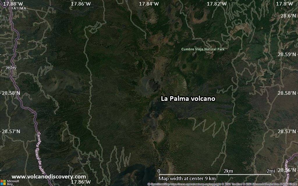
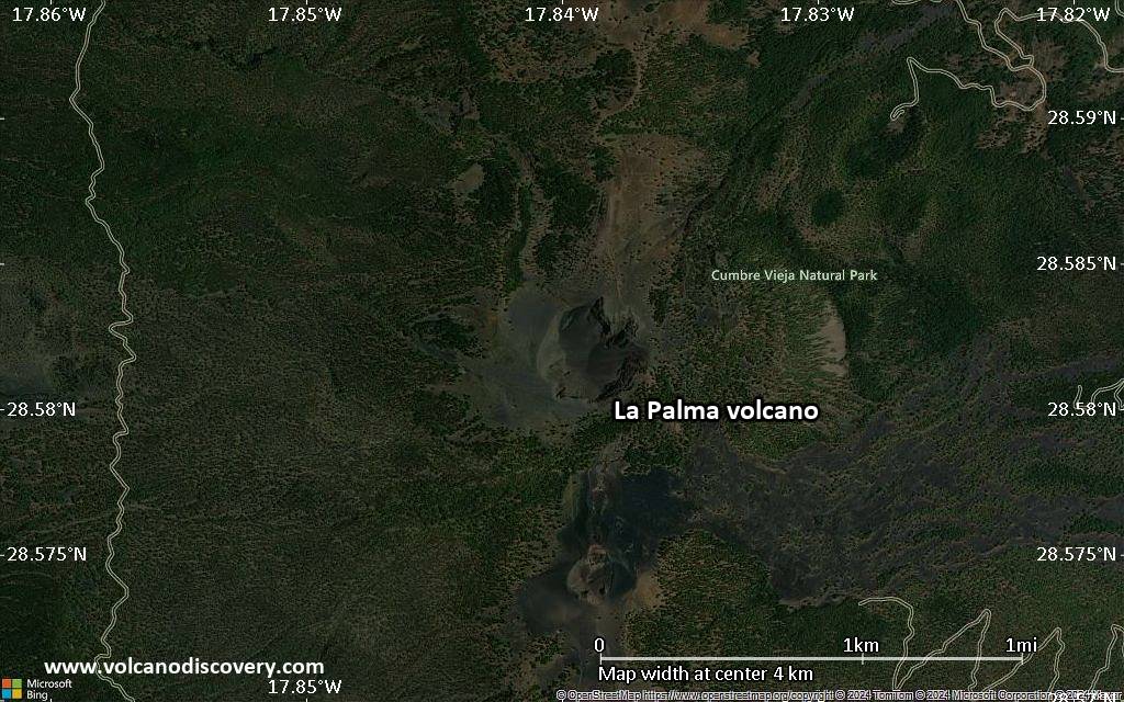
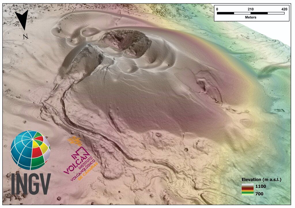
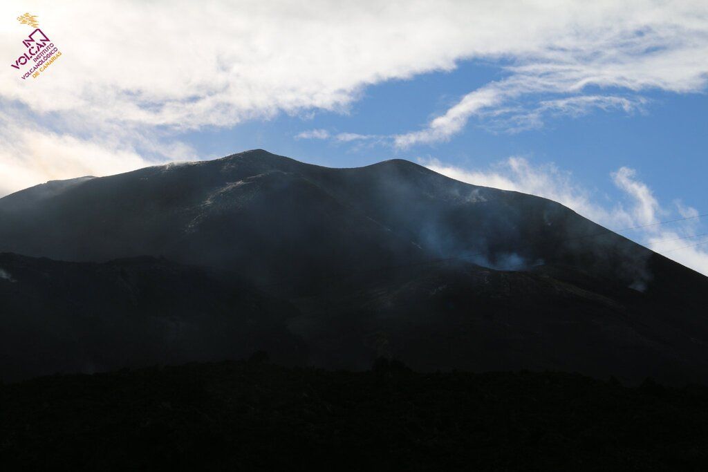
The older 2426-m-high northern one is cut by the massive steep-walled Caldera Taburiente, one of several massive collapse scarps produced by edifice failure to the SW. The younger 1949-m-high Cumbre Vieja, the southern volcano, is one of the most active in the Canaries. The elongated volcano dates back to about 125,000 years ago and is oriented N-S. Eruptions during the past 7000 years have originated from the abundant cinder cones and craters along the axis of Cumbre Vieja, producing fissure-fed lava flows that descend steeply to the sea. Historical eruptions at La Palma, recorded since the 15th century, have produced mild explosive activity and lava flows that damaged populated areas. The southern tip of the island is mantled by a broad lava field produced during the 1677-1678 eruption. Lava flows also reached the sea in 1585, 1646, 1712, 1949, and 1971.

La Palma Volcano Photos

Bedeutende Vulkanausbrüche: La Palma volcano

In the past 10,000 years, La Palma has had at least 14 confirmed volcanic eruptions, out of which 8 are documented by historical records, while the others can be inferred from geological evidence.

The table below lists all known eruptions (date in bold face) of La Palma volcano in historic times and during the past 10,000 years. Updates on the most recent volcanic activity of La Palma can be found on the news page of La Palma volcano.
DatumHinweisVEITodesopferSchaden
2021 Sep 19 - Dez 13Tajogaite eruption
Hist. dokumentiert
3
unbekannt
2021 Sep 19
(Ausbruch 2021 Sep 19 - Dez 13)
Hist. dokumentiert
31
sehr schwer
Info
1971 Okt 26 - Nov 18Teneguia
Hist. dokumentiert
2
unbekannt
1971 Okt 28
(Ausbruch 1971 Okt 26 - Nov 18)
Hist. dokumentiert
21-50 (*)
leicht
Info
1949 Jun 24 - Jul 30San Juan, Llano del Banco, Hoyo Negro
Hist. dokumentiert
2?
unbekannt
1712 Okt 9 - Dez 3El Charco
Hist. dokumentiert
2
unbekannt
1677 AD Nov 17 - 1678 Jan 21N & S flanks of San Antonio (Fuentecaliente)
Hist. dokumentiert
2
unbekannt
1677 AD Nov 22
(Ausbruch 1677 AD Nov 17 - 1678 Jan 21)
Hist. dokumentiert
21
unbekannt
Info
1646 AD Okt 2 - Dez 21South flank of San Martín (Tigalate)
Hist. dokumentiert
2
unbekannt
1585 AD Mai 19 - Aug 10Tahuya
Hist. dokumentiert
2
unbekannt
1481 ±11 y. ADTacande (Montaña Quemada)
Hist. dokumentiert
2
unbekannt
900 ±100 y. ADNambroque II-Malforada?
unbekannt
360 ±50 y. BCEl Fraile?
unbekannt
1320 ±100 y. BCLa Fajana (Volcán Fuego)?
unbekannt
4050 ±3000 y. BCL'Amendrita, Birigoyo?
unbekannt
4900 ±50 y. BC?
unbekannt
6050 ±1500 y. BC?
unbekannt
(*) Geschätzte Zahlen
Anmerkung:
Unsere Liste von Vulkanausbrüchen orientiert sich eng an der Datenbank des Global Volcanism Project (GVP) des Smithsonian Instituts, der international anerkanntesten globalen Datenquelle für Vulkanausbrüche. Sie schließt aber auch bedeutende Eruptionsepisoden oder damit zusammenhängende Vulkanereignisse ein. Unter "Vulkanausbrüchen" versteht man in der Regel meist Serien einzelner Eruptionsepisoden, die zeitlich aufeinander folgen oder sich (bei mehreren beteiligten Ausbruchspunkten an einem Vulkan) auch überlappen können und unter Umständen viele Jahre, Jahrzehnte oder noch länger andauern können. So ist z.B. die aktuelle Tätigkeit des Stromboli als ein einziger Ausbruch verstanden, der seit 1934 anhält.
Quellen: NOAA National Centers for Environmental Information (NCEI), Global Significant Volcanic Eruptions Database. doi:10.7289/V5TD9V7K | Global Volcanism Project / Smithsonian Institution

La Palma Volcano FAQ

+When was the last eruption of La Palma volcano?

+How often does La Palma volcano erupt?

+How active is La Palma volcano at present?

+When was the largest eruption of La Palma volcano?

Neueste Satellitenbilder

lapalma Satellitenbild sat1lapalma Satellitenbild sat2
La Palma Vulkanreisen
Canary Islands
Europe's Volcanic Outpost
8-day geo tour on La Palma and El Hierro
8 days / 7 nights - Leicht bis mittel
Preis 2490 €
zur Zeit keine Termine

La Palma Vulkan Karten

Below is a selection of maps showing the location and surroundings of the volcano at various resolutions based on aerial-imagery / terrain maps. Feel free to use them for non-commercial purposes on your blog or website as long as you credit them with a link back to this page (click to copy it).
Satellite/aerial-type map of La Palma volcano (world scale)
Terrain-type map of La Palma volcano (world scale)
Satellite/aerial-type map of La Palma volcano (region scale large)
Terrain-type map of La Palma volcano (region scale large)
Satellite/aerial-type map of La Palma volcano (region scale medium)
Terrain-type map of La Palma volcano (region scale medium)
Satellite/aerial-type map of La Palma volcano (region scale small)
Terrain-type map of La Palma volcano (region scale small)
Satellite/aerial-type map of La Palma volcano (local scale large)
Terrain-type map of La Palma volcano (local scale large)
Satellite/aerial-type map of La Palma volcano (local scale medium)
Terrain-type map of La Palma volcano (local scale medium)
Satellite/aerial-type map of La Palma volcano (local scale small)
Terrain-type map of La Palma volcano (local scale small)
Satellite/aerial-type map of La Palma volcano (scale of 10s of km)
Terrain-type map of La Palma volcano (scale of 10s of km)
Satellite/aerial-type map of La Palma volcano (scale of 20-40 km)
Terrain-type map of La Palma volcano (scale of 20-40 km)
Satellite/aerial-type map of La Palma volcano (scale of approx. 10-20 km)
Terrain-type map of La Palma volcano (scale of approx. 10-20 km)
Satellite/aerial-type map of La Palma volcano (scale of 5-10 km)
Satellite/aerial-type map of La Palma volcano (scale of few kilometers)
Volcanoes & Earthquakes - new app for Android
Garantierte Reisen
9.-25. Jun 2025: Volcanoes and Spices - N-Sulawesi + Halmahera (Indonesien)
7.-22. Jul 2025: Von Krakatau bis Bali - Java (Indonesien)
7.-23. Jul 2025: Volcanoes and Spices - N-Sulawesi + Halmahera (Indonesien)
1.-17. Aug 2025: Volcanoes and Spices - N-Sulawesi + Halmahera (Indonesien)
1.-14. Okt 2025: Wüste, Salz und Vulkane - Danakilwüste (Äthiopien)
4.-12. Okt 2025: Feuerberge Siziliens - vom Stromboli zum Ätna - Äolische Inseln + Ätna
6.-21. Okt 2025: Von Krakatau bis Bali - Java (Indonesien)
3.-19. Nov 2025: Volcanoes and Spices - N-Sulawesi + Halmahera (Indonesien)
= Plätze frei   = garantiert   = Wenig freie Plätze   = Ausgebucht
Di, 8. Feb 2022, 00:57

La Palma volcano update: digital surface model of new cone

New DSM of the cone at La Palma volcano (image: INVOLCAN/INGV)
The volcanology institute INVOLCAN in collaboration with INGV Catania published a preliminary digital surface model (DSM) of the new cone as shown in the picture. Alles lesen
Sa, 25. Dez 2021, 21:30

La Palma volcano update: eruptive episode ended after almost three months

Degassing activity at La Palma volcano on 19 Dec (image: INVOLCAN/twitter)
The Instituto Geográfico Nacional (IGN) volcano observatory confirmed that the activity at the volcano ended on 13 December at 22:21 local time. ... Alles lesen

Auf dieser Seite:

Try our free app!
Volcanoes & Earthquakes - new app for Android
Android | iOS version

More on VolcanoDiscovery

Warum gibt es Werbung auf dieser Seite?

Unterstützen Sie unsere Arbeit!

Diese Webseite und die dazugehörigen Apps und Tools instandzuhalten und kostenlos Nachrichten zu Vulkanen, Erdbeben und anderen Themen bereitzustellen, verschlingt enorm viel Zeit und auch Geld.
Wenn Sie die Infos mögen und uns in der Arbeit dazu unterstützen wollen, würden wir uns über eine Spende (über PayPal) sehr freuen.
Online Zahlung (Kreditkarte)
Damit können wir Ihnen auch in Zukunft neue Features entwickeln und Bestehende laufend verbessern.Vielen Dank!
Sources: VolcanoDiscovery / VolcanoAdventures and other sources as noted.
Use of material: Most text and images on our websites are owned by us. Re-use is generally not permitted without authorization. Contact us for licensing rights.
Volcanoes & Earthquakes
VolcanoDiscovery Home
Vulkane | Erdbeben | Fotos | News | | Shop | App
Adventure & Study Travel
Reisen zu Vulkanen und Vulkangebieten: Wanderreisen, Studienreisen, Fotoreisen
Tours & Dates | FAQ | About us
Get our newsletter!
Company info
Kontakt | Impressum | AGB
Follow us
Follow us on facebook Follow us on Instagram Follow us on Bluesky Follow us on Twitter Visit our Youtube channel
EN | DE | EL | ES | FR | IT | RU
VolcanoDiscovery GmbH, Germany, Reg. nr.: HRB 103744, EU Tax Id: DE 297 465 123 owned and created by
Dr. Tom Pfeiffer, volcanologist, volcano photographer, tour organizer member of
IAVCEI
IAVCEI
Vulkanologische Gesellschaft
Volcanological Society
Ecotourism Greece
Ecotourism Greece
RUV insurance
Insured by R+V
VolcanoDiscovery © 2004- All Rights Reserved | Datenschutz - Cookie Einstellungen