| RSS | EN | DE | EL | ES | FR | IT | RU

Ibu Vulkan

Updated: 16. Apr. 2025 13:48 GMT -
Stratovolcano
Halmahera, Indonesia, 1.5°N / 127.64°E
Summit height: 1325 m / 4,347 ft
Aktueller Status: Ausbruch (4 von 5)
Last update: 16 Apr 2025 (Volcanic Ash Advisory)
Strombolian explosion from the active vent in Ibu's lava dome (Dec 2014)

Only a few eruptions have been recorded from Ibu in historical time, the first was a small explosive eruption from the summit crater in 1911. An eruption producing a lava dome that eventually covered much of the floor of the inner summit crater began in December 1998.

[smaller] [larger]
Typische Aktivität: Explosive
Ausbrüche des Ibu: 2012-ongoing, 2009, 2008, 2004-05, 2001, 1998-99, 1911

Letzte Erdbeben in der Nähe

Datum und UhrzeitMag / TiefeDistanz / Ort

Beschreibung

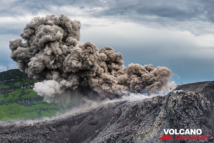
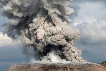
Ibu volcano, located along the NW coast of Halmahera Island, is a stratovolcano with a truncated summit and a number of large nested summit craters. The inner crater, 1 km wide and 400 m deep, contained several small crater lakes through much of historical time. The outer crater, 1.2 km wide, is breached on the north side, creating a steep-walled valley. A large parasitic cone is located ENE of the summit. A smaller one to the WSW has fed a lava flow down the western flank. A group of maars is located below the northern and western flanks of the volcano.

Ibu Volcano Photos

Bedeutende Vulkanausbrüche: Ibu volcano

In the past 10,000 years, Ibu has had at least 5 confirmed eruptions, all documented by historical records or observations.
The table below lists all known eruptions (date in bold face) of Ibu volcano in historic times and during the past 10,000 years. Updates on the most recent volcanic activity of Ibu can be found on the news page of Ibu volcano.
DatumHinweisVEITodesopferSchaden
2008 Apr 5 - anhaltend
Hist. dokumentiert
1
unbekannt
2004 Mai 16 ±15 d. - 2005 Feb 22 ?
Hist. dokumentiert
0?
unbekannt
2001 Mai 28 ? - Okt 3 ?
Hist. dokumentiert
0
unbekannt
1998 Dez 18 - 1999 Sep 16 ±15 d.
Hist. dokumentiert
2
unbekannt
1911 Aug 30 - Sep 1
Hist. dokumentiert
2
unbekannt
Anmerkung:
Unsere Liste von Vulkanausbrüchen orientiert sich eng an der Datenbank des Global Volcanism Project (GVP) des Smithsonian Instituts, der international anerkanntesten globalen Datenquelle für Vulkanausbrüche. Sie schließt aber auch bedeutende Eruptionsepisoden oder damit zusammenhängende Vulkanereignisse ein. Unter "Vulkanausbrüchen" versteht man in der Regel meist Serien einzelner Eruptionsepisoden, die zeitlich aufeinander folgen oder sich (bei mehreren beteiligten Ausbruchspunkten an einem Vulkan) auch überlappen können und unter Umständen viele Jahre, Jahrzehnte oder noch länger andauern können. So ist z.B. die aktuelle Tätigkeit des Stromboli als ein einziger Ausbruch verstanden, der seit 1934 anhält.
Quellen: NOAA National Centers for Environmental Information (NCEI), Global Significant Volcanic Eruptions Database. doi:10.7289/V5TD9V7K | Global Volcanism Project / Smithsonian Institution

Ibu Volcano FAQ

+When was the last eruption of Ibu volcano?
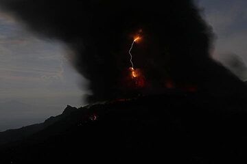
+How often does Ibu volcano erupt?

+How active is Ibu volcano at present?

+When was the largest eruption of Ibu volcano?

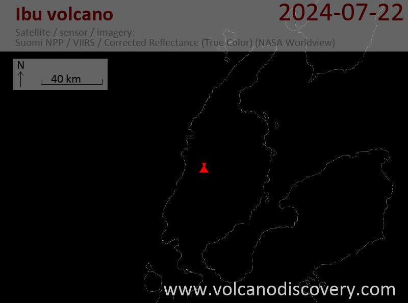
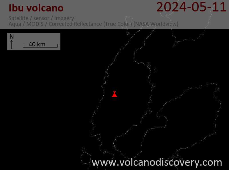
Neueste Satellitenbilder

Ibu Satellitenbild sat1Ibu Satellitenbild sat2
Ibu Vulkanreisen
N-Sulawesi + Halmahera (Indonesien)
Volcanoes and Spices
17-day volcano trekking tour to the Molucca Sea: N-Sulawesi, Karangetang and Halmahera
17 Tage / 16 Nächte - Mittel
Preis 3570 €
12.-29. Mai 2025
9.-25. Jun 2025
7.-23. Jul 2025

Ibu Vulkan Karten

Below is a selection of maps showing the location and surroundings of the volcano at various resolutions based on aerial-imagery / terrain maps. Feel free to use them for non-commercial purposes on your blog or website as long as you credit them with a link back to this page (click to copy it).
Satellite/aerial-type map of Ibu volcano (world scale)
Terrain-type map of Ibu volcano (world scale)
Satellite/aerial-type map of Ibu volcano (region scale large)
Terrain-type map of Ibu volcano (region scale large)
Satellite/aerial-type map of Ibu volcano (region scale medium)
Terrain-type map of Ibu volcano (region scale medium)
Satellite/aerial-type map of Ibu volcano (region scale small)
Terrain-type map of Ibu volcano (region scale small)
Satellite/aerial-type map of Ibu volcano (local scale large)
Terrain-type map of Ibu volcano (local scale large)
Satellite/aerial-type map of Ibu volcano (local scale medium)
Terrain-type map of Ibu volcano (local scale medium)
Satellite/aerial-type map of Ibu volcano (local scale small)
Terrain-type map of Ibu volcano (local scale small)
Satellite/aerial-type map of Ibu volcano (scale of 10s of km)
Terrain-type map of Ibu volcano (scale of 10s of km)
Satellite/aerial-type map of Ibu volcano (scale of 20-40 km)
Terrain-type map of Ibu volcano (scale of 20-40 km)
Satellite/aerial-type map of Ibu volcano (scale of approx. 10-20 km)
Terrain-type map of Ibu volcano (scale of approx. 10-20 km)
Satellite/aerial-type map of Ibu volcano (scale of 5-10 km)
Satellite/aerial-type map of Ibu volcano (scale of few kilometers)
Volcanoes & Earthquakes - new app for Android
Garantierte Reisen
9.-25. Jun 2025: Volcanoes and Spices - N-Sulawesi + Halmahera (Indonesien)
7.-23. Jul 2025: Volcanoes and Spices - N-Sulawesi + Halmahera (Indonesien)
1.-17. Aug 2025: Volcanoes and Spices - N-Sulawesi + Halmahera (Indonesien)
1.-14. Okt 2025: Wüste, Salz und Vulkane - Danakilwüste (Äthiopien)
4.-12. Okt 2025: Feuerberge Siziliens - vom Stromboli zum Ätna - Äolische Inseln + Ätna
3.-19. Nov 2025: Volcanoes and Spices - N-Sulawesi + Halmahera (Indonesien)
= Plätze frei   = garantiert   = Wenig freie Plätze   = Ausgebucht
Warum gibt es Werbung auf dieser Seite?
Sources: VolcanoDiscovery / VolcanoAdventures and other sources as noted.
Use of material: Most text and images on our websites are owned by us. Re-use is generally not permitted without authorization. Contact us for licensing rights.
Volcanoes & Earthquakes
VolcanoDiscovery Home
Vulkane | Erdbeben | Fotos | News | | Shop | App
Adventure & Study Travel
Reisen zu Vulkanen und Vulkangebieten: Wanderreisen, Studienreisen, Fotoreisen
Tours & Dates | FAQ | About us
Get our newsletter!
Company info
Kontakt | Impressum | AGB
Follow us
Follow us on facebook Follow us on Instagram Follow us on Bluesky Follow us on Twitter Visit our Youtube channel
EN | DE | EL | ES | FR | IT | RU
VolcanoDiscovery GmbH, Germany, Reg. nr.: HRB 103744, EU Tax Id: DE 297 465 123 owned and created by
Dr. Tom Pfeiffer, volcanologist, volcano photographer, tour organizer member of
IAVCEI
IAVCEI
Vulkanologische Gesellschaft
Volcanological Society
Ecotourism Greece
Ecotourism Greece
RUV insurance
Insured by R+V
VolcanoDiscovery © 2004- All Rights Reserved | Datenschutz - Cookie Einstellungen