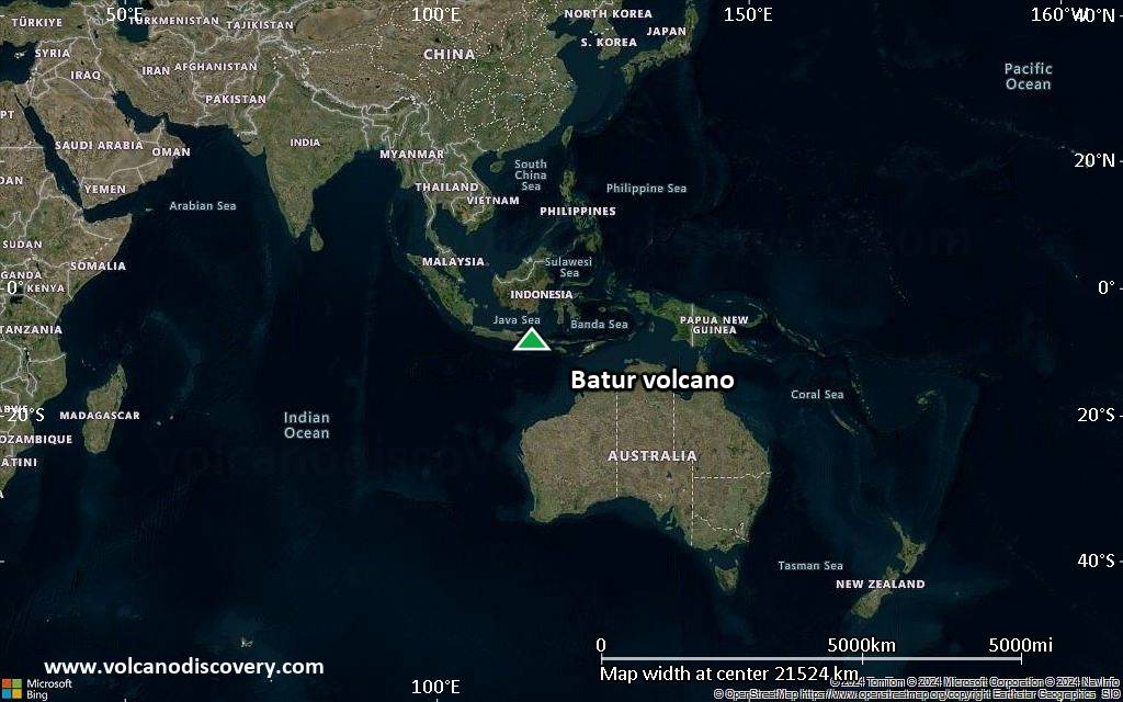
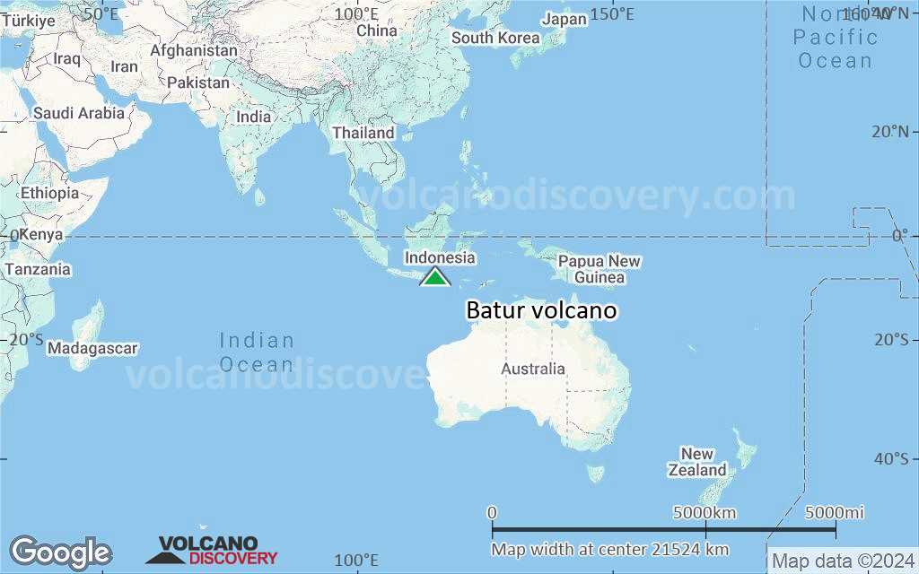
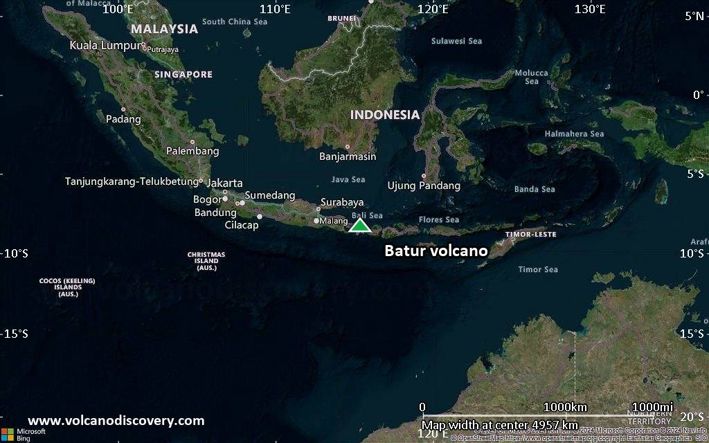
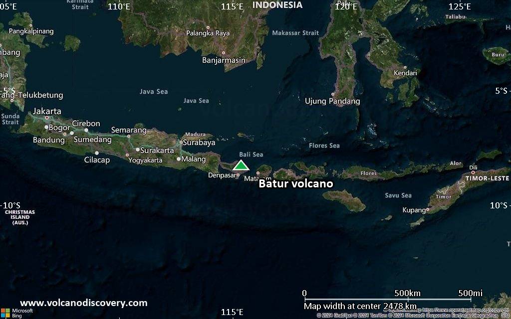
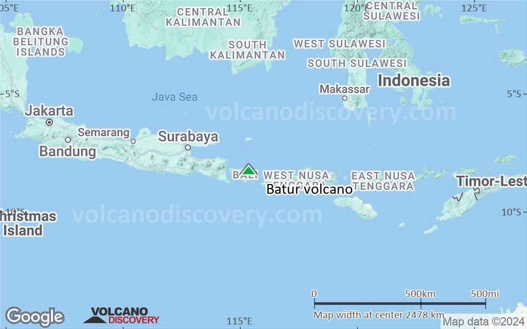
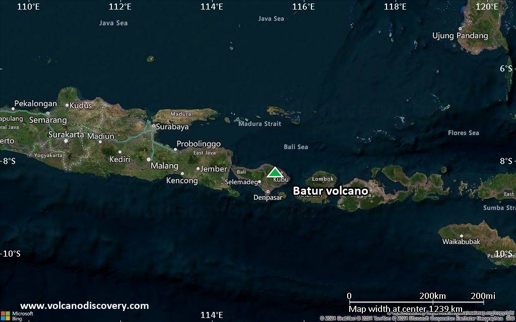
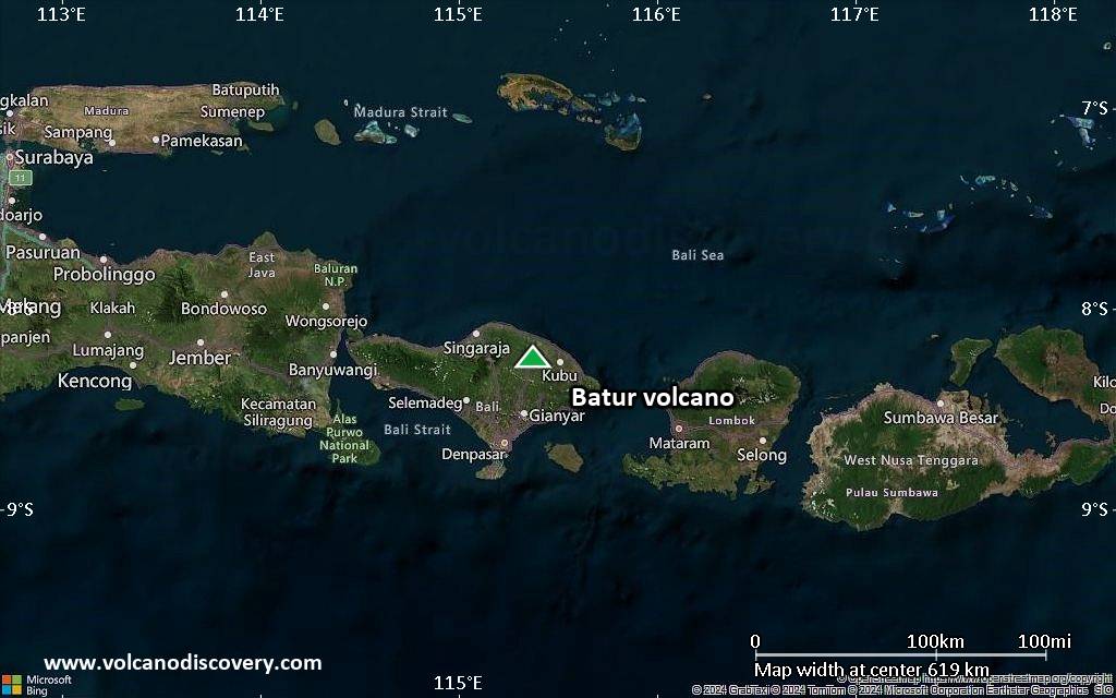
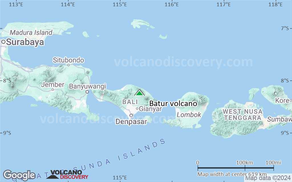
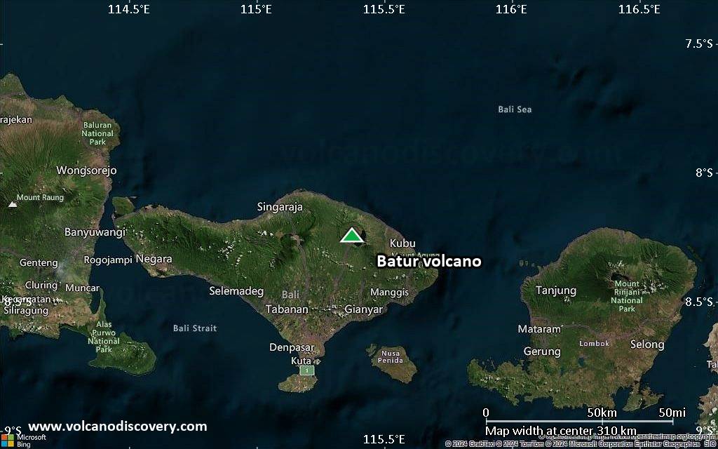
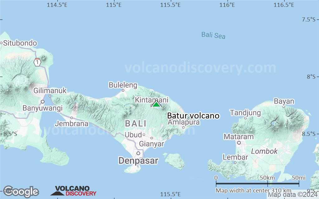
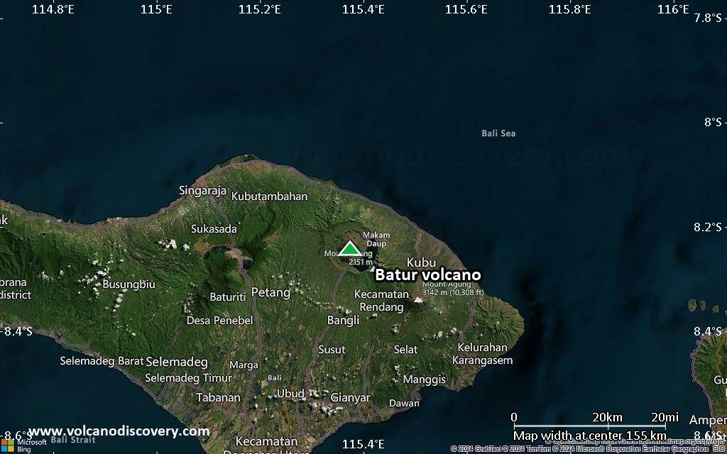
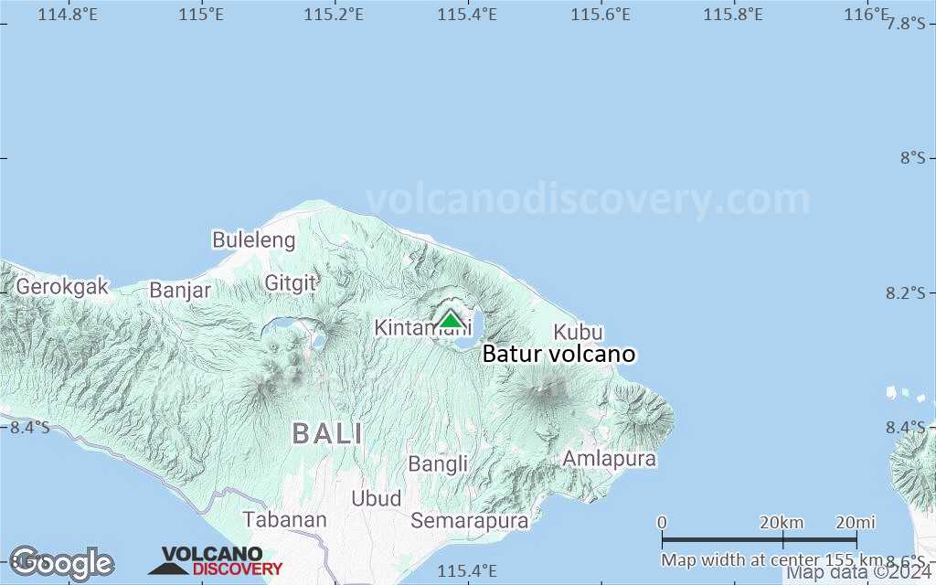
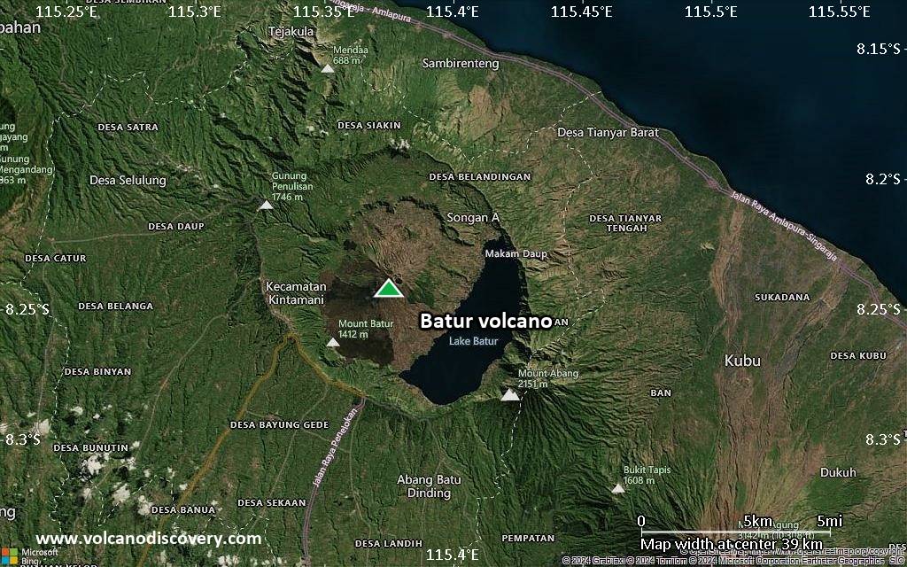
| RSS | EN | DE | EL | ES | FR | IT | RU

Batur Vulkan

Updated: 31. Mär. 2025 22:06 GMT -
Caldera
Bali, Indonesia, -8.24°S / 115.38°E
Summit height: 1717 m / 5,633 ft
Aktueller Status: normal / ruhend (1 von 5)
Last update: 10 Jan 2025 (Smithsonian / USGS Weekly Volcanic Activity Report)

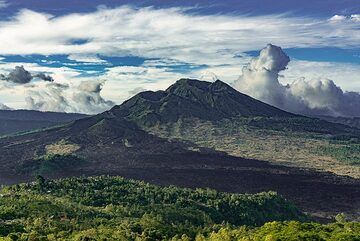
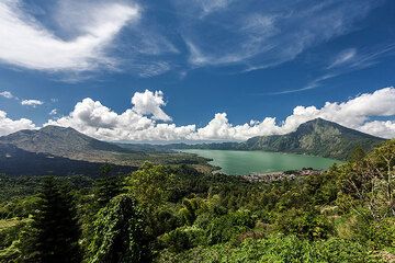
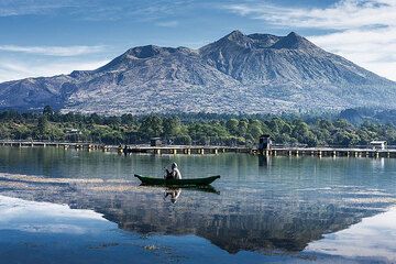
Batur is the most active volcano on the popular tourist island of Bali and one of Inondesia's more active ones. During the past centuries, Batur has had a number of small eruptions every few years. Thanks to the scenic beauty of the caldera with its lake and the cone of Batur, it is one of Bali's most popular destinations.

[smaller] [larger]
Typische Aktivität: Mildly explosive, sometimes emission of lava flows.
Ausbrüche des Batur: 1804, 1821, 1847(?), 1849, 1854, 1888, 1897, 1904, 1921, 1922, 1924, 1925, 1926, 1963-64, 1965, 1966, 1968, 1970, 1971, 1972, 1973, 1974, 1976(?), 1994, 1998, 1999-2000

Letzte Erdbeben in der Nähe

Datum und UhrzeitMag / TiefeDistanz / Ort

Beschreibung

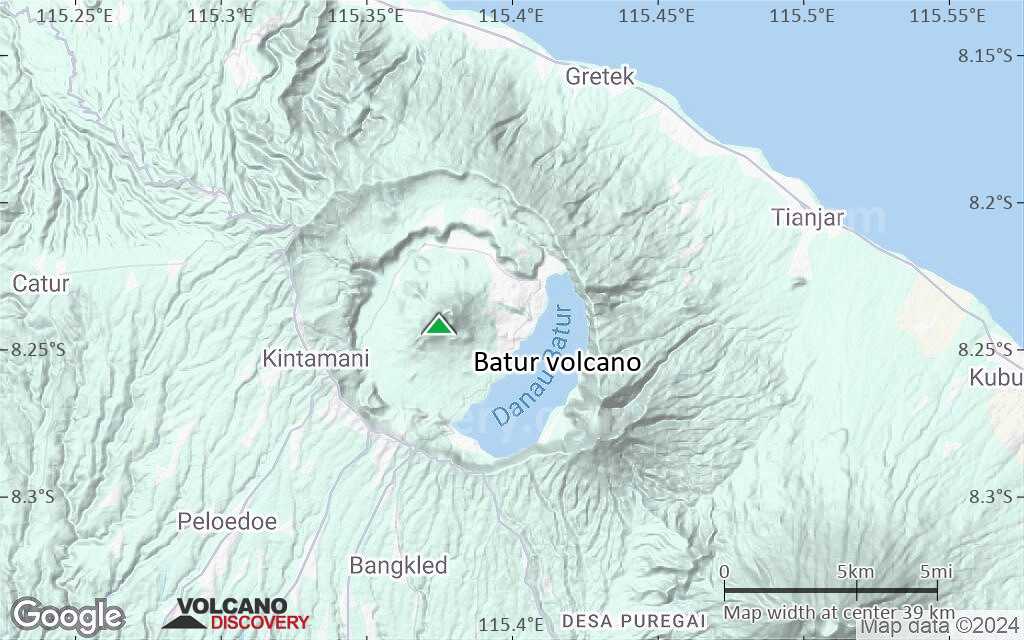
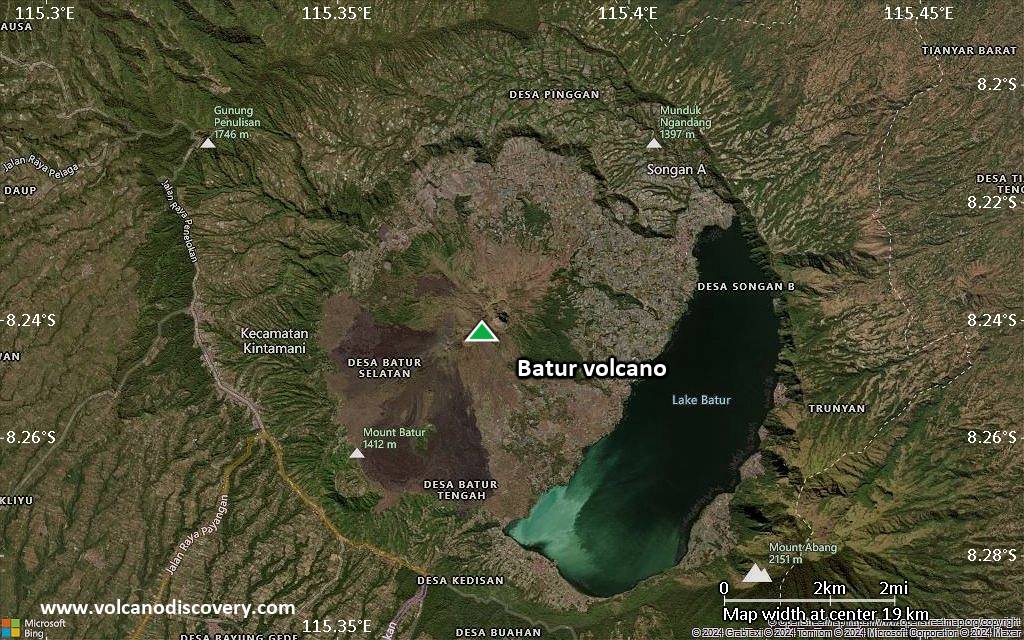
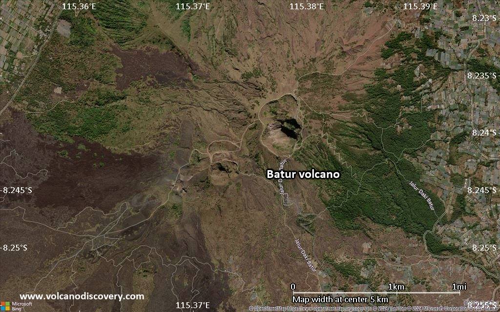
The volcano is located at the center of two concentric calderas NW of Agung volcano. The outer 10 x 13.5 km wide caldera was formed during eruption of the Bali (or Ubud) Ignimbrite about 29,300 years ago and now contains a caldera lake on its SE side, opposite the satellitic cone of 2152-m-high Gunung Abang, the topographic high of the Batur complex.
The inner 6.4 x 9.4 km wide caldera was formed about 20,150 years ago during eruption of the Gunungkawi Ignimbrite. The SE wall of the inner caldera lies beneath Lake Batur; Batur cone has been constructed within the inner caldera to a height above the outer caldera rim. The 1717-m-high Batur stratovolcano has produced vents over much of the inner caldera, but a NE-SW fissure system has localized the Batur I, II, and III craters along the summit ridge.

Historical eruptions have been characterized by mild-to-moderate explosive activity sometimes accompanied by lava emission. Basaltic lava flows from both summit and flank vents have reached the caldera floor and the shores of Lake Batur in historical time.
---
Source: GVP, Smithsonian Institution

Batur Volcano Photos

Bedeutende Vulkanausbrüche: Batur volcano

In the past 10,000 years, Batur has had at least 25 confirmed eruptions, all documented by historical records or observations. Additionally, there are 3 uncertain or discredited eruptions from Batur volcano.
The table below lists all known eruptions (date in bold face) of Batur volcano since around 1900. Updates on the most recent volcanic activity of Batur can be found on the news page of Batur volcano.
DatumHinweisVEITodesopferSchaden
1999 Mär 15 - 2000 Jun 16 ±15 d.
Hist. dokumentiert
1
unbekannt
1998 Jul 4 ±3 d.
Hist. dokumentiert
1
unbekannt
1994 Aug 7 - Aug 14 oder danachBatur III
Hist. dokumentiert
1
unbekannt
?? 1976 Mär 26
Unsicherer Ausbruch
1?
unbekannt
1974 Mär 12 - Apr 16 ±15 d.Batur III
Hist. dokumentiert
2
unbekannt
?? 1973 Mär 30 ±90 d.
Unsicherer Ausbruch
Hist. dokumentiert
1
unbekannt
1972 Jan 19 - Mär 16 ±15 d.Batur III
Hist. dokumentiert
2
unbekannt
1971 Mär 11 - Aug 25 oder danach
Hist. dokumentiert
1
unbekannt
1970 Jan 5 ±4 d. - Jan 15SW flank (1963 vent)
Hist. dokumentiert
1
unbekannt
1968 Jan 23 - Feb 15SW flank (Batur III)
Hist. dokumentiert
2
unbekannt
1966 Apr 28SW flank (west of 1965 vent)
Hist. dokumentiert
1
unbekannt
1965 Aug 18 - Dez 16 ±15 d.SW flank (near Batur III)
Hist. dokumentiert
1
unbekannt
1963 Sep 5 - 1964 Mai 10SW, W flanks (near Batur III, Butus)
Hist. dokumentiert
2
unbekannt
1963 Sep 5
(Ausbruch 1963 Sep 5 - 1964 Mai 10)
Hist. dokumentiert
22
unbekannt
Info
1926 Aug 2 - Sep 21SW flank below Batur III
Hist. dokumentiert
2
unbekannt
1925 Jan 5 ±4 d.Batur II
Hist. dokumentiert
2
unbekannt
1924 MärBatur II
Hist. dokumentiert
2
unbekannt
1923Batur II
Hist. dokumentiert
2
unbekannt
1922 Aug 30
Hist. dokumentiert
2
unbekannt
1921 Jan 29 - Apr 17SW flank (Batur II)
Hist. dokumentiert
2
unbekannt
1905Batur I, Batur II, Batur III
Hist. dokumentiert
2
unbekannt
1904West caldera floor (Gunung Anti)
Hist. dokumentiert
2
unbekannt
Anmerkung:
Unsere Liste von Vulkanausbrüchen orientiert sich eng an der Datenbank des Global Volcanism Project (GVP) des Smithsonian Instituts, der international anerkanntesten globalen Datenquelle für Vulkanausbrüche. Sie schließt aber auch bedeutende Eruptionsepisoden oder damit zusammenhängende Vulkanereignisse ein. Unter "Vulkanausbrüchen" versteht man in der Regel meist Serien einzelner Eruptionsepisoden, die zeitlich aufeinander folgen oder sich (bei mehreren beteiligten Ausbruchspunkten an einem Vulkan) auch überlappen können und unter Umständen viele Jahre, Jahrzehnte oder noch länger andauern können. So ist z.B. die aktuelle Tätigkeit des Stromboli als ein einziger Ausbruch verstanden, der seit 1934 anhält.
Quellen: NOAA National Centers for Environmental Information (NCEI), Global Significant Volcanic Eruptions Database. doi:10.7289/V5TD9V7K | Global Volcanism Project / Smithsonian Institution

Batur Volcano FAQ

+When was the last eruption of Batur volcano?

+How often does Batur volcano erupt?

+How active is Batur volcano at present?

+When was the largest eruption of Batur volcano?

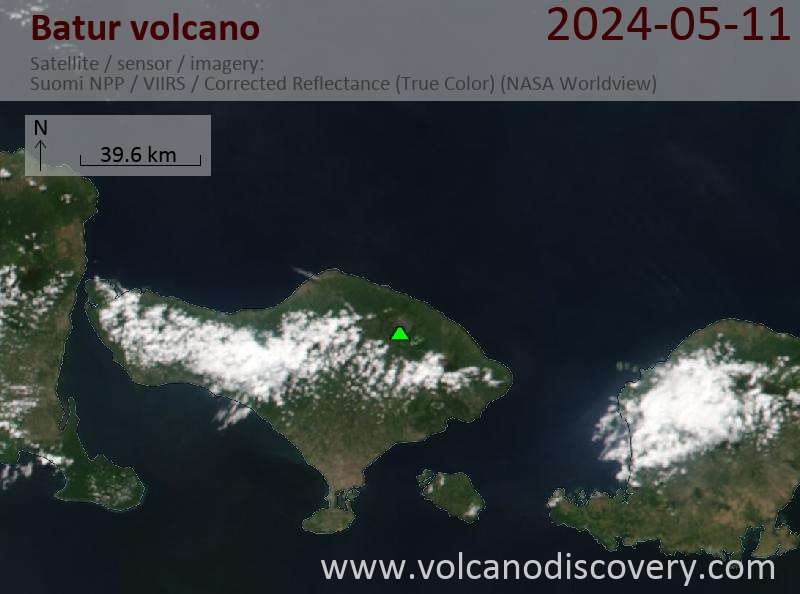
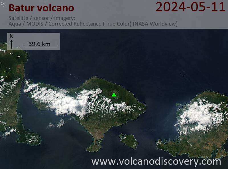
Neueste Satellitenbilder

Batur Satellitenbild sat1Batur Satellitenbild sat2

Batur Vulkan Karten

Below is a selection of maps showing the location and surroundings of the volcano at various resolutions based on aerial-imagery / terrain maps. Feel free to use them for non-commercial purposes on your blog or website as long as you credit them with a link back to this page (click to copy it).
Satellite/aerial-type map of Batur volcano (world scale)
Terrain-type map of Batur volcano (world scale)
Satellite/aerial-type map of Batur volcano (region scale large)
Terrain-type map of Batur volcano (region scale large)
Satellite/aerial-type map of Batur volcano (region scale medium)
Terrain-type map of Batur volcano (region scale medium)
Satellite/aerial-type map of Batur volcano (region scale small)
Terrain-type map of Batur volcano (region scale small)
Satellite/aerial-type map of Batur volcano (local scale large)
Terrain-type map of Batur volcano (local scale large)
Satellite/aerial-type map of Batur volcano (local scale medium)
Terrain-type map of Batur volcano (local scale medium)
Satellite/aerial-type map of Batur volcano (local scale small)
Terrain-type map of Batur volcano (local scale small)
Satellite/aerial-type map of Batur volcano (scale of 10s of km)
Terrain-type map of Batur volcano (scale of 10s of km)
Satellite/aerial-type map of Batur volcano (scale of 20-40 km)
Terrain-type map of Batur volcano (scale of 20-40 km)
Satellite/aerial-type map of Batur volcano (scale of approx. 10-20 km)
Terrain-type map of Batur volcano (scale of approx. 10-20 km)
Satellite/aerial-type map of Batur volcano (scale of 5-10 km)
Satellite/aerial-type map of Batur volcano (scale of few kilometers)

Links and further information

Geology of Batur volcano / www.vsi.esdm.go.id/volcanoes/batur/geology.html
A brief description with photographs of Batur's geology on the server of the Volcanological Survey of Indonesia
Volcanoes & Earthquakes - new app for Android
Garantierte Reisen
6.-19. Apr 2025: Wüste, Salz und Vulkane - Danakilwüste (Äthiopien)
12.-19. Apr 2025: Europe's Volcanic Outpost - Canary Islands
9.-25. Jun 2025: Volcanoes and Spices - N-Sulawesi + Halmahera (Indonesien)
7.-23. Jul 2025: Volcanoes and Spices - N-Sulawesi + Halmahera (Indonesien)
1.-17. Aug 2025: Volcanoes and Spices - N-Sulawesi + Halmahera (Indonesien)
1.-14. Okt 2025: Wüste, Salz und Vulkane - Danakilwüste (Äthiopien)
4.-12. Okt 2025: Feuerberge Siziliens - vom Stromboli zum Ätna - Äolische Inseln + Ätna
3.-19. Nov 2025: Volcanoes and Spices - N-Sulawesi + Halmahera (Indonesien)
= Plätze frei   = garantiert   = Wenig freie Plätze   = Ausgebucht
Batur volcano, Bali
Batur volcano, Bali
Batur volcano, Bali
Batur volcano, Bali
Batur volcano, Bali
Batur volcano, Bali
Mi, 17. Nov 2010, 06:00

Batur volcano (Bali, Indonesia) - Smithsonian / USGS Weekly Volcanic Activity Report for 17 November-23 November 2010 (Continuing Activity)

CVGHM reported that seismicity from Batur decreased from 1 June to 17 November and fumarolic plumes rose from the crater. On 19 November the Alert level was lowered to Normal, or 1 (on a scale of 1-4). ... Alles lesen
Do, 12. Nov 2009, 08:04

Batur volcano (Bali, Indonesia): unrest

Batur might be getting active. As the Indonesian Volcanological Survey reports, increased seismicity from Batur has been observed from September to 7 November and a significant increase in the number of volcanic earthquakes on 8 November. The Alert Level was raised to 2 (on a scale Alles lesen

Auf dieser Seite:

Warum gibt es Werbung auf dieser Seite?
Sources: VolcanoDiscovery / VolcanoAdventures and other sources as noted.
Use of material: Most text and images on our websites are owned by us. Re-use is generally not permitted without authorization. Contact us for licensing rights.
Volcanoes & Earthquakes
VolcanoDiscovery Home
Vulkane | Erdbeben | Fotos | News | App
Adventure & Study Travel
Reisen zu Vulkanen und Vulkangebieten: Wanderreisen, Studienreisen, Fotoreisen
Tours & Dates | FAQ | About us
Get our newsletter!
Company info
Kontakt | Impressum | AGB
Follow us
Follow us on facebook Follow us on Instagram Follow us on Bluesky Follow us on Twitter Visit our Youtube channel
EN | DE | EL | ES | FR | IT | RU
VolcanoDiscovery GmbH, Germany, Reg. nr.: HRB 103744, EU Tax Id: DE 297 465 123 owned and created by
Dr. Tom Pfeiffer, volcanologist, volcano photographer, tour organizer member of
IAVCEI
IAVCEI
Vulkanologische Gesellschaft
Volcanological Society
Ecotourism Greece
Ecotourism Greece
RUV insurance
Insured by R+V
VolcanoDiscovery © 2004- All Rights Reserved | Datenschutz - Cookie Einstellungen