What it does
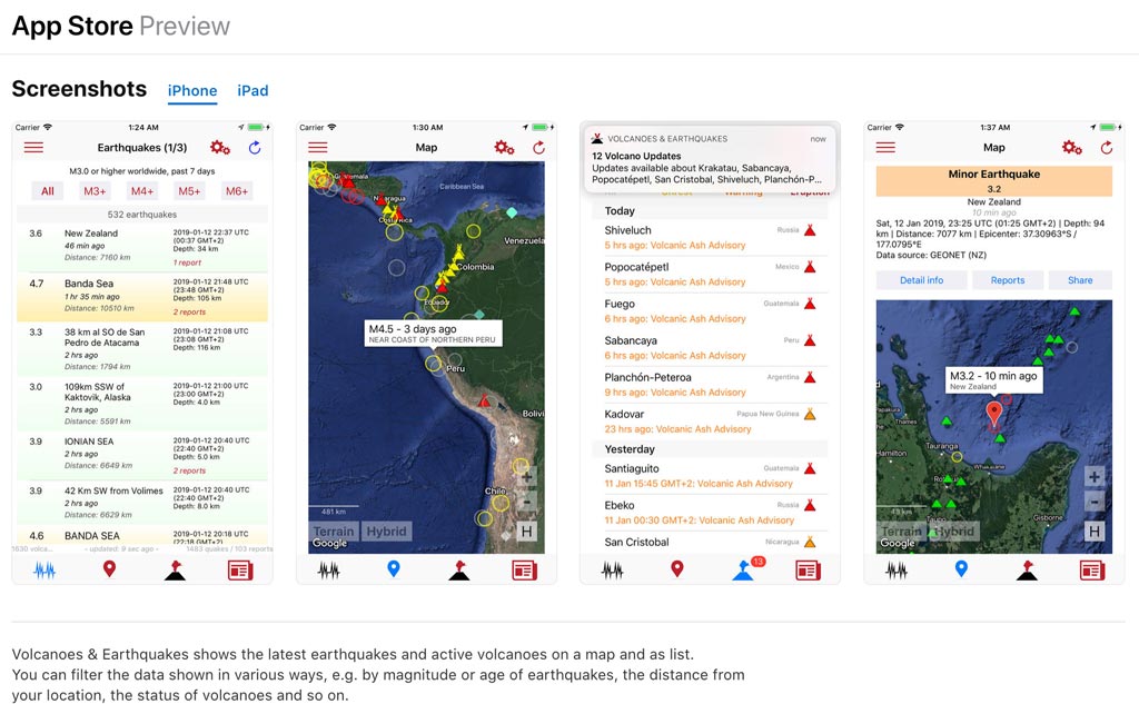
Volcanoes & Earthquakes shows the latest earthquakes and active volcanoes on a map and as list.
You can filter the data shown in various ways, e.g. by magnitude or age of earthquakes, the distance from your location, the status of volcanoes and so on.
The original earthquake / volcano data can be found with more detail on
www.volcanodiscovery.com. Earthquake data are continuously being collected and updated from various public sources, mainly international agencies such as USGS, GFZ, EMSC and many others (currently more than 25 sources).
The single number one question I received from the Android version of the app was:
Why is Yellowstone not on the map?
Yellowstone, Mt St. Helens and many more
ARE of course on the map and in the app's database,
but:
Currently (as of Jan 2019), ALL volcanoes in the continental US are dormant (green / normal alert level). That's why they are not shown immediately by default (the map would be too crowded otherwise). You need to zoom in sufficiently (map) have your filters set to include volcanoes on green alert (A-Z list).